
Location: Miyoshi-machi, Nishikamo-gun, Aichi Prefecture, Japan
Date of interview: 2005/2/14
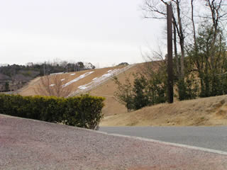
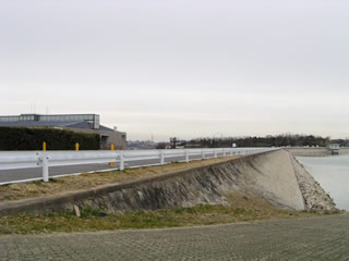
View of the levee from the downstream side of the left bank

Cloudy as usual! So much so that I'd like to properly measure the cloudy OR rainy rate when I'm out and about!
This is the Miyoshi Dam. It is known as "Miyoshi Pond" to the residents of Miyoshi Town. The name "Miyoshi Pond" is written in large letters on the embankment.
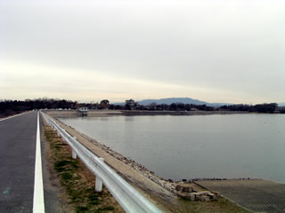
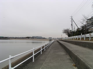
View of the dam lake from the left bank of the top end
It's kind of dark in Elak....
By the way, the mountain in the back is 629 meters high (maybe...).
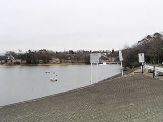
View of the dam lake from the top of the left bank
The dam itself is small, but the dam lake is large in comparison.
A dammed lake where canoeing is also possible
The dam lake is used as a training ground for canoeing, and occasional competitions are held there.
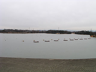
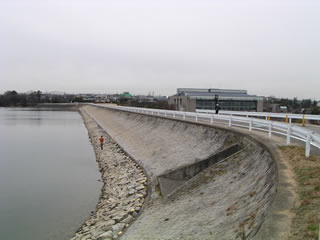
View of the levee from the top of the left bank
Not only canoes, but also a gymnasium is adjacent to the park, indicating that this whole area is planned as a comprehensive sports park. The gymnasium is on the left side of the photo.
stone monument
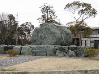
It is a stone monument, but I forgot what was written on it (kora). It must have been written by the mayor of the town or a local representative.
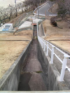
Incline for canoe?
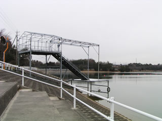
At first I thought it was an incline used for dam maintenance, but in hindsight it may have been an incline (?) for canoes. But in hindsight, it may have been an incline (?) for canoeing.
Considerate dam lakeshore
Some of the areas around the dam lake are stepped like this. This is probably done to make it easier to watch the canoe races and canoeing practice.
water intake building
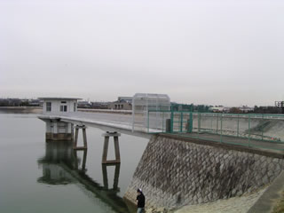
water intake building
Can I also enjoy fishing?
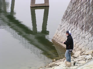
Some people enjoy lure fishing like this. But is fishing allowed here? But is fishing allowed here?
trumpet boy
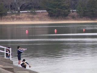
Furthermore, a boy who plays the trumpet also seems to use this place as a practice spot. It seems that he came with his family, but even so, the trumpet looks a little strange in his jersey-like gym clothes.
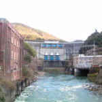
View of the lake side of the embankment dam from the right bank
In the foreground, you can see what looks like a flood discharge, but it may be an after-water discharge, given its size.
Residual water discharge like a drainage channel
This is the end of the above mentioned residual water discharge. It is like a drainage channel.
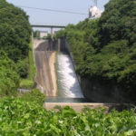
View of the spillway from downstream
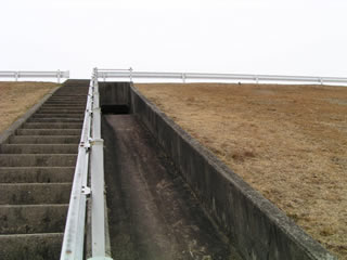
The after-water discharge is seen from the downstream side. It does not look like a dam.
View of the embankment from the downstream side of the right bank
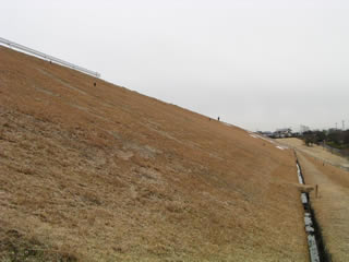
But when you look at it like this, you can see that it is quite large.
Panorama~
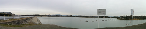
This is the first panoramic photo on this site. But the quality is too poor, so please bear with me at this size. lol
dam characteristics
| River Name | Kiso River System Aichi Irrigation |
|---|---|
| form (something takes) | (electrical) ground |
| Objective | irrigation water |
| Bank height | 19.7m |
| Bank length | 440m |
| Dam volume | 259,000m3 |
| catchment area | 0.8km2 |
| Reservoir area | 41ha |
| Total storage capacity | 2,235,000m3 |
| Effective water storage capacity | 2,200,000m3 |
| Dam operator | Aichi Water Public Corporation |
| Main body constructor | Kajima Construction |
| Name of Dam Lake | Miyoshi Pond |
| Year of launch | counter for years (following a number in the hito-futa-mi counting system) |
| Year Completed | 1958 |
| Access | Get off at Tomei Miyoshi IC Turn left at the immediate traffic light intersection Turn right at the Mazoushinden intersection and go south on Prefectural Road No. 54. Turn left at the Miyoshi Park West intersection and follow the road. When you see the gymnasium, go in there. |
Other facilities/observations
Miyoshi Dam is the keystone of the Aichi Irrigation System. It is also a place of recreation and relaxation for the residents of Miyoshi Town. I wish the weather had been better....
| Parking lot | ○ |
|---|---|
| Toilet | × |
| Park | ○ |
| PR Exhibition Hall | × |
| Fishing | ? |
Comment