
Date of interview: 2012/08/05 (Sun.)
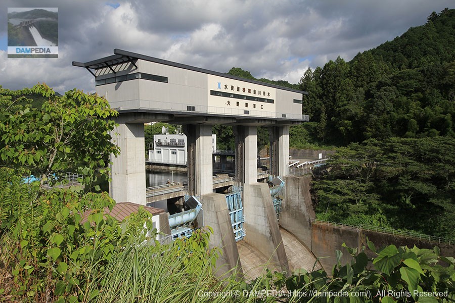
The Ono Headworks is responsible for taking up to 30 m3/s of water from the Uren and Oshima dams.
."weir (usu. for irrigation)A "headworks" is an intake or weir structure used to take in water from a river, mainly for agricultural use. Most headworks are less than 15 m high and are not dams but movable weirs, but the Ono Headworks is 26 m high, so it is treated as a dam under the River Law.
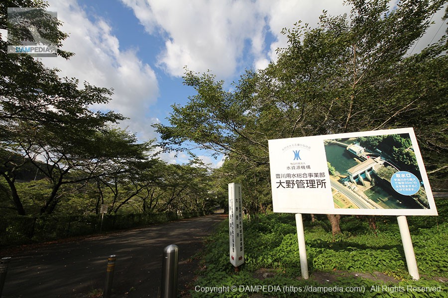
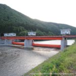
Approach to Ono Headworks
In the past, it was necessary to drive slowly on Route 151 from the Tomei Toyokawa IC, but since the Shinshiro IC of the New Tomei Line was completed, it is now much closer. However, since there is no place to park from the national highway, there is a shoulder on the left bank of the prefectural road where you can park your car.
The cherry trees line the embankment, making it a major local cherry blossom viewing spot.
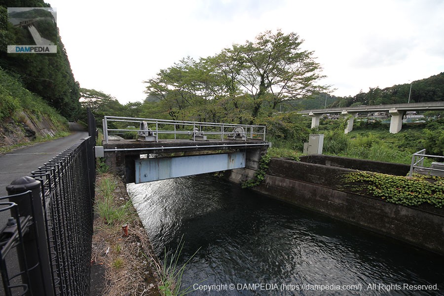
Ono conduit
The Ono conduit is an important waterway that leads from the Ono headworks to the east-west trunk canals (the western trunk canal to the Gamagori regulating pond and the eastern trunk canal to the Hatsutate pond).

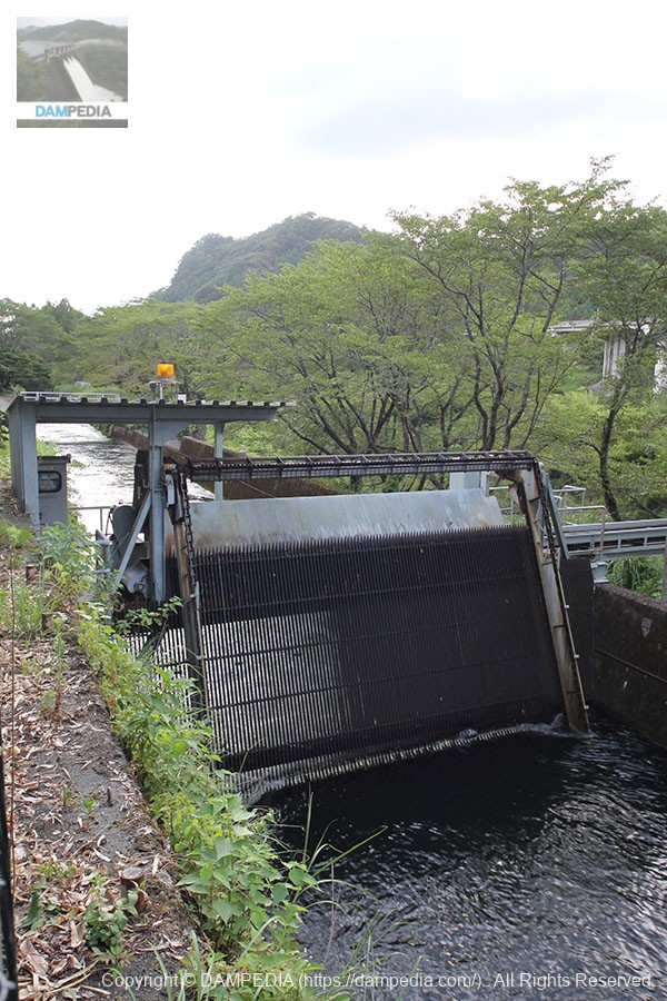
Gate?
There is what looks like a small windlass at the top, but I wonder what it is. And it is low in height for a gate.
dust collector
A dust remover was installed on the Ono conduit.
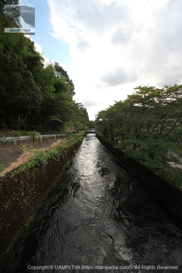
Ono conduit
View of the Ono conduit from the dam site on the left bank. Water flowing torrentially. This is the water that will travel to Gamagori and the tip of the Atsumi Peninsula to enrich the fields.
View of the levee downstream from the left bank
We have arrived at the dike. At the top of the dike is a large gate winder room.
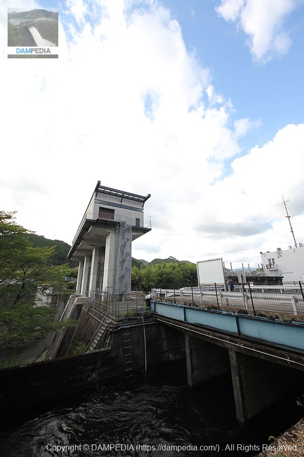
Gate 1 on the left bank side
Gates No. 1 and No. 3 have flap gates at the top of the roller gates.
Gate type: Roller gate with steel flap
Net diameter x door height: 11.0m x 9.9m (including upper door 2.6m)
Watertight system: 3-way rubber watertight and watertight between doors
Opening and closing method: 1 motor 2 drums x 2 wire rope winch type
Opening/closing speed: Upper door 10min 20min (at low speed operation), Lower door 0.3m/min 0.05m/min (at reserve motor)
Lift: 2.6m for upper door, 11.2m for lower door
Door weight: 97 tons
Date of establishment: May 1996
Production Company: Ishibari-Kawaju Special Construction Joint Venture
Gate 2 in the center
This is gate #2 in the middle. It is a roller gate with no flap at the top.

Gate type: Steel roller gate
Net diameter x door height: 11.0m x 10.1m
Watertight method: 3-way rubber watertight
Opening and closing method: 1 motor 2 drums x 2 wire rope winch type
Opening/Closing Speed: 0.3m/min 0.05m/min (at preliminary motor)
Lift: 11.2 m
Door weight: 70 tons
Date of establishment: May 1995
Production Company: Ishibari-Kawaju Special Construction Joint Venture
Gate 3 on the right bank
Gate 3 has the same specifications as Gate 1, but the date of installation is May 1994, indicating that it was installed in the order of No. 3, No. 2, and then No. 1.
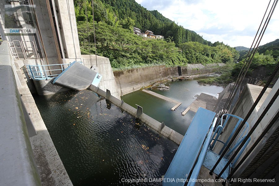
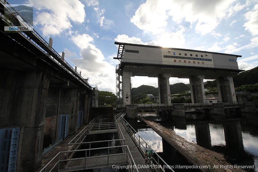
View upstream of the left bank from the top
The white building in the center is the control center and the water intake is on the right.

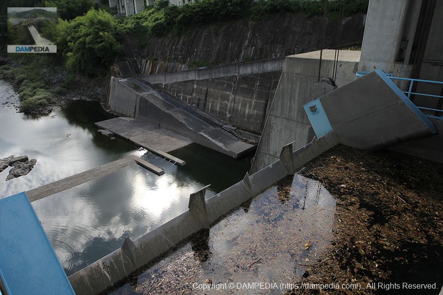
Intake for small discharge facility
The Ono Headworks is equipped with three gates as well as a small discharge facility to allow water to pass through the fishway.
Small Discharge Facilities
From here, the water is channeled through a fish passage installed on the right bank. The fish passage is what you see in the back of the aforementioned photo of Gate 1.
View of the top edge from the right bank
The embankment is very squat. The blue steel plate at the top passage is for a spare gate to be inserted during gate maintenance.
View of the levee downstream from the national road on the right bank
Take pictures with caution as there are no sidewalks on the national road.
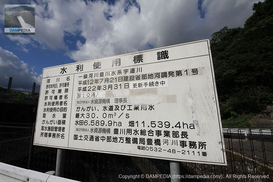
Water Use Signs
Next, we will go back to the control center to get a dam card. The photo shows the water use sign on the way to the control center.
It is pasted on top of the flaps because of various name changes, but this kind of thing is very difficult every time. Since both the minister and the president change so often, they finally decided to use only the name of the organization plus the title, or there are traces of the names that have been erased.
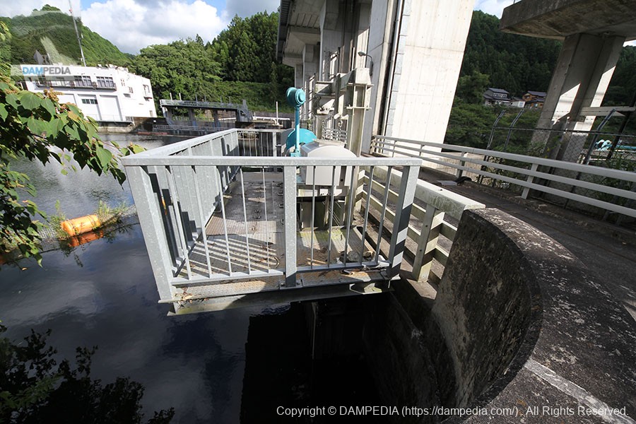
View of the water intake on the canal side
Water flows from here.

View downstream of the water intake and channel
The water intake splits into three channels, which join into one over a bridge, but are they separated for ease of maintenance?
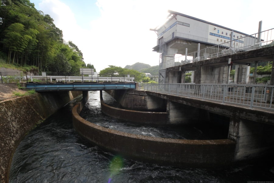
View of the upstream dike and water intake
You can clearly see that the water is dammed by the dike and taken in through the intake on the left.
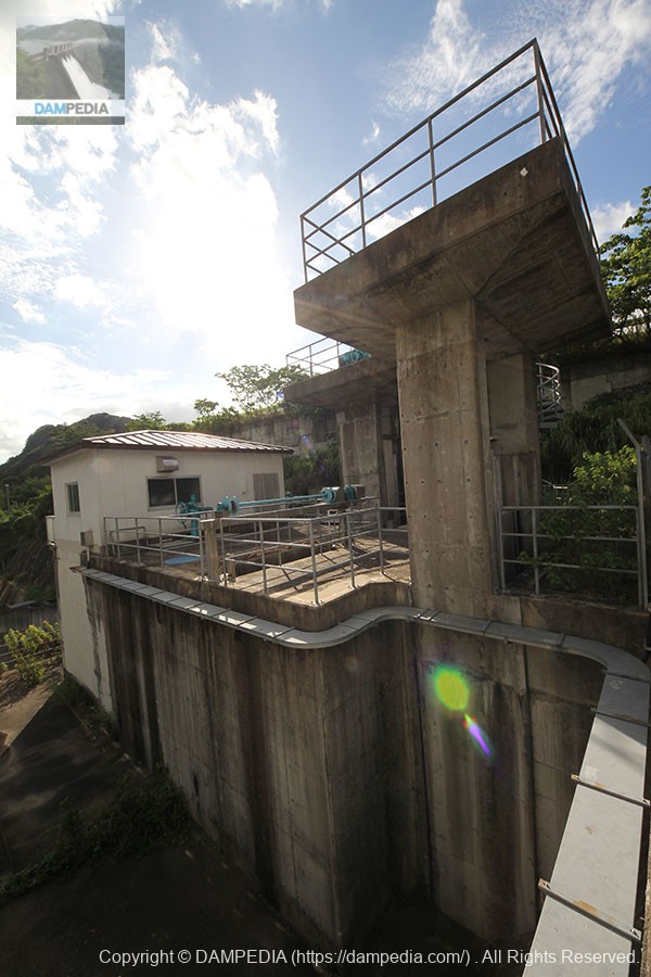
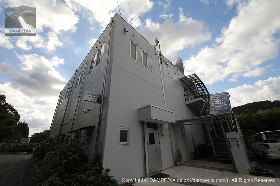
administration office
It is located in a fairly secluded area, making it somewhat difficult to enter, but when I went upstairs and pressed the intercom, I was pleasantly greeted by a staff member.
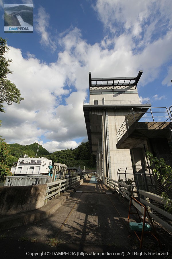
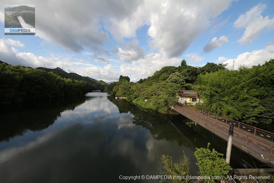
View of the dam lake from the stairs of the control center
The surface of the lake is calm. You can proceed on foot on the right side, which may be a walking trail for locals.
The Ono Headworks is an important facility for the Toyokawa River water supply. Moreover, everything from here downstream flows naturally. The Ono Headworks is such a place where one can experience firsthand the source of life, the Toyokawa River water supply.
dam characteristics
| Location | Shinshiro City, Aichi Prefecture, Japan |
| River Name | Uren River in the Toyokawa River system |
| Objective | A (irrigation water) W(Water for water supply) I (industrial water) |
| Model | gravity-fed concrete dam |
| Bank height | 26m |
| Bank length | 66.2m |
| Dam volume | 28,000m3 |
| Watershed Area | 130 km2 |
| Reservoir area | 16 ha |
| Total storage capacity | 1,096,000m3 |
| Effective water storage capacity | 906,000m3 |
| Dam operator | Aichi Water Public Corporation |
| Main body constructor | - |
| Year of launch | 1949 |
| Year Completed | 1961 |
| Name of Dam Lake | - |
Other facilities/observations
| Parking lot | △ |
| Toilet | × |
| Park | × |
| PR Exhibition Hall | × |
| Fishing | × |
Comment