
Location: Sobue-cho, Inazawa City, Aichi Prefecture
Date of interview: Wednesday, October 13, 2010
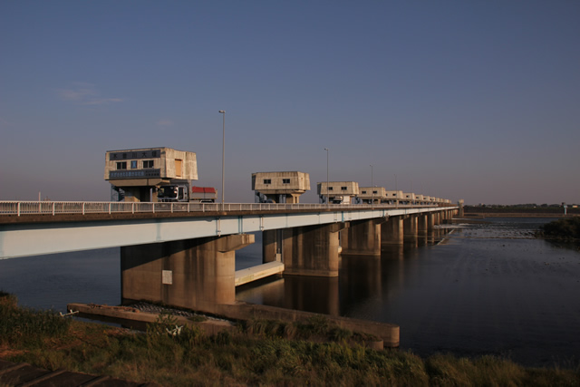
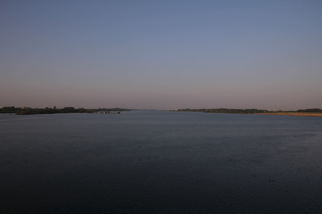
View of the embankment from upstream on the left bank

As its name suggests, the Kiso River weir is not a "dam" but a "weir" under the River Law because its embankment height is less than 15 m. However, it is listed in the Dam Handbook, so we dare to introduce it on this site.
I had been to the Kisogawa weir several times, but never had the chance to visit it properly. Because I had been there before, I knew that the area was crowded and that there were no parking spaces, so I came here by mistake to a space where I could see the weir from such a distance. This is the view of the weir from the parking lot of Wild Nature Plaza, part of the National Kiso San-river Park.
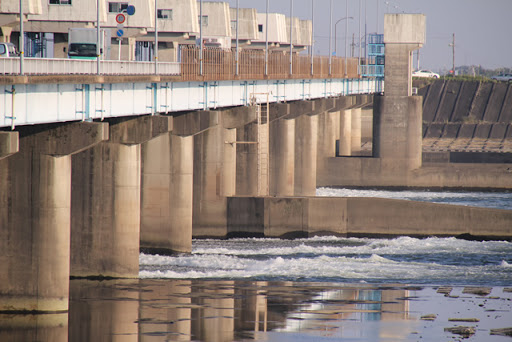
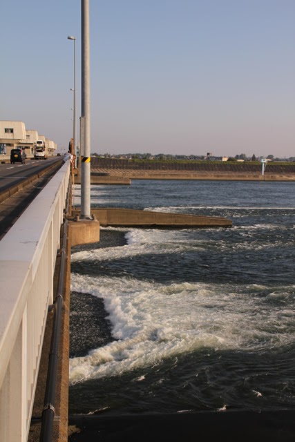
View of the embankment from the right bank downstream
We came from the left bank to the right bank at once. I think it is slightly easier to park on the right bank.
The Kisogawa Great Weir is a movable weir constructed as the headwaters of the Kisogawa River water supply, and supplies water and sewage to Nagoya City. It also supplies water and irrigation water to Mie Prefecture via the Mie Irrigation Canal, and industrial water to the Nobi area. It also supplies water and industrial water to the Chita Peninsula in cooperation with the Nagara River estuary weir.
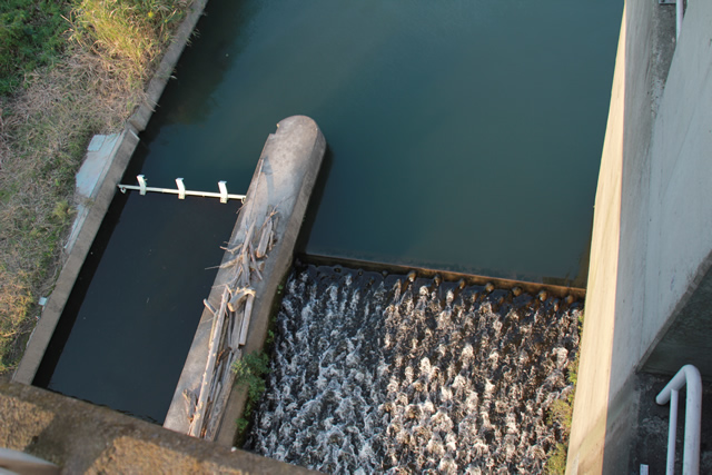
View of the fish passage from the right bank downstream

This may be because the Kiso River becomes wider when it reaches this point,right bank (shore)interpoint (interword separation)left bank (of a river)The center and fishway are in place.
View of the gate from the right bank downstream
This roller gate functions as a flood discharge.
View of the embankment from the right bank downstream

Because the bank height is low, the discharge of water is not flashy, but the water is still flowing with great vigor.
View of the dam nameplate on the top rail
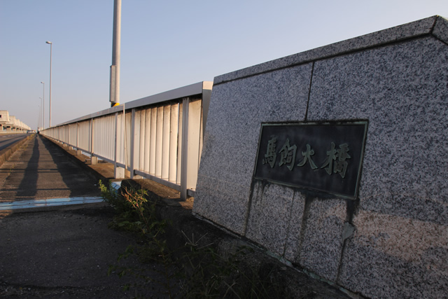
The embankment also has the name of Umakai Ohashi, and a prefectural road runs through the top end.
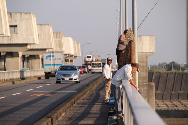
View of the top edge from the right bank

I photographed the moment the traffic slowed down, but it is very busy during the day.
View downstream from the top of the right bank
It may not be exactly what one would expect from a "discharge," but the water is flowing in whitecaps.
The gate configuration of the Kisogawa weir is as follows.
Sediment discharge gates: 27m x 2 gates
Regulating sluice: 40m x 3 gates
Flood discharge gates: 40m x 9 gates
View of the top edge
Let's see...fishing is supposed to be forbidden at the top of the river.... I heard you can catch ayu fish.
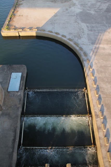
View of the fish passage (downstream) in the center of the dike
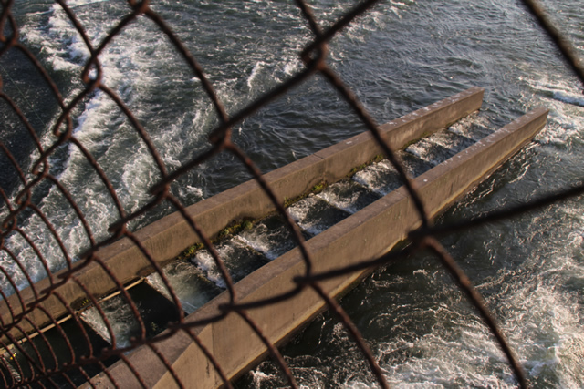
A fishway installed in the center of the dike.
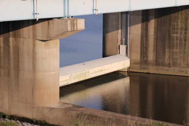
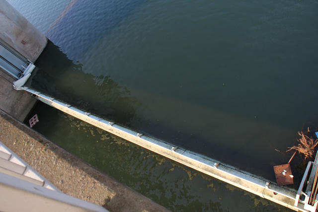
View of the locks (downstream side)
These are locks installed to allow ships to navigate.
View of the fish passage (downstream) on the left bank
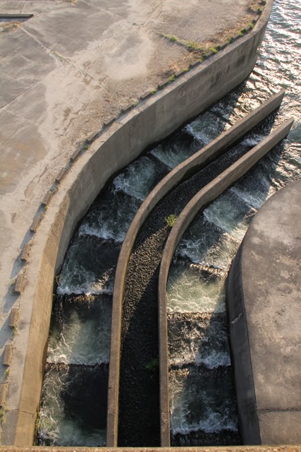
This is the fishway on the left bank side. Unlike the fishway on the right bank and in the center, it is curved.
View of the levee from the downstream side of the left bank

The gates, or rather gate piers, lined up in a row are quite spectacular. Moreover, the reddish tint at dusk creates a different atmosphere.
View of the top edge from the left bank
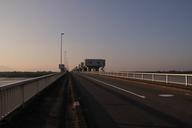
Cars are whizzing by, so even if you are looking for a shutter release opportunity, the wind pressure from the passing cars can blow you away. Especially since there are many trucks, it is a bit nerve-wracking to take pictures.
View of the administration office and still water pond
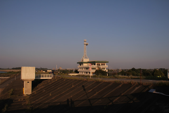
On the left bank is the Kisogawa Water Supply General Management Station of the Japan Water Agency and the Kisogawa Water Supply Still Water Pond.
View of the top edge from the left bank
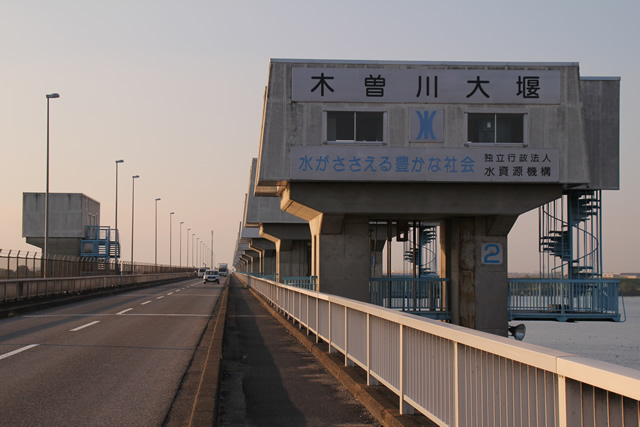
Gate piers lined up in a row. And the impressive catchphrase, "Water-supported affluent society.
View of the fishway on the left bank
Fish passage entrance on the upstream side of the left bank. It is located off to the side.
View of water intake

This is the intake of the Kaifu trunk canal. The water flows into the irrigation canal via a still water pond on the other side of the embankment.
View of the gate from the top
This is a sediment discharge gate, a roller gate with flaps.
Birds resting their feathers upstream
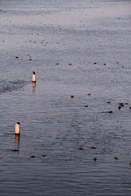
I looked upstream and saw many birds resting their wings.
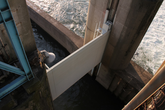
View of the locks on the upstream side
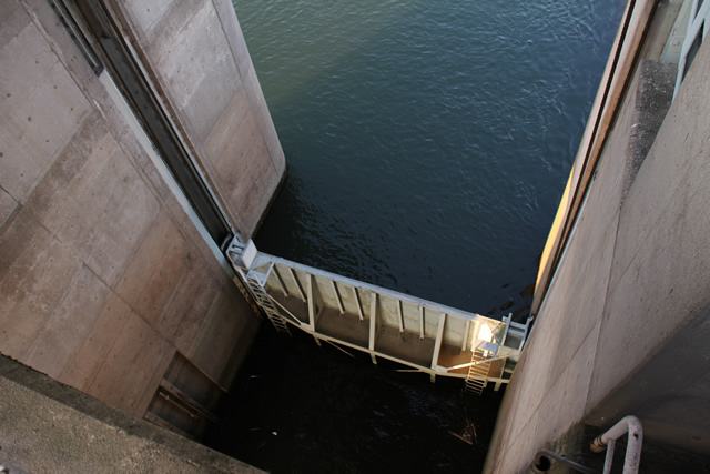
These are the locks on the upstream side. This one is closed.
View upstream from the top
The bridge of the Tokaido Shinkansen and the elevated Meishin Expressway are faintly visible upstream. I used to take my children to that bridge in the summer of that year.
View of roller gate

This is a flood discharge gate. It is a roller gate.
View of the cornerstone

The cornerstone was embedded in the gate pier in the middle of the river. It is rare to see it in this way.
Fish passage and gate (?) on the right bank View of the fish passage and gate (?) on the right bank
The right side is a fish passage, while the left side is supposed to serve as a lock.
View of the top edge from the right bank

We went from the right bank to the left bank and then from the left bank back to the right bank.
Although the Kiso River weir is more conspicuous for its role as a bridge (it is often referred to as the Umakai Bridge), I have a renewed awareness that it plays a major role in providing a stable supply of irrigation water not only to western Aichi Prefecture where I live, but also to Mie Prefecture.
dam characteristics
| River Name | Kiso River System Kiso River |
|---|---|
| Objective | Irrigation water, water supply water, industrial water |
| Model | weir |
| Bank height | 4.2m |
| Bank length | 586.8m |
| Dam operator | Public corporation for water resources development, 2 works |
| Main body constructor | Maeda Corporation |
| Year of launch | 1970 |
| Year Completed | 1974 |
Other facilities/observations
Wild Nature Plaza has a large parking lot and restrooms, but it is a bit far from the dike. Also, fishing is prohibited 200m upstream and downstream from the dike, respectively.
| Parking lot | △ |
|---|---|
| Toilet | △ |
| Park | ○ |
| PR Exhibition Hall | × |
| Fishing | △ |

Comment
DamPedia Archives: 1228-Kisogawa weir (Magai headworks) http://t.co/wYmMQHVlji