
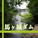
Location: Aza-Tsutsumishita, Inuyama City, Aichi Prefecture
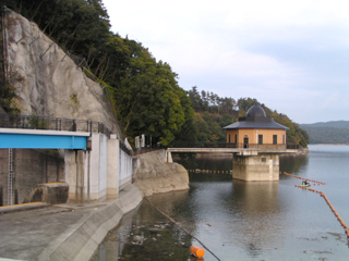
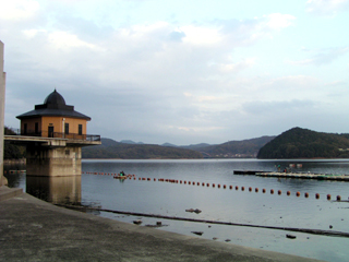
View of the intake tower from the dike
I didn't know there was a dam in a place like this! I was honestly surprised. This dam is located next to "Meiji-mura," a place that most people who grew up in Aichi Prefecture visit on a field trip. As I recall, I also visited there on a field trip when I was a high school student. Please be assured that you do not need to pay an admission fee to the Meiji-Mura when you visit the dam.

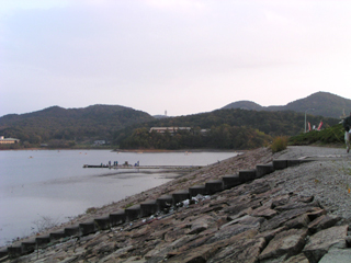
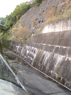
View of the lake side of the embankment dam from the right bank
Although not shown in the photo, the top end was lined with stores and relatively crowded with fishermen and tourists. It may be unusual to find so many stores on the top edge.
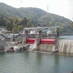
Gate...
And speaking of unusual, what a surprise, you could touch the gate directly! There were no no trespassing signs, and the lake was calm, so it's probably okay, but "Flood dischargeI was a little worried about going into the "Gyotai" with all my might, so I scurried around the area and became a suspicious person. I was a little worried that I might step on the gate of the embankment with my feet and get punished later (laugh).
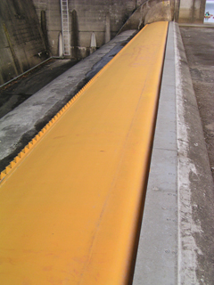
Gate...
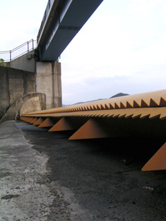
tentativelyradial gateIt appears to be a tipping gate. The color of the gate is beautiful. Also, the spoilers lined up in a row look like shark's teeth. It is the first time for me to photograph the gate from such an angle.
View of the conduction area from the gate
This is a very simple structure of a conduit. It is possible to climb down here as well, but I stopped because I was too small-minded lol.
View of the dam lake from the gate
It is a small dam, but I was able to photograph it from a completely different angle than usual, and I think it was a very valuable experience. I just wish I had a little more information about it.
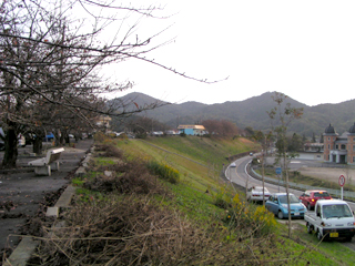
View downstream from the top
This is the downstream side. I am not sure where the river is, but perhaps there is a river in the foreground of the photo. A prefectural road runs directly under the embankment. Hmmm, it does not look like a dam.
dam characteristics
| Model | E(earth dam) |
| Objective | F (flood control, agricultural disaster prevention) A (irrigation water) |
| Bank height | 25.7m |
| Bank length | 724.1m |
| Dam volume | 1,667,000m3 |
| Watershed Area | 34.4km2 |
| Reservoir area | 140ha |
| Total storage capacity | 18,523,000m3 |
| Effective water storage capacity | 15,183,000m3 |
| Name of Dam Lake | Iruka Pond |
| River Name | Gojo River, Kiso River System |
| Year of launch | 1978 |
| Year Completed | 1991 |
| Access to D@M | Turn right at the traffic light immediately after exiting the Komaki-Higashi IC on the Chuo Expressway Turn left at the Gonaka Shinbashi Minami intersection→then drive on Prefectural Route 16 for a while and you will see it. |
Other facilities/observations
We recommend that you also visit Meiji-Mura. I personally recommend the former Imperial Hotel designed by Frank Lloyd Wright. History buffs may not be able to resist....
| Parking lot | ○ |
| Toilet | ○ |
| Park | ○ |
| PR Exhibition Hall | × |
Comment
plumage of birds