
Location: Toyooka-cho, Gamagori City, Aichi Prefecture
Date of interview:2011/05/15 (Sun.)
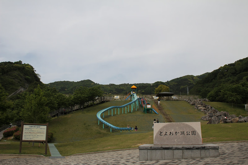
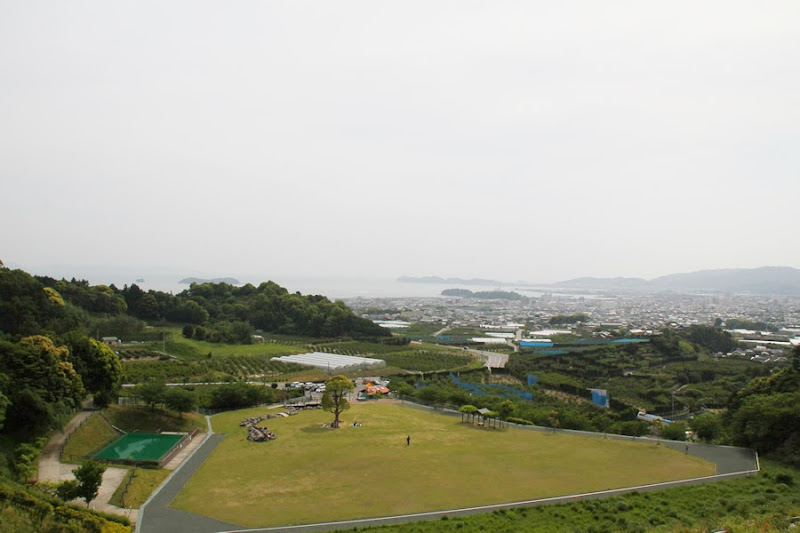
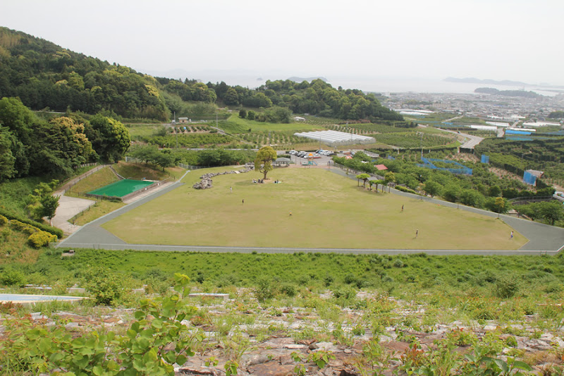
View of Lake Toyooka Park
The Gamagori Regulating Pond is a regulating pond for the western trunk canal of the Toyokawa water supply managed by the Japan Water Agency. In the past, Gamagori was close to the mountains and the sea, and when it rained, it flowed quickly to the sea, so many reservoirs were built.
Under such circumstances, the Toyooka Pond was constructed after overcoming construction woes during the chaotic postwar period. Even so, it was not a drastic solution to the water shortage, and Toyooka Pond was renovated and passed on to the construction of the Gamagori Regulating Pond. The dam lake is named "Toyooka Lake" in honor of the local residents who worked hard to build Toyooka Pond.
Now, Gamagori City in Aichi Prefecture is known for its tangerines, Laguna Gamagori, Takeshima, and other driving spots for Aichi residents, but this Gamagori Regulating Pond is located a short distance from the center of the city. The downstream of the dike is maintained as a park and was crowded with many families.
Touganomi-no-oka
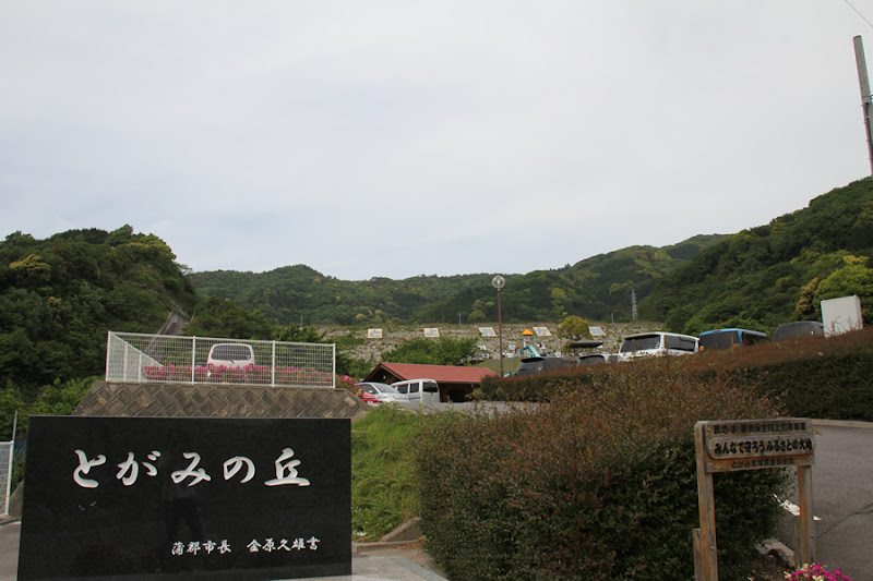
There is a nearby mountain called Togamiyama, which seems to be named after it.
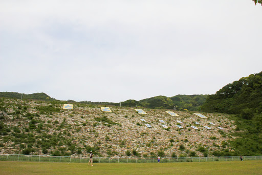
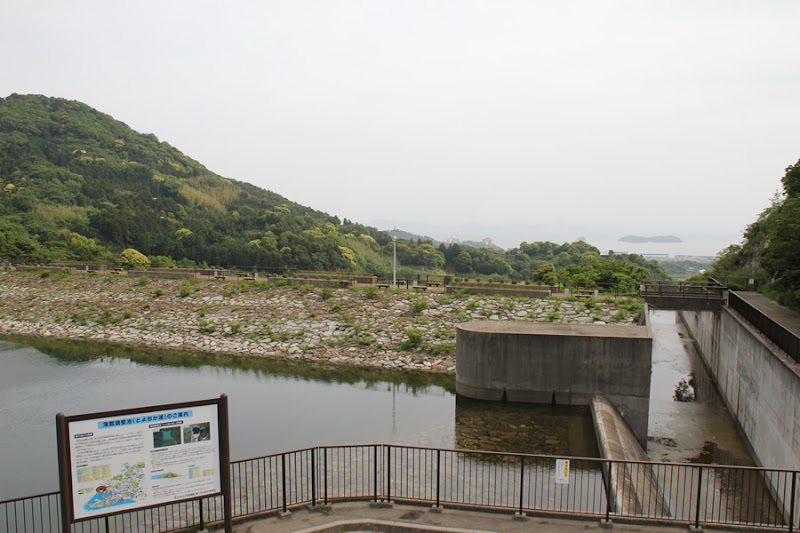
View of the flood discharge from the downstream side of the right bank
Quite splendid.Flood discharge(Residual water discharge). The left side is equipped with a jet flow gate discharge facility.
In addition, the
The regulating reservoirs store water from their own watersheds, while excess water from the Toyokawa and Uren Rivers is taken from the Ono Headworks and pumped at the Gamagori Pumping Station located in the Toyooka culvert of the Western Trunk Canal. The stored water is returned from the regulating reservoir during times of drought to ensure a stable supply of water to meet downstream water demand."
(quoted from the sign). (quoted from the sign)
View of the flood discharge and alarm from the downstream side of the right bank
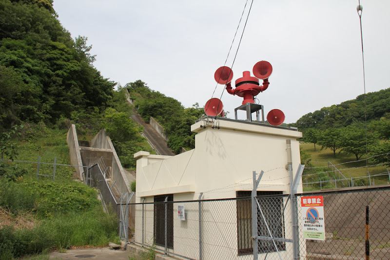
Whenever I see this type of alarm, I can't help but think of it as a toy chimpanzee clanging its cymbals.
View of the levee from the downstream side of the right bank
Downstream, vast tangerine fields spread out. The scenery is typical of Gamagori.
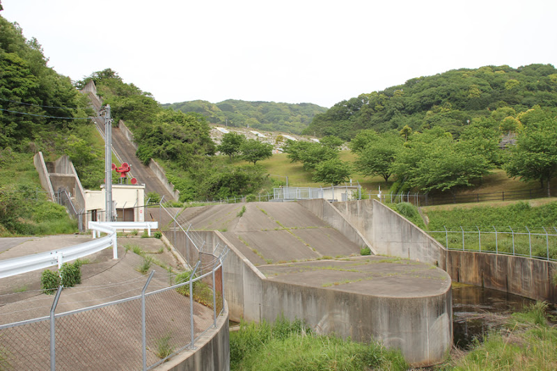
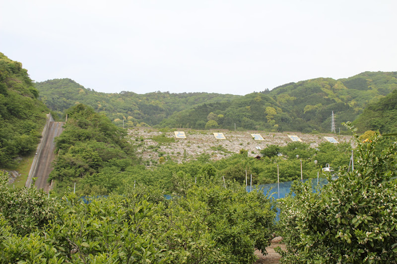
View of the flood discharge from downstream

The downstream area is maintained as a park, but there is also a walking trail that leads visitors up to the top of the levee, where they can view the embankment.
View of the levee from downstream

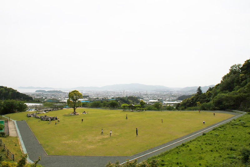
Just below the embankment is a large open space where various families were playing catch, Frisbee, and other games.
Downstream Park

It is full of suspiciousness because I am snapping the shutter by myself in the midst of many families.
View of the park downstream from the middle of the left bank
On the left bank, there are stairs leading up to the top of the mountain. Looking back on the way up, you can see Mikawa Bay. Unfortunately, it was hazy that day.
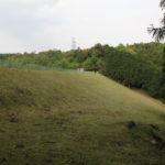
View of the levee downstream from the middle of the left bank
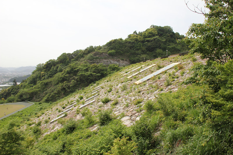
It must be very difficult to mow rockfill grass. Unlike the northern mountainous areas, there is almost no snowfall in winter in this area.
View of the top edge from the left bank

I rode my big scooter to the sky's edge (lie).
Vehicle traffic is prohibited on the top edge, so take your time to walk around.
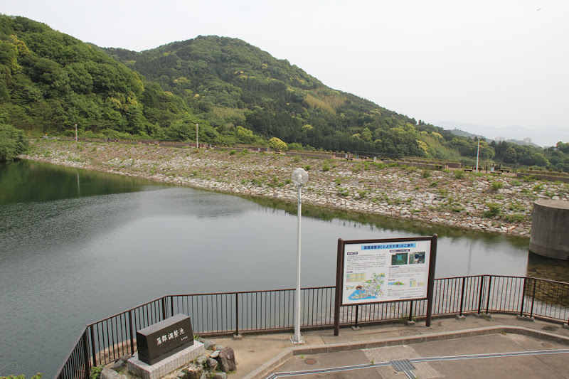
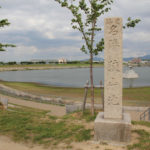
Toyooka Pond completion monument and information sign

A stone monument from the time of Toyooka Pond construction remains at the left bank dam site.
View of downstream and Gamagori city from the left bank dam site

When you reach the top level, the view opens up even more. Incidentally, the small island on the left is Takeshima. It is not that Takeshima, which has been the subject of territorial disputes (lol).
View of the dam lake side embankment and dam lake from the left bank

The embankment on the dam lake side is also a bit grassy.
View of the park downstream, Gamagori city and Mikawa Bay from the top
The more you move to the right bank, the more you can see downstream. Still, if only the weather had been better...
View downstream from the center of the top edge
If the weather had been better, we would have had a view of the expansive Mikawa Bay, but, well, we had no choice.
seismometer
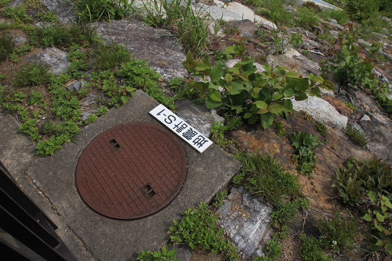
A manhole cover with a seismograph installed at the top end.
Surface Displacement Transducer

Measuring devices are placed here and there to check for abnormalities in the levee.
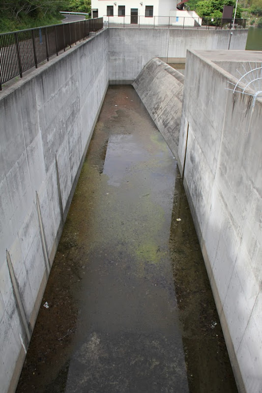
View of the flood discharge from the top
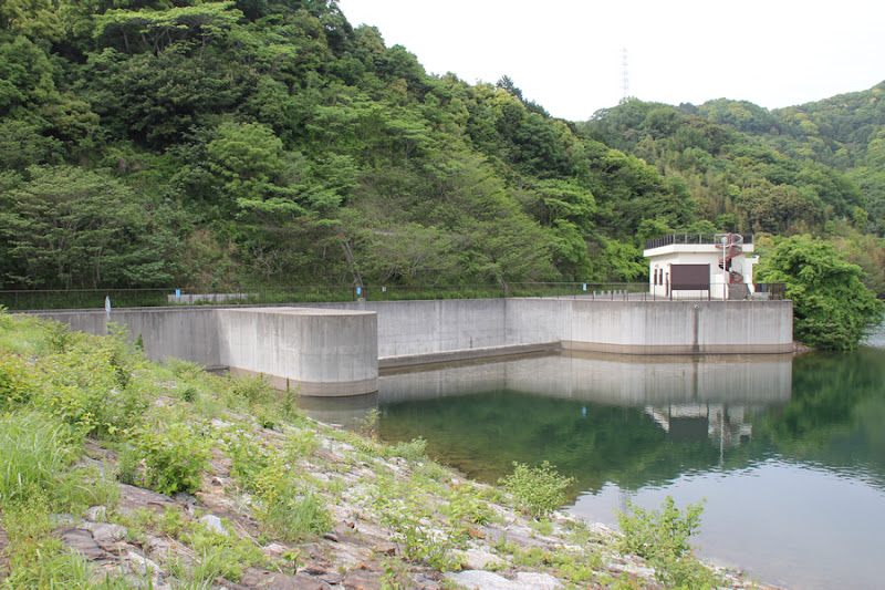
This is a common type of flood discharge in rockfill dams.
View of the dam lake from the top
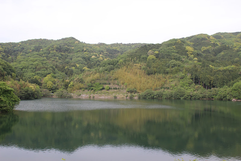
The dammed lake is not so large, with a water area of 5 ha.
View of the downstream flood discharge from the top
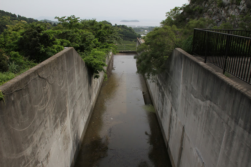
It is a flood discharge that seems to be directly connected to the sea. Incidentally, the island in Mikawa Bay is Mikawa Oshima. It is an uninhabited island that is used as a beach in summer.
View of the flood discharge on the lake side of the dam from the top
It is a very standard flood discharge.
View of the top edge from the right bank

There are benches and the dam is ideal for viewing the dam lake and Mikawa Bay.
View of the embankment on the lake side from the right bank

By the way, there is a light at the top edge, but I am not sure if it will be lit at night. If it is a night view spot, I have a feeling that it will be lit at night as well, but is it? I checked the night view information website to be sure, but for some reason there were no photos of the night view from the top edge, even though it is a night view spot.
View of the flood discharge from the right bank

I am wondering how it will flow if it is overflowed.
Gamagori Adjustment Pond Stone Monument

We are wondering if the mayor at this time was a modest person, or if his name is not engraved. We do not know who he was, but he may have been a good government official.
View of the embankment on the lake side of the dam from the observation deck
The rooftop of the intake facility building is an observation deck where you can get a bird's eye view of the dam lake side. Personally, I would like to see a bird's eye view of the downstream side.
Slant-flume intake system

This is a slant-flume intake system commonly used in dams for irrigation purposes.
View of the embankment and Mikawa Bay on the dam lake side from the observation deck
It is a pity, because the view would have been better if the weather had been better.
Gamagori Regulating Pond Specifications
| River Name | Nishida River System Yamabayashi River |
|---|---|
| Objective | Water for irrigation and water supply |
| Model | rockfill dam |
| Bank height | 43.2m |
| Bank length | 178m |
| Dam volume | 360,000m3 |
| Watershed Area | 0.8km2 |
| Reservoir area | 5 ha |
| Total storage capacity | 612,000m3 |
| Effective water storage capacity | 500,000m3 |
| Dam operator | Tokai Agricultural Administration Bureau |
| Main body constructor | Maeda Corporation, Yahagi Corporation, Tokura Corporation |
| Year of launch | 1977 |
| Year Completed | 1996 |
| Name of Dam Lake | Lake Tokaoka |
Other facilities/observations
| Parking lot | ○ | It is maintained as a park and has very good facilities. A picnic with a packed lunch would be nice. |
|---|---|---|
| Toilet | ○ | |
| Park | ○ | |
| PR Exhibition Hall | × | |
| Fishing | ×x? |
Comment
Marubashi Satoru liked this on Facebook.
Oota Toshiaki Syunmyou liked this on Facebook.
Abe tea (Camellia sinensis) liked this on Facebook.
Keizo Imai liked this on Facebook.
Keizo Imai liked this on Facebook.
Kazue Abe liked this on Facebook.
Oota Toshiaki Syunmyou liked this on Facebook.
Marubashi Satoru liked this on Facebook.