

Location: Samen, Ono-shi, Fukui Prefecture (Date of interview: 2010/07/30)
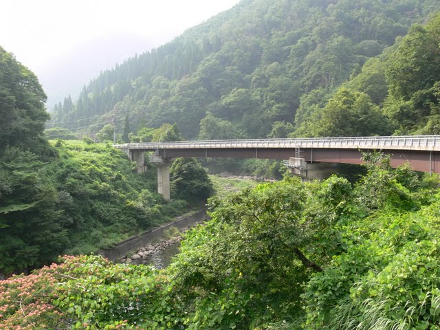
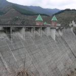
View of the levee from the bridge downstream
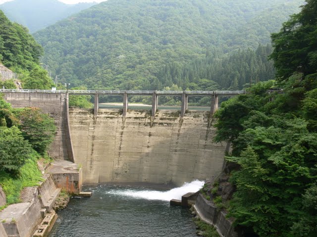
Ishitashira Dam is a dedicated power generation dam for the J-Power Development Project and is one of the few gravity arch dams in Japan. There is a bridge downstream, from which you can see the dam from the front (actually, the back), which is nice. By the way, "Ishitetsubaku" is read as "Itoshiro," but it is difficult to read.
Go upstream from Ishitashira Dam and enter Gifu Prefecture.There is a ski resort with the fashionable name "Itoshiro Charlottetown."(It appears that Itoshiro Charlottetown ceased operations in 2011). Further in the back is Wing Hills, a ski resort operated by Alpine, a major chain of sporting goods stores. This was my home slope when I started snowboarding.
After the Ichinomiya JCT was built and the Meishin Expressway and Tokai-Hokuriku Expressway were connected, it was so crowded (both on the road and on the slopes) that I moved my home to Mitake. Ah, but I would like to go to Itoshiro after a long time.
Oops, this is unrelated to the dam and is an unimportant story, but please note that the road from Ishitashira Dam to Itoshiro Charlotte Town is closed during the winter season. In that case, you will have to go via the Aburasaka Pass Road, but during the heavy snow season, the Aburasaka Pass Road is often closed to traffic, so the road may be closed from the Gifu Prefecture side....
View of the levee from the downstream side of the right bank
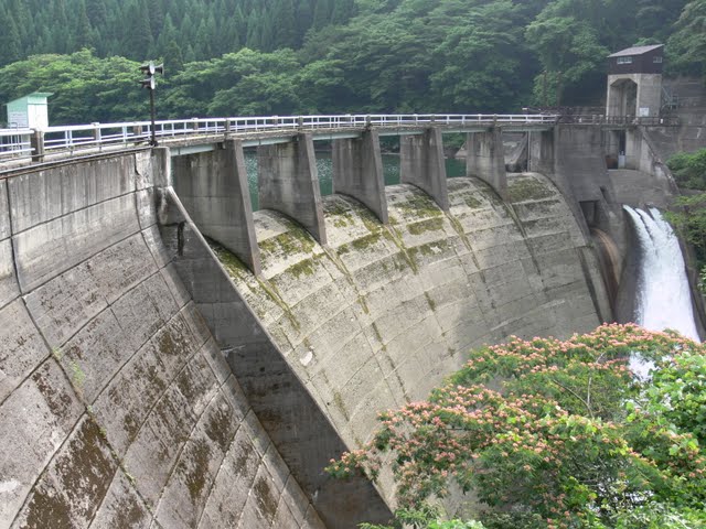
The mossy feeling gives it a nice flavor. There is something very nice about this atmosphere. On this day, the sun was shining after it rained, but it made us forget the heat.
View of the dam nameplate and embankment from the right bank

The paint has peeled off the nameplate as well, but even the nameplate looks so sweet when I think about how it has watched over this dam for so many years.
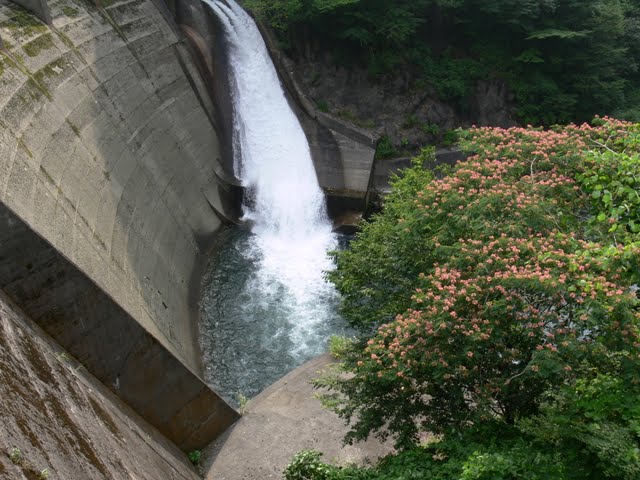
Downstream view of the levee from the right bank
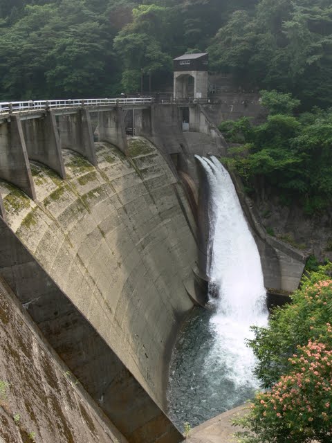
It appears to be a river maintenance discharge. It is flowing beautifully. I was admiring it for a while.
View of the top edge from the right bank
The top edge is off-limits. However, I feel that this is a good thing. Even if you cannot enter the top end, you will be satisfied with this dam.
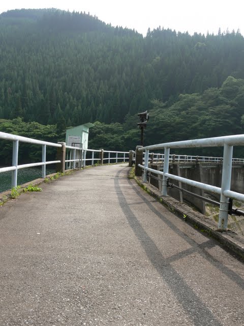
Looking downstream from the right bank
That bridge is the one that allows you to look directly ahead (or more precisely, directly behind). Also ahead is the Yamahara Dam (0943-Yamabara Dam).
View of the reduction work from the right bank
I was staring at it, especially the part that flows into this abatement. I felt as if it would wash away all the bad things. Ishitashira Dam is a healing dam. I am sure.
View of the embankment on the lake side from the right bank

A few days ago at the Kuzuryu Dam and Managawa Dam, "Season for Familiarization with Forests and LakesThe event was being held at the time of the "Crest" event, and they were releasing the fish from the crest at that time. Unfortunately, the fish were not discharged on that day. I was disappointed that I could not go to the event and see the discharge, but I had no choice. When the fish are released from Crest, they seem to flow beautifully.
View of the dam lake from the right bank

There seems to be somewhat too much sediment. I am sure this is not a problem at all, though, since the dam is for power generation only.
View of the water intake from the right bank
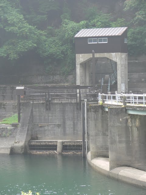
The water taken in through this intake is sent through a water pipeline tunnel to the Kuzuryu Dam.
dam characteristics
| River Name | Ishitashira River, Kuzuryu River System |
|---|---|
| Objective | generation (e.g. power) |
| Model | gravity arch dam |
| Bank height | 32m |
| Bank length | 113.6m |
| Dam volume | 20,000m3 |
| Watershed Area | 104.6 km2 |
| Reservoir area | 11 ha |
| Total storage capacity | 917,000m3 |
| Effective water storage capacity | 917,000m3 |
| Dam operator | Power Development Co. |
| Main body constructor | Tobishima Construction |
| Year of launch | 1965. |
| Year Completed | 1968. |
Other facilities/observations
There is no parking lot because the dam is for power generation only, but there is a wide shoulder nearby that may be a place to turn around when the road is closed for the winter.
| Parking lot | × |
|---|---|
| Toilet | × |
| Park | × |
| PR Exhibition Hall | × |
| Fishing | × |
Comment