
Date of interview: 2013/04/29 (Mon.)
It was seven years ago, and I have completely forgotten why I headed to Hirono Dam on that day, but I think it was probably because I stopped by for a day drive during Golden Week.
View of the levee downstream from the right bank
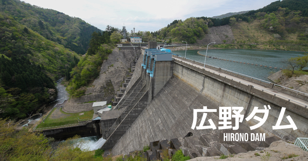
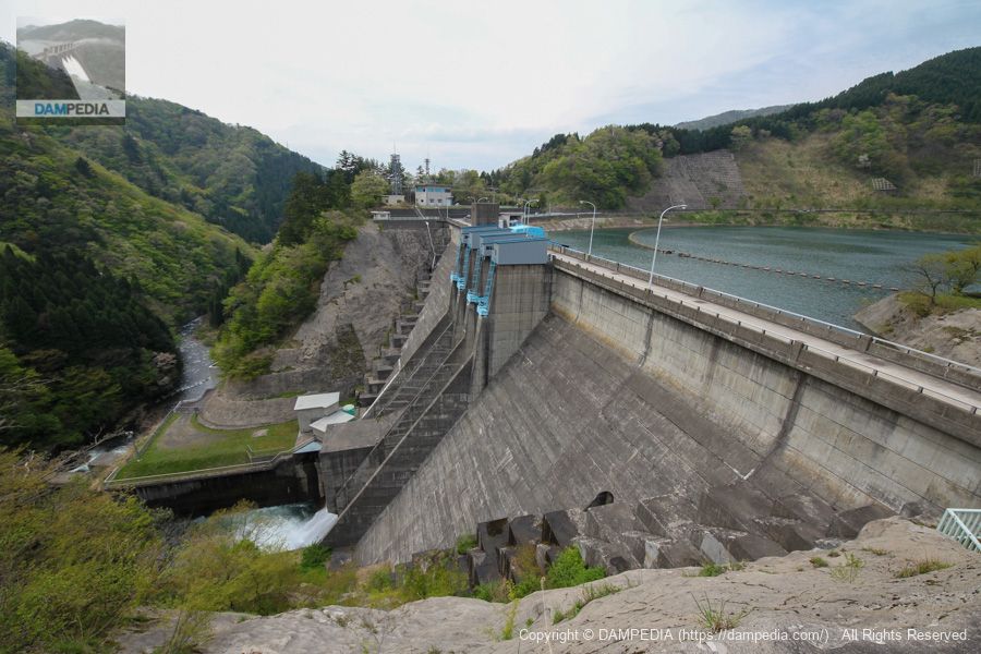
Hirono Dam is a gravity concrete dam completed in 1976 and operated by Fukui Prefecture.
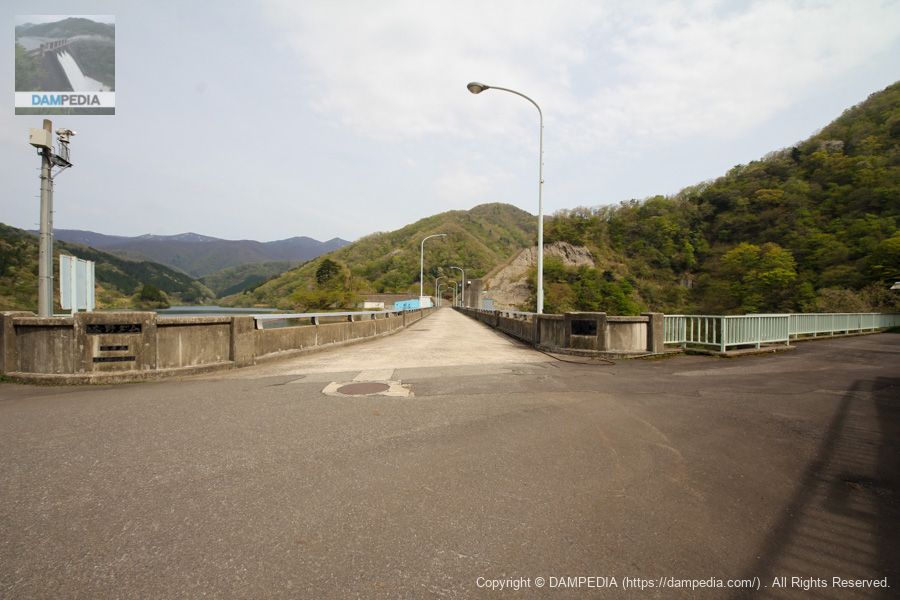
View of the top edge from the right bank
The top end is accessible to vehicles as the route leads to the Fukui Kawadori Mountain Road at Yashagaike Pond.
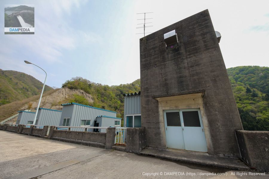
Gate winder room and elevator building?
The rightmost one is probably the elevator building. The four on the left are radial gate winder rooms in Crest.
Mystery hangar
Cross the top edge to the left bank. It looks like a hangar of some kind. There are rails, so it seems to be a hangar for some heavy objects. I thought it was a boatyard, but as you can see in the left side of the photo, there is a boatyard on the right bank, so it does not appear to be a boat.
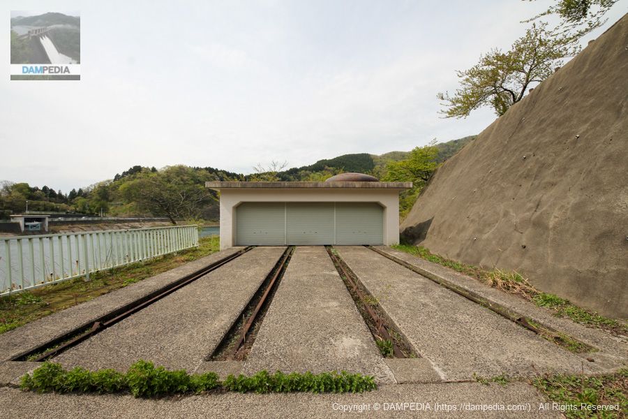
I will visit the management office later to get a dam card, and now I regret that I should have asked what this was about at that time.
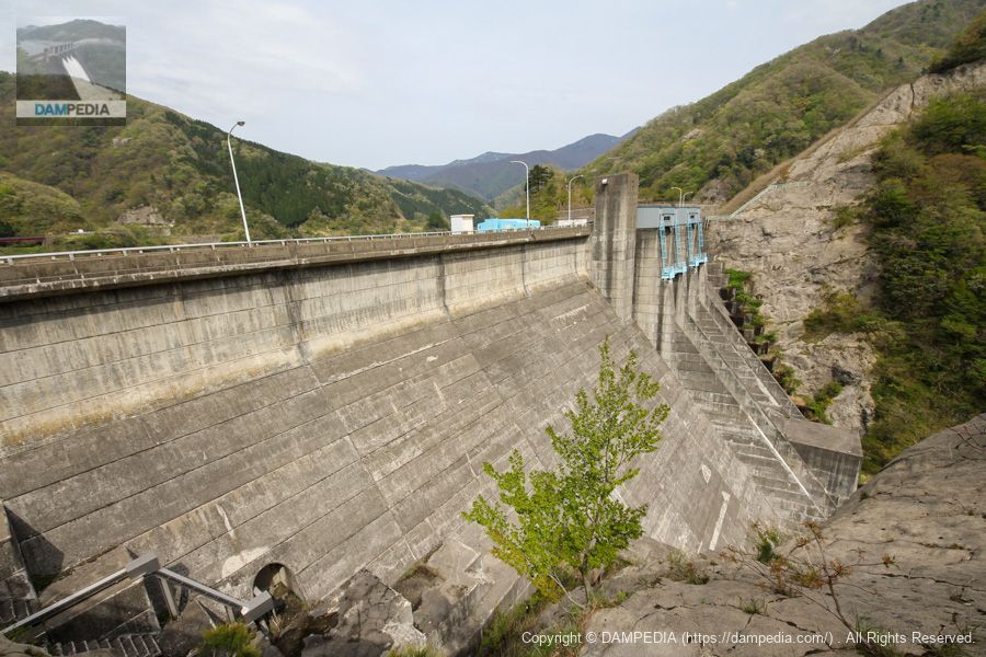
View of the upstream face of the embankment from the left bank
The Hirono Dam has two radial gates for emergency flood discharge at the left and right crests, one conduit gate in the center, and a multi-stage high-pressure slide gate and hollow-jet valve on the extreme right bank for water utilization.
The roller gate in the center of the photo is a spare gate (security gate in the local expression).
The preliminary gate specifications are as follows
Hirono Dam Safety gate
From the local nameplate
Effective span x inlet height: 2.100x2.100m
Opening/closing speed: 0.3m/min
Door weight: 3t
Date of production: October 1975
Production: Ishikawajima-Harima Heavy Industries Co.
On the right bank side will be the surface intake gate. The specifications here are as follows.
Hirono Dam Surface intake gate
From the local nameplate
Effective span x inlet height: 3.600 x 27.000 m
Opening/closing speed: 0.3m/min
Door weight: 35t
Date of production: October 1975
Production: Ishikawajima-Harima Heavy Industries Co.
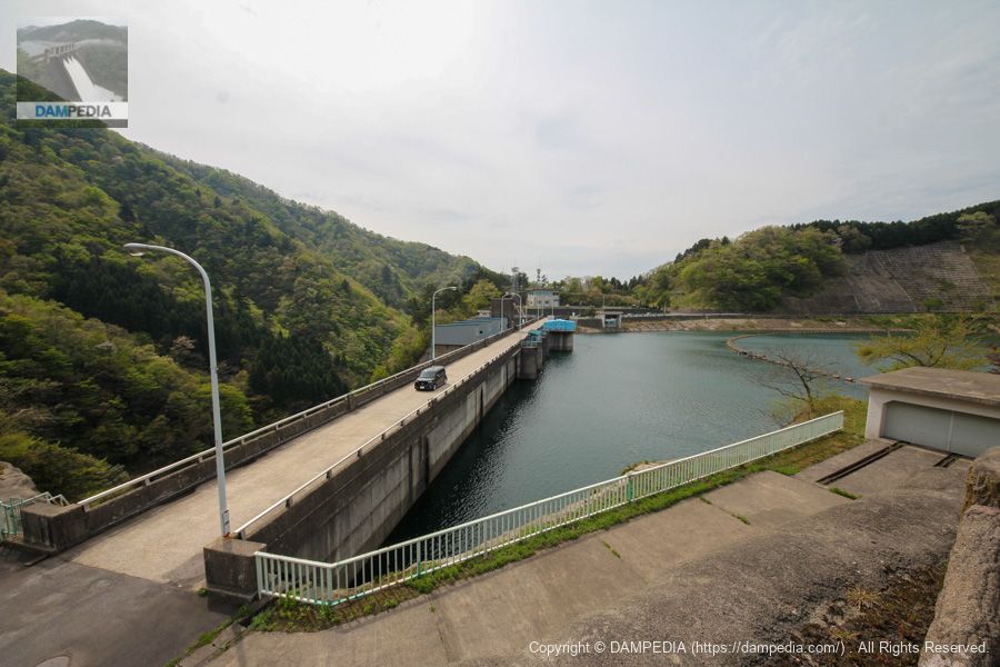
View of the levee from the high ground on the left bank
There is an elevated platform on the left bank that can be climbed freely, offering a view of the upstream face of the embankment.
Signboard of Hirono Dam Hometown Park
Its high ground is "Hirono Dam Furusato Park". It is also equipped with restrooms.

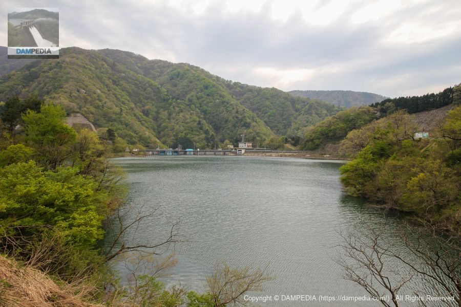
View of the dam lake from around Hirono Dam Furusato Park
There is a bridge on the right, beyond which you can circle the dam lake.
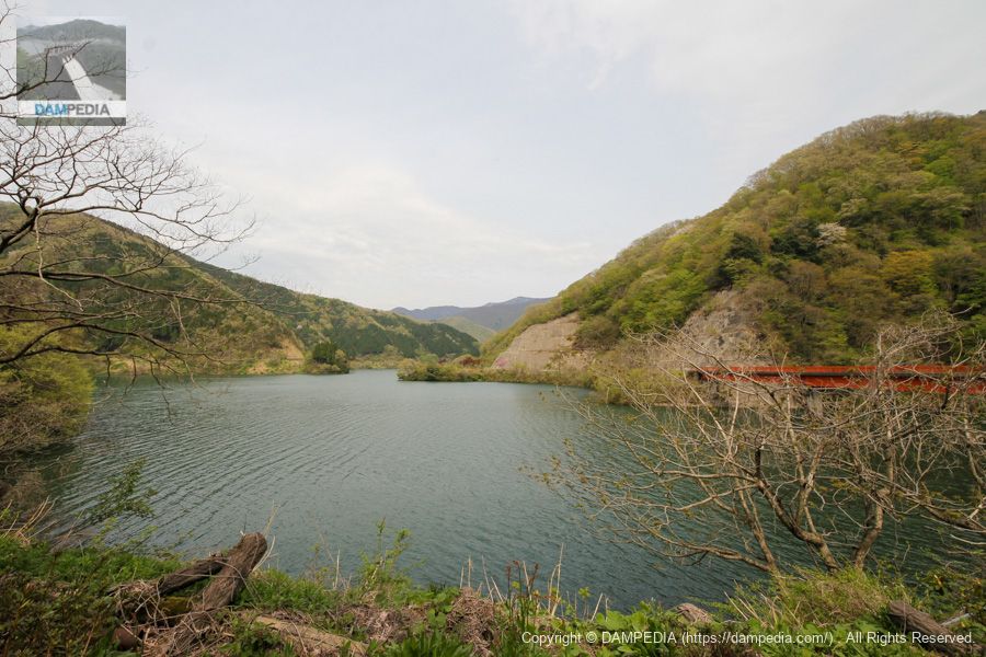
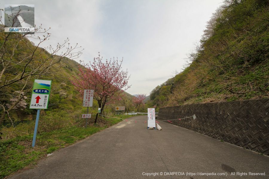
Yashagaike Climbing Route
It was late April, but the climbing route across the top to Yashagaike Pond to the south was closed due to lingering snow.
View of the top edge from the left bank
Simple top edge.

View of the downstream face of the levee from the observation platform on the left bank
There is an observation platform downstream on the left bank from which the embankment can be viewed. It is a good angle to see the dam holding back the water.
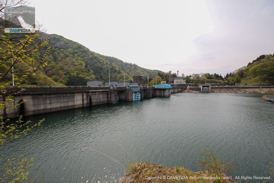
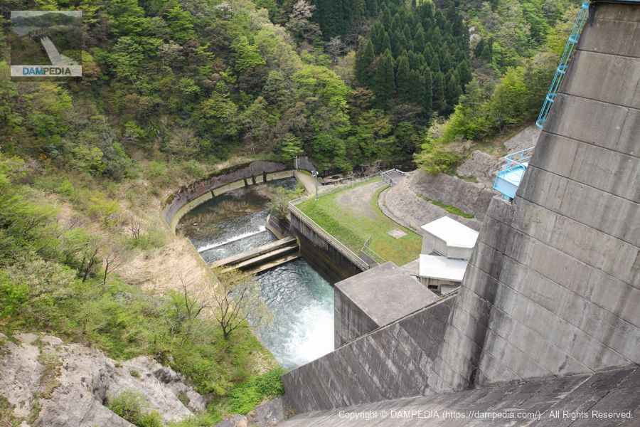
View of the irrigation water discharge system from the left bank observation deck
On the right bank is a water diversion and discharge facility where water taken in through a multi-stage gate pipe is discharged through a high-pressure slide gate and then through a hollow-jet valve. On this day, no water was discharged from the hollow-jet valve, probably because the water was being discharged through the conduit gate.
Incidentally, the Hirono Power Station is located at the downstream bend of the right bank. Hirono Power Station was owned by the prefecture when it started operation in 1996, but was transferred to Hokuriku Electric Power Company in 2010. The maximum output is 1,400 kW.
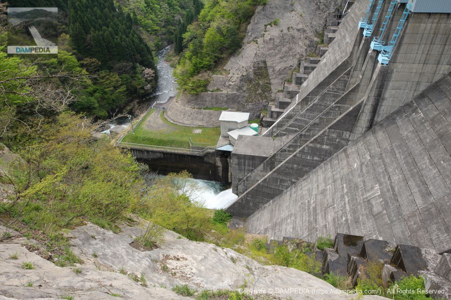
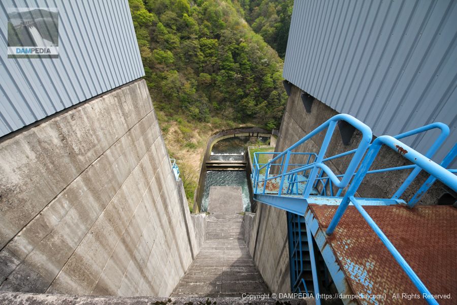
View of the reduction work from the top edge
You can see that the downstream turns right at a right angle to the right. There is no road downstream, so it is not possible to look up from the bottom. There may be a tour during the "Friendship with the Forest and Lake" event, so you may be able to look upstream at that time.
View downstream from the crest gate on the left bank
We will start from the left bank.
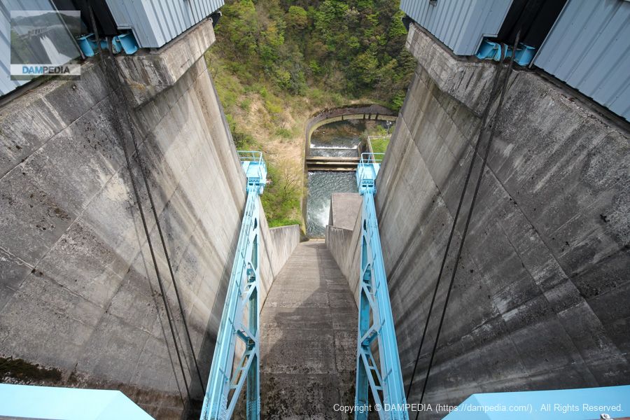
Crest's radial gate is 7.0 m wide and 11.355 m high, with two gates on each side.
View downstream from between the left and right crest gates
Looking downstream from between the left and right crest gates. Below is the outlet of the conduit gate. The conduit gate is a single sliding (high pressure) radial gate, 2.4m x 2.4m in size.
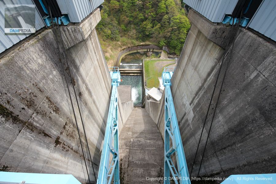
View downstream from the crest gate on the right bank
It is the rightmost side.
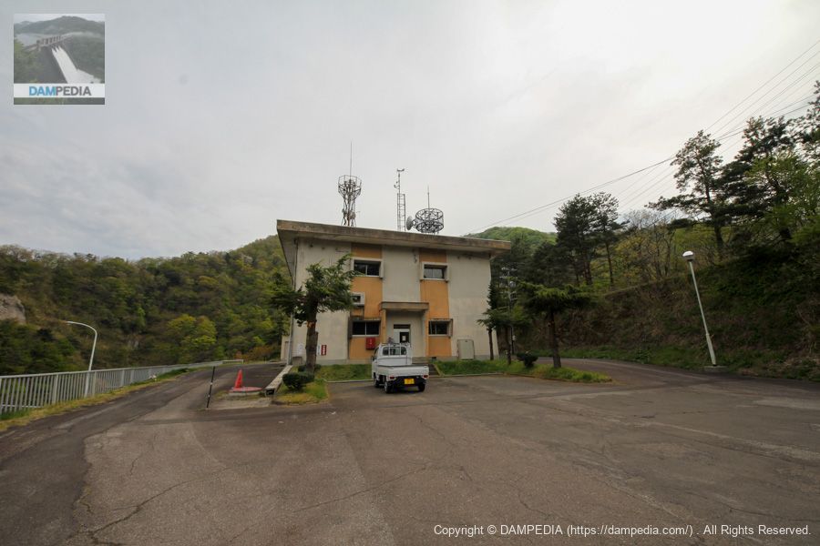
dam monitoring station
I received a dam card at the dam monitoring station. He seemed to be a commissioned officer, but he was friendly and asked where I was from.
View of the upstream face of the embankment from the right bank
The design is linear and lean. The design is very prefectural. At the far right is a restroom.
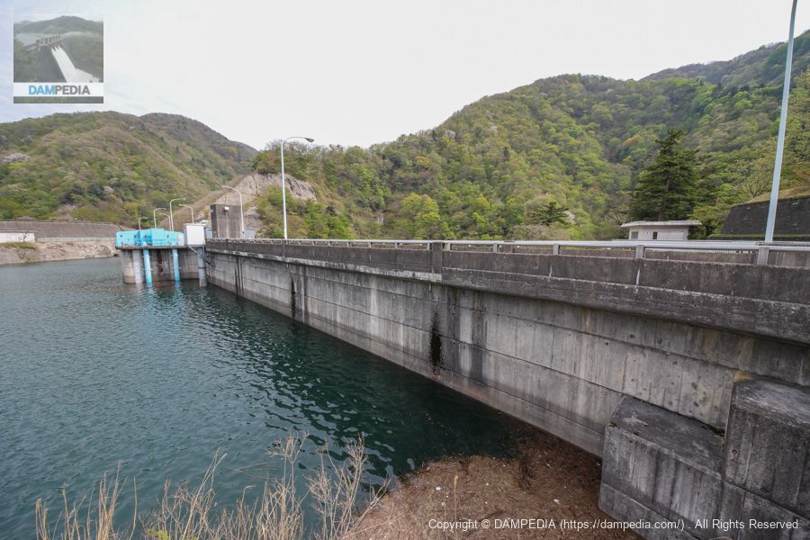
View of the upstream face of the embankment from the prefectural road on the right bank
On the way to the Futatsuya Diversion Weir, I looked back at the levee and took this photo. In technical terms, this is the front view, but when the water level is high, the levee is not visible, so from an enthusiast's point of view, it looks like the back of the levee.
Hirono Dam was constructed by Fukui Prefecture as part of the Hino River Comprehensive Development Project, and provides flood control for 265 m3/s of the planned high water flow rate of 350 m3/s at the dam site.
As for unspecified irrigation, the Hino River basin has been suffering from drought every year, and the project will use a maximum capacity of 3,100,000 m3 during the irrigation season to replenish vested water for 3,547.6 ha of existing cultivated land downstream.
They also supply up to 0.5 m3/s (40 thousand m3/day) to the Sabae East Industrial Park.
In addition, as mentioned above, hydroelectric power generation is taking place, with a maximum water intake of 3.2 m3/s and an effective drop of 54.4 m at the Hirono Power Station, generating a maximum output of 1,400 kW.
In this way, the Hirono Dam is a simple dam that is typical of prefectural management, yet useful to the community.
Hirono Dam Specifications
| Location | 50 Aza Yubayashi, Hirono, Minami-Echizen-cho, Nanjo-gun, Fukui |
| River Name | Hino River, Kuzuryu River System |
| Objective | F (flood control, agricultural disaster prevention) N (unspecified water, water for river maintenance) I (industrial water) P(Power generation) |
| Model | G(gravity-fed concrete dam) |
| Bank height | 63m |
| Bank length | 162m |
| Dam volume | 143,000m3 |
| Watershed Area | 42.3km2 |
| Reservoir area | 54ha |
| Total storage capacity | 11,300,000m3 |
| Effective water storage capacity | 9,600,000m3 |
| Dam operator | Fukui prefecture (Hokuriku area) |
| Main body constructor | Kumagai Gumi |
| Year of launch | 1967. |
| Year Completed | 1976 |
| Name of Dam Lake | Hirono Dam Lake |
Other facilities/observations
| Parking lot | ○ |
| Toilet | ○ |
| Park | ○ |
| PR Exhibition Hall | × |
| Fishing | ○○ (excluding no-take zones) |

Comment