
Date of interview: 2013/04/29 (Mon.)
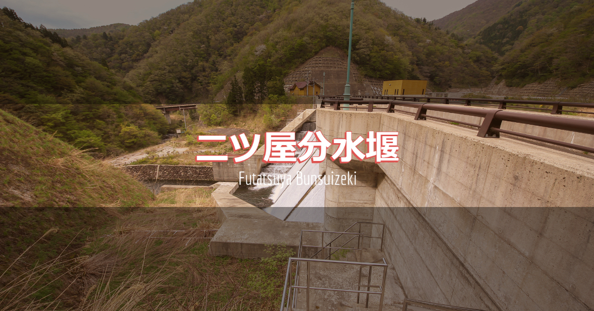
The name "Futatsuya Diversion Weir" makes it sound like a weir rather than a dam, but with an embankment height of 24.7 meters, it is a magnificent dam. It is located upstream of Hirono Dam. On the local signboard, the embankment is described as a "diversion works. Therefore, it is also called Futatsuya Diversion Works or Futatsuya Headworks.
The construction of the Hirono Dam ensured a flood control safety level of once in 70 years for the upper reaches of the Hino River, but the flood control plan was later revised in line with the revision of the Kuzuryu River Construction and Implementation Master Plan, and the flood control safety level was revised to a probability of once in 100 years.
However, the existing Hirono Dam was found to have insufficient flood control capacity, and it was decided to compensate for this shortage by conducting water to the Masudani Dam, located one ridge over from the Hirono Dam.
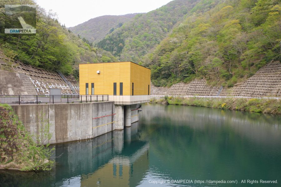
View of the monument and the upstream face of the embankment from the right bank
Because the facility for conducting this water is located at the Futatsuya Diversion Weir, the stone monument reads "Futatsuya Water Conducting Facility.
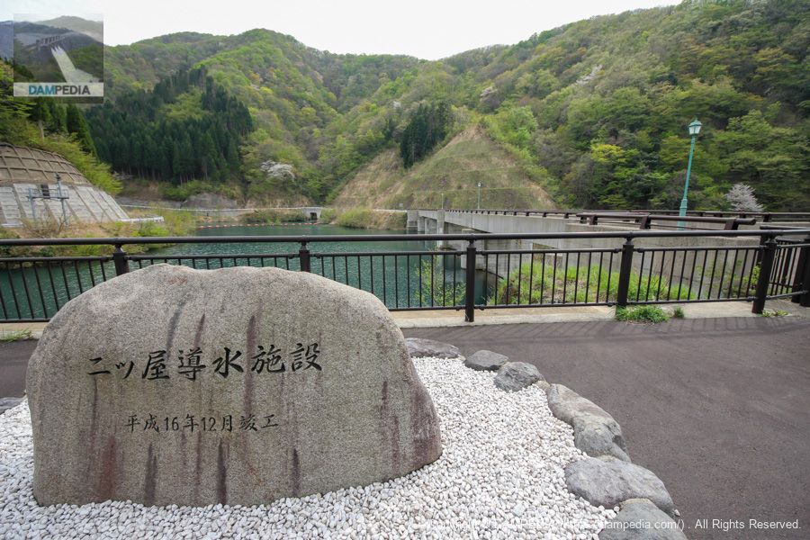
View of the upstream face of the embankment from the right bank
The crest is free overflow but seems to be constantly overflowing. The water is quite clear because there are no houses upstream beyond this point.

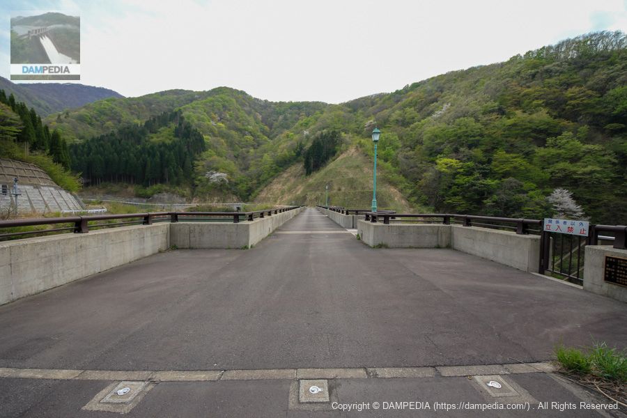
View of the top edge from the right bank
The top end is open to automobile traffic as it connects to a forest road beyond, but you will need to be very prepared to pass through.
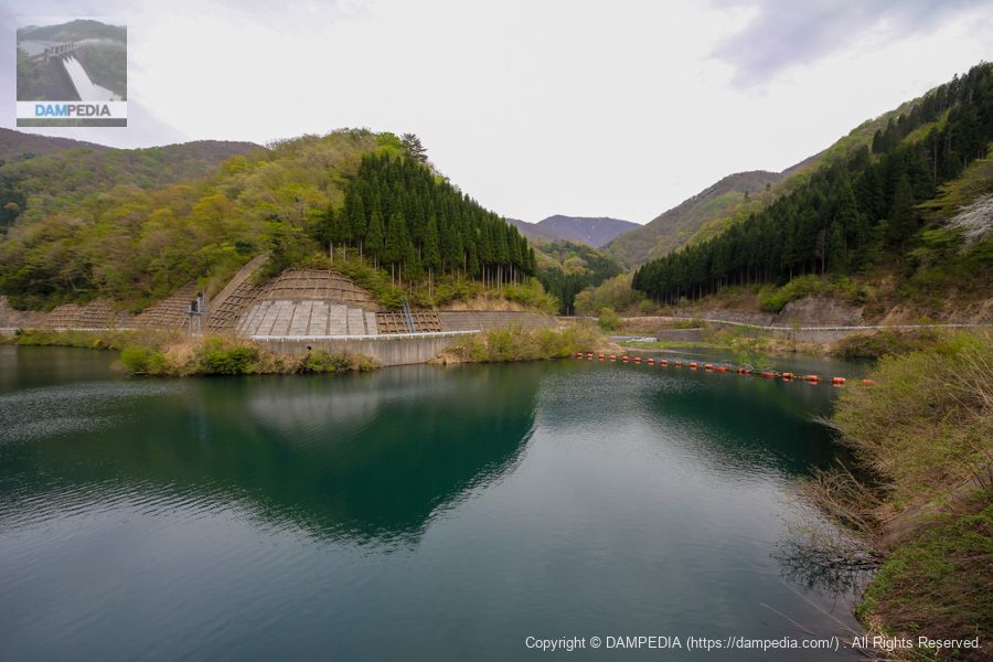
View of the dam lake from the top
According to the signboard at the site, the Okochi River is on the left side toward the dam (which is the Hino River on Google Maps and GSI maps), and the Suzudani River is on the right side, which seems to change its name to the Hino River from downstream after the dam.
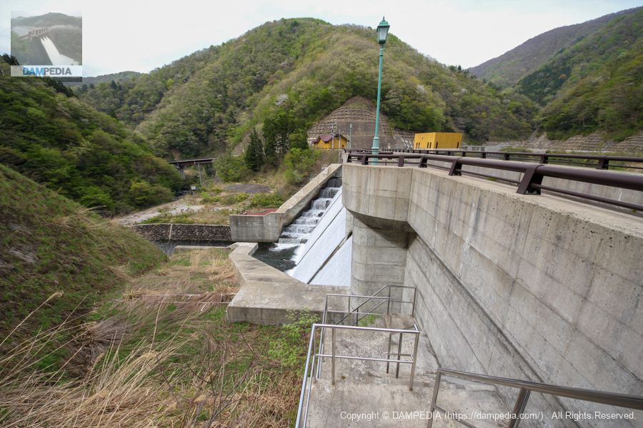
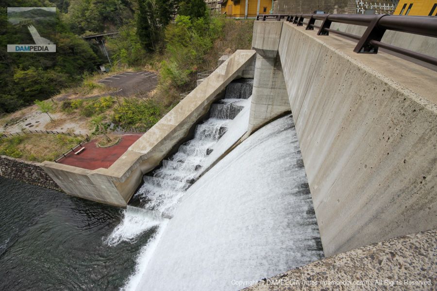
Downstream view of the embankment from the left bank
Looking downstream from the left bank across the embankment. It is a small dam with an embankment height of 24.7m, but it has a magnificent toe-lead flow wall. The lighting is stylish. The control center and water channel facilities are also impressive in the color of golden yellow.
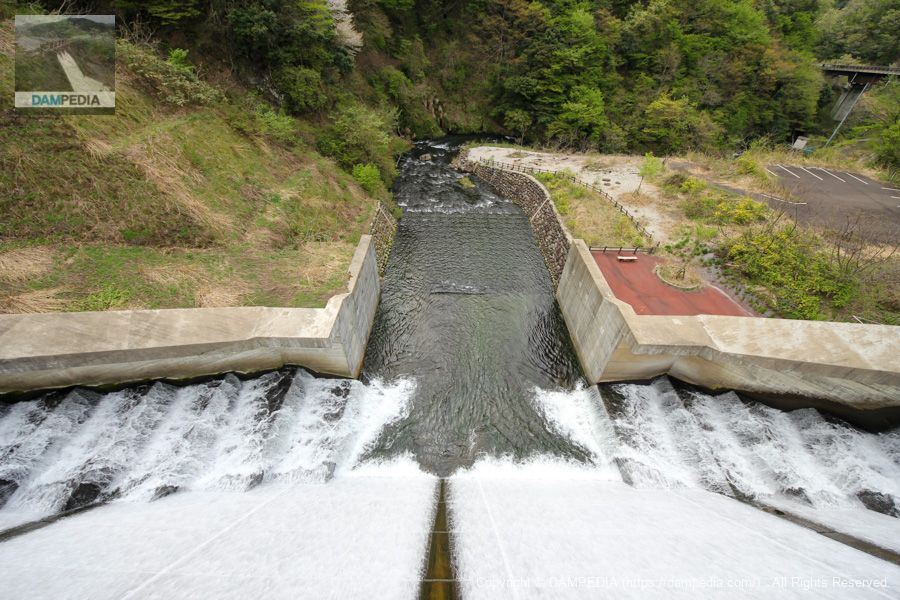
View downstream from the top
Although it is a constant overflow, it is the enthusiasts who are excitednature (of a person)Is. There is a parking lot on the downstream side of the right bank and some benches can be seen directly below, as if it were a park, but unfortunately it has been abandoned, probably because the access road has collapsed. Unfortunately, the access road has been abandoned, probably due to the collapse of the access road. (Of course, you can't get there.)
View downstream from the terrace in the center of the top edge
There are five terraces on the downstream side of the top edge from which the downstream face can be viewed.
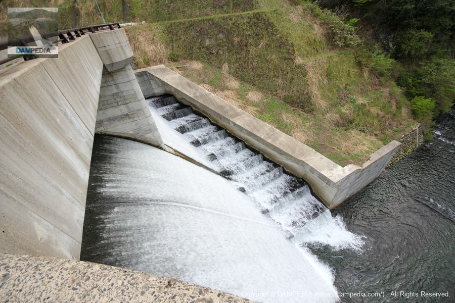
View downstream on the right bank from the terrace in the center of the top edge
Looking toward the right bank on the opposite side. By the way, there is a signboard at the site that says "Jet Flow Gate (Φ600mm)," but I could not visually confirm it, and the signboard also shows a plan and elevation view, but I could not confirm them either. However, looking at the photos in the dam handbook, it seems that the gate is located in the center of the photo below.
View of the mouth of the conduit from the top
This is the mouth of the conduit. From here, the water flows out through the 3,112-meter conduit tunnel to the Masudani Dam.
The specs of the conduit are as follows. The Φ700m for the slew valve is indeed a 700mm mistake.
| Tunnel Extension | 3,112.00m |
| cross-sectional profile | 2R Horse Trapeze Form |
| Tunnel shape | R1 = 2,500, R2 = 5,000 |
| Cross-sectional area of inner space | 20.733m2 |
| plane track | R=∞ to R=300 to R=∞ |
| longitudinal gradient | 1/410 |
| Discharge Facilities | orifice gate(Roller gate)B2.5mxH2.0m Discharge main gate (slew valve) Φ700m |
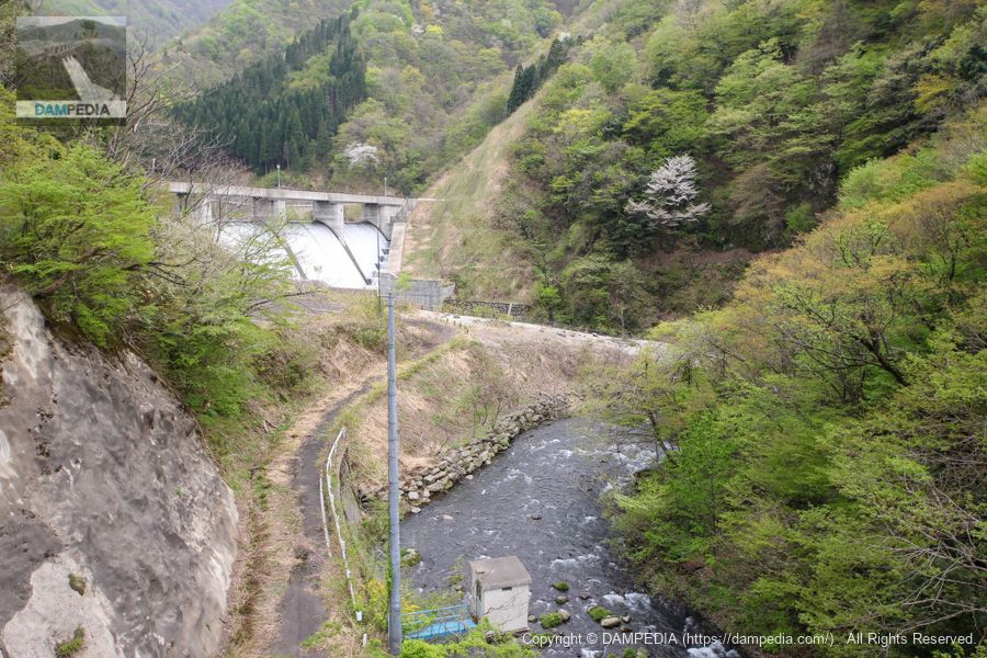
View of the levee from the bridge downstream
When returning to Masutani Dam after visiting the Futatsuya Diversion Weir, I took this photo at the bridge where the levee body can be seen on the downstream side. I still wish the road below would be improved so that we could look up directly at the embankment.
Incidentally, the Futatsuya Diversion Weir not only supports the flood control plan of the Hirono Dam, but also uses the surplus water for irrigation, water supply, and industrial use, which are the water utilization purposes of the Masudani Dam, making it one of the major features of this project to utilize all the water in the basin.
It was the Futatsuya diversion weir, a small body playing a large role.
Futatsuya Diversion Weir Video
A video of the overflow is available.
Futatsuya Diversion Weir Specifications
| Location | Futatsuya, Minami-Echizen-cho, Nanjo-gun, Fukui |
| River Name | Hino River, Kuzuryu River System |
| Objective | F (flood control, agricultural disaster prevention) N (unspecified water, water for river maintenance) A (irrigation water) W(Water for water supply) I (industrial water) |
| Model | G(gravity-fed concrete dam) |
| Bank height | 24.7m |
| Bank length | 97.5m |
| Dam volume | 18,000m3 |
| Watershed Area | 20.3 km2 |
| Reservoir area | 3 ha |
| Total storage capacity | -m3 |
| Effective water storage capacity | -m3 |
| Dam operator | Hokuriku Agricultural Administration Bureau (Fukui Prefecture) |
| Main body constructor | Kumagai Corporation, Penta-Ocean Construction, Yamato Construction |
| Year of launch | 1986 |
| Year Completed | 2005 |
| Name of Dam Lake | - |
Other facilities/observations
| Parking lot | ○ |
| Toilet | × |
| Park | × |
| PR Exhibition Hall | × |
| Fishing | ○○ (excluding no-take zones) |
Map around Futatsuya Diversion Weir
Weather around Futatsuya Diversion Weir
Accommodations that may be close to the Futatsuya Diversion Weir


Comment