
Date of interview: Sunday, 02/19/2012
Location: (left bank (of a river)) Aiaizawa-cho, Kanazawa City, Ishikawa Prefecture (right bank (shore)) Kamitatsumi-cho, Kanazawa City, Ishikawa Prefecture
Forgive me for finally writing an article on the occasion of the test release after almost 7 years....
It had snowed the day before, and we had to pick up Dashiro and Prince Nishi, a dam enthusiast from Kyoto who did not have studless tires, from Aichi before going to the site for a very memorable visit.
However, it was really an unusual amount of heavy snowfall, and it seemed like we were driving on snowy roads all the way into Kyoto.
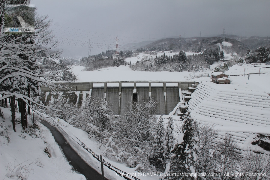
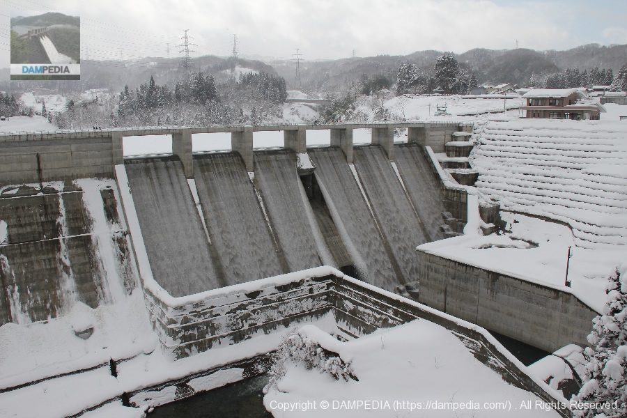
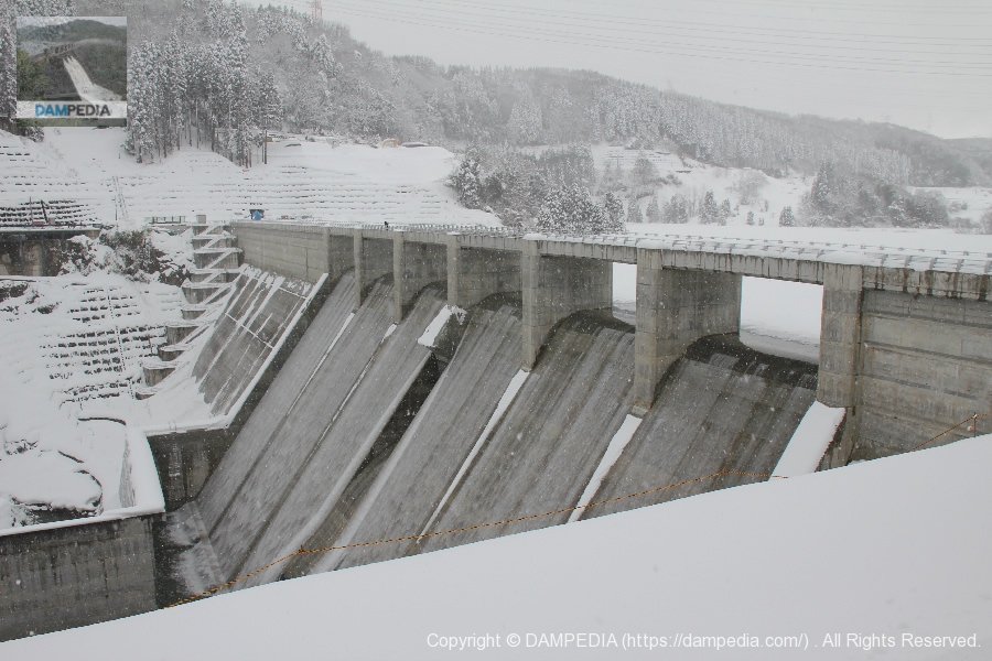
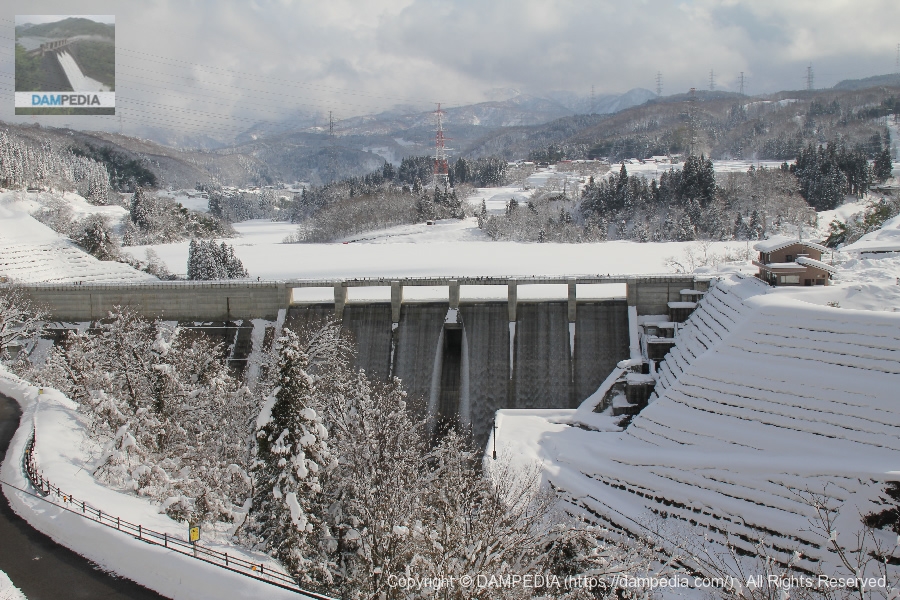
View of the levee from downstream
We arrived at Tatsumi Dam after picking up two people in Kyoto early in the morning. It is quite deep in snow. And we can see the Tatsumi Dam where water is released from the free overflow crest.
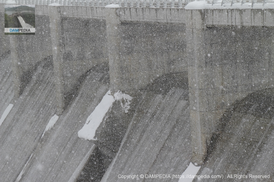
View of the crest area
It is nice to have a view of the levee in a good position.
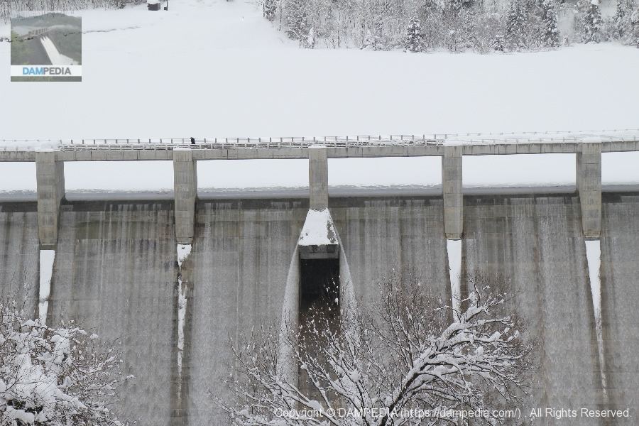
View of Crest Gate
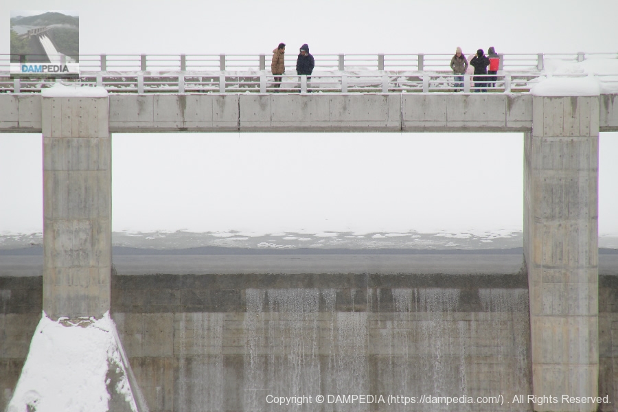
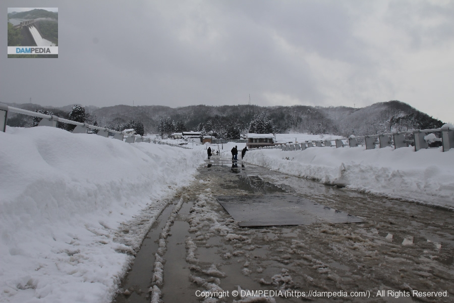
Not only enthusiasts but also the general public came to watch the release. Despite the heavy snowfall, the number of visitors seemed to be quite large.
Ishikawa Tatsumi Dam Administration Building
You can see the management office on the right bank. Let's go there later.

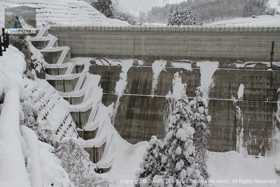
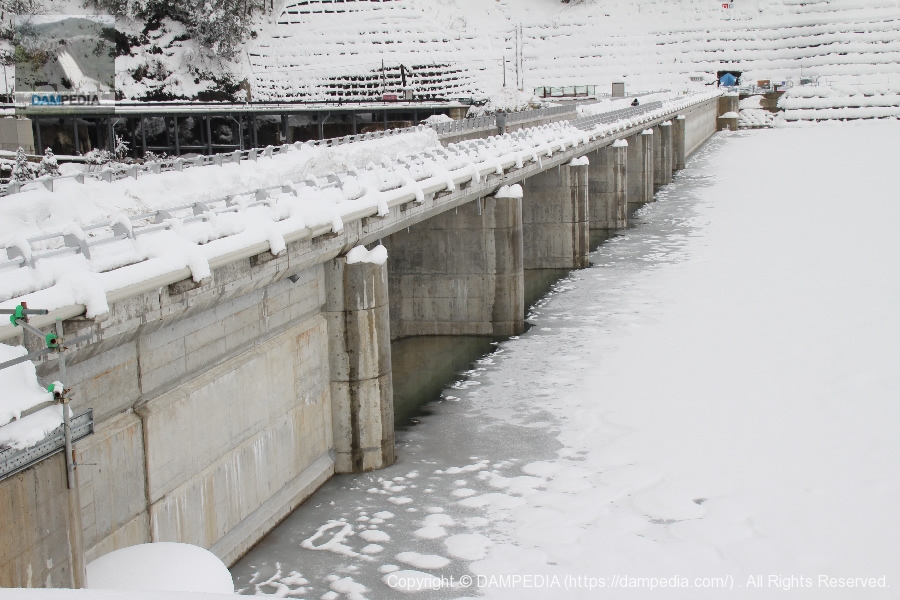
Downstream bank and footing on the right bank
The snow was so heavy that day that the embankment is also covered with snow. The footings are quite piled up and it is impossible to ascend or descend.
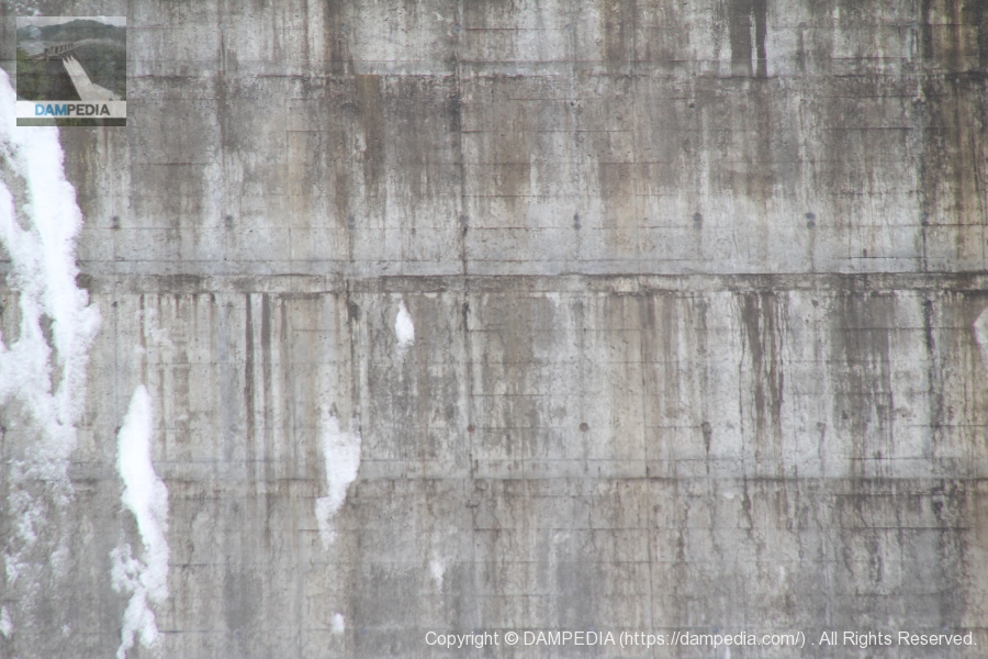
Embankment concrete surface
Zoom in on the concrete surface of the embankment. It is wet with snow, but you can see that it is freshly poured and clean.
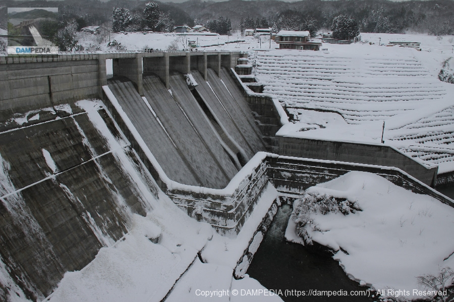
View of the levee downstream from the right bank
We are approaching the embankment little by little. The flow-conducting wall seems to be high in relation to the size of the embankment.
View of the levee downstream from the right bank
There is a depressed area outside the conduit wall on the right bank side of the L-shaped bend.
Diversion works for the Tatsumi irrigation system to the Higashiwa intake
This depressed area is a facility for the diversion of water for the Tatsumi water supply to the Higashiwa intake. Water discharged from the dike flows through this hole. This structure is not often seen in ordinary dams.
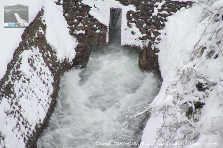
East rock intake of the Tatsumi irrigation canal
This is the Higashiwa intake of the Tatsumi Irrigation Canal. The Tatsumi Irrigation is an approximately 11-km irrigation channel that runs through Kanazawa City, Ishikawa Prefecture, and was constructed under the order of Maeda Toshitsune, the third lord of the Kaga Domain. This intake is located a little downstream of the right bank of the Tatsumi Dam, and the upper diversion works were built because it was necessary to pass the water there.

In addition, the original Tatsumi Dam construction plan called for the intake itself to be submerged, but the plan was changed to move the embankment upstream.
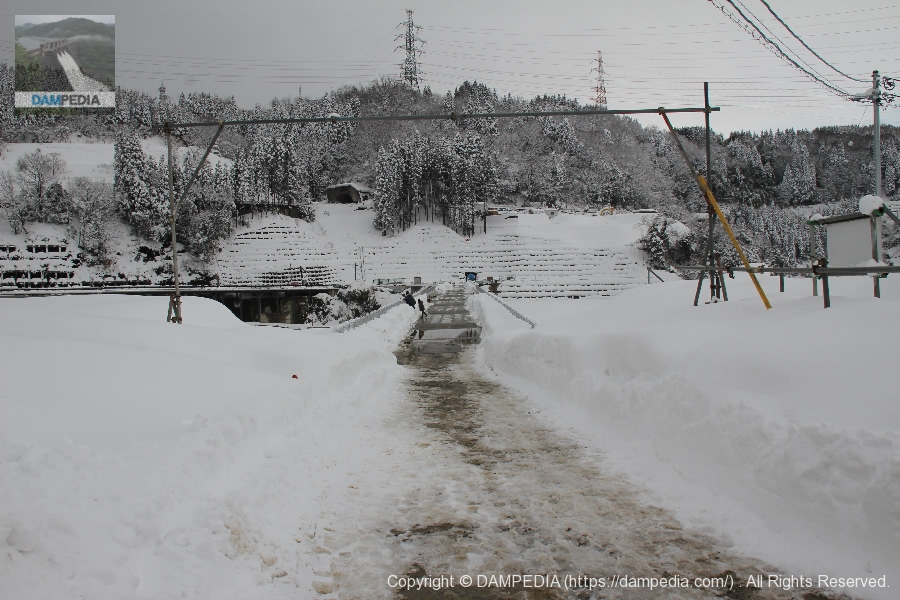
View of the top edge from the right bank
The top edge was well cleared of snow. In addition, although no automobile traffic was allowed on that day, asphalt has now been laid to allow cars to pass through.
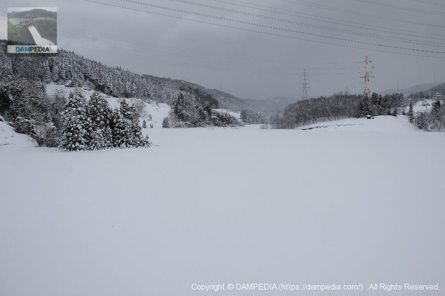
View of the dam lake from the top
Snow had accumulated on the frozen dam lake, making it a snow field all around.
View of the reduction work from the top edge
Normally, the right bank should be protected, but it looks as if the rivers merge here. It looks as if the rivers are merging here. This is so that the excess water that was diverted to the Tatsumi Irrigation Canal earlier will join the main river.

View of the levee downstream from the left bank
You can clearly see that the surface of the dam lake is frozen over.
View of the top edge from the left bank
I am surprised that visitors are coming in different places in spite of the heavy snowfall and poor footing.
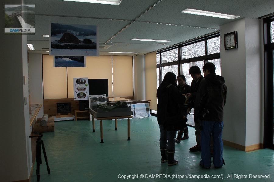
Inside the dam management building
We took a short break in the administration building. Various exhibits, including models, were set up inside.
Foundation of Tatsumi Dam
A brand new cornerstone was installed inside the administration building.

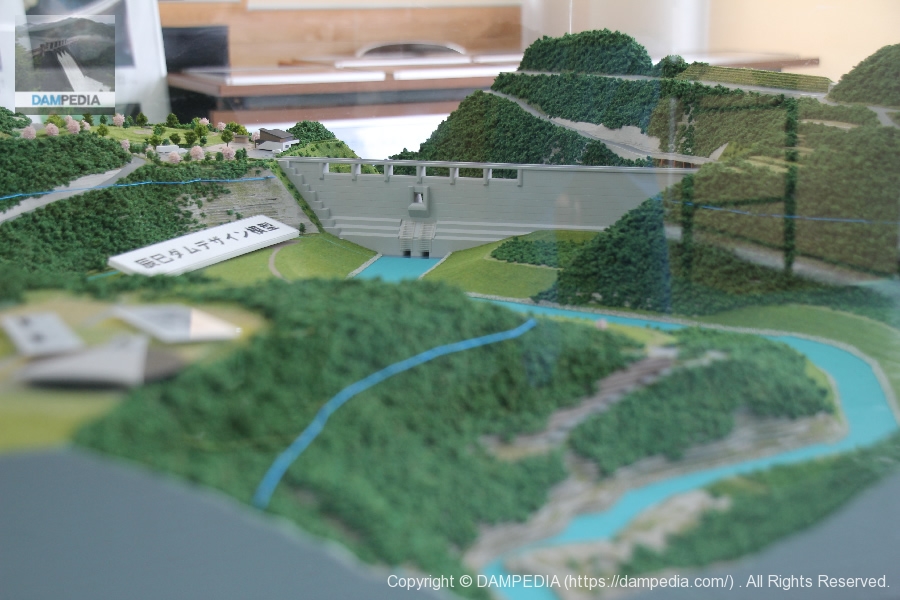
Model installed in the administration building
A model was also placed. The photo shows the image of the dike from the backwater side.
View of the levee downstream from the left bank
The side of the administration building is like a terrace where you can see the embankment. After the completion of the construction, the atmosphere will be a little more different, which we will introduce in another article.
View of the downstream crest from the left bank
The weather changes constantly, from when it stops snowing to when it blizzards. But this is a pleasant memory.
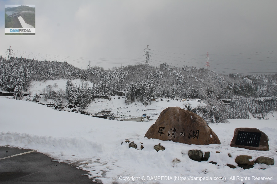
View of the stone monument with the name of the dam lake on the left bank
A stone monument with the name of the dam lake is placed on the right bank. The dam lake is written "Saisei no Umi" (Lake of Saisei).
It may be difficult to imagine because of the deep snow, but there is a dam lake beyond the stone monument. However, it is a dam with a hole in it that usually does not store water at all, so you can see a dam lake without water. The word "lake" or "sea" without water is a bit complicated.
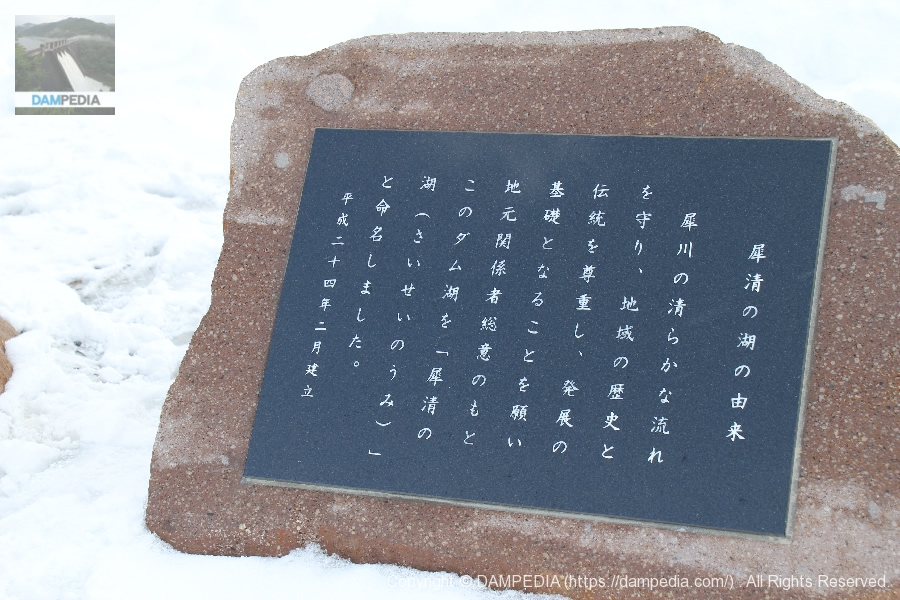
Stone monument of "The Origin of Lake Saicheng
Origin of Lake Saicheng
From the monument
With the consensus of local officials, this dammed lake was named "Saisei no Umi" (Lake Saisei) in the hope that it will protect the pure flow of the Saigawa River, respect the history and traditions of the region, and serve as a foundation for development.
Erected February, 2012
View of the levee from downstream
Just as we were about to leave, the snow finally stopped and the sun began to shine.
Video of test discharge
We have compiled a video of this event. I am not accustomed to making videos, and the quality of the content is not very good, with dust adhering to the inside of the camera, but I hope you can at least get an idea of what the test discharge was like.
It was a memorable test discharge...and probably won't be discharging water from the crest again in my lifetime. It was worth seeing for that reason alone, but personally, I think that a dam dedicated to flood control is a delicate thing.
Of course, you are probably aware that a dam costs a lot of money just to build, but if it is going to be built anyway, I think it would be more economically rational to make it a multi-purpose dam. If this is the result of the local consensus, I suppose it cannot be helped, but I honestly feel that it would be a waste of money.
At any rate, the dam is expected to play an active role in protecting Kanazawa City from flooding in the future.
Tatsumi Dam Specifications
| River Name | Saigawa River water system Saigawa |
|---|---|
| Objective | F (flood control, agricultural disaster prevention) |
| Model | G(gravity-fed concrete dam) |
| Bank height | 47m |
| Bank length | 195m |
| Dam volume | 154,000m3 |
| Watershed Area | 77.1 km2 |
| Reservoir area | 42ha |
| Total storage capacity | 6,000,000m3 |
| Effective water storage capacity | 5,800,000m3 |
| Dam operator | Ishikawa prefecture (Hokuriku area) |
| Main body constructor | Tobishima Corporation, Fukuda Corporation, Takada Corporation, Maida Corporation |
| Year of launch | 1975. |
| Year Completed | 2012 |
| Name of Dam Lake | Lake Saisei no Umi |
Map of Tatsumi Dam
Other facilities/observations
| Parking lot | Fat. |
|---|---|
| Toilet | Fat. |
| Park | Fat. |
| PR Exhibition Hall | × |
| Fishing | Fat. |

Comment