
The dam was originally described as "Ko-ike" in the dam handbook, but it seems to be described as "Yamago Oike" in the water intake facility, and furthermore, according to a survey by the dam association, this other name was Ko-ike (Abebee-sama Thanx!).
Location: Kakunoda, Hokusei-cho, Inabe City, Mie Prefecture
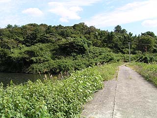
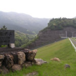
View of the levee from the downstream side of the right bank

In the dam handbook, the location is listed as "Hokusei-cho Yamago," and the name of that place did not exist due to rezoning or something, but if you trace the name of the place where Yamago Elementary School and a pond are located nearby from the map, the characters are different, but the name is "皷," so it probably refers to this place.
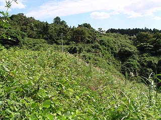
Still, it's hard to tell if this is a dam or what. The grass was that thick.
View of the top edge from the right bank
Moreover, according to the dam handbook, this dam is a "gravity-type concrete dam. It did not look like such a type because of the overgrown grass, but upon closer inspection, it was concrete. Grass seemed to be growing through the cracks in the concrete.
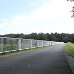
The top end is open to automobile traffic, but it is narrow and it is quite difficult to separate from oncoming traffic. Even though the area in front of this photo is a dead end, a Legacy is parked there, and an Elgrand appears from the back of this photo, so it seems that people do visit even though no one seems to come here. It seems to be a hole in the ground for fishing.
View downstream from the top
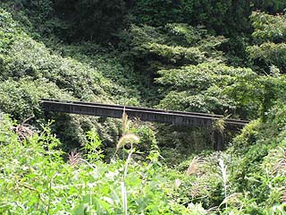
There was what looked like an aqueduct downstream, but we have no idea if it was really an aqueduct or if it is still in use.
View of the water intake from the left bank
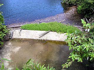
This is a natural overflow flood discharge. It is a dam for irrigation, so the residual water discharge is more suitable.
View of the flood discharge from the left bank
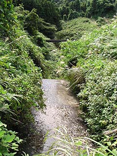
There were traces of water running down it, so it may have had a chance to be active. It seems to be a slope, but I can't see the end of it and wonder what is going on.
dam characteristics
| da mu | form (something takes) | earth dam |
|---|---|---|
| Objective | irrigation water | |
| Bank height | 22m | |
| Bank length | 72m | |
| Dam volume | 28,000m3 | |
| savings water (esp. cool, fresh water, e.g. drinking water) pond | Watershed Area | 0.4km2 |
| Total storage capacity | 130,000m3 | |
| Effective water storage capacity | 130,000m3 | |
| Year Completed | 1963. | |
| Access | Get off at Kuwana IC on Higashi-Meihan Expressway and turn left Go west on Prefectural Road 63. Turn right at the end of the road and follow Route 421. Enter Inabe Town and go straight at the intersection of Inabe Police Station East to Prefectural Road No. 5. Entering Hokusei Town, turn right at the Ouda intersection. Go straight on Prefectural Road 609... This destination is too difficult to explain, so I will omit it. | |
Other facilities/observations
| Parking lot | × | Poof! What? ~~~~! Really Gravity Concrete? I thought you said it was earth!" It's the kind of dam that If you look closely at ~~~~, it is indeed a gravity type. It was a new discovery for me to know that there are gravity concrete dams like this.... |
|---|---|---|
| Toilet | × | |
| Park | × | |
| PR Exhibition Hall | × |
Comment