

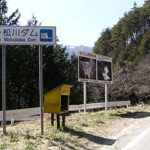
Location: 4553 Iwato Minami-oki, Oaza-Iriyama, Nagano City, Nagano Prefecture
Official Web site:.http://www.pref.nagano.jp/xdoboku/susobana/index.htm
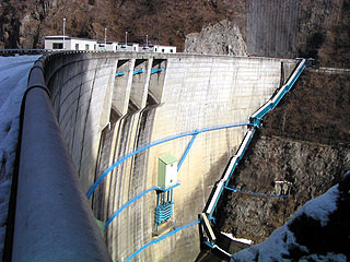
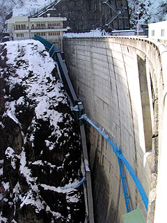
View of the embankment from the lake side of the right bank
This time, after enjoying snowboarding in Hakuba, I stayed overnight in Togakushi and stopped by on my way to Zenkoji Temple (that's the big word).
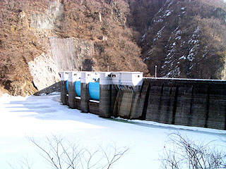
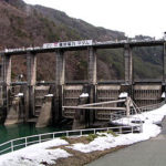
The season is February. It was the middle of winter. Although this is my favorite winter dam, there were avalanches here and there on the road, and the dam site and top edge were completely frozen, creating a dangerous atmosphere. Three radial gates can be seen in the crest section.
View of the levee from the downstream side of the right bank
The top end was off limits, so we asked permission from the management office. This was our first attempt to attack the management office. I was very nervous, but they readily agreed to allow me to take pictures. I was very nervous, but he agreed to let me take pictures. After business hours (?), the prefectural government entrusts the management of the dam to the neighbors. I wonder if the prefecture outsources the management of the dam to the neighbors...? The embankment looks like a compacted Yahagi No. 1 Dam.
Inside the gate operation room
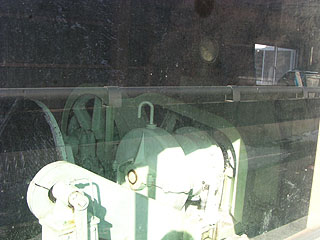
You can peek inside the gate operation room.
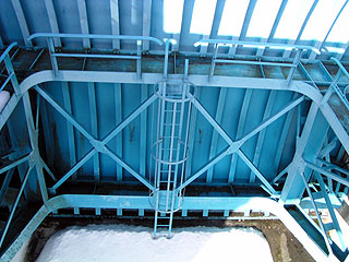
View of the gate from the top
View downstream from the top
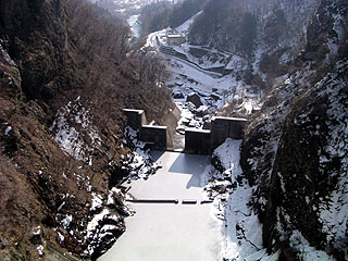
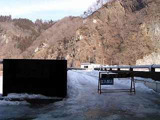
The dam lake, as well as the water in the abatement works, is completely frozen, almost like a skating rink.
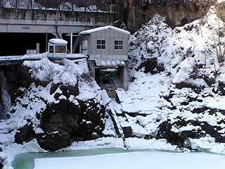
View of the levee and control center from the left bank
A staircase extends from the administration office. The stairs are very steep. The stairs are covered because of the heavy snowfall in this area.
View of the Incline from the top
It will definitely not be usable in the winter. The dam lake is frozen.
View of the intake tower from the top
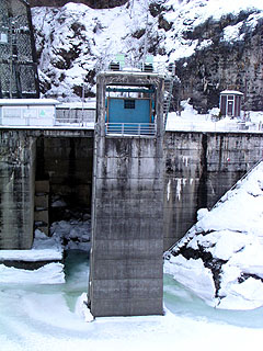
It is a small water intake tower.
View of the frozen top from in front of the right bank management office
As I was returning to my car after leaving the coverage of the dam, a person who obviously must have a high position in the management office came to work. He told me that I could go inside the dam, which I misunderstood to mean that I could visit the inside of the embankment. He meant, "You can go to the other side of the bank. Too bad...
dam characteristics
| da mu | Model | arched concrete dam |
|---|---|---|
| Objective | Flood control, agricultural disaster prevention, water supply, power generation | |
| Bank height | 83m | |
| Bank length | 211.2m | |
| Dam volume | 130,790m3 | |
| savings water (esp. cool, fresh water, e.g. drinking water) pond | Watershed Area | 250km2 |
| Reservoir area | 58 ha | |
| Total storage capacity | 15,000,000m3 | |
| Effective water storage capacity | 10,000,000m3 | |
| River Name | Susohana River, Shinano River System | |
| Year of launch | 1962 | |
| Year Completed | 1969. | |
| Access to D@M | Get off at Nagano IC on Joshinetsu Expressway and turn right at the traffic light. Go north on Prefectural Road 35. On the way, you will enter Route 117, but just keep going north. Turn left at the T-intersection with Route 406 (Shindai-mae intersection) Then go west on Route 406. On the way through the Onabe Tunnel, there is a break that leads to the dam, so turn right. | |
Other facilities/observations
| Parking lot | ○ | There is a sign at the entrance to the dam that reads "No Entry Except by Authorized Persons." Don't worry about it, just go in. However, please ask at the management office before you visit. The people at the management office are friendly, so feel free to offer a tour. But there are signs and such introducing the dam. I wanted to create an environment that was a little more accessible in appearance. |
|---|---|---|
| Toilet | × | |
| Park | × | |
| PR Exhibition Hall | × |
Comment