
The second son of the three Azusa River brothers. Mizudono Dam.
Location: Tochisawa, Aza Azumi, Matsumoto City, Nagano Prefecture
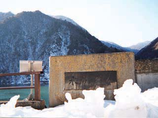
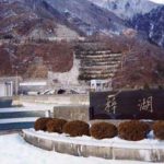
Levee nameplate
Sudden New Year's Day 2003dam tourThe fourth installment of the "MIZUDEN DAM" is the Mizuden Dam. It would be a natural course of action. It is the second son of the three Azusa River brothers and is located between Inakaku Dam and Nagawa Wataru Dam. Therefore, it is located along Route 158. Also, there is a roadside station "Kaza-no-sato" nearby. As you can see, snow accumulation increases as you go deeper into the mountains.

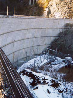
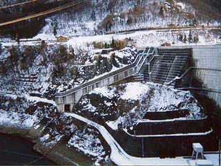
View of the levee (downstream side) from the right bank
I knew it had to be this one! I realized the size of the arch dam. The arch dam is very beautiful against the snow. Incidentally, there is a power generation facility just below the embankment. The remains of the dam construction can be seen on the left bank.
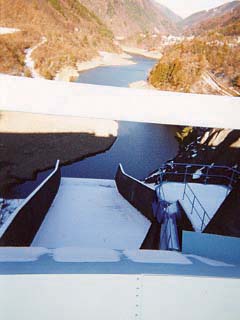
View of the conduit from the top edge
The conduit of the flood discharge is on a slope like a slide. It looks like a ski jump. In the back is the dam lake. The Inakaku Dam is just ahead. There are two radial gates.
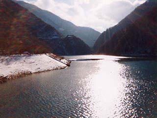
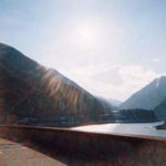
View of the dam lake from the top
The western sun backlit the view near the evening. Ngawa Watershed Dam is located behind this dam.
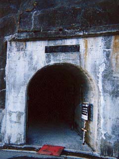
Mystery Tunnel
corridor connecting an annex to a pond-side building (in traditional palatial-style architecture)I wondered why. I wondered, but the sign in front of it says, "Please turn off the lights when you turn on the lights," and it looks like anyone can pass through. However, the map shows that it does not seem to lead to the embankment. Furthermore, looking to the left of this tunnel, there was a bridge that seemed to lead to it. It seems to be a tunnel for hunters and forestry workers. I tried to ask the person concerned what the tunnel was for, but he went away before I knew it and I could not ask him. I was also hesitant to enter this tunnel because I am a novice. In the end, I could not figure out what it was.
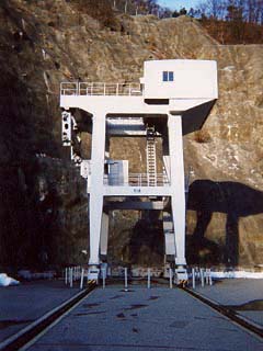
Giant crane
I have seen many dams, but I think this is the first time I have seen such a large crane. The rails are drawn all the way to the top end, so you can tell that it is a movable type. However, the rails at the top end were buried under a thick layer of snow, so it may be that the crane does not move during the winter.
View of the conduit from the left bank
It is a little hard to see because the snow and concrete have assimilated. There is a path built under the slide. I would like to see it from here if it is ever discharged from the flood discharge.
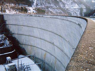
Downstream view of the levee from the left bank
This is quite my favorite of the photos I took of the dam this time. It was taken with a disposable camera, but it is surprisingly beautiful. Of course, I processed the photo after scanning it in.
dam characteristics
| Model | arched concrete dam |
| Objective | generation (e.g. power) |
| Bank height | 95.5m |
| Bank length | 343.3m |
| Summit width | 7m |
| Dam volume | 301,000m3 |
| Watershed Area | 431km2 |
| Reservoir area | 57 ha |
| Total storage capacity | 15,100,000m3 |
| Effective water storage capacity | 4,000,000m3 |
| River Name | Shinano River System Azusa River |
| Year of launch | 1965. |
| Year Completed | 1970 |
Other facilities/observations
Many restrooms are closed during the winter when you go deep into the mountains, but this one was open. The parking lot is also spacious.
| Parking lot | ○ |
| Toilet | ○ |
| Park | ○ |
| PR Exhibition Hall | × |
Comment