

Date of interview: 2009/04/08
Location: Omote-Shiomizu, Narai, Shiojiri-shi, Nagano, Japan
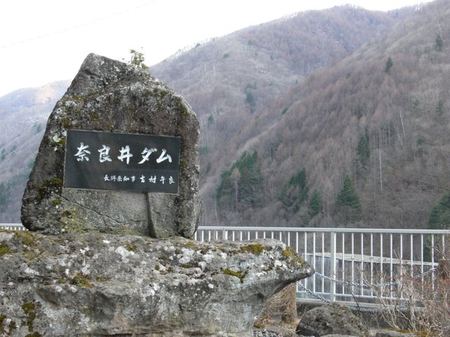
View of the monument from the right bank
He stopped by with his family, minding his own business on his way back from strawberry picking and cherry blossom viewing at the ruins of Takato Castle.
View of the top edge from the right bank

Unfortunately, the top edge is inaccessible from around the conduit.
Explanation board on the right bank
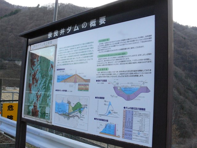
This is a very detailed description. The following is quoted verbatim from the original.
The Narai River is a first class river that originates in Mt. Chausu on the north face of Mt. Komagatake (2956m above sea level) in the Central Alps, the dividing line between front and back Japan, and flows north through Naragawa Village, Shiojiri City, and Matsumoto City in Kiso County. However, it has suffered damage from numerous floods to this day. In addition, the downstream area has been designated as the only new industrial city in the inland area, and industrial infrastructure has been rapidly developed through the expansion of transportation networks connecting various economic zones, resulting in a marked trend of population concentration in urban areas and a rapid increase in demand for water supply. The Narai Dam is a multi-purpose dam constructed to solve various problems related to flood control and water utilization.
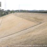
View of the downstream bank from the right bank
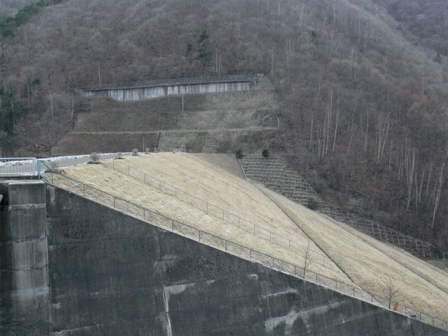
It is rockfill, but no riprap is visible on the downstream side. It looks like an earth dam.
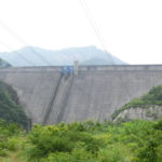
View of the flood discharge from the right bank
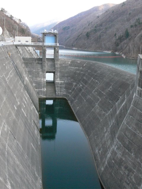
This is a flood discharge with a slightly unusual structure. The gate in the back is a roller gate for normal flood discharge. The raised area around it is a free overflow type.
View of the top edge from the right bank

I took this photo of the top edge through a gap in the gate out of frustration.
View of the conduit from the right bank
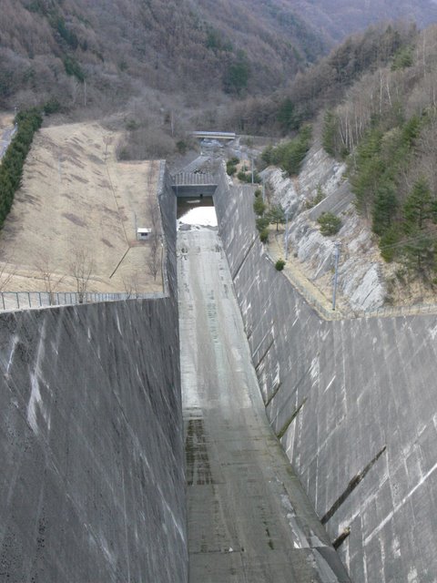
It is a large conduit wall for a flood discharge.
dam characteristics
| River Name | Shinano River System Narai River |
|---|---|
| Objective | Flood control, agricultural disaster prevention, unspecified water, river maintenance water, water supply water |
| Model | rockfill dam |
| Bank height | 60m |
| Bank length | 180.8m |
| Dam volume | 953,000m3 |
| Total storage capacity | 8,000,000m3 |
| Effective water storage capacity | 6,400,000m3 |
| Dam operator | Nagano prefecture (Chuubu area) |
| Main body constructor | Nishimatsu Construction and Okumura Gumi |
| Year of launch | 1966 |
| Year Completed | 1982 |
| Name of Dam Lake | Narai Lake |
Other facilities/observations
| Parking lot | ○ | Until now, if you were coming from the Nagoya area, you could get off at the Nakatsugawa Interchange on the Chuo Expressway. You can either continue north on Route 19 or exit at the Shiojiri Interchange. It had to go south, but with the opening of the Gonpei Tunnel It is now accessible by exiting at the Ina Interchange. |
|---|---|---|
| Toilet | × | |
| Park | × | |
| PR Exhibition Hall | × | |
| Fishing | ? |
Comment