

Location: Tanma, Kakegawa City, Shizuoka Prefecture
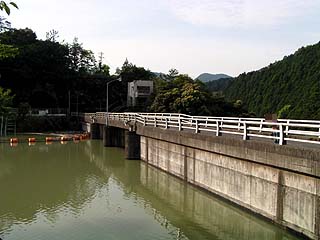
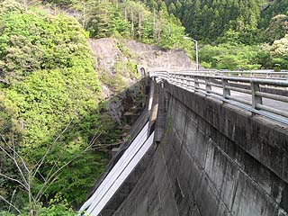
View of the embankment from the lake side of the right bank
May 2004 "Oigawa River Systemdam tourThis is the first dam. There were few visitors, probably because it was early in the morning. I had also heard that this dam was a "dry dam" with no water, but perhaps because it was the season of melting snow, there was plenty of water. I would have liked to see a dry dam, but the dam was functioning well.
Mystery Tunnel
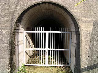
There is a tunnel on the right bank that appears to be an audit corridor, but it is unclear where it leads. It may not be the same as an audit corridor, as it does not seem to be connected to the dike.
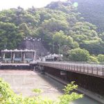
View of the top edge from the right bank
The top end of the dam is open to automobile traffic. At the time of the interview, a mountain bike was passing by, but there is apparently a mountain bike training area upstream of this dam, so they may have been headed there to practice their skills.
View downstream from the top
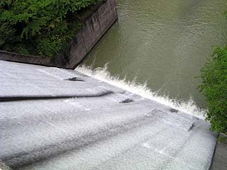
It was full of water and water was flowing out of the free overflow gate. It is small in scale, so it is not a "sluice", but it is powerful in its own way. I would have liked to shoot a video if I could have, but since I was going to visit several dams this time, I did not want to shoot a memory-consuming video because I anticipated that my digital camera would run out of memory.
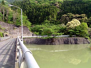
View of the dam lake from the top
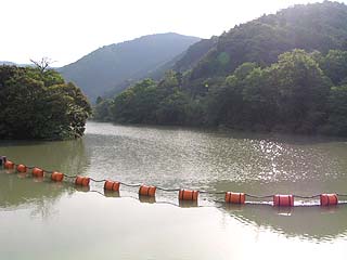
The dam is working properly for flood control. It is good to see a dam that works visibly.
View of the Incline from the top
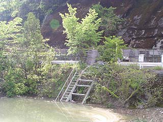
Because of the small size of the dam, the incline is also small.
Mysterious tunnel on the left bank side
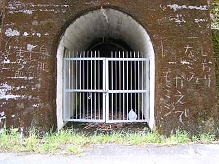
Shiori," "nagomi," "kaede," "momiji," "torikami," "mochihada," ... The existence of this tunnel is a mystery, but the meaning of this graffiti is even more mysterious.
administration office
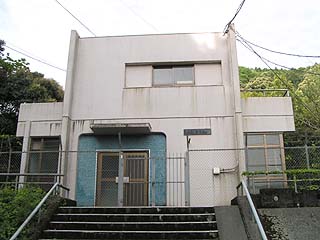
The control center is fenced off and completely off limits. There is probably no one inside. It was early in the morning, but it looked like a haunted house, creating a bit of a scary atmosphere.
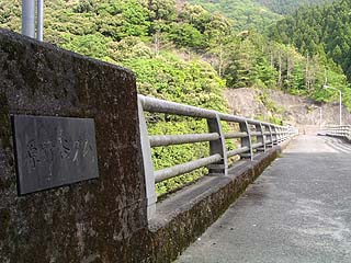
View of the levee from the downstream side of the left bank
Nameplate embedded in the top rail
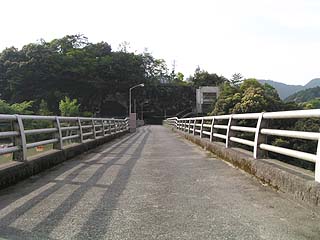
View of the top from the left bank of the dam
dam characteristics
| dam | Model | gravity-fed concrete dam |
|---|---|---|
| Objective | Flood control, agricultural disaster prevention | |
| Bank height | 31m | |
| Bank length | 89m | |
| Dam volume | 23,000m3 | |
| reservoir | Watershed Area | 17.9km2 |
| Total storage capacity | 1,252,000m3 | |
| Effective water storage capacity | 1,207,000m3 | |
| River Name | Ota River system Harano Valley | |
| Year of launch | - year | |
| Year Completed | 1968. | |
| Access to D@M | Get off at Kakegawa IC of Tomei Expressway Turn right at the immediate traffic light Turn right at the next traffic light intersection and go north. At the intersection with Route 1, turn left at the "Kitaike" intersection and go west. Turn right at the third traffic light "Jonai" and go north The rest of the way is just up north on Prefectural Road 39. There is a tunnel in front of the dam, and a gorilla figurine (stuffed animal?) is at the south entrance of the tunnel. The gorilla figurine (stuffed animal?) is at the south entrance of the tunnel. | |
Other facilities/observations
| Parking lot | ○ | It is small in scale, but a working dam is a good thing. There is what appears to be a toilet on the right bank that resembles a thick trunk, though, It is not clear if it is functioning properly. Therefore, it is a "△" judgment. |
|---|---|---|
| Toilet | △ | |
| Park | × | |
| PR Exhibition Hall | × |
Comment