
Date of interview: Saturday, August 03, 2013
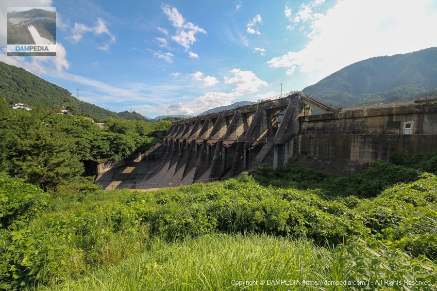
After the Shinji Dam, the next dam to arrive was the eldest son, the Shinichi Dam. In terms of the year of completion, Jinni Dam is the eldest son, but in terms of the year of start of construction, Jinichi Dam is the oldest.
Looking downstream from the left bank
It is somewhat backlit, but it is impressive how the sun's rays are passing through the gate and casting their shadows on the gate piers. Still, like the Shinji Dam, it is a cool dam with a sense of history.
Garbage dump?
The photo is pretty hard backlit, but I think this is where they collect driftwood and trash from the reservoir. I wonder if it is crushed and turned into wood chips.

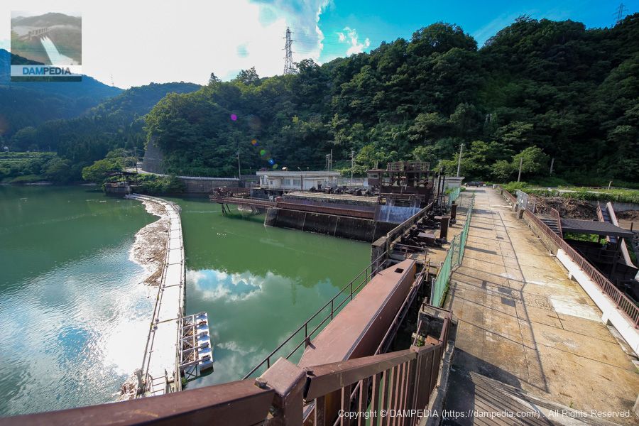
Downstream view of the levee from the Yoshino Bridge downstream
Once we came to the downstream side. The bridge is directly below us, so we can get a good view of the downstream face of the embankment. The mortar-shaped conduit is beautifully and smoothly curved. Further downstream, we can see the remains of a silver mine that once existed in the area.
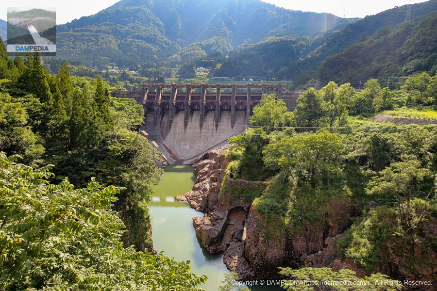
Looking downstream from Yoshino Bridge
The Jinzu River flows eastward at the Jinichi Dam and then makes a sharp left curve. The section of the curve is a spectacular gorge.

View of the top edge from the left bank
The top of the embankment of the Shinichi Dam is 344.4 m in length, but when checked against the scale of the aerial photograph, it appears that this area is also the embankment.

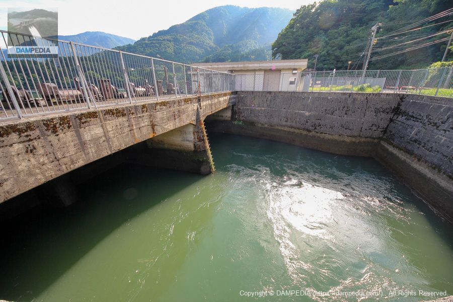
Water flowing from the intake
The water is flowing in torrents. The water taken in here is not directly under the dam, but is delivered to the Jinzu River No. 1 Power Station and the Iwaya Power Station through the underground conduit tunnel in the Iwaya Pass, as if to bypass the Jinzu River, which flows in a U-shape.
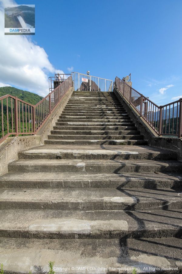
Stairs leading up to the gate pier
Although the bridge above the gate pier is a controlled bridge, it is open to free passage.
View of the water intake from the stairs
The image shows a power plant on the other side of the mountain in front.
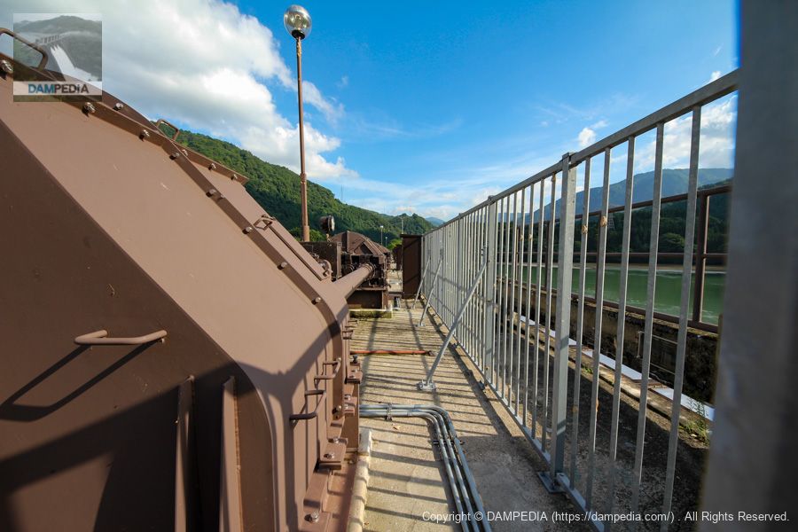
Gate winders lined up in a row
Like the Shinichi Dam and the Shinji Dam, the Shinichi Dam also has machinery and a fence on the downstream side, so it is not possible to look downstream from the top of the dam. I remember that this was the year of a large outbreak of the mysid moth, which was so numerous here and there on the embankment that it was quite creepy. I remember it was a year when there were a large number of mysid moths, and they were gathering here and there on the bank, which was very creepy. (At that time, there were a lot of caterpillars in the forests around Magajo Dam, and I also remember that they were eating away at the forests at Tokuyama Dam...)
gate nameplate
Like the Shinichi Dam, the Shinichi Dam has nine gates. Come to think of it, the same was true of the Shinji Dam, but it seems that the gates were renewed between 2010 and 2012. Also, the Shinichi Dam does not seem to have a breakwater board.

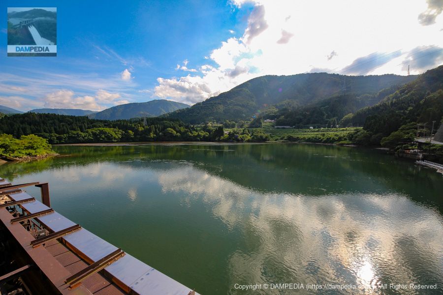
View of the reservoir from the top
left bank (of a river)(in the back of the photo), it appears to be composting, but according to a 2014 survey by the Ministry of Land, Infrastructure, Transport and Tourism, the total storage capacity is 11,346,000 m3 and the composting capacity is 2,703,000 m3, while the amount of composted sand is 7,174,000 m3. Although the sediment capacity has already exceeded 100%, there is no problem with the dam's function itself. Incidentally, the Shinichi Dam is equipped with two orifice radial gate-type sand discharge gates.
Looking upstream from the water intake
Returning to the left bank, this photo was taken from the area around the water intake. The words "Hokuriku Electric Power Company Shinichi Dam" written in pale blue are cute, and the brown-colored metal parts such as the gate and the water intake are also austere.
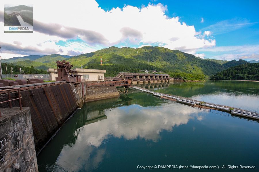
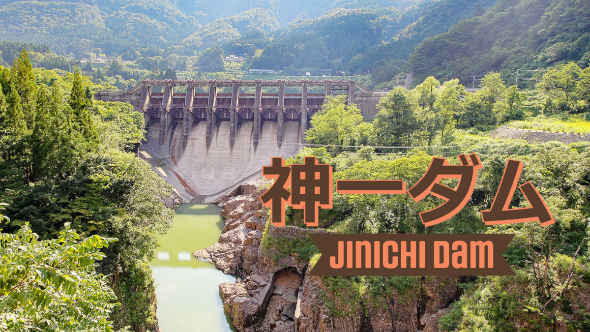
The eldest of the three Jinzu River brothers. He was a cool, austere and cool godichi dam.
Shinichi Dam Specifications
| Location | Katakake, Toyama City, Toyama Prefecture |
| River Name | Jinzu River system Jinzu River |
| Objective | P(Power generation) |
| Model | G(gravity-fed concrete dam) |
| Bank height | 45m |
| Bank length | 344.4m |
| Dam volume | 108,000 m3 |
| Watershed Area | 1,960km2 |
| Reservoir area | 78 ha |
| Total storage capacity | 5,742,000 m3 |
| Effective water storage capacity | 3,194,000 m3 |
| Dam operator | Hokuriku Electric Power Co. |
| Main body constructor | Sato Kogyo |
| Year of launch | 1951 |
| Year Completed | 1954 |
| Name of Dam Lake | - |
Other facilities/observations
There is no parking lot, but there is space to park on the shoulder of the road.
| Parking lot | △ |
| Toilet | × |
| Park | × |
| PR Exhibition Hall | × |
| Fishing | ○ |
Map around Shinichi Dam
Weather around Shinichi Dam
Accommodations that may be close to Kamiichi Dam
Comment