
Location: Amehata, Hayakawa-cho, Minamikoma-gun, Yamanashi
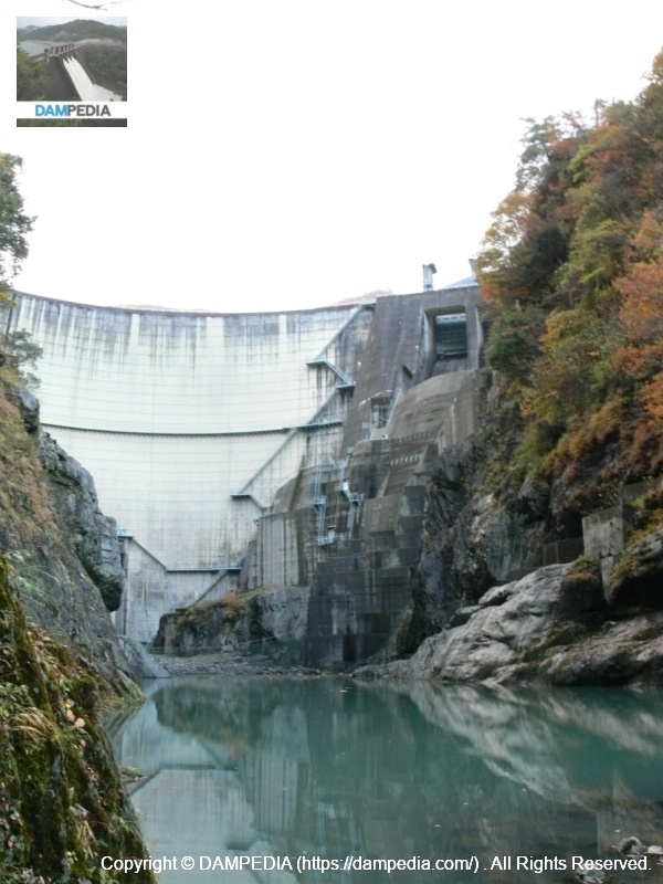
View of the embankment from the left bank
The Amehata Dam isNippon Light Metal Company, Ltd.The dam is owned by a company that manufactures aluminum called This is probably the first time on this site that we have seen a dam owned by a private company. Nippon Light Metal's group companies include the well-known truck body (laugh)Japan Full Halfis also under the umbrella of the company.
Unfortunately, there were almost no spots to take pictures, so we could only view the dam from afar....
Also, I was told in advance that I could approach the dam from downstream by passing through a private house's field, but I couldn't locate the house, got lost for a long time, and couldn't even get there as the sun went down in the evening... orz
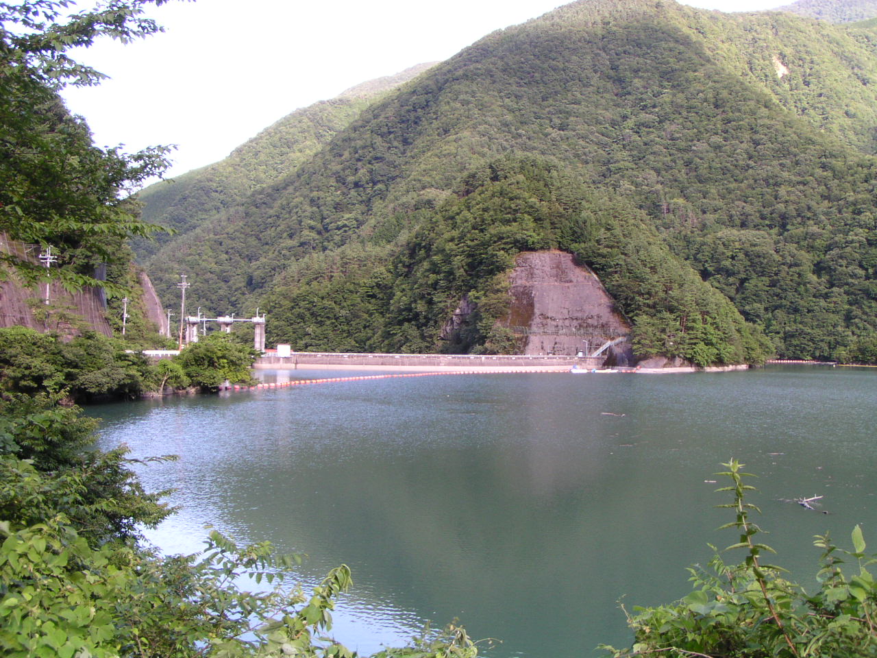
View of the embankment on the lake side from the right bank
Here are some photos from our visit on 11/24/2006. We were also able to go directly under the dike, which we will do later....
View of the dam lake from the right bank
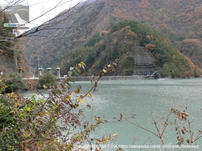
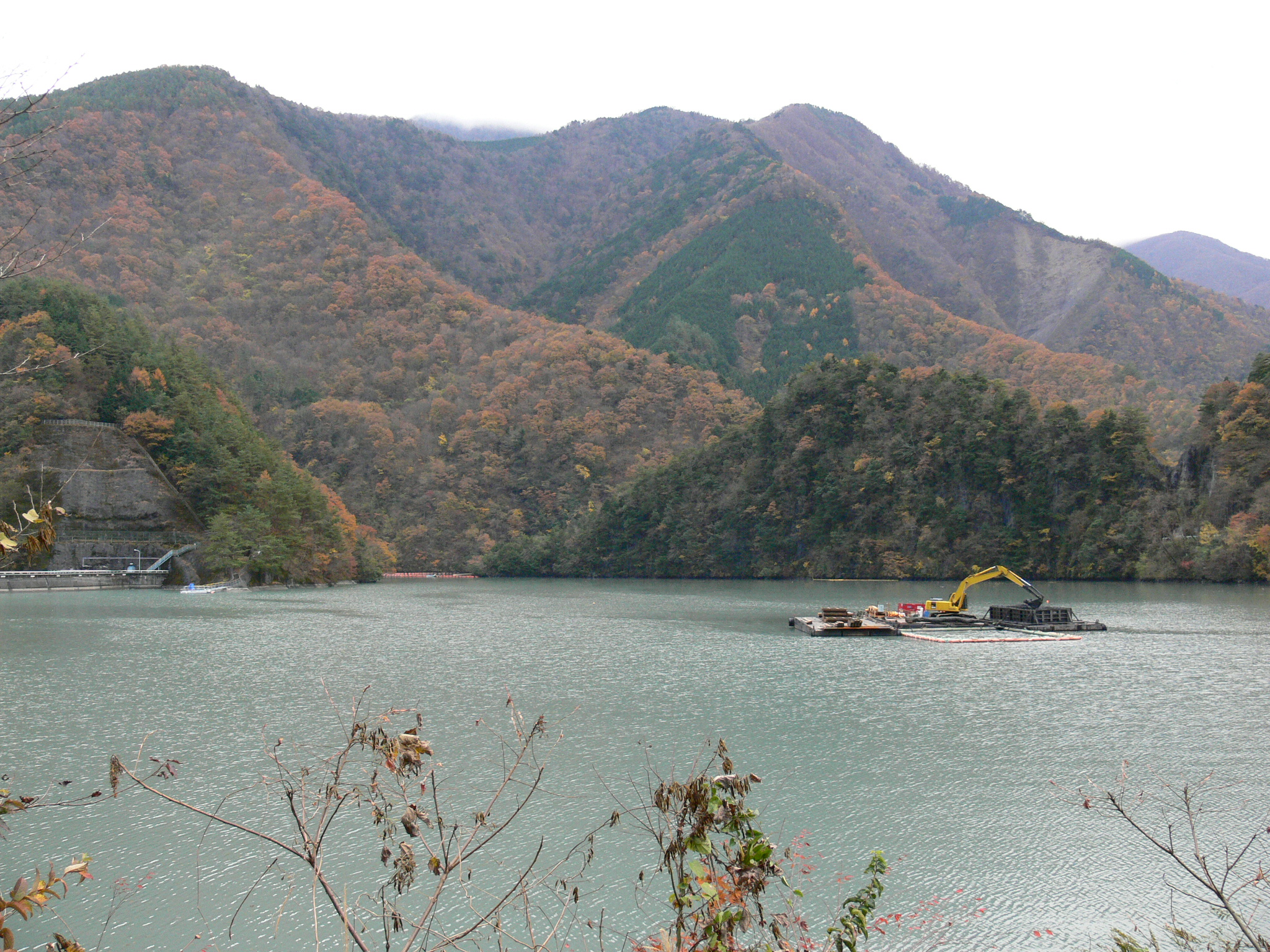
The scenery is almost the same as the last time I was here. We can see what appears to be dredging work being done at the dam lake.
erosion-control dam
Perhaps because of its proximity to the Fossa Magna, perhaps because of its fragile bedrock, or perhaps because of its steep mountains, large-scale erosion control dams can be seen here and there.
View upstream of the dam lake
We are a bit upstream from the levee, but it appears that sedimentation is progressing.
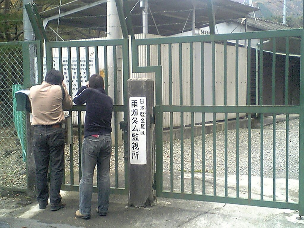
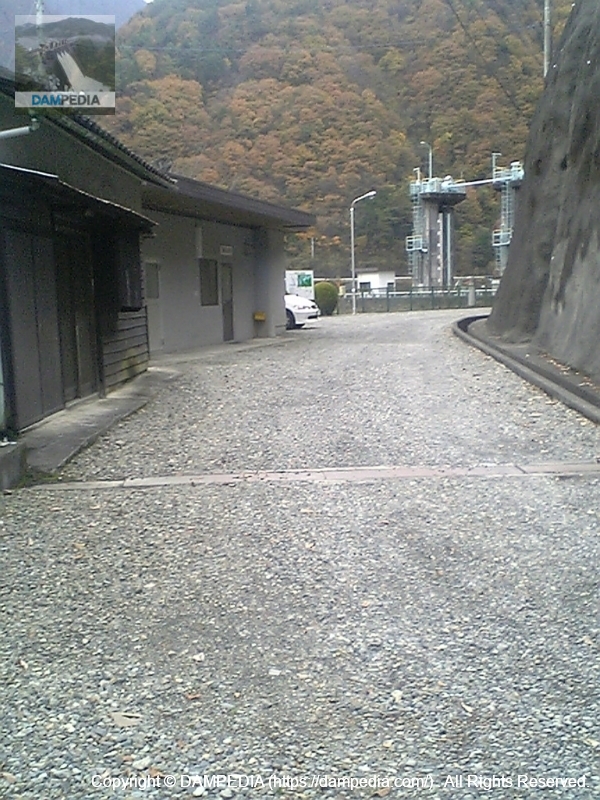
Amahata Dam monitoring station
Like the Kakimoto Dam, this place was also called a "monitoring station" instead of a "control station. Mr. Miyajima and Mr. Abebe monitoring the monitoring station.
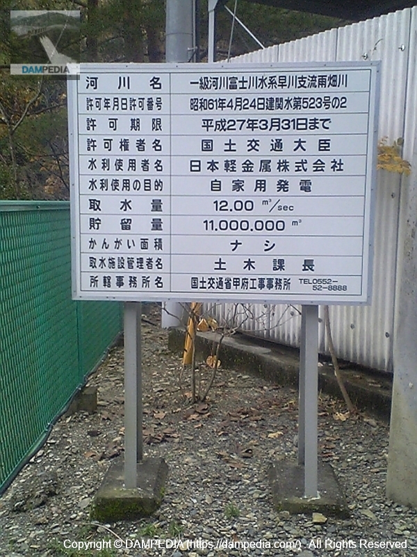
water diversion sign
And I follow their lead and monitor.
Inside the Amahata Dam monitoring station
Since it is not allowed to enter from here, I took this photo through a gap in the gate.
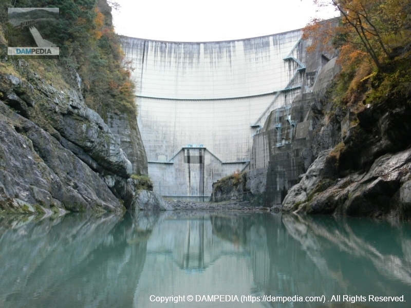
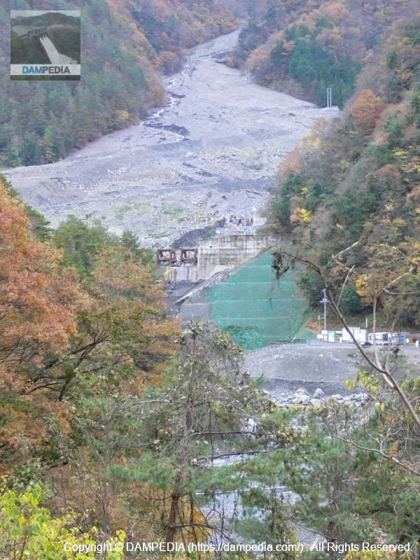
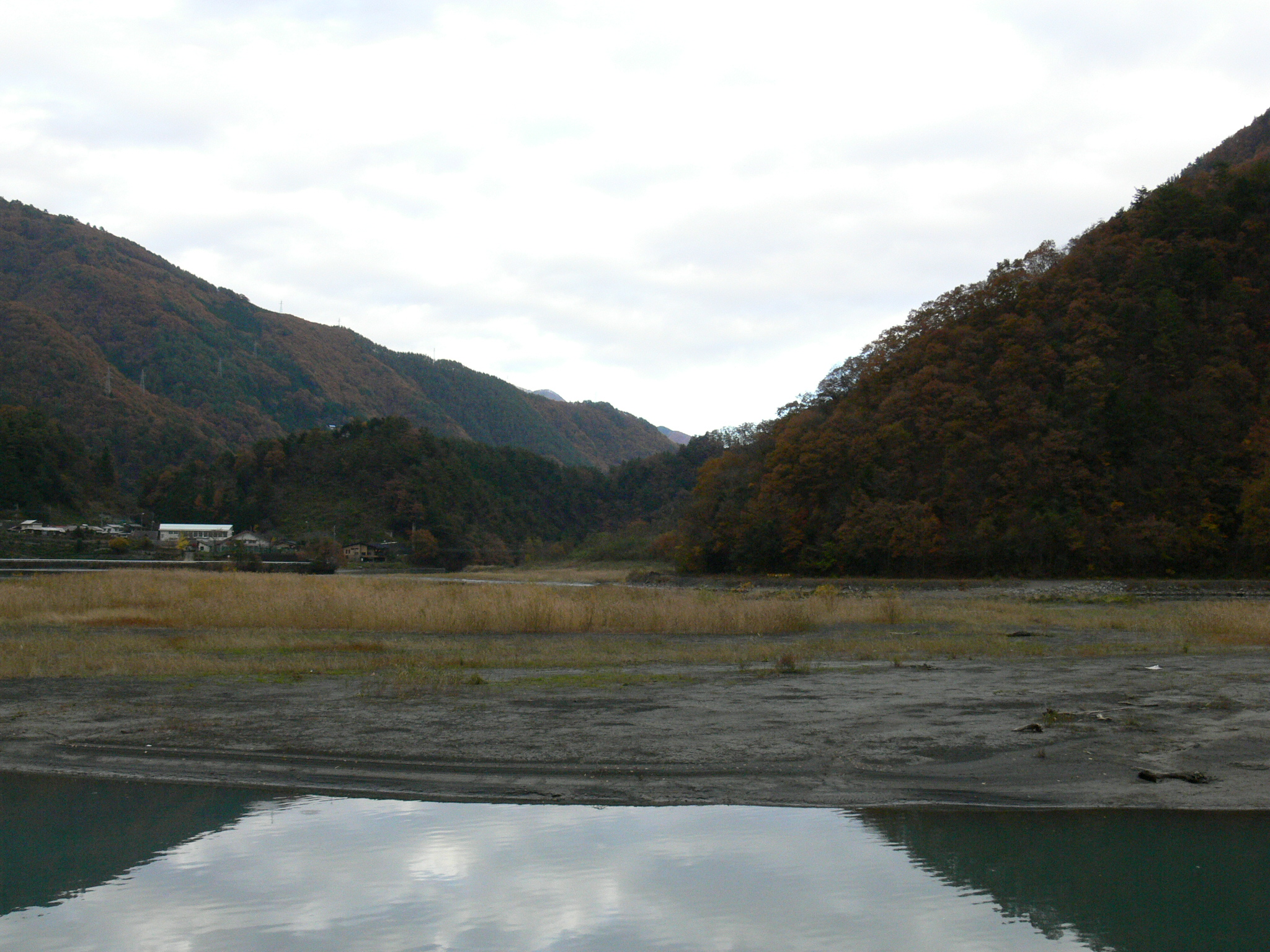
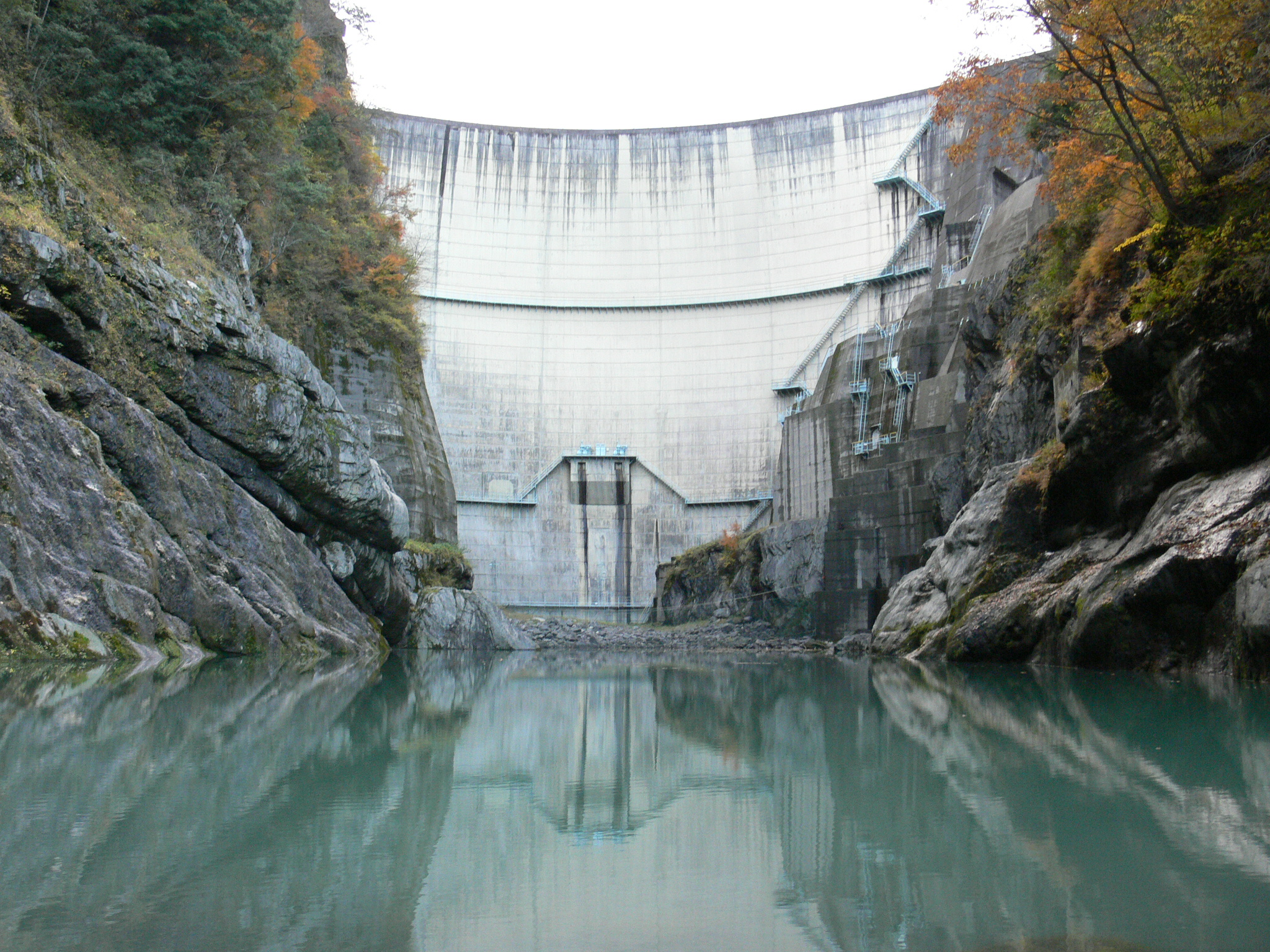
View of the levee from downstream
I did not know how to get to the bottom of the embankment, so I had to learn from a private homeowner who had accidentally entered the area by mistake. I can only say that it was amazing. The way to get there was like a path through a thicket of trees.
Still, I am very pleased with this sight. Since the river downstream is quiet and there are no waves, the embankment is reflected in the water like a water mirror. The contrast is truly wonderful. It is a long way to get there, but it is well worth the effort.
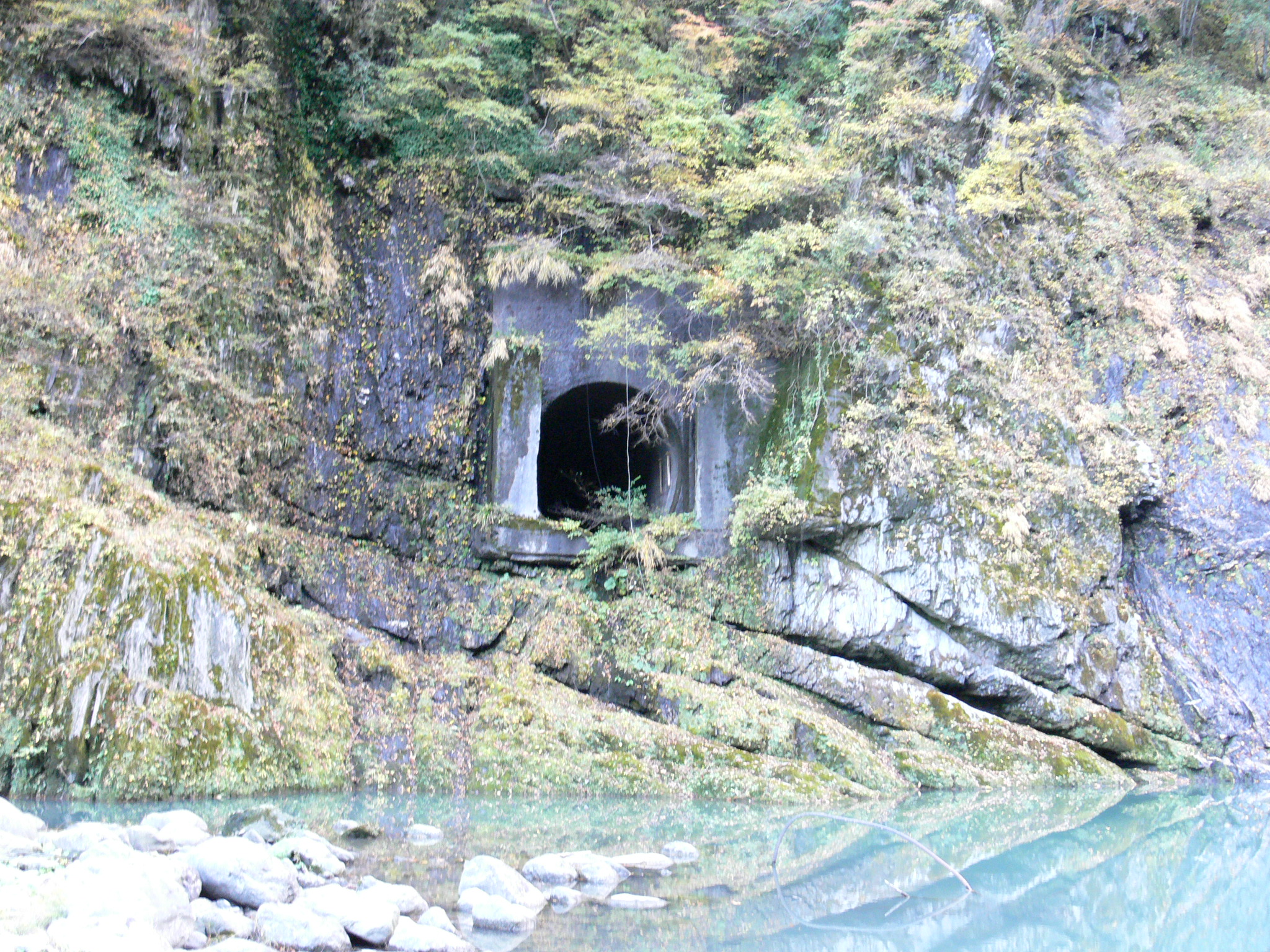
Temporary drainage tunnel?
There was a mysterious tunnel on the right bank side. It is thought to be a temporary drainage tunnel.
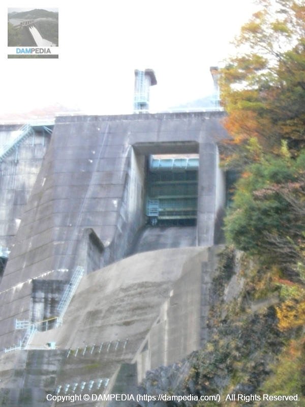
View of the levee from downstream (flood discharge on the right)
If you look directly at the embankment, you cannot see the crest gate because the bedrock in front of it is in the way, but if you move to the right bank, you can manage to see the gate. It is a ski jump type gate, but it is quite rugged in design.
Close-up of flood discharge
There are two roller gates. I would like to see how it would flow if it were discharged at this point.
dam characteristics
| Model | arched concrete dam |
|---|---|
| Objective | generation (e.g. power) |
| Bank height | 80.5m |
| Bank length | 147.6m |
| Dam volume | 72,000m3 |
| Watershed Area | 99.7km2 |
| Reservoir area | 0ha |
| Total storage capacity | 11,000,000m3 |
| Effective water storage capacity | 11,000,000m3 |
| River Name | Fuji River System Amuhata River |
| Year of launch | - year |
| Year Completed | 1967. |
| Name of Dam Lake | Lake Amabatake |
| Access | The Trans-Central Highway, currently under construction halfway across the country, is convenient. Get off at Minami-Alps IC of Chubu-Chubu Expressway Take Route 52 south toward Shizuoka Prefecture. Drive 22 km and turn right at the intersection with the main local road 410. Drive about 2 km and you will see a bridge on your right. After crossing, turn right Then take Prefectural Road 37 (Minami-Alps Park Route) west for 9 km. Turn left at the intersection with main local road 810 the rest is history |
Other facilities/observations
What an undigested dam. Hmmm, I wish it could be made public...
| Parking lot | × |
|---|---|
| Toilet | × |
| Park | × |
| PR Exhibition Hall | × |
| Fishing | ○ |
Comment