
Date of the interview: Sunday, September 16, 2012
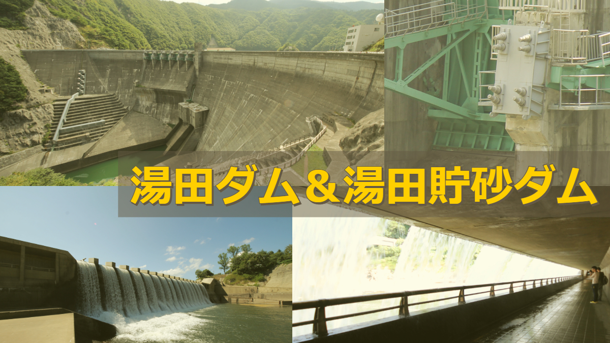
After the Ishibane Dam, the next stop is finally the Yuda Dam. The Yuda Dam, which I had longed to visit. The excitement at this time was at its maximum value.
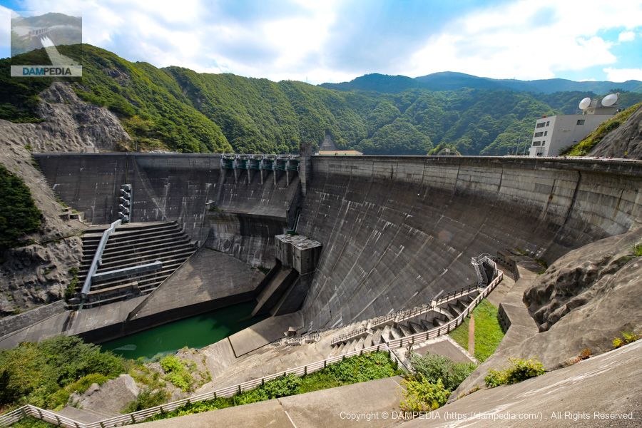
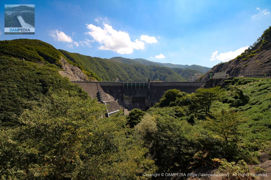
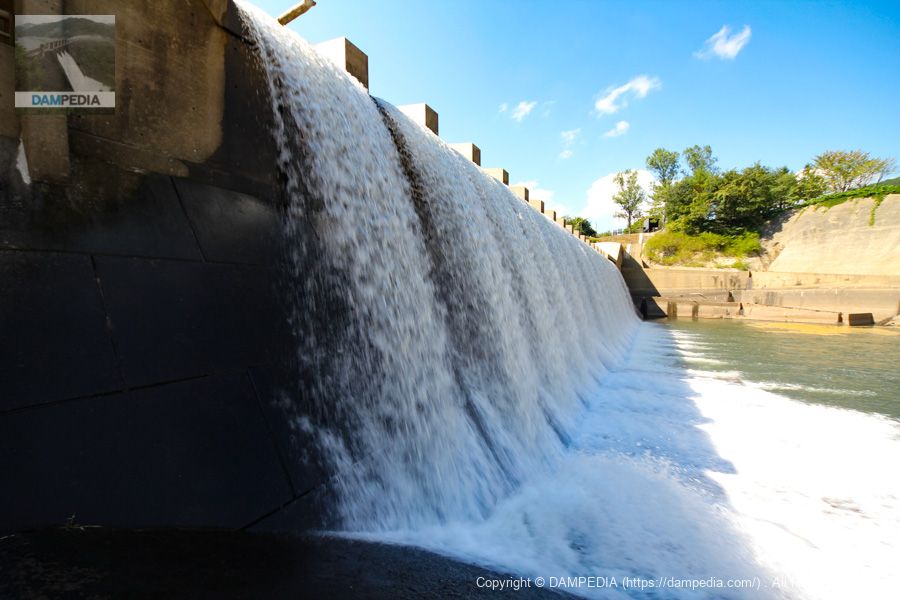
View of the levee downstream from the left bank
It is so cool, you know. Personally, I think the Yuda Dam is the coolest gravity arch dam.
Information-rich downstream
I have personally never seen such a complex dam structure in all the dams I have seen.
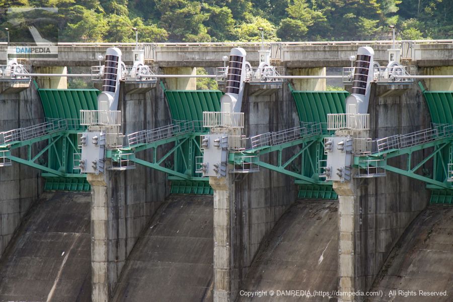
View of the permanent flood discharge
There are two conduit gates in the permanent flood discharge. They are high-pressure radial gates.
View of Crest Gate
The crest gate has six radial gates. The mechanical look is again very mechanical. The gray and black vertical structures attached between the gates are supposed to be inspection stairs or ladders inside to prevent slipping on the snow, but the design here alone is interesting.
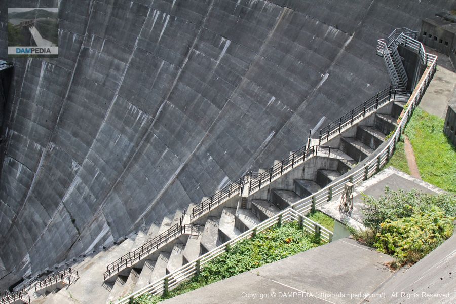
Inspection stairs
Instead of elevating the footing, a staircase is daringly placed on top of the footing, which, like the crest gate mentioned earlier, shows consideration for the workers. Yuda Dam friendly.
Inspection corridor on the right bank
I think this is another passageway that was built to allow people to move around even when there is snow on the ground, but it is just cool.
Zoom in on the inspection corridor.
Perhaps this passageway did not exist when construction was completed and was an afterthought, but it has a great visual impact as if it was intended.
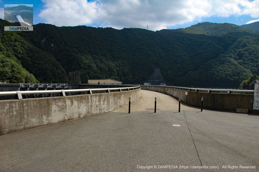
View of the top edge from the left bank
When photographing the top of an arch dam, it is often difficult to know which angle and position to use, and it tends to be appropriate.
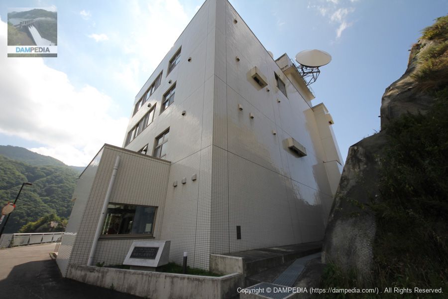
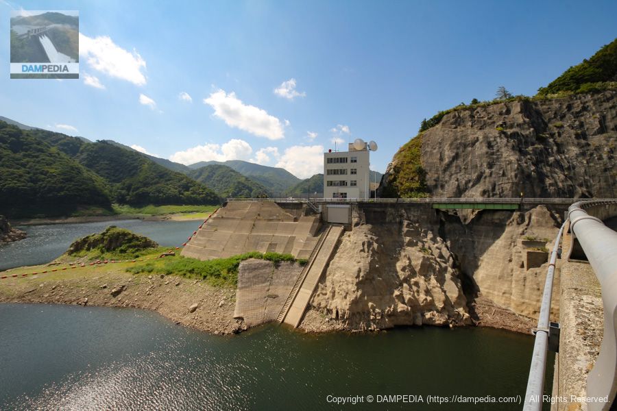
Yuda Dam Management Branch Office, Kitakami River Dam Integrated Management Office, Tohoku Regional Development Bureau, Ministry of Land, Infrastructure, Transport and Tourism
The reason why I took this photo from the back of the building instead of the entrance is because I wanted to take a set photo of the stone monument, but the backlighting was so bad that I couldn't really tell what was going on in the photo.
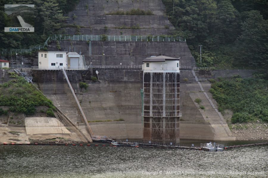
Water intake for power generation
This intake is located on the right bank and is normally inaccessible.
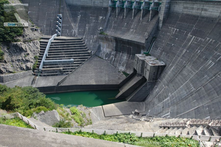
View of the embankment on the lake side from the left bank
On the left is the spare gate for the conduit gate, and on the right is the crest gate.
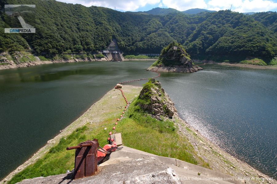
Netting site, island and water intake
The water level was also low that day. Still, I also remember that even though it was September, I thought it would be cool because it was in the northeast, but it was as hot as midsummer.
View of the dam lake (Lake Kinju)
The water level is so low that one can almost see the abandoned remains of the old Kitakami Line, which was sunk by the Yuda Dam.

View downstream from the top
The stair-like structure looks like a coliseum.

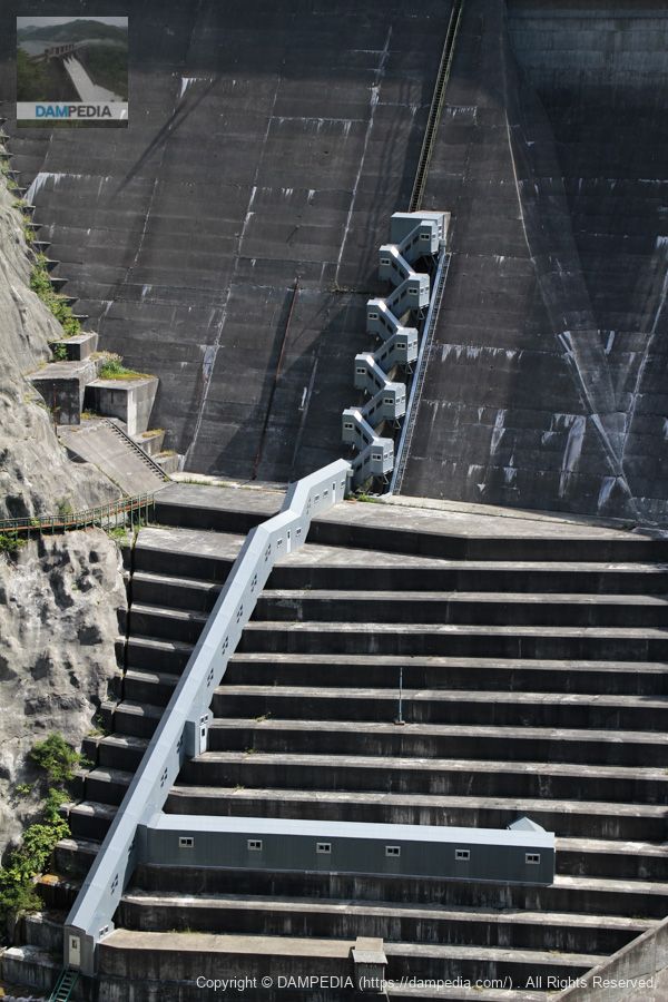
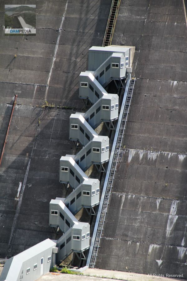
View of the control center and the incline from the top
The boatyard is located in the basement of the control center and seems to be directly connected to the incline. It is a very rational construction.
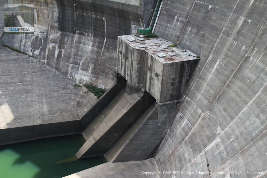
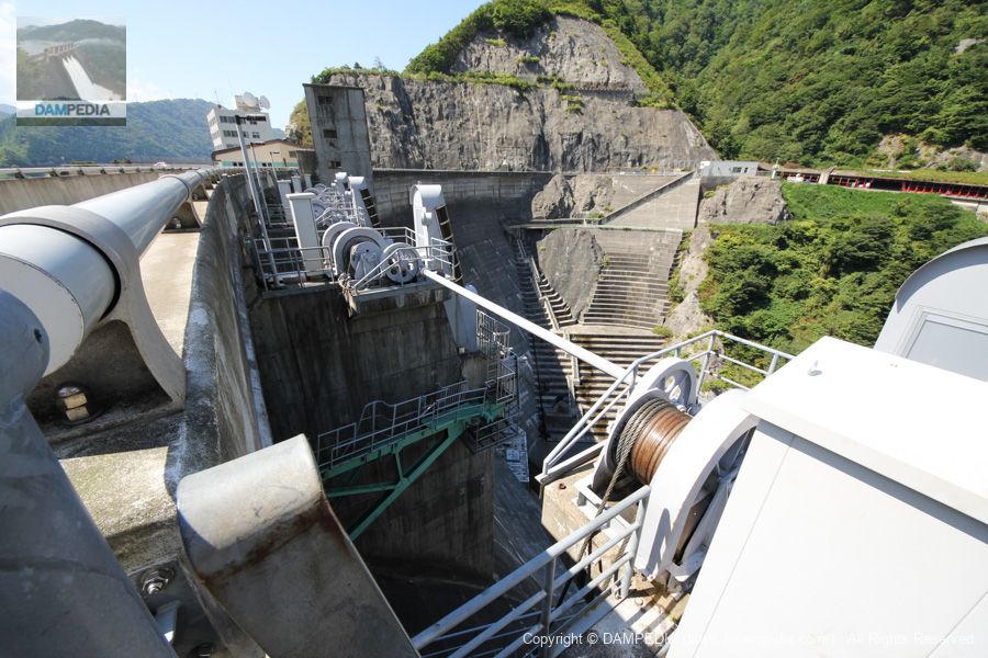
Conduit gate reserve gate winder room
The winding machine room is curved to fit the shape of the embankment.

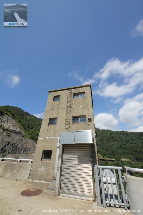
elevator tower
This simple elevator tower retains its Showa-era appearance.
View downstream from the crest gate
Water discharged from the crest gate flows into the ski jump chute section and then flows in a parabolic curve into the attenuation basin. Recently, it has become easy to watch videos of the discharge event, and we hope you will search for and watch them, but we would like to see the actual event anyway.

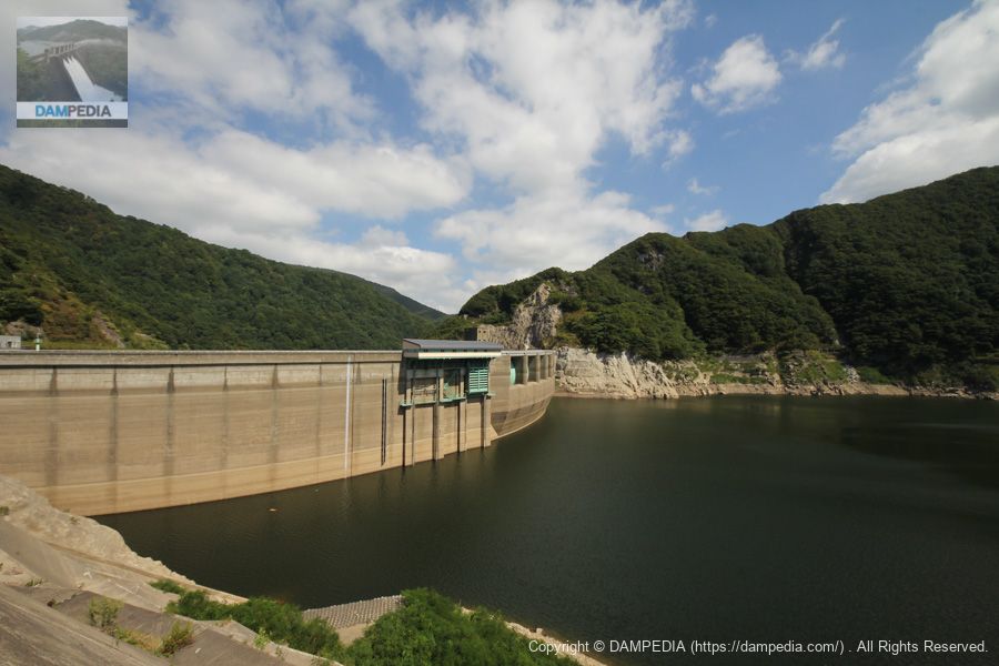
View of the levee downstream from the right bank
The Yuda Dam is cool from any angle.

Yuda Dam Joint Intake Management Tunnel
This is an administrative tunnel that leads to the aforementioned water intake area. The tunnel is 517 meters long and is open during events, so I would like to go through it.
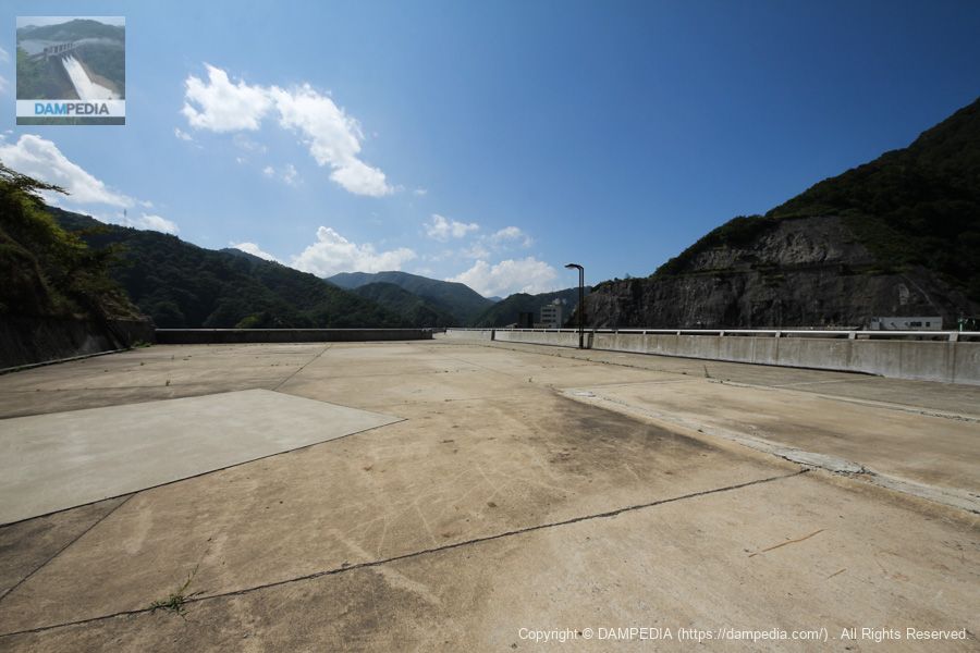
Right bank dam site
The right bank is extremely wide and empty, but it is like a plaza.
View of the top edge from the right bank
This curve is also glossy.

View around the crest gate from the right bank
I can't get enough of this complex mechanical feel.
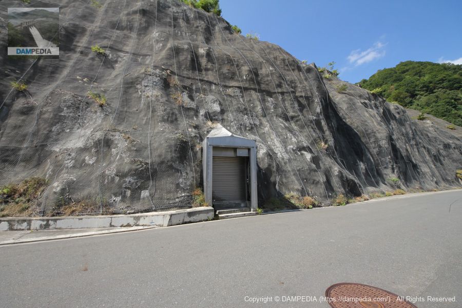
Tunnel on the left bank?
We are back on the left bank. Is it a rim tunnel?
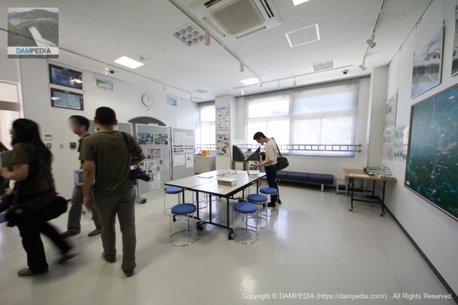
Kinshukomonshiryokan, Kinshuko-ko Disaster Prevention Center
This is the interior of the Kinshukomonshiryokan/Kinshukko Disaster Prevention Center. Panels and models were displayed.
View of the levee downstream from the snow shed
I think it would be very nice to see the levees spreading their wings downstream from the snowsheds (snow shelters) on the national highway. I would also like to see the discharge from the crest.
Yuda Sand Reservoir Parking Lot
We left the Yuda Dam behind and moved upstream to the Yuda Reservoir.
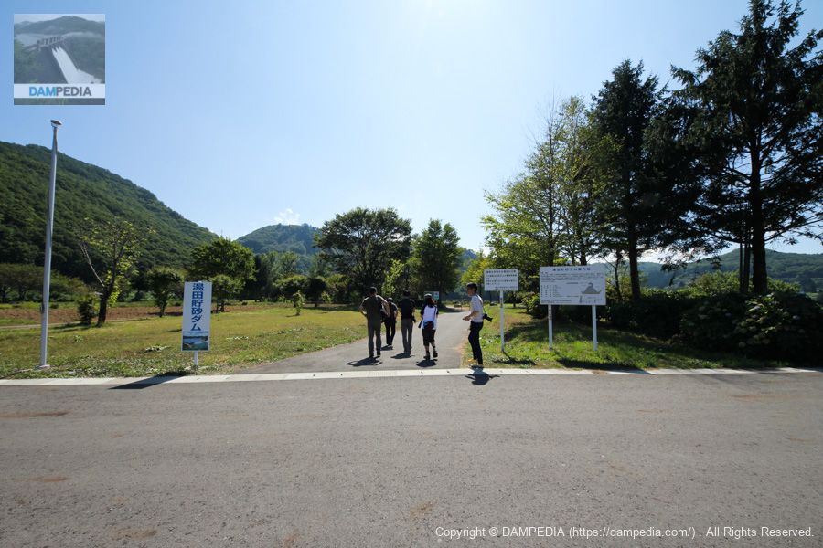
View of the embankment of the Yuda Reservoir from the left bank
The Yuda Sediment Reservoir is said to be visible only during the summer months when the water level is low. The dam was completed in 2002, so the embankment is in good condition. Water is flowing over the top of the dam.

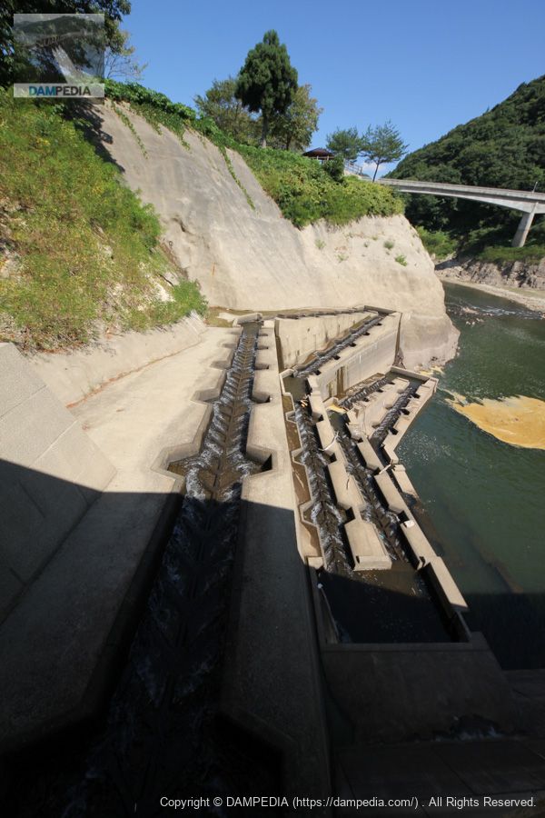
fish ladder
The fishway is also very cool. It looks as if it was made with the intention of being seen.
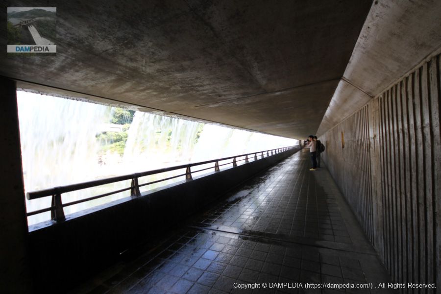
Inside the embankment of the Yuda sediment storage dam
The greatest feature of the Yuda Reservoir Dam is that the inside of the embankment is a passageway, like a waterfall in the back view. This is probably the only sand storage dam like this.
Lake Kinshuko-Otaki Waterfall
This Urami Falls is called "Kinshu-ko Great Falls" and was decided by a public contest.
View of the embankment of the Yuda Reservoir downstream from the right bank
It was hot in the Tohoku region, but we took a moment here to cool off and admire the Yuda Reservoir.

We have also made a video of it, if you would like to watch it.
Both the Yuda Dam and the sand storage dam are wonderful in every way, and recently they have been focusing on tourism, not only by holding discharge events but also by lighting up the dam. Of course, they are useful to the beneficiaries in terms of their uses and functions, but I hope that they will continue to attract a wide range of visitors in the future.
Yuda Dam Specifications
| Location | 44-162-15 Suginahata, Nishiwaga-cho, Waga-gun, Iwate |
| River Name | Kitakami River System Waga River |
| Objective | F (flood control, agricultural disaster prevention) A (irrigation water) P(Power generation) |
| Model | GA(gravity arch dam) |
| Bank height | 89.5m |
| Bank length | 265m |
| Dam volume | 379,000m3 |
| Watershed Area | 583km2 |
| Reservoir area | 630ha |
| Total storage capacity | 114,160,000m3 |
| Effective water storage capacity | 93,710,000m3 |
| Dam operator | Tohoku Regional Construction Bureau |
| Main body constructor | Kajima Construction |
| Year of launch | 1953. |
| Year Completed | 1964 |
| Name of Dam Lake | Lake Kinshu |
Yuda Reservoir Dam Specifications
| Location | Nishi-Waga Town, Waga County, Iwate Prefecture |
| River Name | Kitakami River System Waga River |
| Bank height | 17.5m |
| Bank length | 123m |
| Ceiling elevation | 226m |
| Dam operator | Tohoku Regional Construction Bureau |
| Main body constructor | Takaya Construction Co. Sato Gumi Co. |
| Year Completed | 2002 |
Yuda Reservoir Dam Gate Equipment Specifications
| form (something takes) | Stainless steel slide gate |
| watertight system | Rear four-side metal watertight |
| volume | two gates |
| effective interval | 2m |
| Effective height | 2m |
| crossing gate | Hydraulic cylinder type |
| Manufacturing Company | Marushima Aqua System Co. |
Other facilities/observations
| Parking lot | ○ |
| Toilet | ○ |
| Park | ○ |
| PR Exhibition Hall | ○ |
| Fishing | ? |
Map around Yuda Dam
Map around Yuda Reservoir Dam
Accommodations that may be close to the dam

Comment