
Location: Kawaji Onsen Kawaji, Nikko-shi, Tochigi
Date of interview: Saturday, October 02, 2010
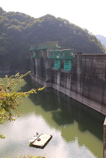
View of the conduit from the observation platform on the right bank
This rounded, feminineconduitOh, my God!
View of the crest from the observation deck on the right bank
Plus, here's another rounded crested section!
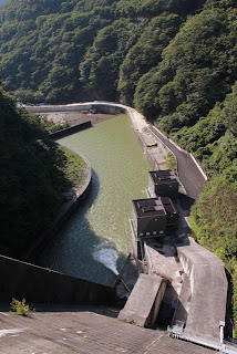
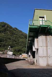
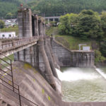
View of the reduction work from the observatory on the right bank
And this abatement and conduit!
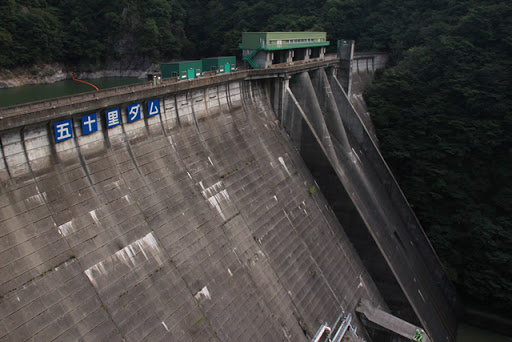
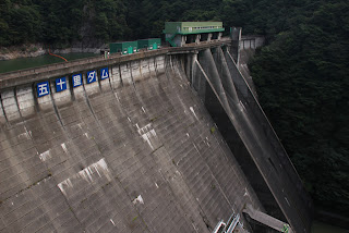
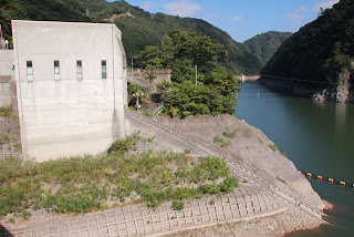
View of the levee from the observation deck on the right bank
Fifty miles from Tokyo Nihonbashi. At last, here we are at the Gojuri Dam!
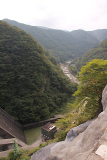
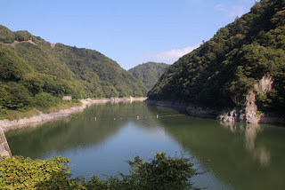
View downstream from the observatory on the right bank
There is a hot spring resort downstream and the atmosphere looks nice. If possible, I would like to stay there for a long time.
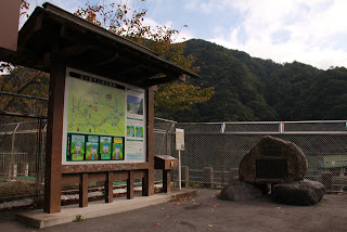
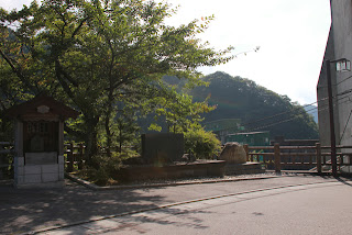
Information sign and stone monument at the observatory on the right bank
It is a magnificent sign and stone monument. The sign in particular was designed to evoke history and contained information about the surrounding area and the Gojuri Dam.
Since there is still some time left, I decided to go downstream before the top of the dam, but unfortunately, it was under maintenance work that day, so I could not visit the dam.... So, it was time to go to the control center to get a dam card.
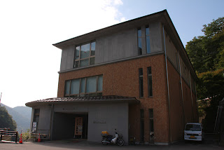
Entrance to the Gojuri Dam Management Office
... and then you can't get in.
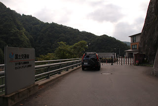
The time was around 8:30 a.m. It seemed that tours were available from 9:00 a.m. I had a next appointment. Since I had my next appointment, I ping-ponged and asked if I could at least visit from the top edge, but it was a no-go.
Gojyuri Dam Management Station
However, they opened the door 10 minutes before. I apologized for rushing him and got the dam card.
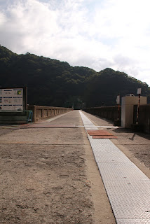
View of the top edge from the right bank
I was the first one to arrive on this day. w
There's no one here!
You can enjoy the Gojuri Dam to the fullest!
The Gojuri Dam was completed in 1956 (Showa 31), and although it is a rather old dam, it gave the impression of being properly utilized while being maintained. It was the first dam in Japan to exceed 100 m in height, and at the time, it was the tallest dam in Japan.
In addition, to give a brief history of the construction of the Gojuri Dam, the construction plan started in 1926, excavation began in 1929, a fault was found in 1933 and construction was temporarily halted, construction started again in 1941 despite flood damage, and construction was suspended in 1942 due to the war...it seems to have been quite a difficult history.
And I was afraid to plan a 100-meter high dam in the Taisho era.
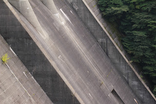
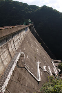
View of the levee downstream from the right bank
The Gojuri Dam does not have stairs installed in the footing, but rather a catwalk like an arch dam, which can be used to patrol downstream.
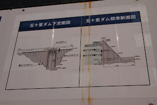
Downstream face and standard cross section of the Gojuri Dam
I couldn't see it from the front, so I studied this drawing and others.
In the center of the embankment is the "oldconduit gateThe gate can only be operated in two ways, fully open or fully closed, and its water discharge capacity is low at about 100 tons per second, making it very difficult to adjust the water level. Therefore, a new conduit gate with a capacity of 500 t/sec was installed on the right bank side. Of course, the gate can be partially opened.
Function of the Gojuri Dam [Flood control
The detailed construction of the new conduit gate isKajima websiteYou can see it at Anyway, I read this and was very impressed.
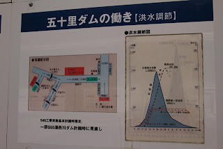
And this graph gives an idea of how difficult it was to control flooding with the old conduit gates.
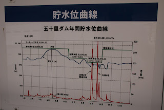
Annual storage level curve of the Gojuri Dam
This is evidence of when the Gojuri Dam did its best in 1998. The new conduit gate was completed in 2003, so it was still being adjusted with the old conduit gate.
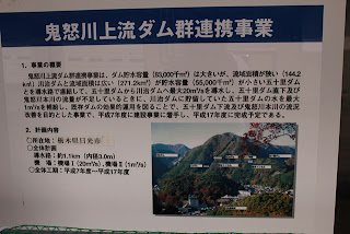
Kinugawa River Upper Stream Dam Group Linkage Project
What is really interesting is the "Kinugawa Upper Kinugawa River Dam Group Linkage Project. This project is to form a "dam-to-dam network" by directly connecting the Gojuri Dam and the Kawaji Dam, which is right next to it, with a 1.1 km long, 3 m inner diameter water pipeline.
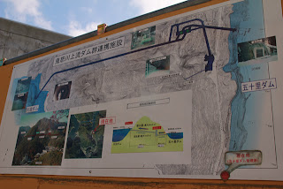
Kinugawa upper stream dam group cooperative facility
This allows for the pumping of up to 20 m3/s of water to the Kawaji Dam, which has a large storage capacity, in the event of an inflow that the Gojari Dam is full and cannot store water, and conversely, in the event of a shortage of river maintenance flow immediately below the Gojari Dam or in the Kinugawa River main channel, water can be pumped from the Kawaji Dam to the Gojari Dam in coordination. This is said to be the case.
The Gojuri Dam and Kawaji Dam do not operate separately, but rather both work together to protect the downstream...that is the image I have in mind.
Each one is a mere fire, but when two overlap, they become a big flame. ...Well, in this case, it is water.
So it is understandable that even old dams are properly utilized in this project.
incline
This incline also looked like it had just been maintained and was quite beautiful.
I'd like to see the patrol boat appear on the scene. w
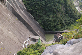
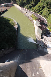
View of the reduction work from the top of the right bank
You are in the middle of a river maintenance discharge.
Also, the structure on the right bank is the new conduit gate. The area downstream of this conduit gate is currently under construction and is inaccessible, but I heard that you will be able to walk around after the construction is finished, so I would definitely like to revisit the area to take a closer look at this conduit gate.
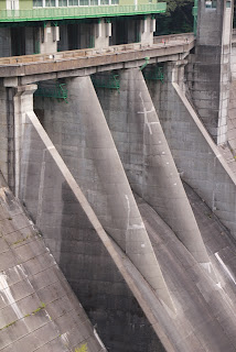
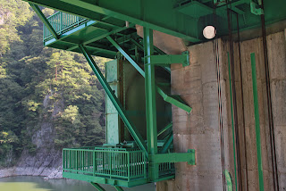
View of Gate Pier
This is a gate pier that feels quite stumpy. It feels like the gate hoisting room is on top of the dossier.
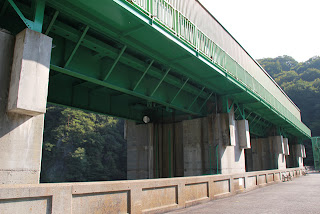
View of roller gate
It is 10m wide by 5.2m high (this is the upper door height and the lower door height is 8.3m, for a total of 13.5m and a two-step gate). The roller gate of the crest gate of the "Crest Gate" is also as stately as you can see. It even has a sense of style. Incidentally, it was made by Hitachi Zosen.
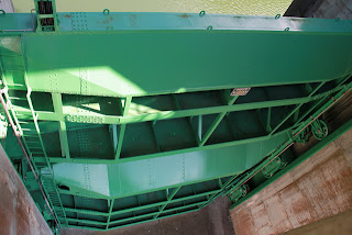
There are a total of three crest gates. They can discharge a maximum of 300 m3/s.
Spare gate door body?
I believe this is a spare gate door body for the old conduit gate.
Birds - I don't know what kind.
A bird at the edge of the sky.
But I don't know what it's called.
View of the reduction work from the top edge
If only downstream wasn't under construction.... I think that over and over again when I look at this picture, but it can't be helped.
More interesting is the contrast between the oldness of the dike and the newness of the new conduit gate.
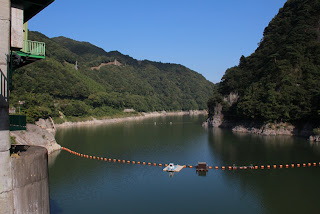
View of the dam lake from the top near the left bank
The dam lake seems thin compared to the size of the embankment, which is no wonder it is linked to the Kawaji Dam.
But what a blue sky!
View of the top edge from the left bank
Don't dams and blue skies go well together?
Stone monument placed on the right bank
Let's put our hands together at the cenotaph.
A moment to remember the hardships of our predecessors....
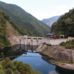
View of the embankment on the lake side from the right bank
The conduit gate is on the right and the crest gate on the left.
The concrete surface is colored to evoke a sense of history, giving the dam a stately appearance.
View of the dam lake from the right bank
Upstream of this dam, the Yunishigawa Dam is under construction. One can only hope that in the near future, the old and new dams will work together like this to regulate flooding!
dam characteristics
| River Name | Tone River System Oga River |
| Objective | Flood control, agricultural disaster prevention, unspecified water, river maintenance water, power generation |
| Model | gravity-fed concrete dam |
| Bank height | 112m |
| Bank length | 267m |
| Dam volume | 468,000m3 |
| Watershed Area | 271.2 km2 |
| Reservoir area | 310ha |
| Total storage capacity | 55,000,000m3 |
| Effective water storage capacity | 46,000,000m3 |
| Dam operator | Kanto Regional Construction Bureau |
| Main body constructor | Kajima Construction |
| Year of launch | 1941. |
| Year Completed | 1956 |
| Name of Dam Lake | Ikariko (Lake Ikari) |
Other facilities/observations
Parking is available at the observation deck on the right bank and next to the administration office. After the downstream maintenance, it may be possible to park here as well. However, the parking lot next to the management office opens only from 9:00 am.
| Parking lot | ○ |
| Toilet | ○ |
| Park | × |
| PR Exhibition Hall | ○ |
| Fishing | ○ |
Accommodations that may be close to Gojuri Dam

Comment