
Date of interview: 2011/10/02 (Sun.)
Location: Oiwatake, Ikuno, Dojo Town, Kita-ku, Kobe City, Hyogo Prefecture
I visited Kobe and Arima Onsen on a family vacation and left my family (and mother-in-law) in Arima Onsen and came to Chikkari Dam by myself.
Chikari Dam was constructed in 1919 and is dedicated to water supply.
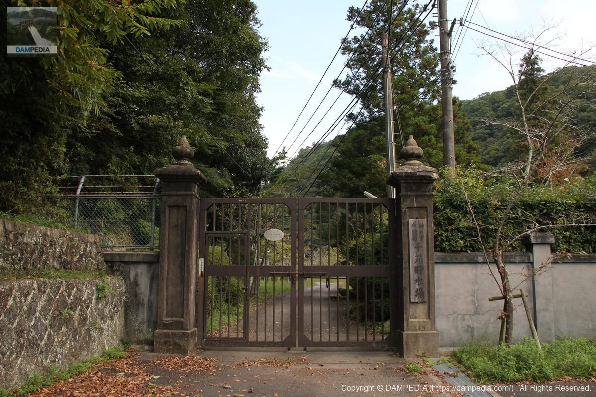
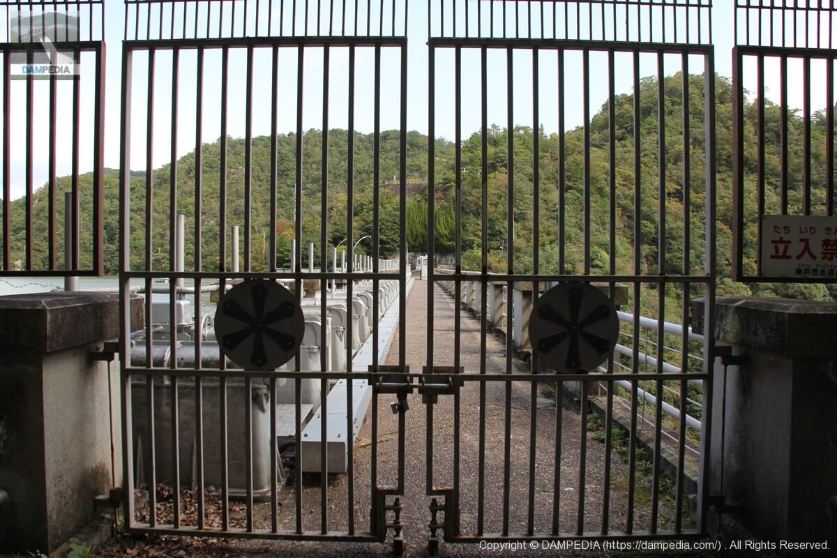
Gate of Chikari Water Reservoir
But that... the gate was closed and I couldn't get in... I thought this was a dead end...
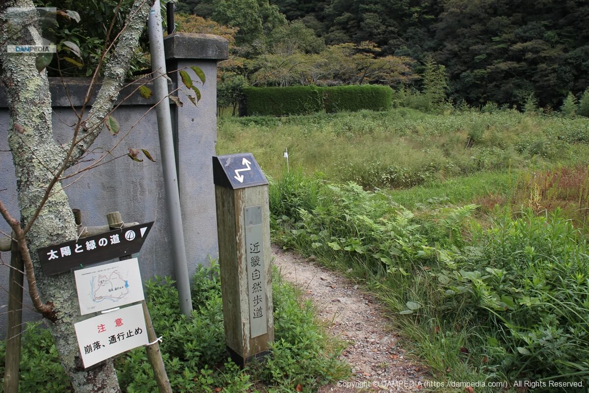
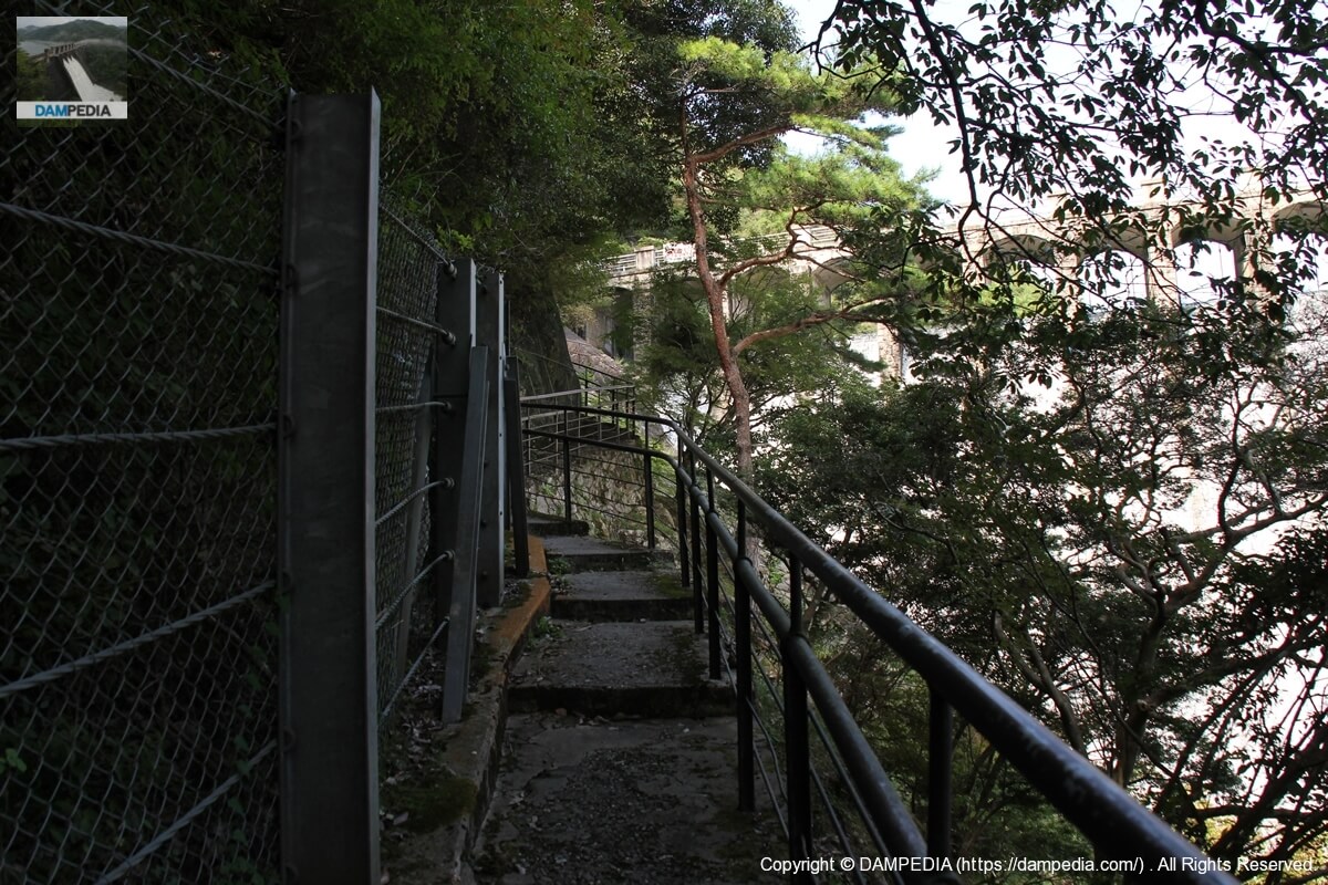
Kinki Nature Trail
Apparently, you can reach the dike from here. Incidentally, there is a large parking lot in front of the embankment, so you can drive up to this point.
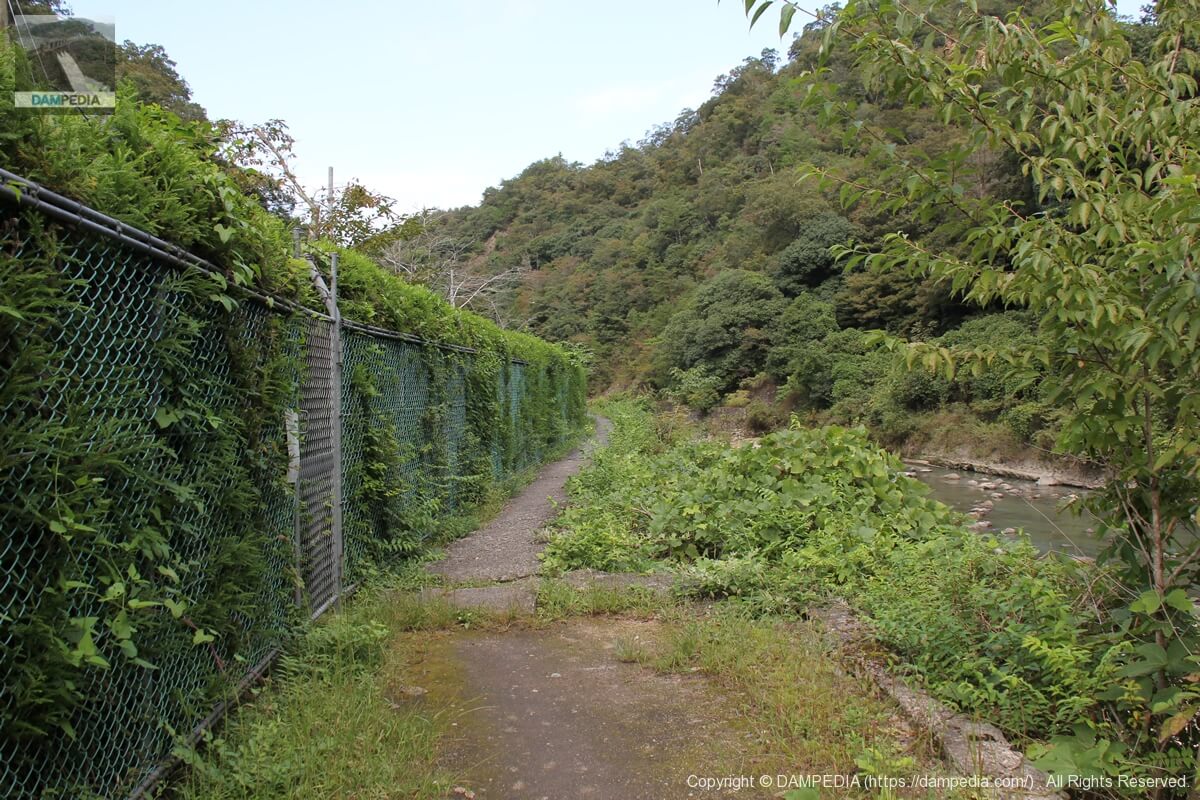
Path leading to the levee
However, it is a path that makes me extremely anxious to see if I can really reach the embankment.
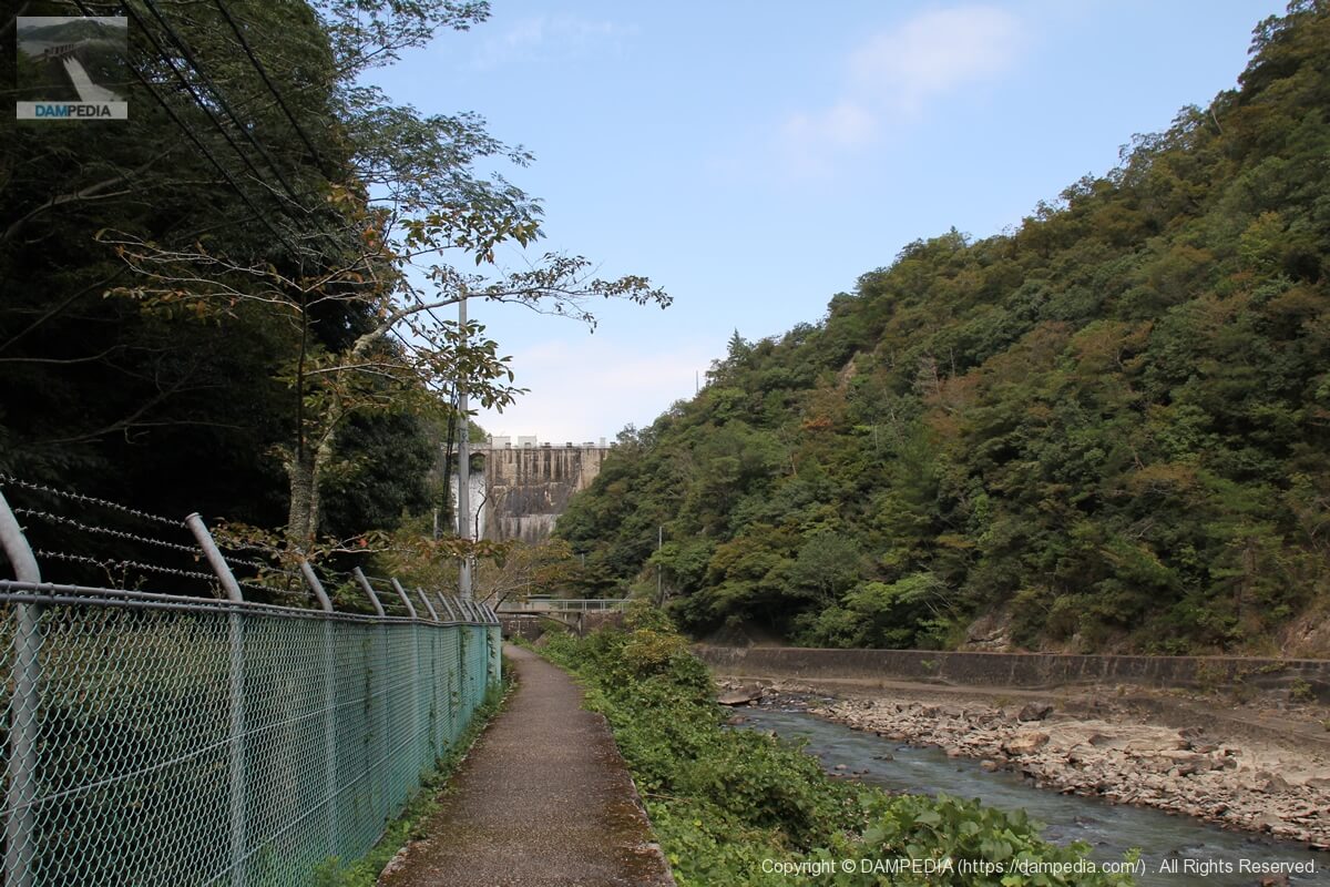
levee chirality
This is the ultimate in glimpses! As we proceeded deeper, the embankment finally came into view.
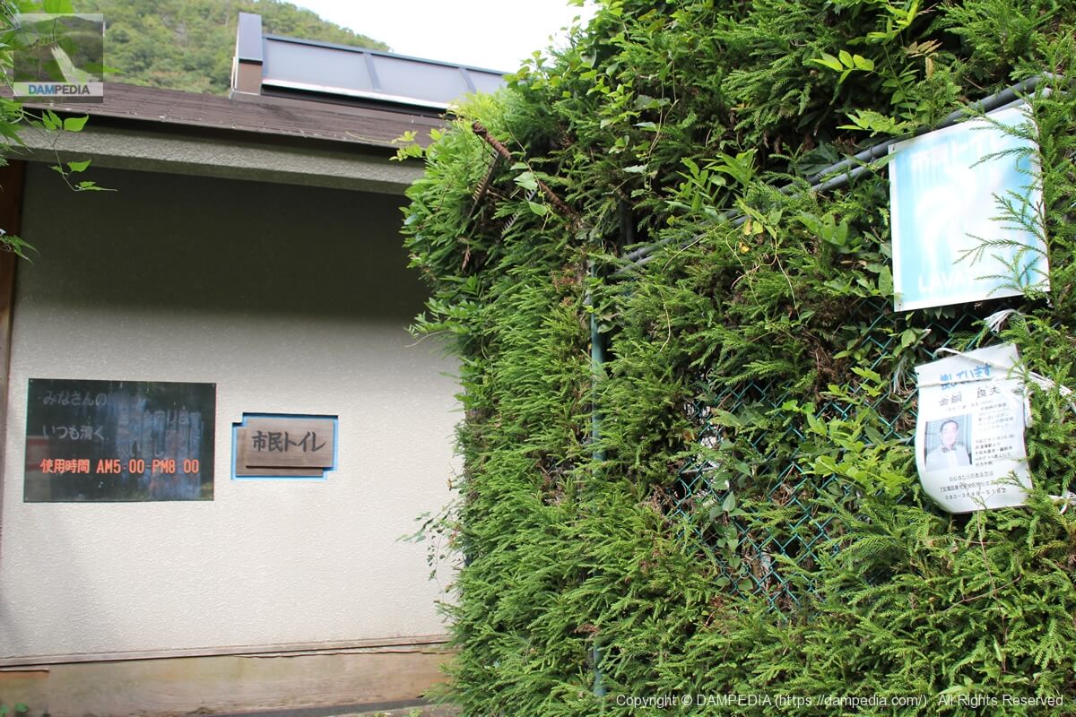
Civic Toilets
There is a toilet on the way to the dike. This would be very helpful in an emergency, as it seems to be a climbing route for Mt. Oiwa.
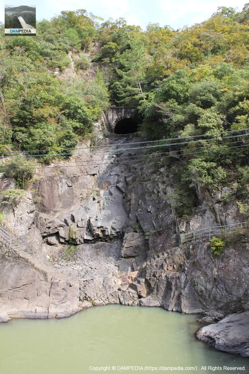
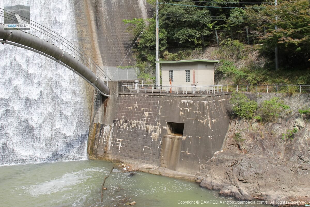
Sediment discharge tunnel?
There is what looks like a tunnel on the opposite bank. It looks like a sediment discharge, but I am not sure.

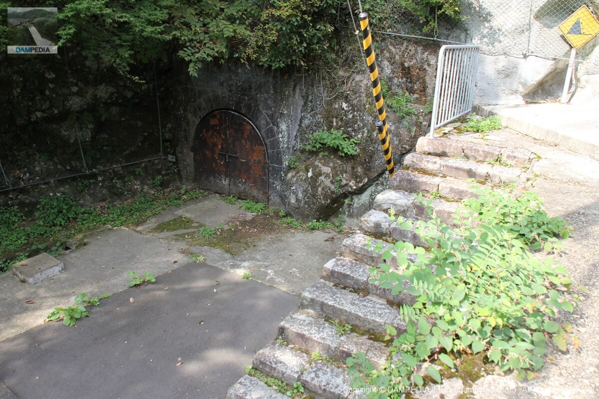
Tunnel?
There are other mysterious structures. If you continue on the road on the right bank, you will find what looks like a tunnel. Since the Chikari Dam was built in the Taisho era (1912-1926), there is no idea of an audit corridor, and it is too far away from the embankment to be a tunnel for grouting.
I was looking at the map and thinking that perhaps there used to be a route from the water treatment plant through this tunnel to the levee. Due to the danger of the tunnel collapsing, or because they wanted to limit the public's access to the water purification plant, they built a route for the public to go through the side of the river, and as a result, this tunnel was no longer needed....
However, the tunnel seems to be low in height, so there may have been an iron pipe running through it for water conduit.
In any case, it's a bit of a guess, but somehow I have a feeling that's the case.
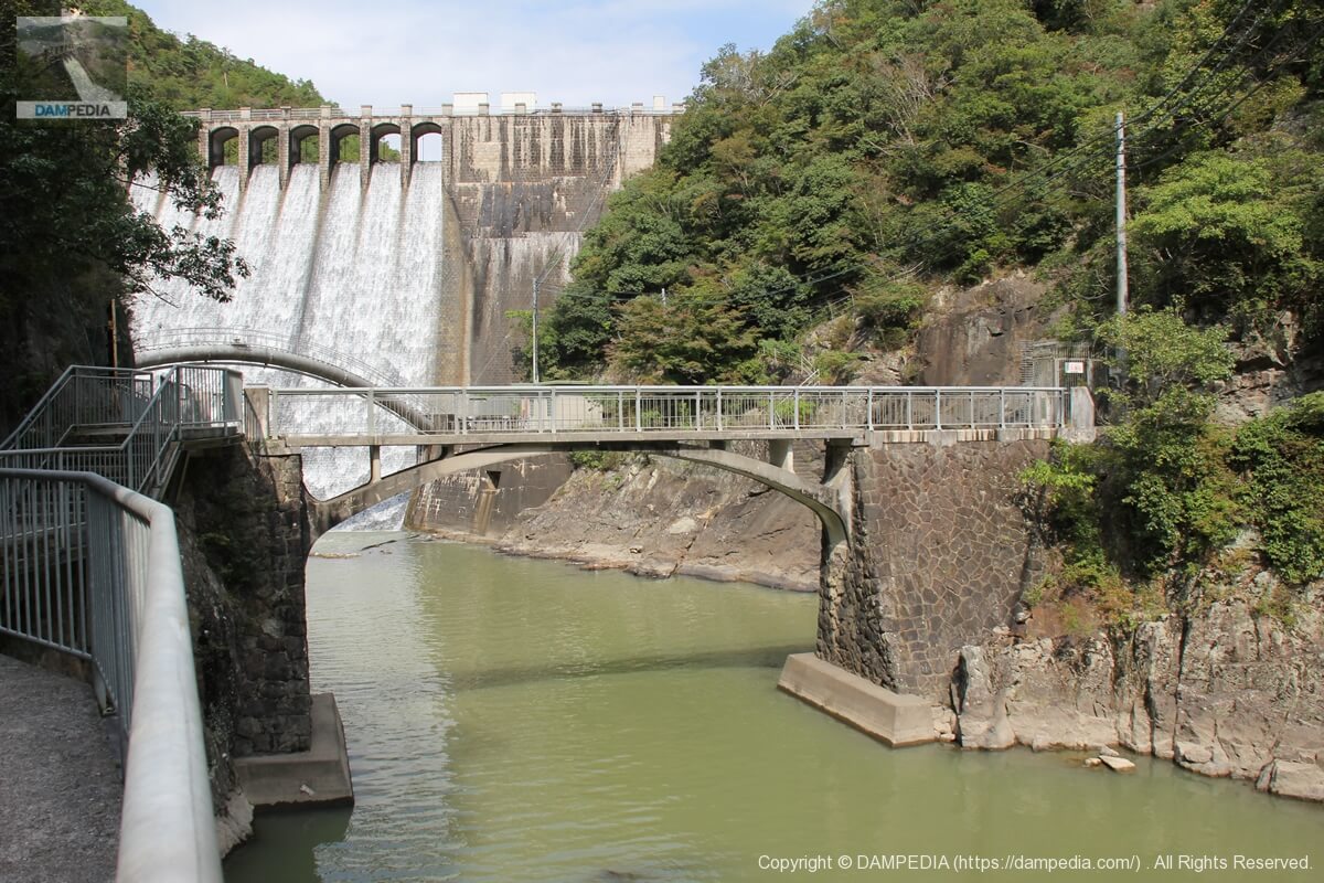
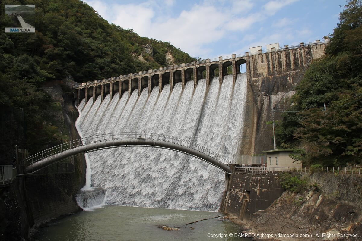
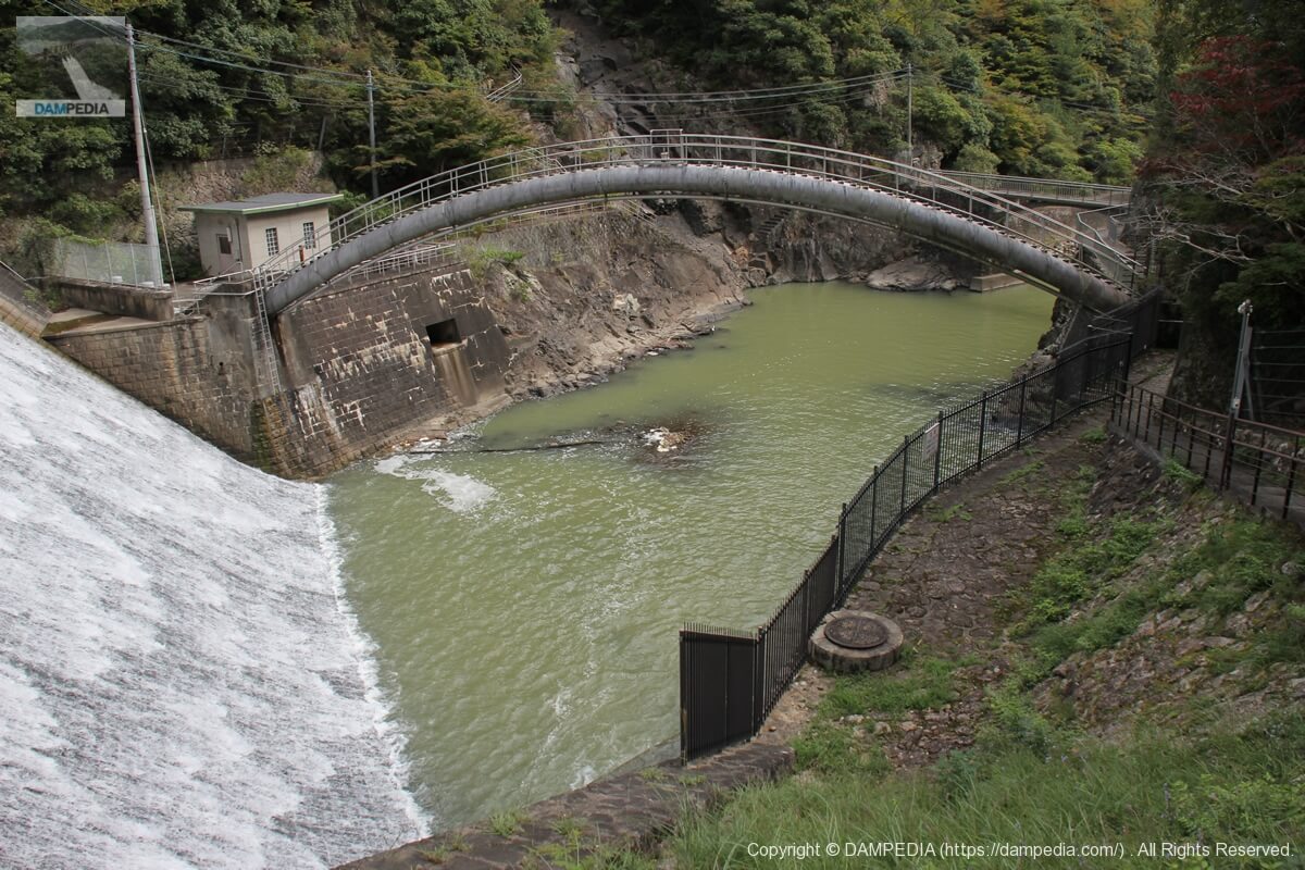
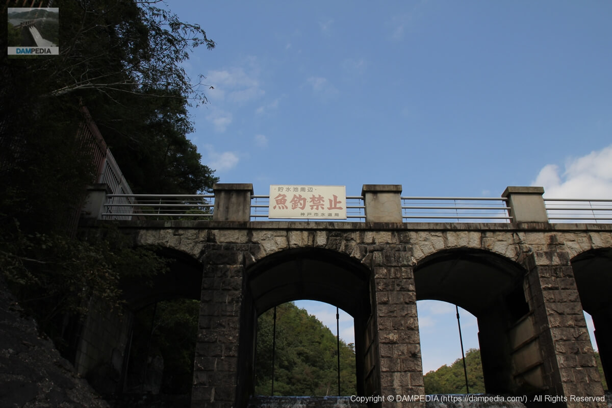
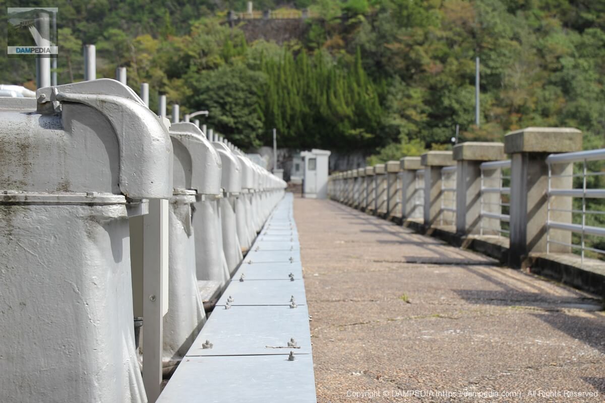
View of Chikkari Bridge
A dam with a bridge directly under the embankment is a good dam. However, this bridge is not for observation, but rather for administrative purposes or as part of the Oiwa-dake mountain climbing route.
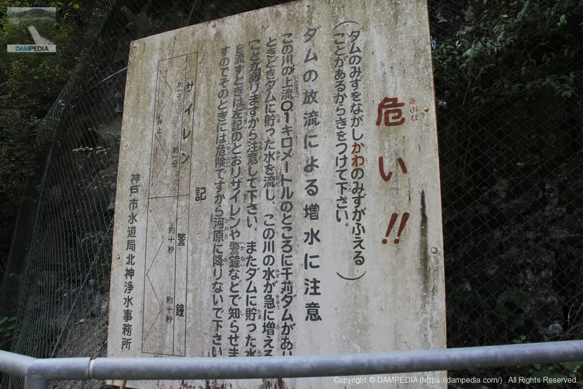
Discharge warning sign
A nice mossy discharge warning sign.
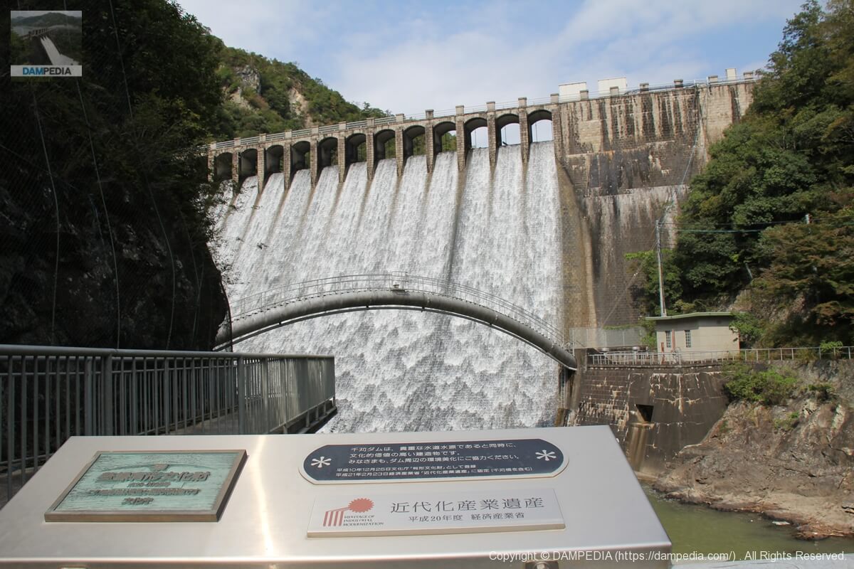
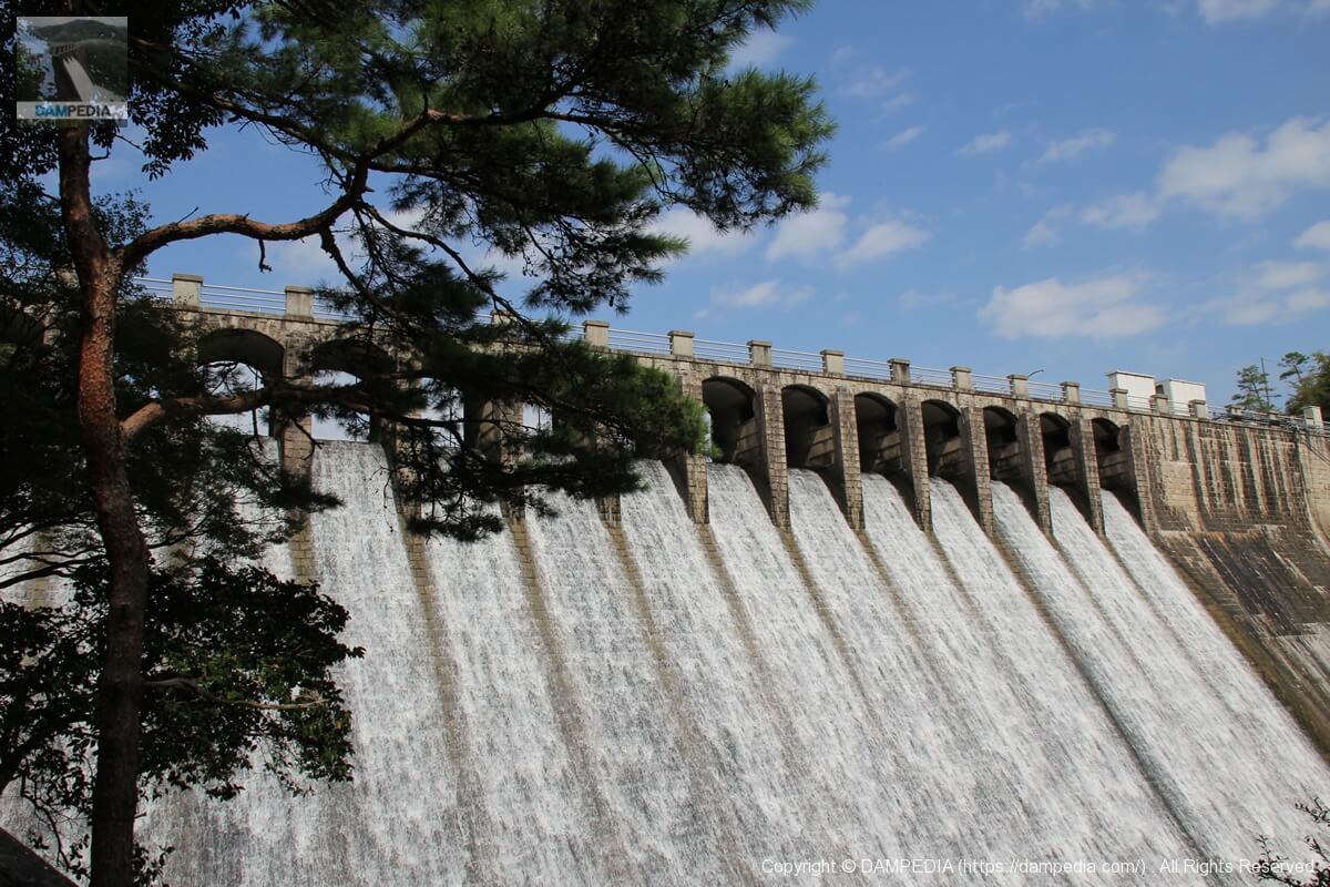
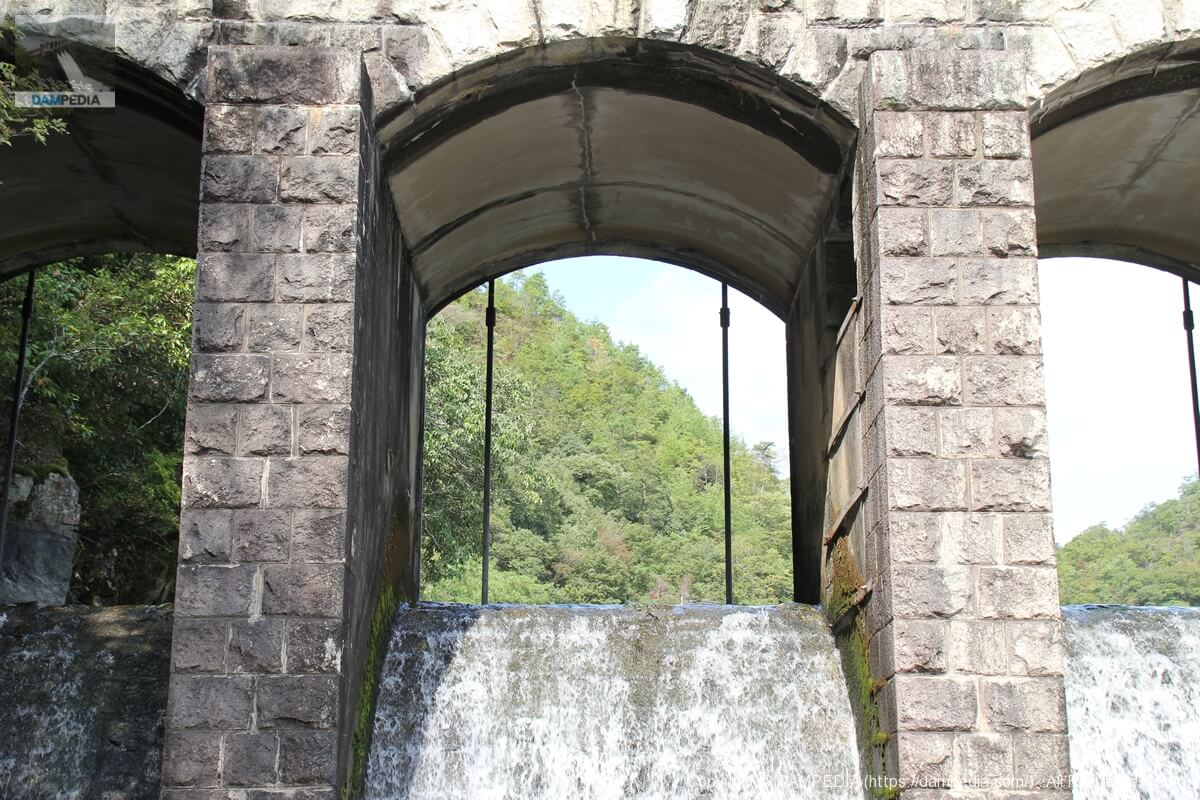
View of the plate and the embankment of the Registered Tangible Cultural Property and Industrial Heritage of Modernization from Chikkari Bridge
The Chikari Dam is a structure of high cultural value, and was recognized as a "Registered Tangible Cultural Property" by the Agency for Cultural Affairs on December 25, 1998, and as a "Heritage of Industrial Modernization" by the Ministry of Economy, Trade and Industry on February 23, 2009. It was also recognized as one of the "2000 Most Important Civil Engineering Structures in Japan" by the Japan Society of Civil Engineers (JSCE). When I saw the embankment, I could not help but think, "That's no wonder it is recognized as a Heritage of Modern Industry.
View of the levee from Chikari Bridge
Since the dam viewing locations are limited, the angles are inevitably similar to those of other visitors, but the angle from this location is also a standard angle seen on many websites, blogs, and social networking sites. So, I spent some time here after arriving at the site.
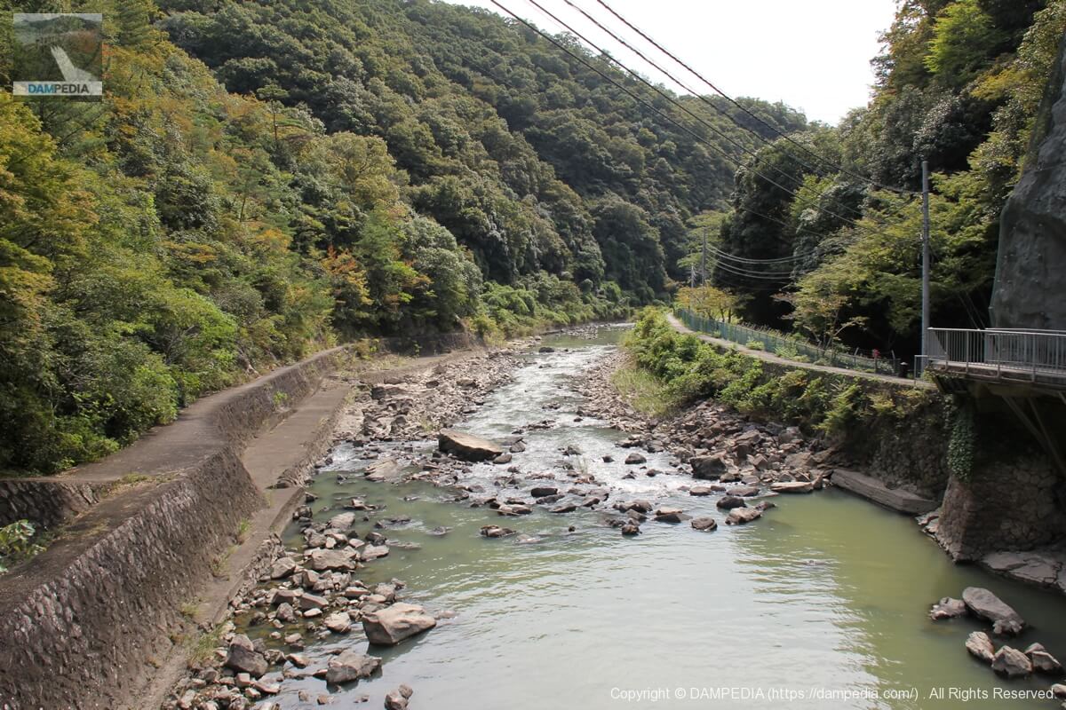
Looking downstream from Chikari Bridge
The rocks seem to be strewn about, but where do these rocks come from?
Residual water discharge tunnel
The tunnel is located high on the left bank. The Chikari Dam is always full of water at the height of the top of the gate when the crest gate of the embankment is closed. In addition to the crest gate, the Chikkari Dam has an overflow section on the left bank, and if the inflow exceeds the full water level, the water is discharged through this tunnel.
It serves as an emergency flood discharge, so to speak. I have seen pictures of the water actually being discharged from this dam, and it looked like a cascade of water. However, I have never seen any other dam with such a function in such a form.
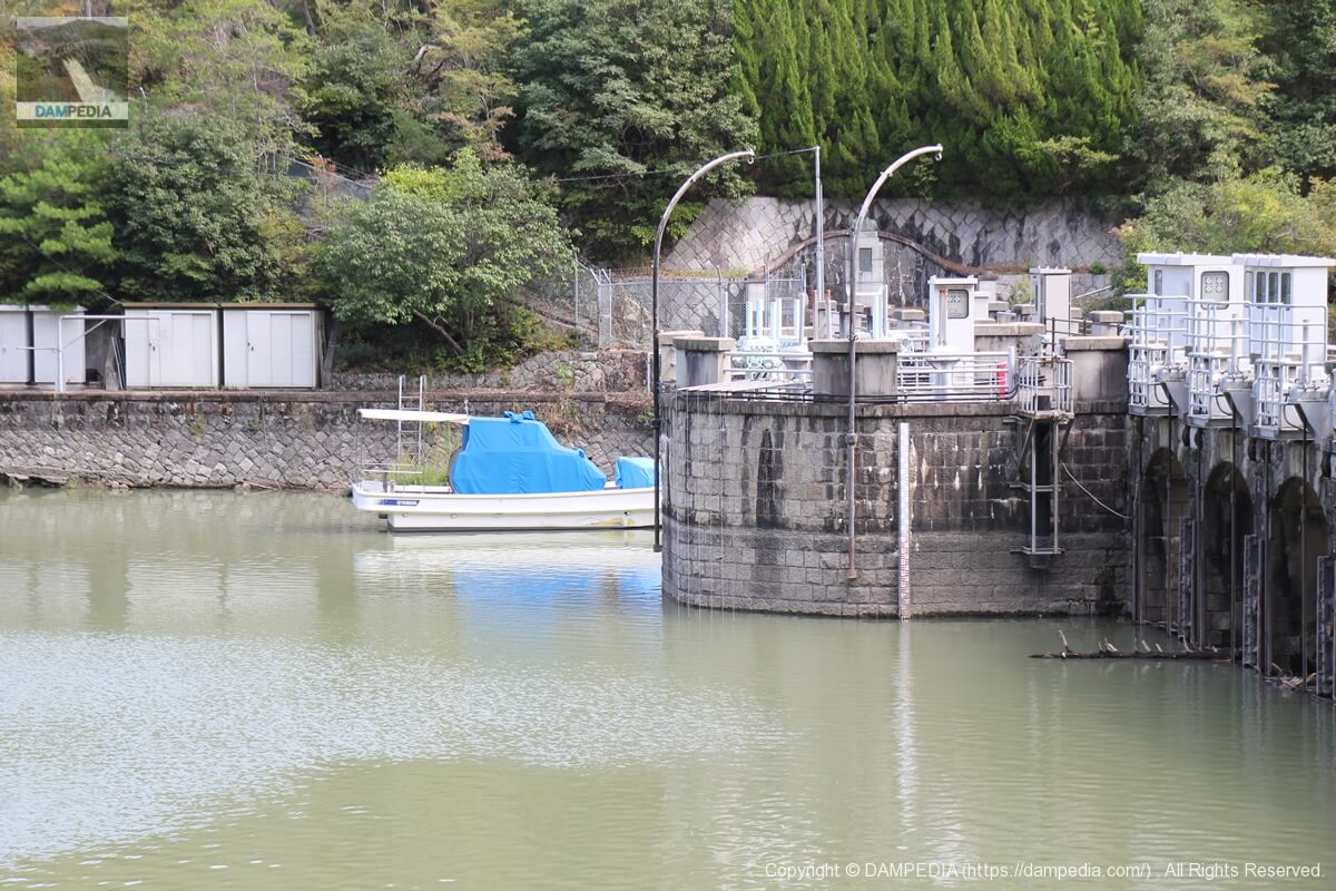
structure for housing heavy machinery
Probably a valve room for transporting water to a water purification plant.
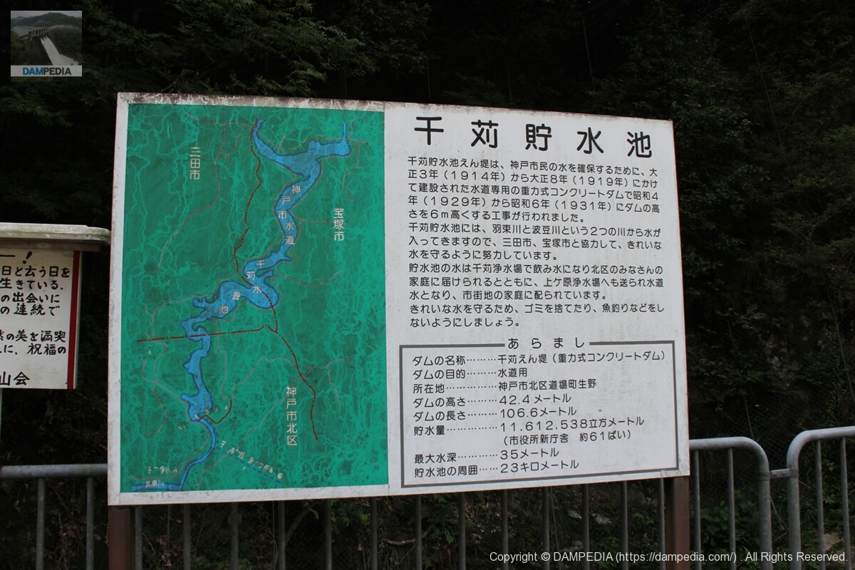
information sign
This information sign indicates that it was constructed between 1914 and 1919, and that it was further raised by 6 meters between 1929 and 1931.
View of the levee from downstream
I am at a loss for words.
View downstream from the stairs on the right bank
Because the promenade continues beyond the embankment, a stairway has been installed on the right bank. You can clearly see the relationship between the levee, the iron pipes for water supply, and the Chikkari Bridge.
View of the embankment from the stairs on the right bank
I had never imagined that pine trees and dams would go so well together.
Stairs on the right bank
By the way, the stairs on the right bank look like this. It is a promenade, so it is rather easy to walk.
View of the embankment from the stairs on the right bank
The weather was unusually clear for me, but the contrast was clear and it was truly a dam day and discharge day.
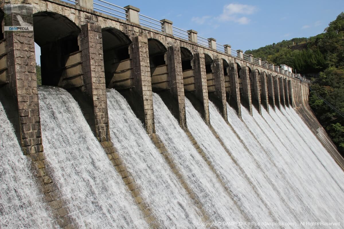
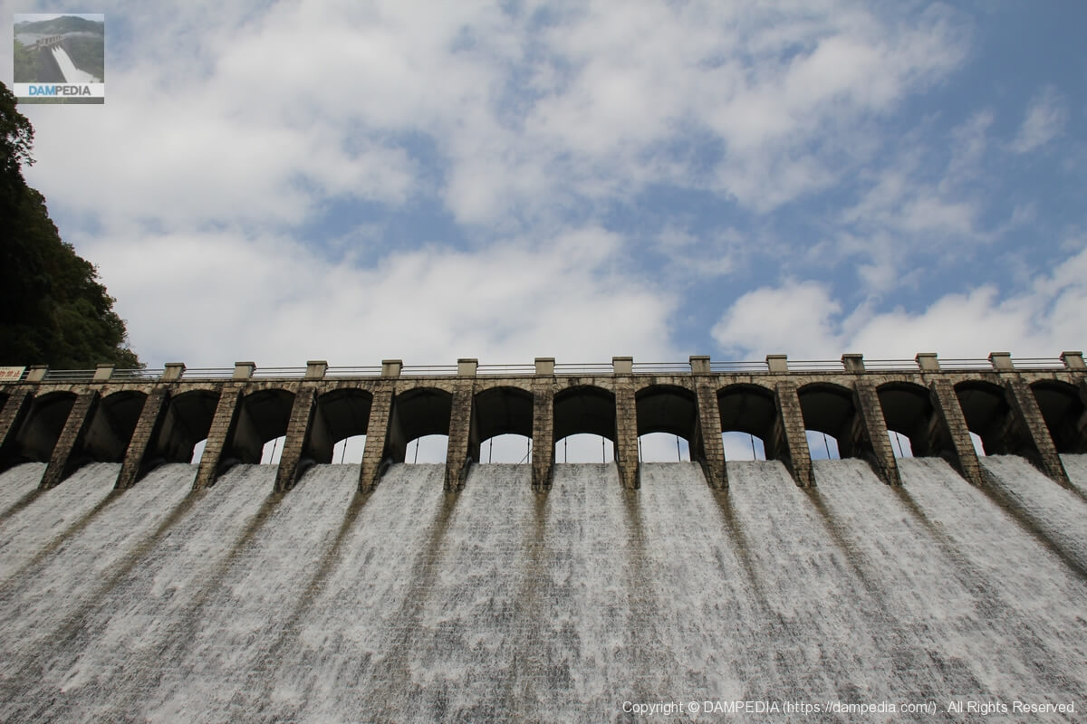
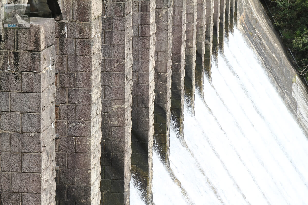
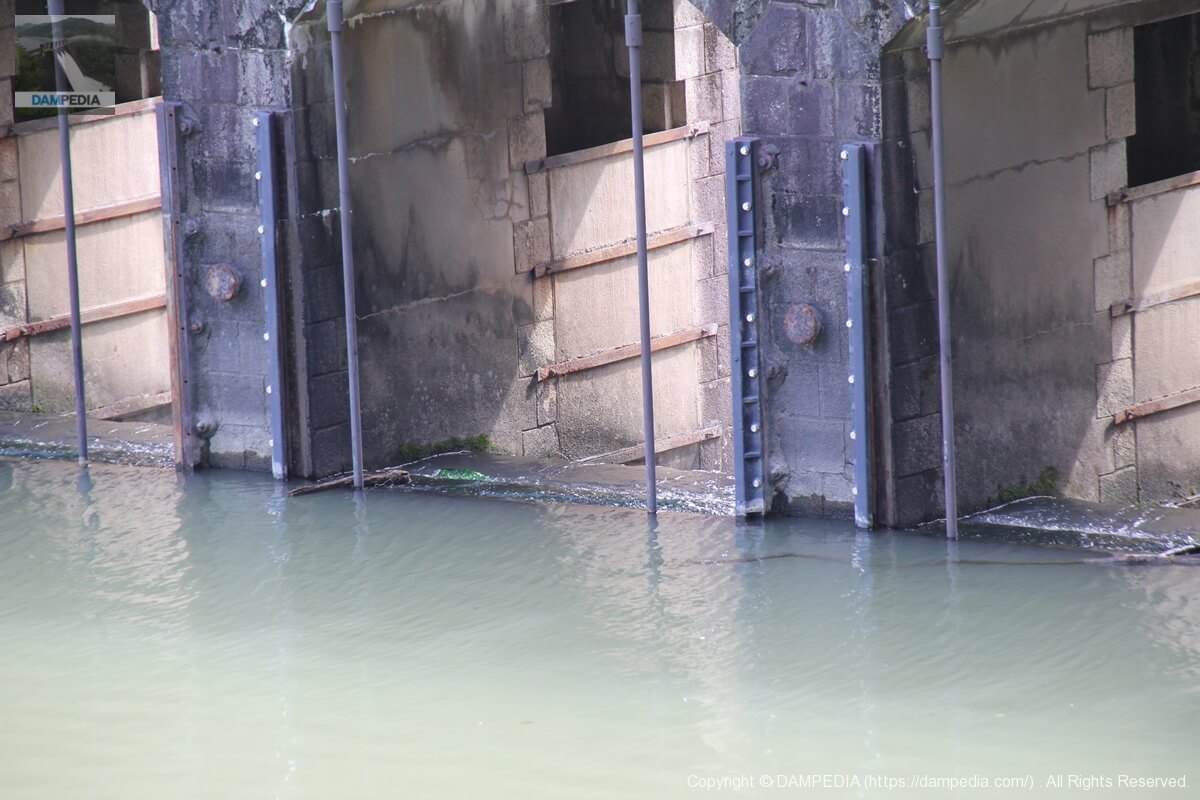
Zoom in on the discharge from the crest gate.
The white splashes are also beautiful and enhance the stone embankment.
View of Crest Gate
The discharge of water from the Chikkari Dam is said to be relatively easy to see, but even so, it is hard to find another dam where you can see the gate so close up.
View from the stairs on the right bank to the left bank
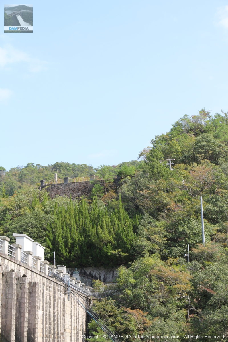
On the high ground on the left bank, we can see a railing and what appears to be a shrine gate. However, it seems to be in a place where it is not allowed to enter freely. The Chikkari Dam embankment seen from that place must be wonderful.
View of the crest gate from the stairs on the right bank
Fishing is prohibited in the dam lake. It is an austere prohibition sign with a Ming Dynasty font.
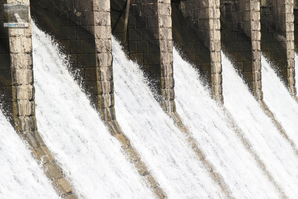
View of the levee downstream from the right bank
I am at a loss for words to describe the white, shining droplets flowing between the rows of stone crest gates as beautiful.
View of the top edge from the right bank
Unfortunately, the top end is off-limits. It is closed tightly by a gate, but that is to be expected since it is a precious source of water for Kobe. As a lover of water, I would love to go inside, but....
Incidentally, the round crest-like object on the gate is the mark of the Kobe City Waterworks Bureau with the word "water" on it.
Stone monument on the right bank
A large stone monument is erected on the other side of the gate at the top of the temple.
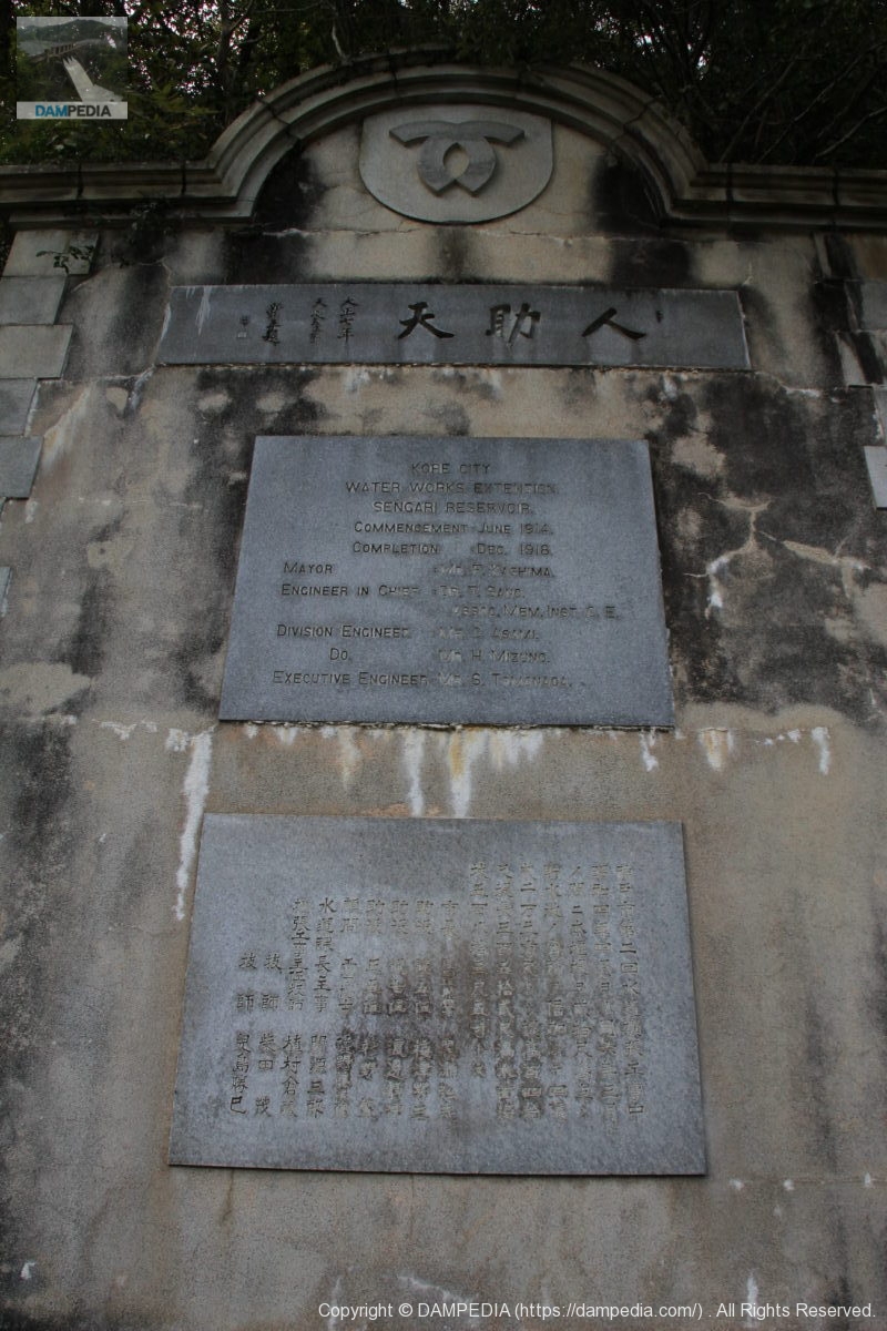
KOBE CITY
WATER WORKS EXTENSION
SENGARI RESERVOIR
COMMENCEMENT : JUNE 1914.
COMPLETION : dec. 1918.
MAYOR : MR.F.KASHIMA.
ENGINEER IN CHIEF :DR.T.SANO.
ASSCC.MEM.INST.C.E.
DIVISION ENGINEER :MR.C.ASAMI.
DO. :MR.H.MIZUNO.
EXECUTIVE ENGINEER:MR.S.TOMONAGA.Kobe City 2nd water supply extension under construction
April 1929 to March 1931
The weir was raised by 2,000 feet during the period of
Reservoir volume doubled to 400 million
2,000,000 cubic feet in length and 1,400 in height
(length of embankment 352 shaku, full surface of the sea)
5803 shaku 5 suntos.Mayor, Order of the 4th degree, 4th class Hiroshi Kurose
Assistant Officer, Fifth Rank, Yoshizo Umezu
Assistant Officer, 7th rank, Shizuki Watanabe
Shigeru Sugino, Assistant Director, Sho-fifth rank
Advisor Dr. Tojiro Sano, Ph.
Genzaburo Seki, Director, Water Supply Division
Chief Extension Engineer Kurazo Uemura
Katsumi Koshima, Engineer
The advisor, Tojiro Sano, is a civil engineer who was involved in the Nunobiki-Gohonmatsu Dam and Toyotoshi Pond, and is now well known in the dam enthusiasts' association.
View of the top edge from the right bank
I am tempted to take a single-point perspective photograph of a row of objects, but that is just my nature.
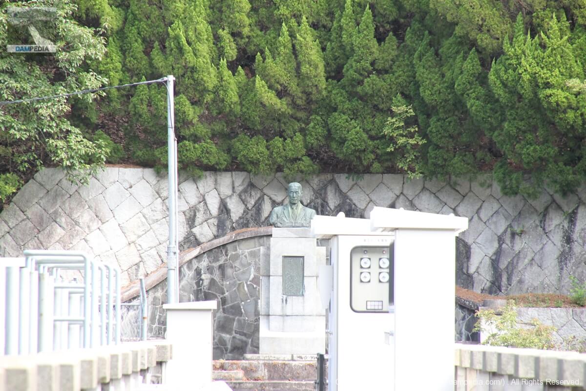
View of the statue on the left bank from the right bank
You can see a statue on the left bank. but unfortunately, I do not know the details.
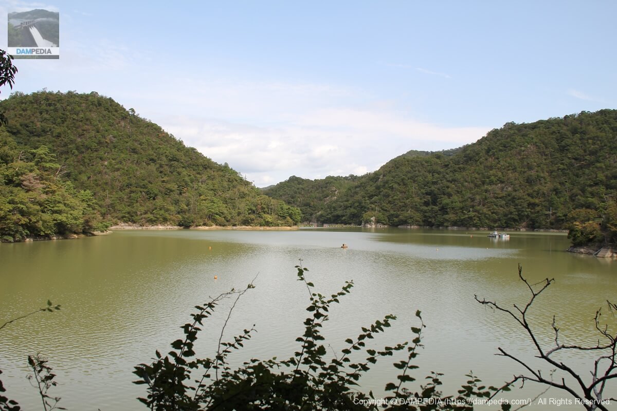
View of the dam lake from the right bank
It is a quiet dam lake because there are no people. Even so, you will occasionally encounter hikers heading upstream.
View from the right bank to the left bank
Is the part protruding from the embankment toward the dam lake an intake facility?
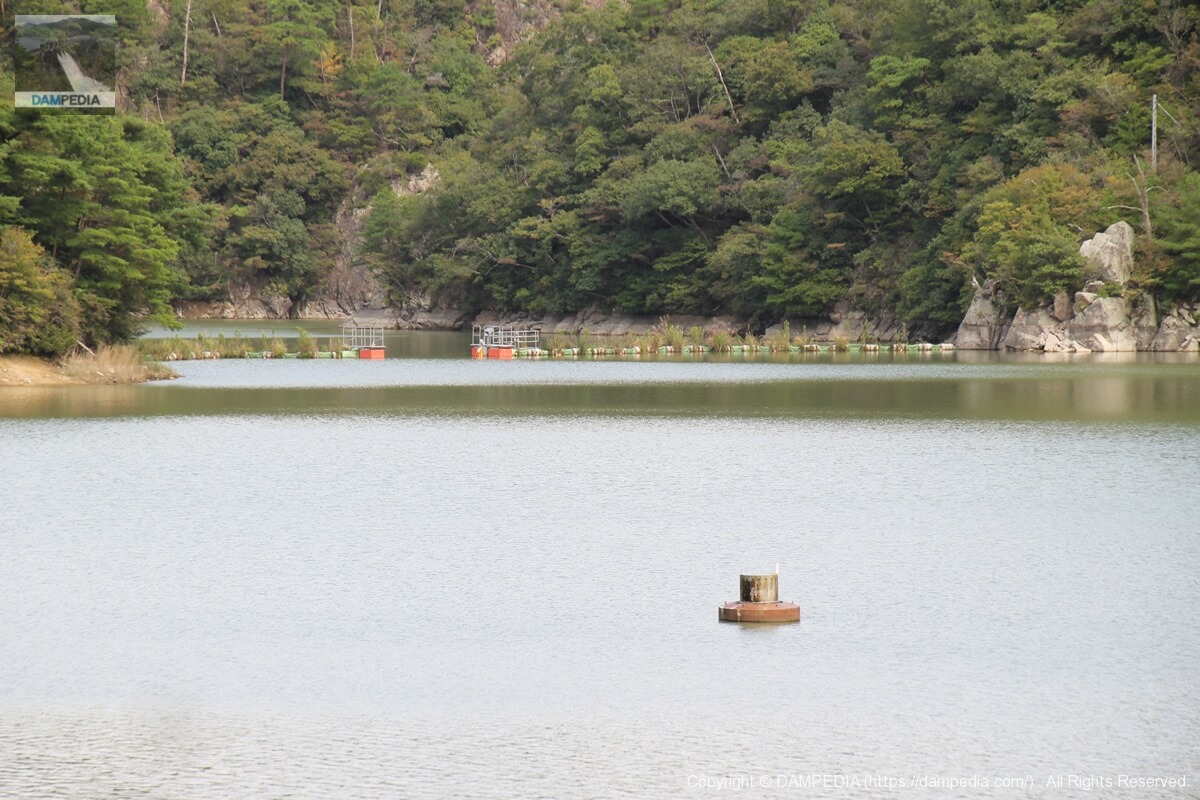
View of the structure floating on the dam lake
Probably a float for water quality testing.

Aeration equipment?
It looks like an aeration facility, but it is unknown.
View of the embankment on the lake side from the right bank
I walked along the walking path upstream for a bit. The upstream side is also quite spectacular.
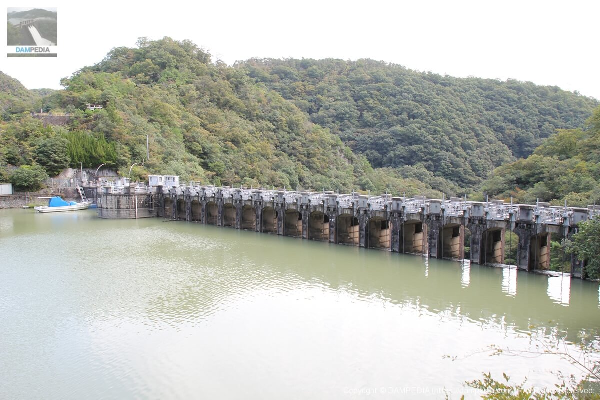
View of Crest Gate
The gate of Chikkari Dam is a kind of roller gate called a stony gate, and it is said that a gate with a roller on the side of a doorway is called such a gate, but I don't really understand it this way (laughs).
Chikkari Dam Specifications
| River Name | Mukogawa River System Hazukagawa |
| Objective | waterworks |
| Model | Gravity Concrete |
| Bank height | 42.4m |
| Bank length | 106.7m |
| Dam volume | 41,000m3 |
| Watershed Area | 94.5 km2 |
| Reservoir area | 112 ha |
| Total storage capacity | 11,717,000m3 |
| Effective water storage capacity | 11,612,000m3 |
| Dam operator | Kobe City |
| Main body constructor | Directly managed by dam operator |
| Year of launch | 1914. |
| Year Completed | 1919 |
| Name of Dam Lake | Chikkari Water Source Pond |
Other facilities/observations
It is a bit of a walk from the parking lot to the dam, but it is not very far. However, if you forget something in your car when you get to the embankment, it will be a bit of a hassle, so it is better to be well prepared.
| Parking lot | ○ |
| Toilet | ○ |
| Park | × |
| PR Exhibition Hall | × |
| Fishing | × |
Comment