
Date of interview: Saturday, 1/4/2014
After the Hachimantani Dam, we visited the Mikumari Dam. The name of the dam is written in hiragana, which is unusual. To approach Mikumari Dam from Hachimantani Dam, it looks on the map as if you can go from the upstream side of Mikumari Dam, but there is a fence on the way, so you have to go around to the downstream side.
The Mikumari River basin, where the dam is located, has suffered from flood damage, including Typhoon No. 10 in September 1983, and Tamba-Sasayama City, which has become a bedroom town for Osaka and Kobe due to the Maizuru-Wakasa Expressway and the underground electrification of the JR Fukuchiyama Line, has seen its water demand increase, leading to the construction of Mikumari Dam. (However, the population has been declining since 2010, after the dam was constructed...)
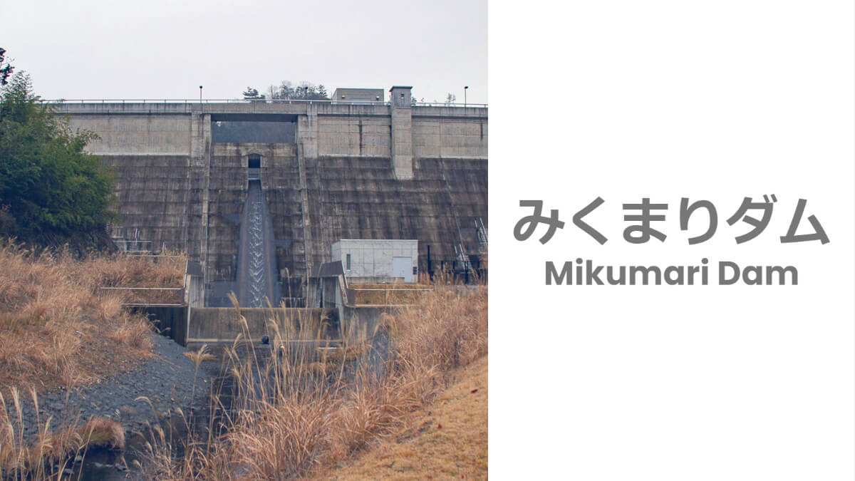
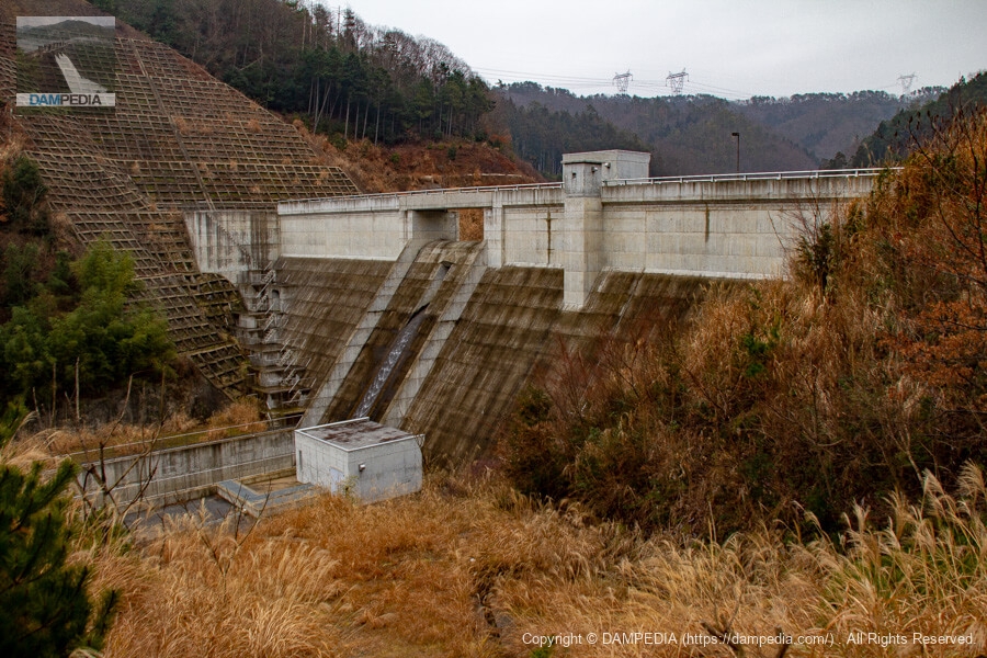
View of the downstream face of the dike
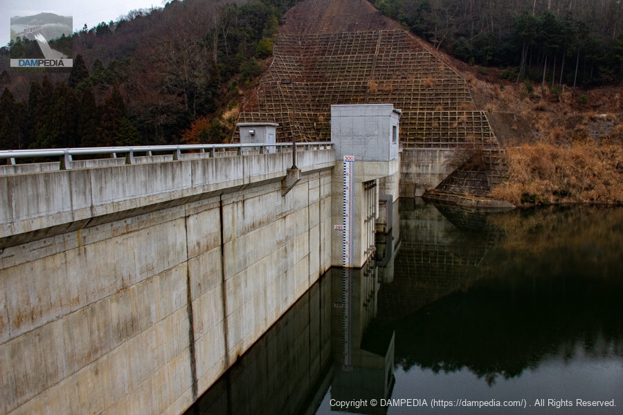
First, let's look at the downstream side. The Mikumari Dam is a new dam, completed in 2009, so the concrete was a beautiful color. However, a light rain started to sprinkle soon after our arrival, gradually wetting the embankment.

As for the origin of the name Mikumari Dam, a local signboard stated the following.
There is a legend that "Mikumari no Kami" lived in the upper reaches of the Sasayama River in the northeastern part of the Sasayama Basin and shared pure and delicious water with the people living in this area. Later, it is said that the character "Mikuma" was applied to "Mikumari," and there is still a shrine for moisture along the Mikumagawa River downstream of the dam.
From the local sign
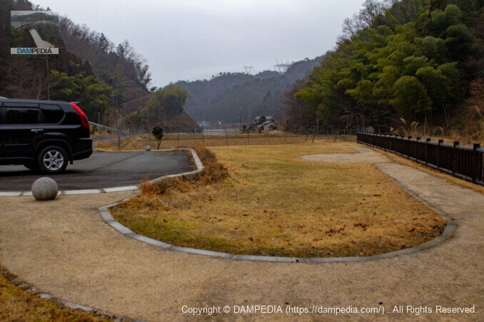
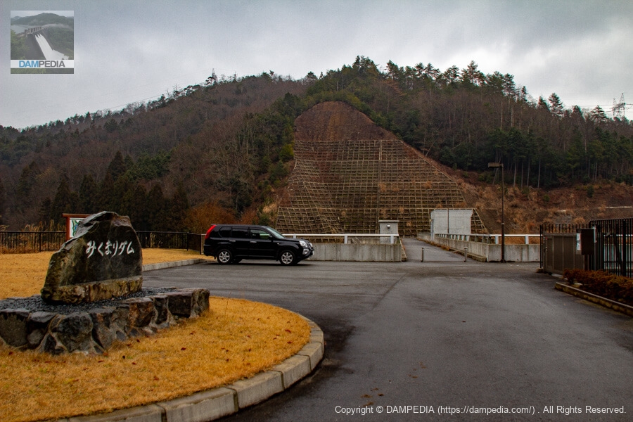
Downstream plaza and parking lot
There is a plaza and parking lot just downstream from the dam, but the shape of the plaza is a bit strange. It is a mystery whether the plan was to build a pavilion but there was no budget, so only the sidewalk was maintained.
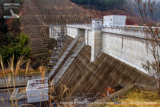
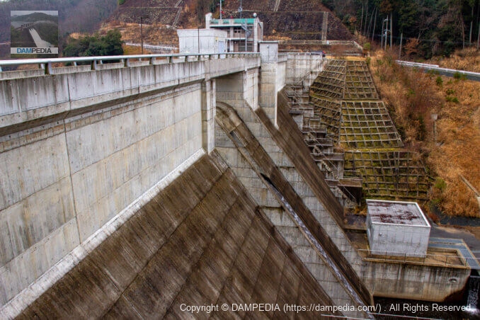
sub-dam
The embankment is a design typical of prefectural dams, and the sub-dam is also designed in a standardized manner. However, the rounded construction of the overflow section shows the care taken in its construction.
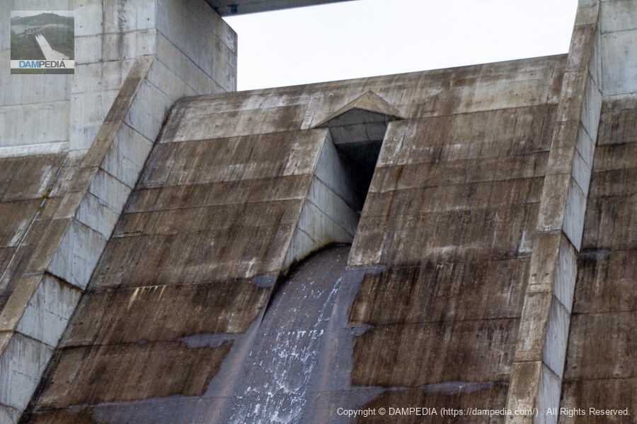
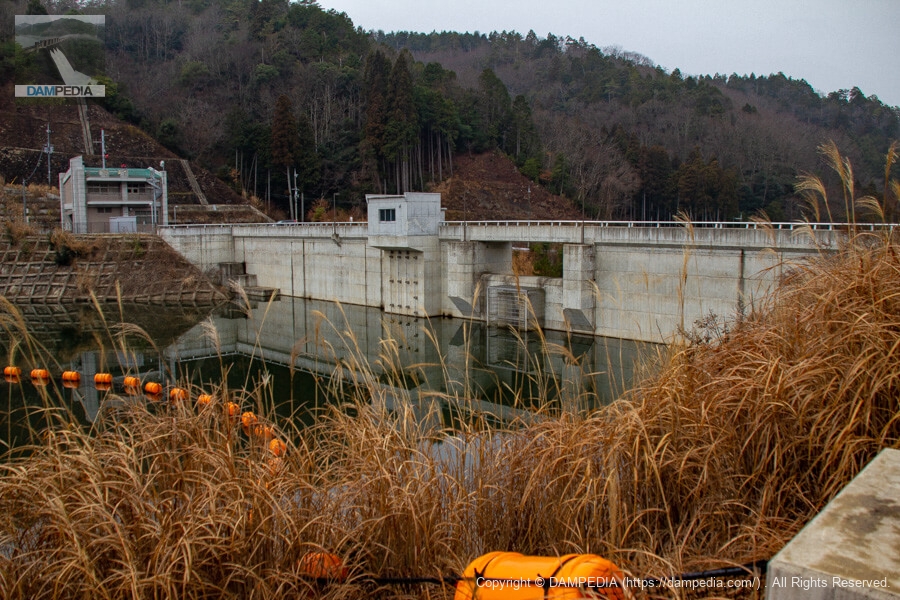
Crest & Orifice
The emergency flood discharge at the Mikumari Dam crest is naturally overflowing, and the orifice as a normal flood discharge is also naturally overflowing. Incidentally, the bedding height of the crest is EL.296.5m and the orifice is EL.292.2m.
Looking downstream from the left bank
On the way from downstream to the top edge, there is a roadside-like area from which the downstream face of the dike can be captured.
Closer to the levee, looking downstream from the left bank
The left bank at the top end level is a little square, from which you can see the downstream face of the levee. It is very nice to be able to admire the levee from various places.
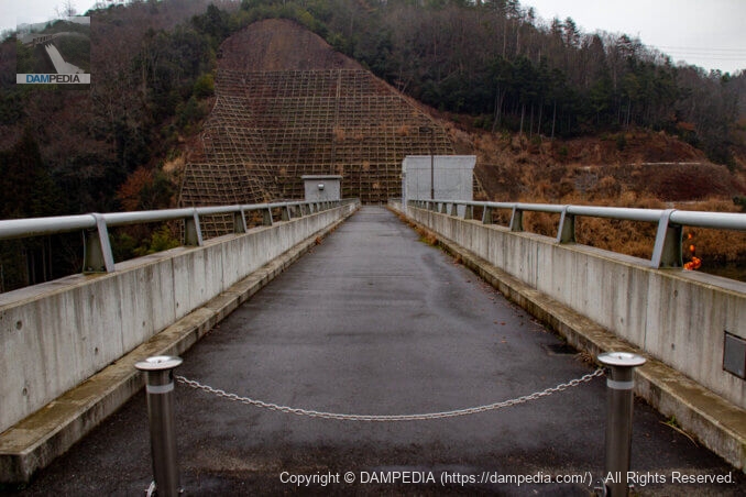
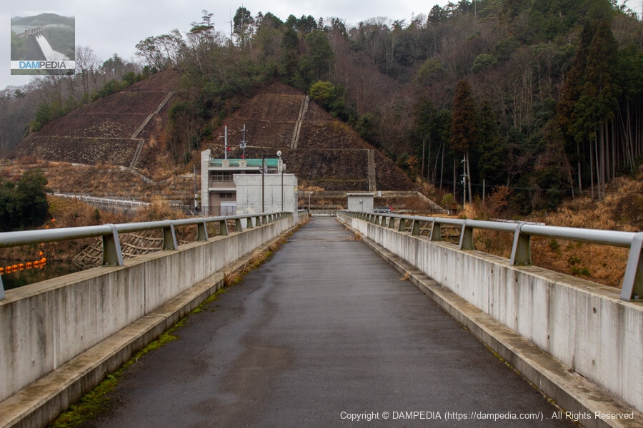
View of the top edge from the left bank
The top edge is blocked off and not accessible to vehicles.
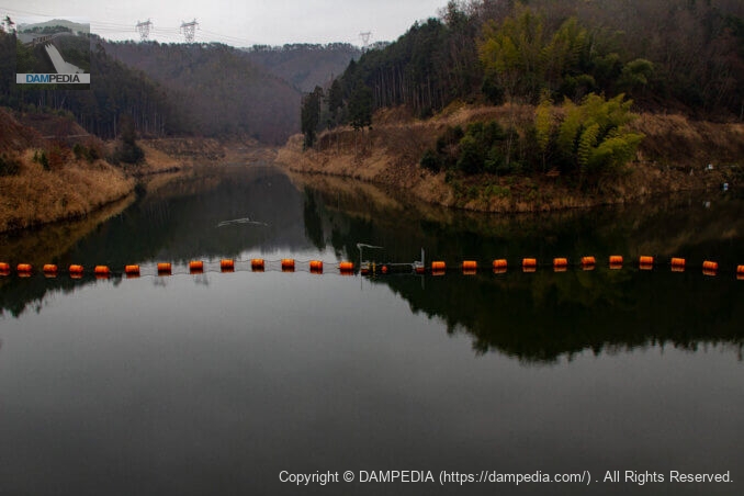
View of the reservoir from the top
The upstream end on the left appears to be a biotope.
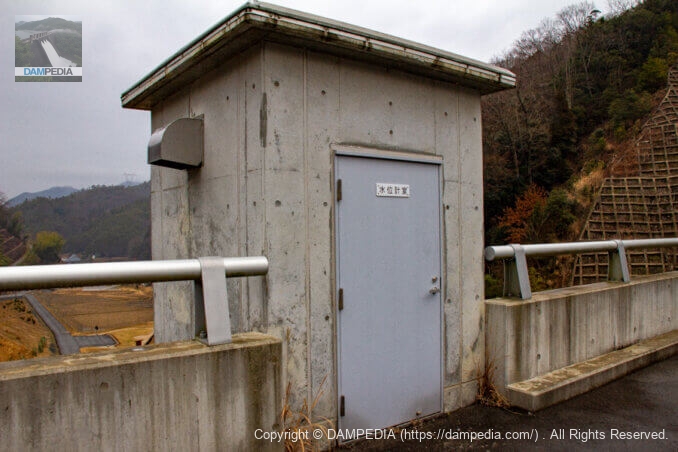
Water gauge chamber
The water level gauge chamber is located downstream of the top edge.
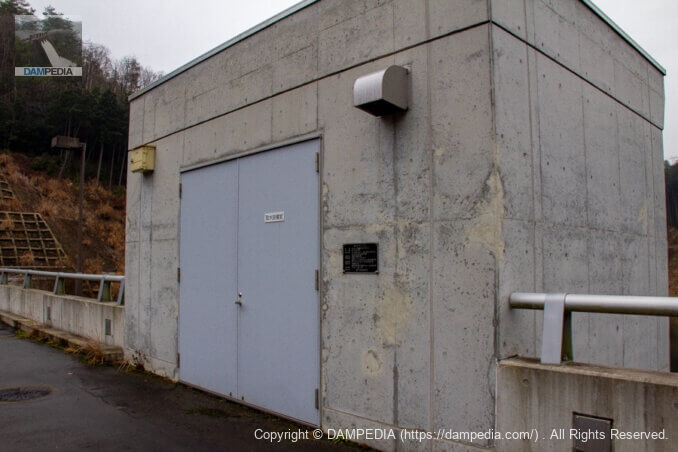
Water intake equipment room
The water intake equipment room is located upstream of the top end.
The specifications of the intake gate are as follows
| form (something takes) | Stainless steel slide gate |
| number of gates | 1 gate each (4 gates in total) |
| size of the mouthpiece | Φ0.200m (No.1) Φ0.350m (No.2 and 3) Φ0.600m (for lowering water storage level) |
| watertight system | Rear 4-way metal watertight |
| crossing gate | Manual gear rack type (No.1) Electric spindle type (No.2, 3, for lowering water level) |
| Opening and closing speed | Approx. 0.3m/min (No.2, 3, for lowering water level) |
| Operation method | Manual operation (No.1) Machine side and distant operation, automatic operation (No.2, 3, for water level lowering) |
| Completion date | March 2009 |
| Manufacturing Company | Marushima Aqua System Co. |
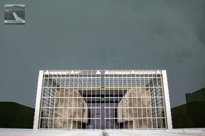
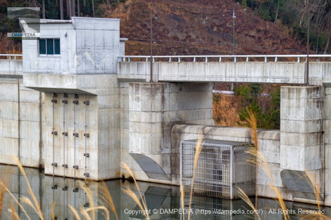
View of orifice mouth from top edge
The orifice is surrounded by a screen that keeps driftwood and other debris from flowing through. Come to think of it, there are dams like Mikumari Dam that have screens on the orifice and others that do not. I wonder what the difference is between the two dams and whether they are installed or not.
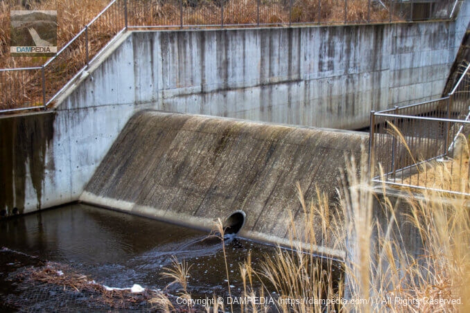
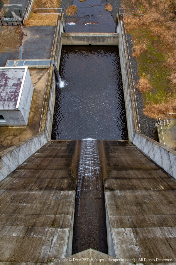
View of the flow guide and reduction works from the top edge
The force reducer is also quite simple.
View of the top edge from the right bank
Unfortunately, there are no viewing platforms on either side of the river.
Looking downstream from the right bank
The right bank side is also like a terrace and allows you to see the downstream face.
Looking upstream from the right bank
The right bank road can be followed on foot to see the upstream face of the embankment. The concrete surface on the upstream side was still pure white and clean.
Close-up of flood discharge and intake facilities
The water intake facility is on the left, and the crest and orifice are on the right.
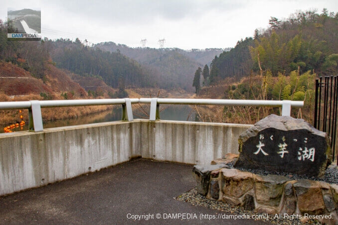
Stone monument on the left bank
We are back on the left bank. A stone monument indicating the name of the dam lake is placed on the left bank. It is called "Lake Okumokko," which means "big potato lake. The name was chosen through a public contest, and is said to come from the name of the children of the local Okumo Elementary School, who are called "Okumokko. Unfortunately, the elementary school was closed in March 2016, and in April 2020, the school building seems to have been reborn as "Overnight School Okumo-mura" as an accommodation facility for one group of 8 or more people only.
Looking upstream from the left bank
The water level is about EL.292.2m. It is flowing smoothly from the orifice, so it is no wonder.
Left bank dam site
There is a large parking lot and a small plaza on the left bank.
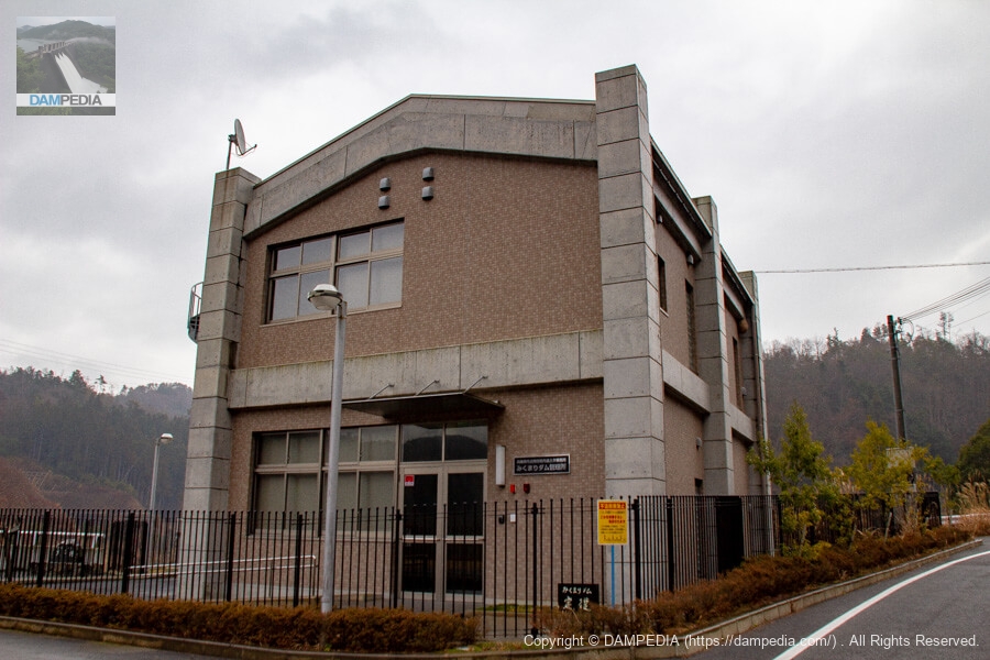
Mikumari Dam Management Station
The management office is naturally a new and magnificent building.
The embankment is a standard design of the so-called municipal type, and the dam and reservoir have an unusual name, but it was the Mikumari Dam, one of the newest additions to the list of dams protecting the city of Tamba Sasayama since 2009.
Mikumari Dam Specifications
| Location | Mikuma, Tambasasayama City, Hyogo Prefecture |
| River Name | Kakogawa River System MIKUMAGAMI River |
| Objective | F (flood control, agricultural disaster prevention) N (unspecified water, water for river maintenance) W(Water for water supply) |
| Model | G(gravity-fed concrete dam) |
| Bank height | 26m |
| Bank length | 86m |
| Dam volume | 18,000 m3 |
| Watershed Area | 1.7km2 |
| Reservoir area | 6 ha |
| Total storage capacity | 380,000 m3 |
| Effective water storage capacity | 340,000 m3 |
| Dam operator | Hyogo prefecture (Kinki area) (Hyougo) |
| Main body constructor | Kajima Corporation, Kabushiki Kensetsu, Araigumi |
| Year of launch | 1993 |
| Year Completed | 2009 |
| Name of Dam Lake | Lake Taimo |
Other facilities/observations
| Parking lot | ○ |
| Toilet | × |
| Park | × |
| PR Exhibition Hall | × |
| Fishing | ○? |
Comment