
Date of interview: Sunday, 04/20/2014
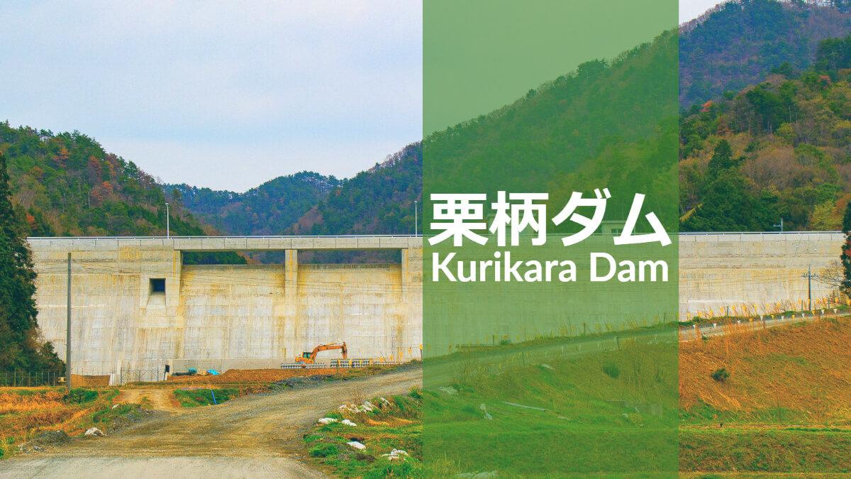
The Kurigara Dam was originally constructed under the name Nishiki Dam. It is a gravity-type concrete dam designed to control floods in the Kurigara area, provide water for the water supply, and maintain the normal functioning of running water.
The name Kurigara has nothing to do with the famous battle of Kutugara Pass during the Genpei War (Jisho and Juei wars), but seems to have been given to the area because of the nearby Kutugara Fudo Shrine.
Incidentally, the Kurigara area has a very interesting topography.
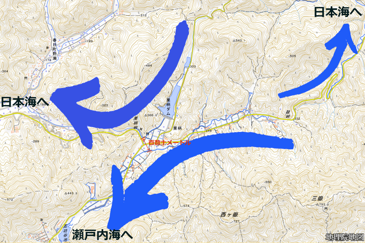
The eastern part of Kurigara Dam is located at the Kitsu Pass, which is a watershed where the northern part flows into the Sea of Japan as the Miyatate River, and the southern part becomes the Miyata River, which flows into the Seto Inland Sea via the Sasayama River and the Kako River.
The Sugigaya River, which flows through Kurigara Dam, is fed by Sugigaya Pond upstream, but turns its course suddenly to the west around Kannondo when it is about to flow south to join the Miyata River, descends the Kutsukura Fudo Falls, and joins the Takinoshiri River, Takeda River, and Yura River before flowing into the Sea of Japan.
This topography is said to have been formed about two years ago as a result of riverine competition, with the Sugigaya and Miyata Rivers approaching each other at a distance of more than a hundred meters on the flat land in the valley, but never merging, forming a central divide where the Sugigaya River flows into the Sea of Japan as the Yura River system and the Miyata River into the Inland Sea as the Kako River system. (Incidentally, some people mistakenly believe that the term "river warfare" refers to humans competing for water, but it is a natural geographical phenomenon.)
The Kurigara area is located within sight of these two rivers, and is unique in Japan in that it has two central watersheds in one area. Because the watershed is located in a valley, it is called the Kokuchu watershed, and signs have been erected in the district calling it the "Kurikara Yanaka watershed.
Incidentally, according to data from the Ministry of Land, Infrastructure, Transport and Tourism, the Sugigatani River is called the Orogatani River from its headwaters, and the Taki no Shiri River from the upstream end of the reservoir of the Kurigara Dam. Please understand this in advance.
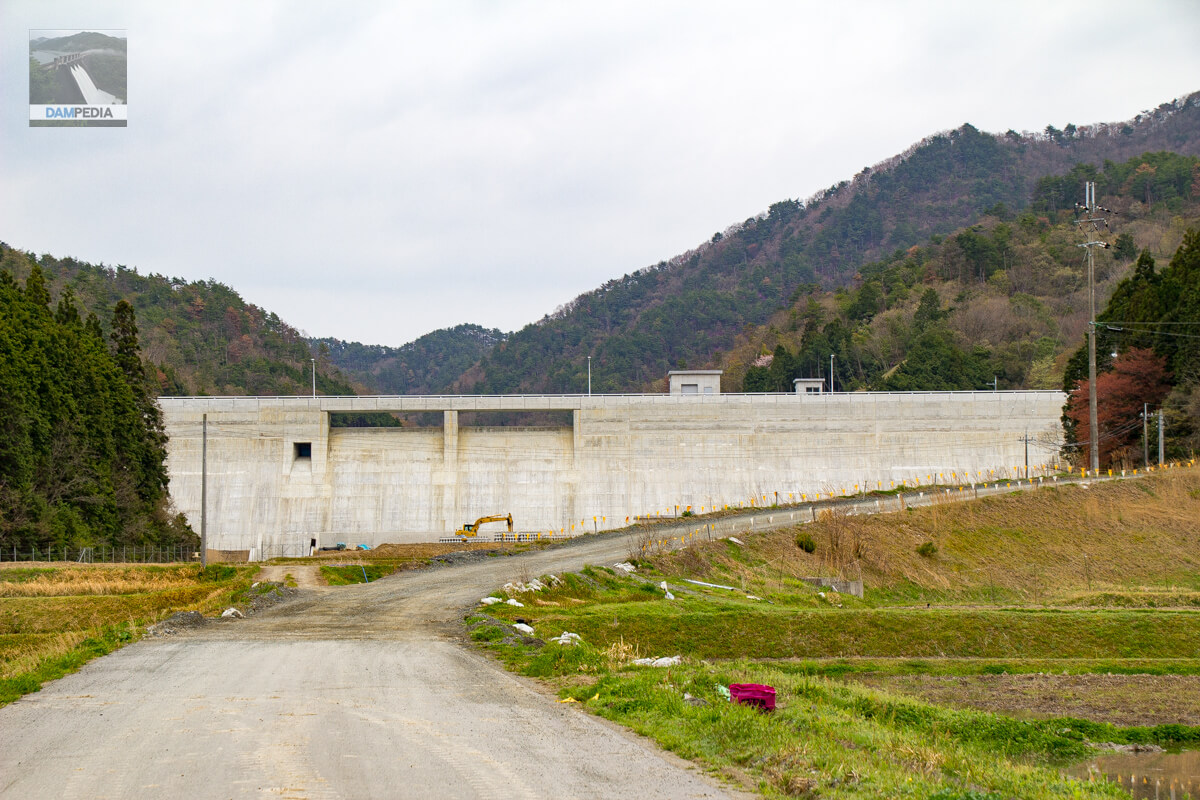
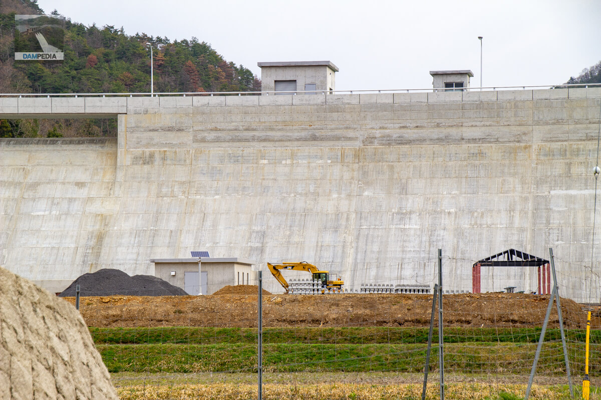
View of the downstream face of the dike
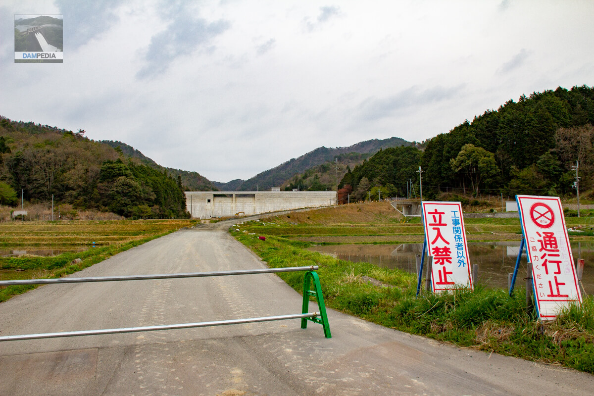
The Kurigara Dam, which is located in such a geographical area, was supposed to be under test flooding in 2014 when we visited, but unfortunately it was off-limits, probably because the surrounding maintenance was not yet completed. I have not been able to revisit the dam since then, but I will definitely do so.
View of the downstream face of the dike from the single pipe fence
With my fingers in my mouth, I look at the downstream face of the levee from the single-tube fence.

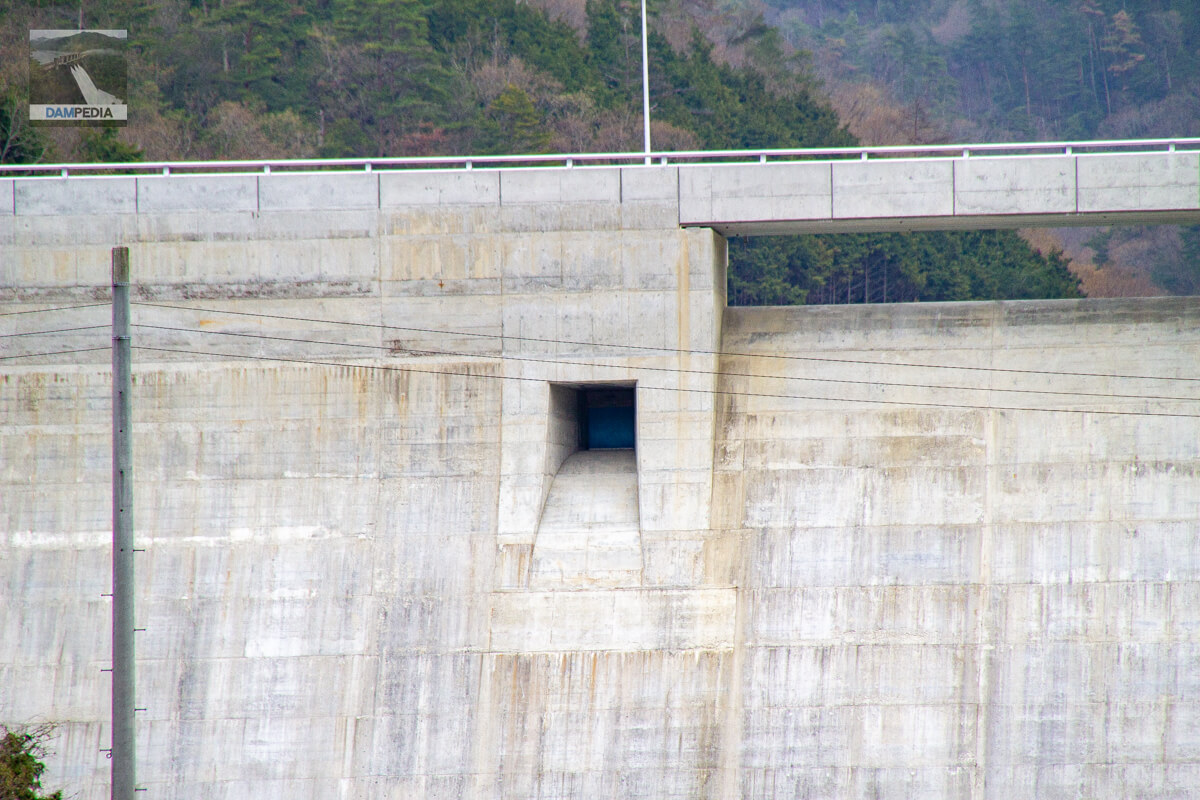
Zoom in to see the downstream face of the dike
There are two free-flow overflow orifices at the crest gate and one free-flow orifice on the left bank, but it is unusual that they are attached to the left bank side instead of the center. The downstream side of the gate looks very neat and clean without any flow-conducting walls.
orifice gate
A temporary gate can be seen attached to the orifice due to the test waterlogging.
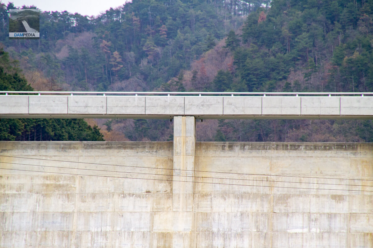
crest gate
Unfortunately, the test discharge was over some time ago and I missed it, but what kind of overflow was seen?
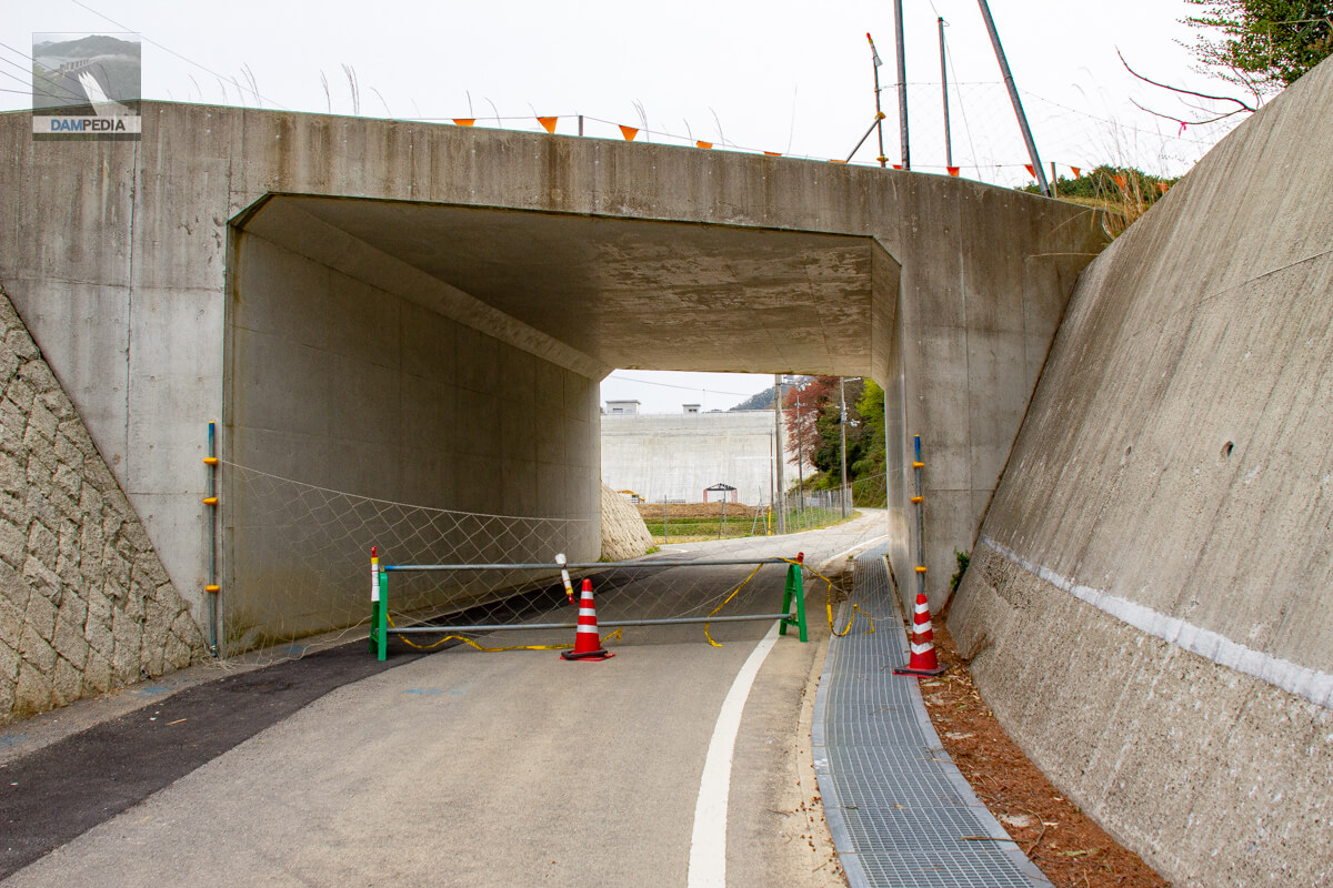
Passing under Prefectural Road 509
Up to the photo above, we are looking from County Road 509, the replacement road, and have moved to the road leading to the downstream face of the levee. Was this the old road?
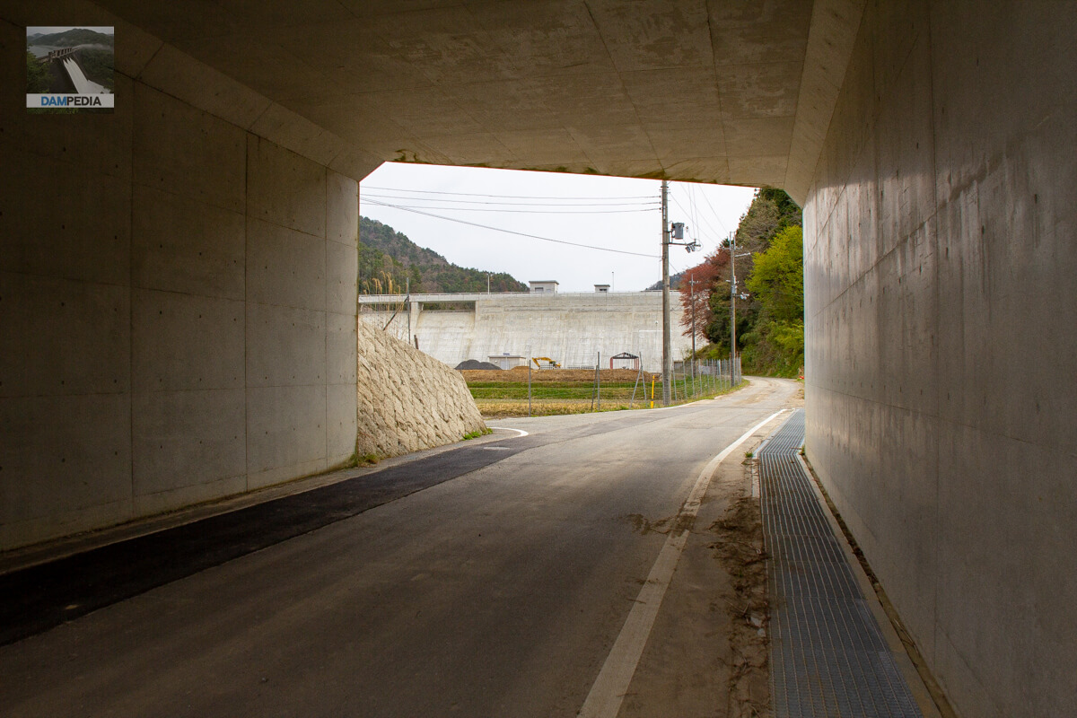
Looking downstream of the embankment through the box culvert
I can't help but wonder if they are concerned about safety, but it is sad that we can't get close to them even though they are right under our noses.
Further telephoto view of the downstream face of the dike
It looks as if the dike is built almost perpendicular without much angle to the ground, but it may just look that way because of the low height of the dike. I still need to revisit the site soon. Also, it seems that the downstream plaza was under construction at that time. You can also see a pavilion without a roof.
Almost only a description of the diversion boundary, but I would like to add more information and photos to this page when I revisit. In any case, it was the Kurigara Dam, a new addition as a member protecting the city of Tamba Sasayama since 2015.
Kurigara Dam Specifications
| Location | Kurigara, Tambasasayama City, Hyogo Prefecture |
| River Name | Yura River System Taki no Shiri River |
| Objective | F (flood control, agricultural disaster prevention) N (unspecified water, water for river maintenance) W(Water for water supply) |
| Model | G(gravity-fed concrete dam) |
| Bank height | 26.7m |
| Bank length | 172m |
| Dam volume | 38,000 m3 |
| Watershed Area | 1.1 km2 |
| Reservoir area | 4 ha |
| Total storage capacity | 383,000 m3 |
| Effective water storage capacity | 356,000 m3 |
| Dam operator | Hyogo prefecture (Kinki area) (Hyougo) |
| Main body constructor | Maeda Corporation, Weda Construction Co. |
| Year of launch | 1994 |
| Year Completed | 2015 |
| Name of Dam Lake |
Other facilities/observations
| Parking lot | ○ |
| Toilet | × |
| Park | ○ |
| PR Exhibition Hall | × |
| Fishing | ○? |
Map around Kurigara Dam
Weather around Kurigara Dam
Accommodations that may be close to Kurigara Dam

Comment