
Date of the interview: 12/30 (Sun.) - 31 (Sat.), 2012
The year 2012 was a miraculous year in which three dams (Tatsumi Dam, Otsuro Dam, and Otaki Dam) conducted test water releases in conjunction with test flooding, but there was one more dam that was added at the end of the year. This is the Hata River Dam.
Day 1
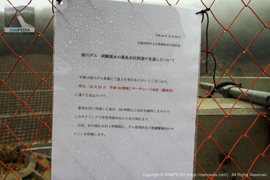
Prospects for Achieving Maximum Water Level for Test Flooding
I left the year-end cleaning to my wife (yerba mate) and came to the Hatakawa Dam. But it seems I was flying.
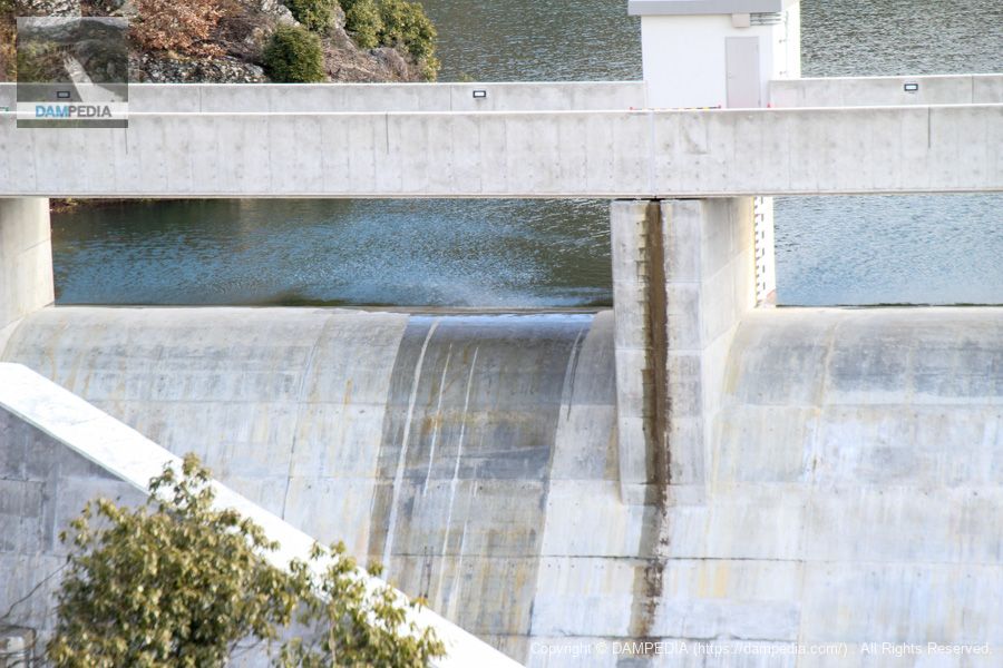
View of the levee downstream from the left bank
At any rate, since we have come all this way, we will take a tour of the surrounding area. The thick wall of the dike toe is visible in front of us.

View of the levee downstream from the left bank
We moved a little further downstream.
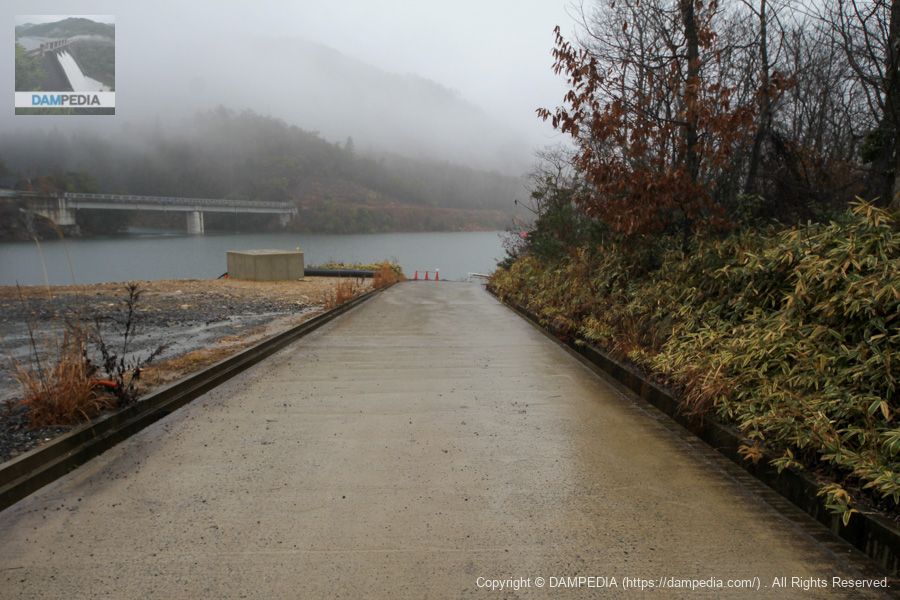
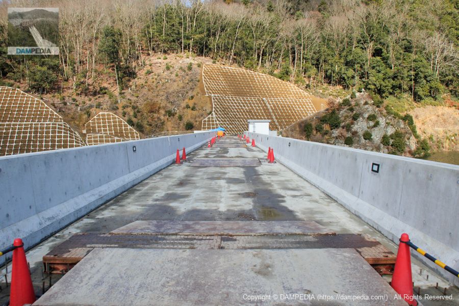
View of the top edge from the left bank
The top edge was off limits to visitors because paving of the top edge road and other incidental work was still in progress.

View of the upstream bank from the left bank
It is raining quite hard. You can clearly see that we are only a few inches away from discharge.
Hatakawa Dam Management Station
The wooden latticework on the windows and other parts of the building give the management center a slightly Kyoto-like atmosphere.

Ramps for boats?
Since there is nothing that looks like an incline, I assume that boats are placed on the trestle to come and go on this ramp, but this has not been confirmed.
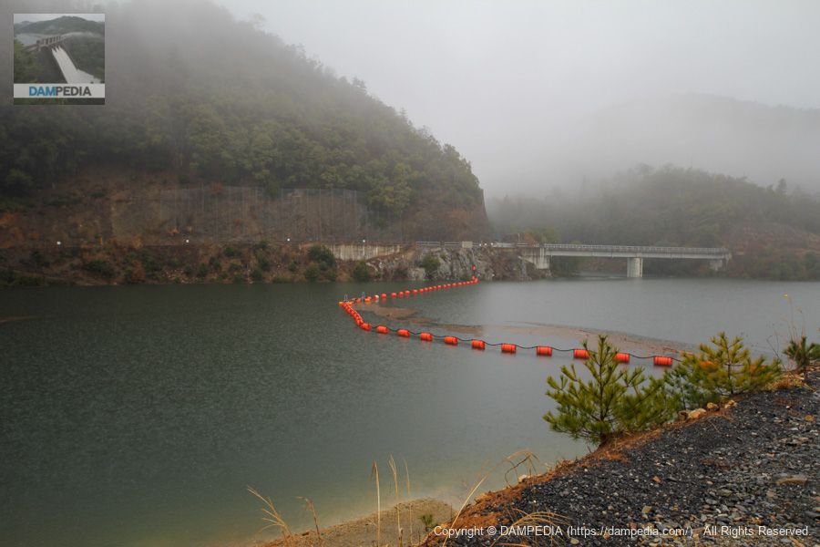
View of the dam lake from the left bank
It is smoky from the rain, but the floating orange of the brand-new netting station stands out.
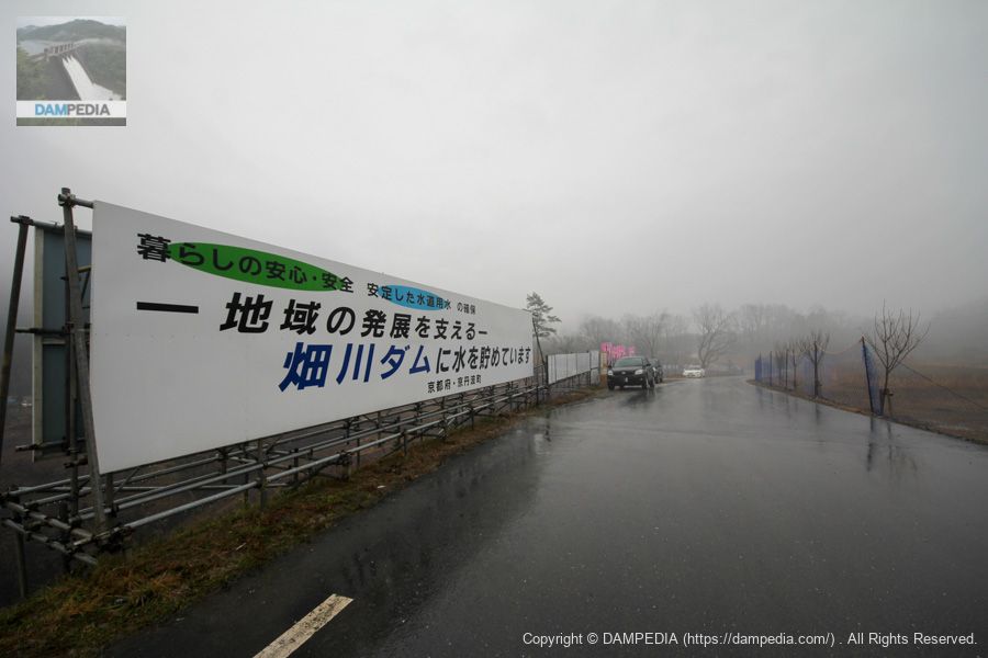
Sign visible from Route 27
The sign was also found in Google Street View taken in May 2018, so it may still be there as I write this article.
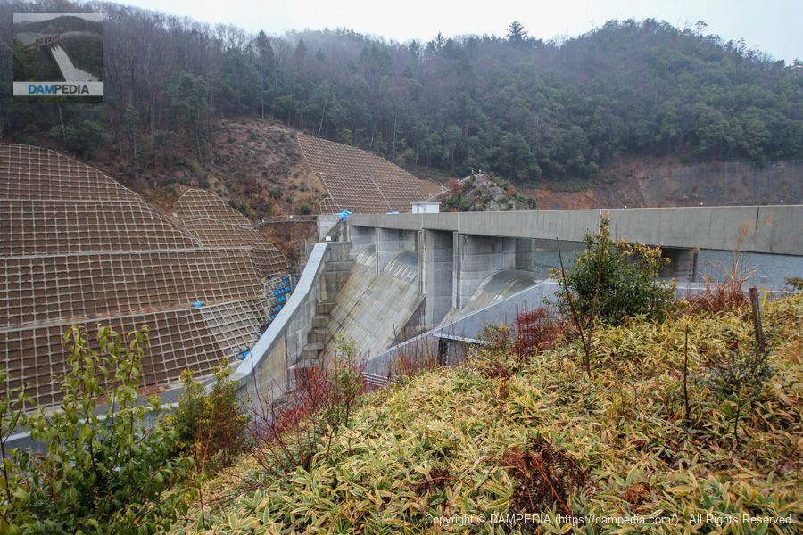
View of the levee downstream from the Route 27 bridge
The national highway is a bit nerve-wracking because there are no sidewalks and many cars speed downhill, but I managed to get a shot.
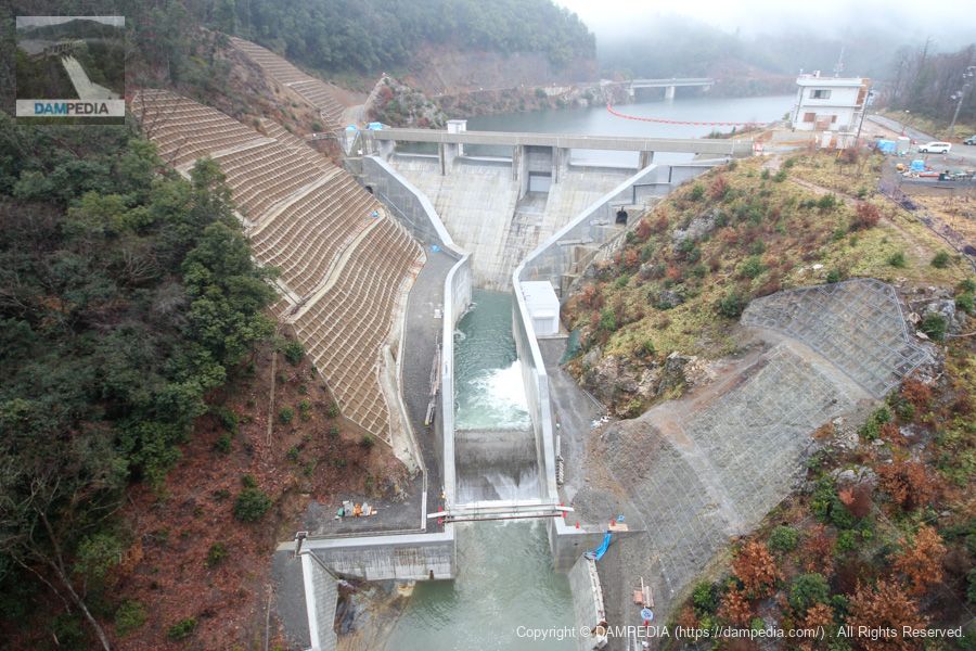
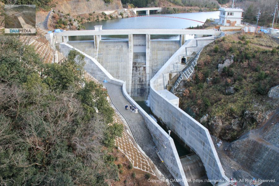
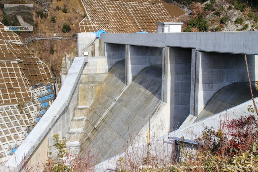
View of the downstream area from the bridge on Route 27
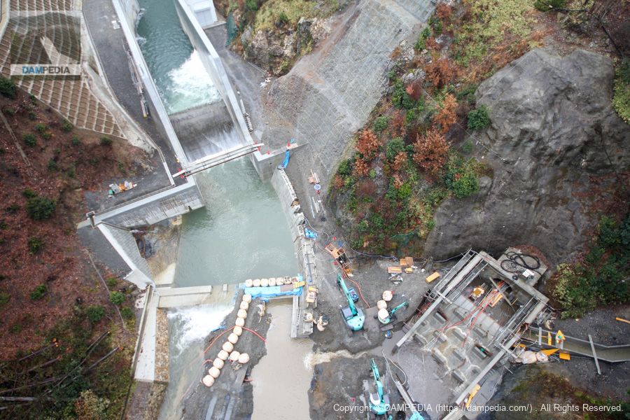
Looking directly downstream from the bridge, you can see the downstream still under construction. The structure on the lower right is not a diversion structure, but the Hata River side dam (saddle damThis is the exit of the tunnel channel used to channel water flowing from the stream to the east of the stream (see Figure 1). The outlet of the diversion works seems to be located just upstream of it, but it appears to have already been filled in at this time. The area covered by the tiger fence may be it.
Temporary drainage tunnel penetration stone
Although it was the end of the year, a business hotel in front of Ayabe Station was available and I was able to stay there with a same-day reservation, so I decided to pull out for the day. Before leaving the hotel, I found a stone that had been pierced in front of the management office, so I took it home.
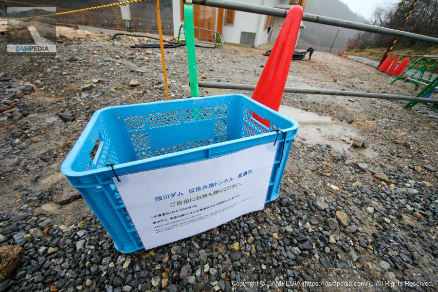
The basket was marked as follows.
This penetration stone was collected near the penetration point of the temporary drainage tunnel of the Hata River Dam.
The penetrating stone is used as a talisman for safe delivery and academic success.
The term "safe delivery" is derived from the Kojiki (Records of Ancient Matters), which tells of a stone that Empress Jingu obtained during her expedition to the Korean Peninsula (Silla) and placed by her bedside during childbirth, which resulted in a safe delivery.
By the way, the business hotel where we stayed in Ayabe is here. There are famous dams nearby, such as the Yuragawa Dam, Wachi Dam, and Ono Dam, so I think this hotel is a good base for visiting dams. I remember the hotel as being clean and neat.
2nd day
We stayed overnight in Ayabe and came back to visit the Yurakawa Dam, Wachi Dam, and Ohno Dam.
View of the levee downstream from the Route 27 bridge
According to the time recorded in the EXIF, it was 9:46 a.m. A video of the discharge is available at the end of the page if you would like to see it.
Overflow on the left bank side
Little by little, it overflows little by little.

View of the levee downstream from the Route 27 bridge
10:13. The right bank side also begins to overflow.
Overflow on the right bank side
The overflow area is slowly expanding here as well.
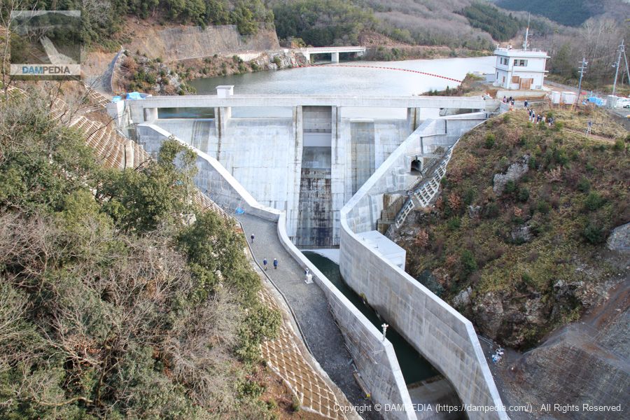
View of the levee downstream from the Route 27 bridge
At 10:55, the entire surface finally overflows.
Overflow conditions
It is not a spectacular event because it is a slow and gradual overflow, but even so, it is a rare and precious moment. Moreover, it is a rare chance to see a free overflow through a crest gate.
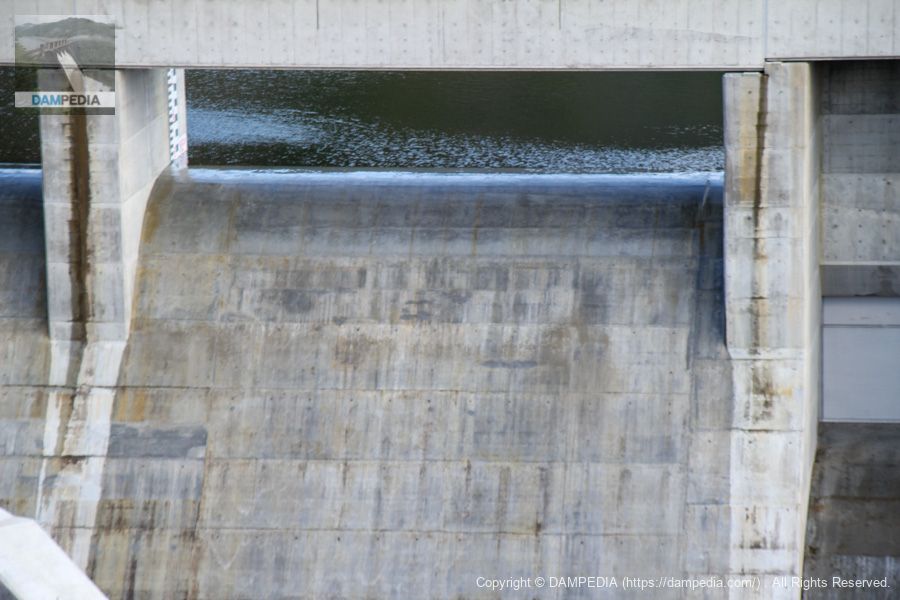
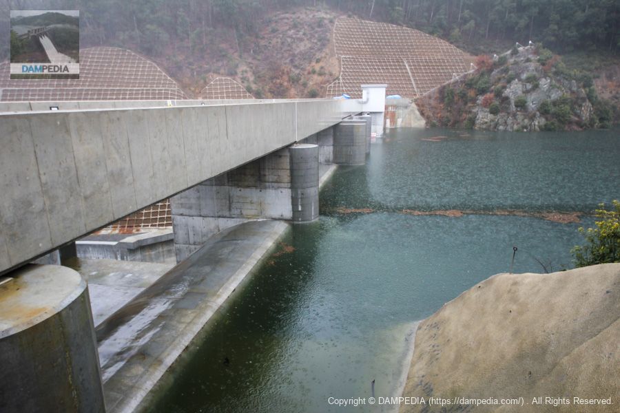
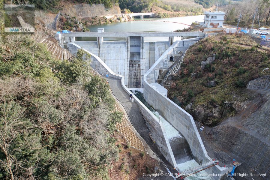
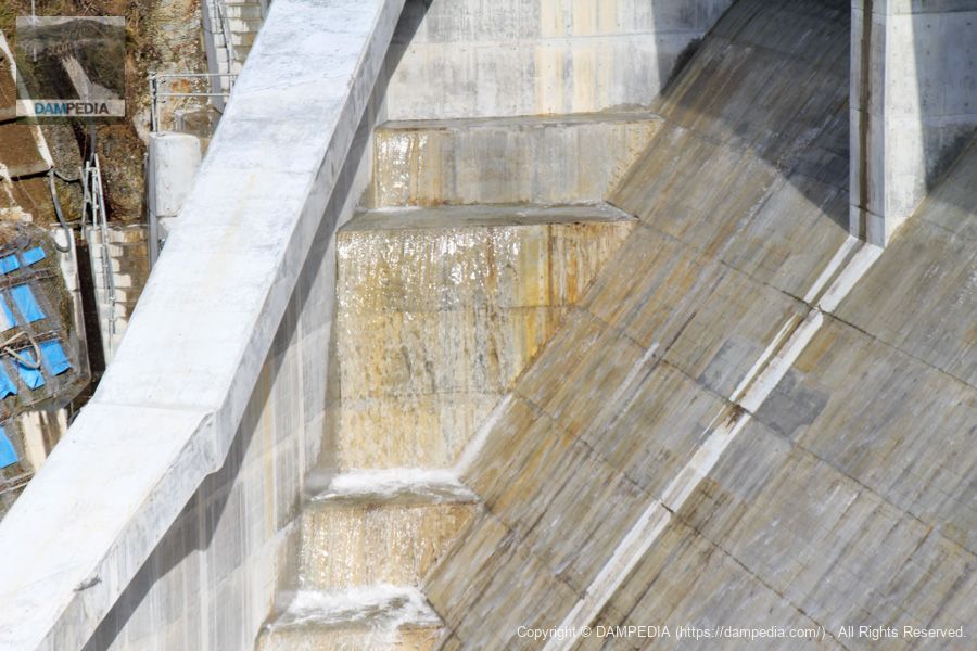
View of the conduit from the bridge on Route 27
It is flowing smoothly, but the water flowing through the footing between the main body and the levee toe guide wall seems to be a little more vigorous.
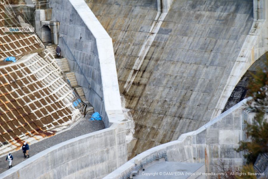
View of the top edge from the left bank
We have come to the dike. The top edge is still off-limits on this day.
View of the upstream bank from the left bank
Water flowing from the dam lake. It rained quite a bit the day before, but we were glad it cleared up.

View of the levee downstream from the left bank
Perhaps because not much time has passed since the flow began, it is still flowing smoothly.
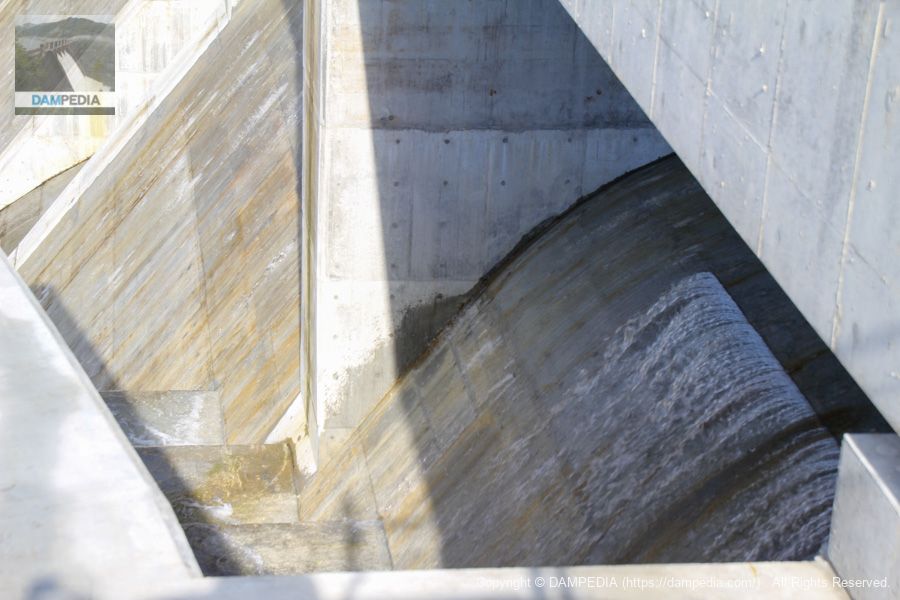
Water flowing through footings on the right bank
The water flowing through the conduit does not seem to be that vigorous, but when it is staircase-shaped, it appears to be flowing in a jabbering stream.
View of the crest from the left bank
Some of the crests had water splashing in some areas due to burrs in the concrete.
After that, we had lunch at "Tanba no Sato Yamagataya" and headed home. I wanted to continue the tour in the afternoon, but I felt sorry to my wife that I stayed too long since I was allowed to stay one night at the end of the year.
The Hatagawa Dam will play a role in reducing flood damage to the downstream Hatagawa and Takaya Rivers and supplying water to Kyotamba Town in the future, and I was very happy to witness the test discharge.
Hata River Dam Specifications
| Location | Shimoyama, Kyotanba-cho, Funai-gun, Kyoto |
| River Name | Yura River system Hata River |
| Objective | F (flood control, agricultural disaster prevention) N (unspecified water, water for river maintenance) W(Water for water supply) |
| Model | G(gravity-fed concrete dam) |
| Bank height | 34m |
| Bank length | 87.8m |
| Dam volume | 29,000m3 |
| Watershed Area | 21.2 km2 |
| Reservoir area | 20 ha |
| Total storage capacity | 1,960,000m3 |
| Effective water storage capacity | 1,530,000m3 |
| Dam operator | Kyoto (metropolitan area) |
| Main body constructor | Fujita Corporation, Kosei Corporation, Terao Corporation |
| Year of launch | 1992 |
| Year Completed | 2012 |
| Name of Dam Lake | Shimoyama Four Seasons Lake |
Other facilities/observations
| Parking lot | ○ |
| Toilet | ○? |
| Park | × |
| PR Exhibition Hall | × |
| Fishing | ○○ (excluding prohibited areas) |
Comment