
Date of interview: Saturday, 1/4/2014
Next to Mawari-ike Pond, we visited Nishigaya Dam. From Mawari-ike, it is easy to reach via National Route 477, but on the day we visited, the national highway was closed due to a typhoon the previous year, so we had no choice but to take a long detour via Prefectural Route 50.
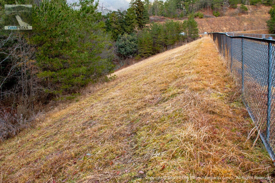
View of the top edge from the right bank
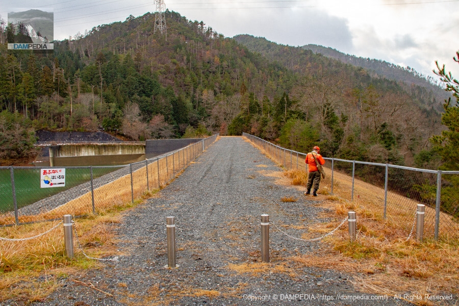
When I arrived, I thought the atmosphere was strange... but there was a hunting club member with a hunting rifle at the edge of the sky. I heard the sound of gunshots in the distance, but I did not dare to ask whether it was for vermin extermination or hunting because I thought it might be an intrusion.
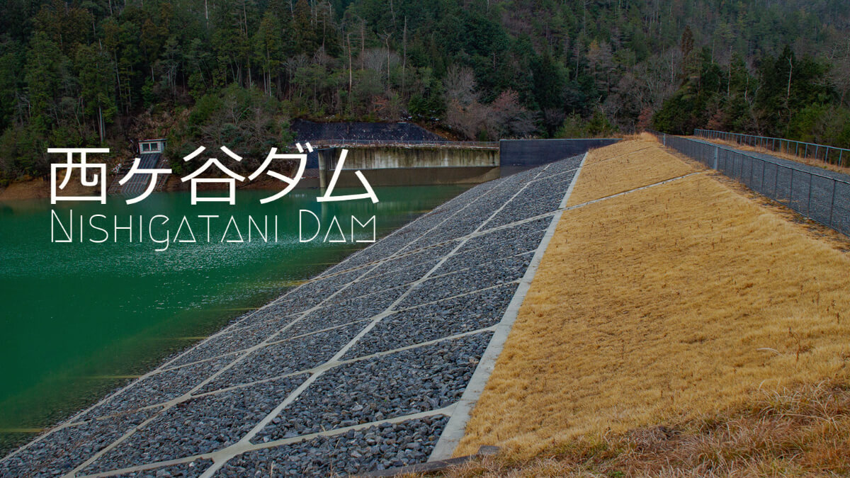
The Nishigaya Dam was originally an earth dam called Nishigaya-ike in the dam handbook, but was renamed Nishigaya Dam in 1996 after a large-scale renovation project. However, in the Kyoto Prefecture Reservoir Database, it is still called Nishigaya Pond. In 2021, it was designated as a specific agricultural reservoir and a priority agricultural reservoir for disaster prevention.
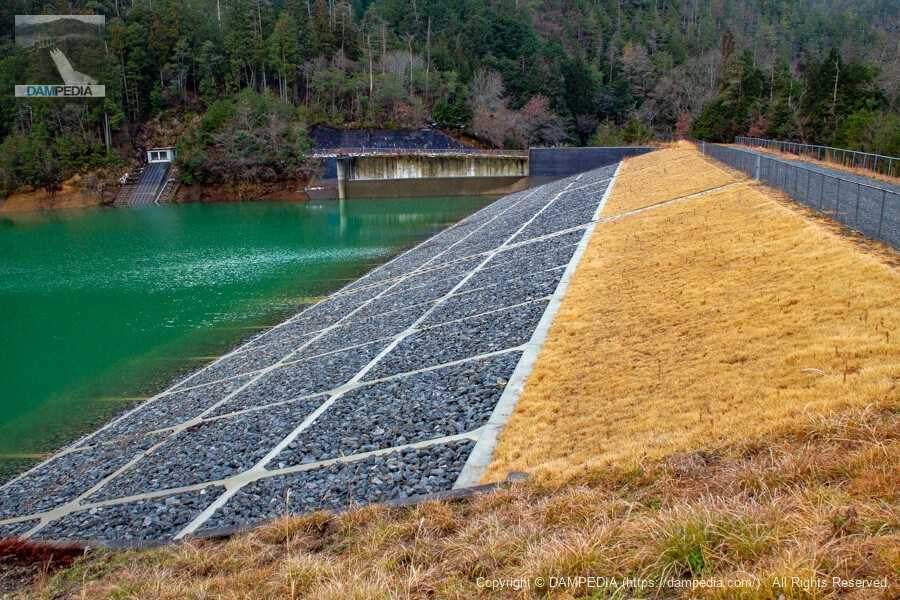
Looking upstream from the right bank
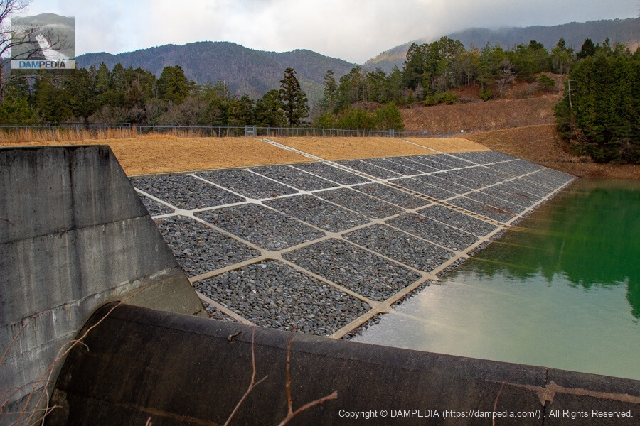
At the time of our visit, it had been nearly 20 years since the dam was repaired, and it appears that the slope on the reservoir side had been repaired once more during the past 20 years. The slightly older photos in dam handbooks and other publications show the reservoir side slope protection work as block lining, but at the time of our visit, as shown in the photo below, it was concrete framing and filling work.
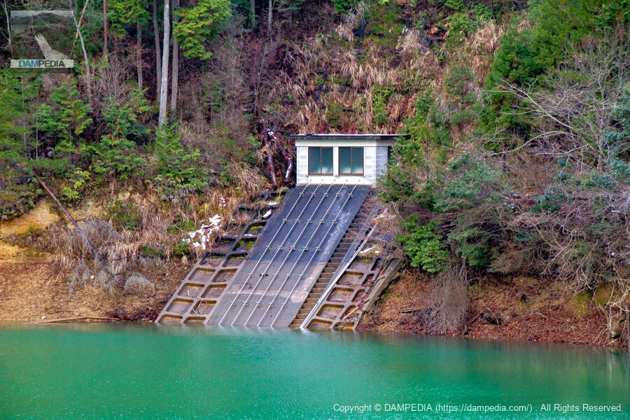
Water intake facilities on the left bank
There is a slant-flume intake facility on the left bank. The dam is located in Kyoto Prefecture, but the irrigation water is supplied to the Yagi district of Nantan City.
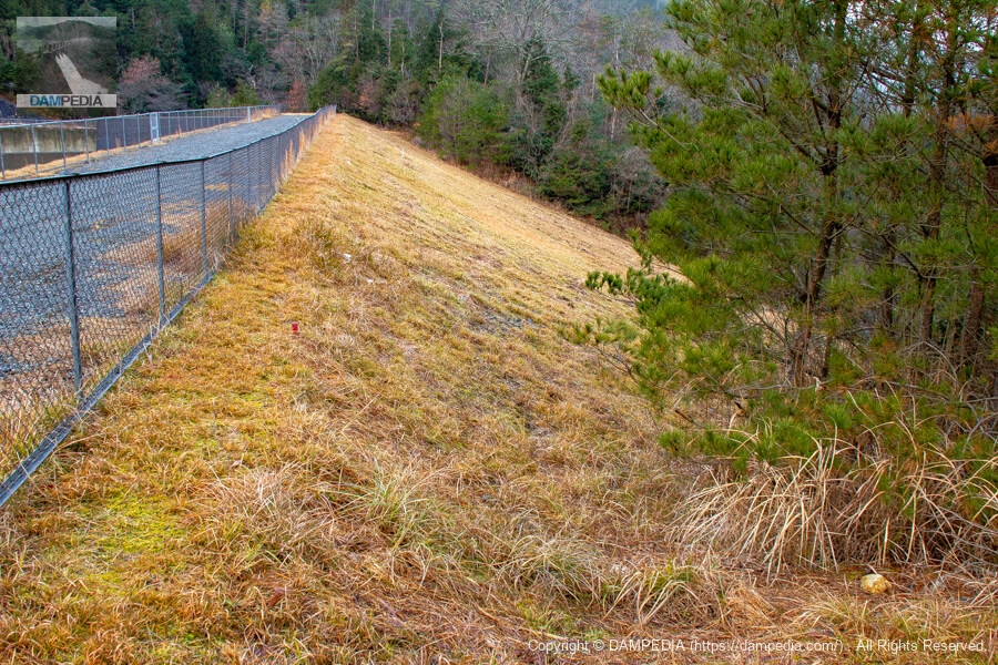
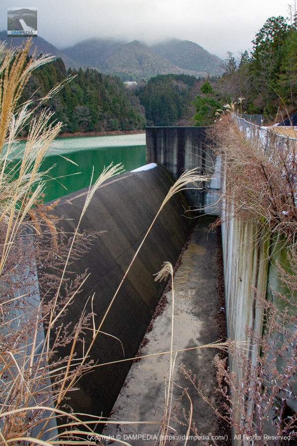
Downstream view of the embankment from the right bank
The grass is neatly mowed.
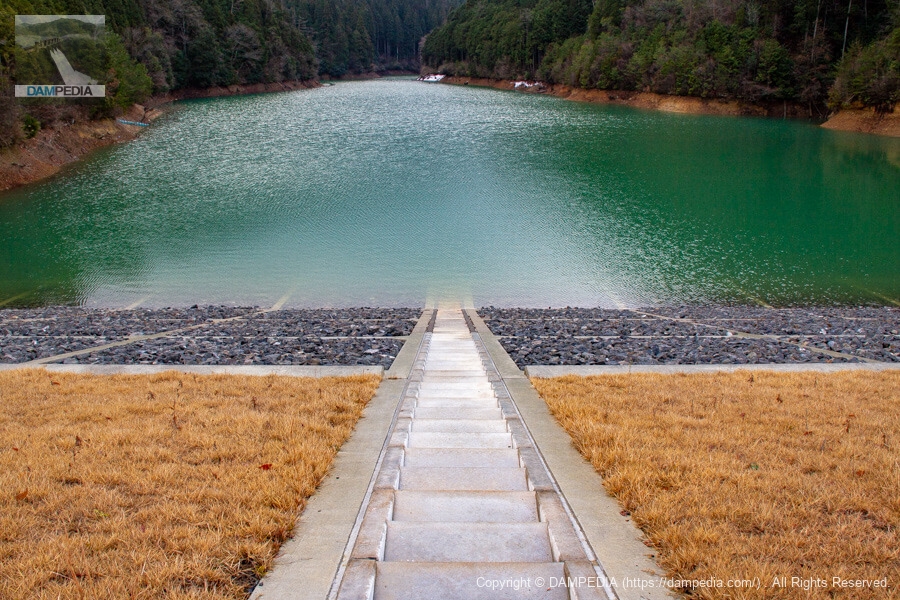
View of the upstream stairway of the embankment from the top edge
Unusually, a stairway has been installed on the upstream face of the earth dam. Entry is prohibited, but is this in case of accidents or construction work?
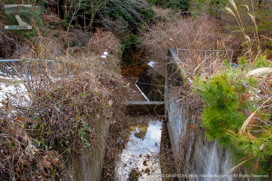
Residual water outlet
The spillway is located on the left bank. It is a side channel type, which is common in earth dams.
Looking downstream from the left bank
A member of the hunting party climbed over the fence and descended the slope of the levee. It appears that he joined the other members downstream.
View of downstream residual water discharge
The conduit does not follow the slope of the embankment, but flows toward a little distance away from it. I am a little concerned about what happens next.
Looking upstream from the left bank
It is a beautiful upstream surface.
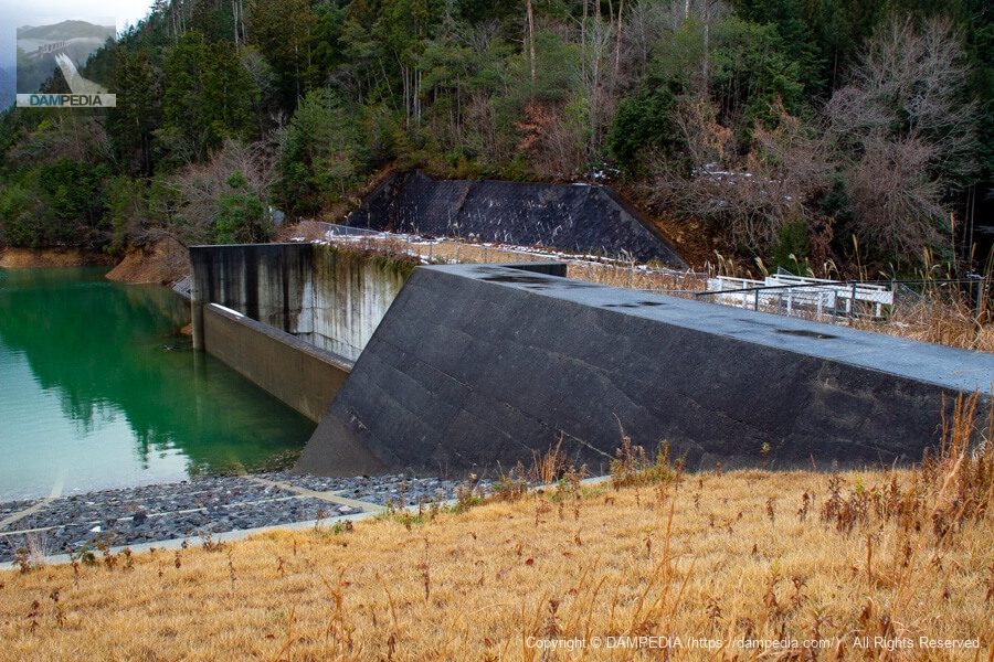
spillway
It is a thick and stout flood discharge. The water level was low on this day because it was midwinter, but I wonder what it will look like when it overflows.
Although there is little information and a lot of mystery, the Nishigaya Dam has been renovated and cared for several times.
Nishigaya Dam Specifications
| Location | 10 Saga Koshihata Momohara, Ukyo-ku, Kyoto City, Kyoto (reservoir database) |
| River Name | Yodo River System Minamata River |
| Objective | A (irrigation water) |
| Model | E(earth dam) |
| Bank height | 24.8m (dam handbook) 26.6 m (reservoir database) |
| Bank length | 97.1m |
| Dam volume | 100,000 m3 |
| Watershed Area | 2km2 |
| Reservoir area | 3 ha |
| Total storage capacity | 250,000 m3 (dam handbook) 255,000 m3 (reservoir database) |
| Effective water storage capacity | 210,000 m3 |
| Dam operator | Minamata Land Improvement District (Yagi Town in the dam handbook) |
| Main body constructor | Kosei Construction |
| Year of launch | 1993 |
| Year Completed | 1996 |
| Name of Dam Lake | - |
Other facilities/observations
There is no dedicated parking lot, but there is a space for parking at the right bank dam site. However, it would be better to refrain from climbing on the wooden cover of the gutter.
| Parking lot | △ |
| Toilet | × |
| Park | × |
| PR Exhibition Hall | × |
| Fishing | × |

Comment