
Date of interview: Sunday, March 24, 2013
The Ichinoki Dam was the first dam we visited before our mission to pick up our dam enthusiast helmets that had been completed at the Nanashiki Dam.
Signboards in Gojo City and Nishiyoshino Village
Nishiyoshino Village" is a former village that was incorporated into Gojo City in 2005. Both signs are facing the same direction, but it seems that the other side of the bridge was Gojo City and the front was Nishiyoshino Village. I also thought that boundary lines were drawn along rivers and roads, but the boundary lines in this neighborhood are kind of...unclear.
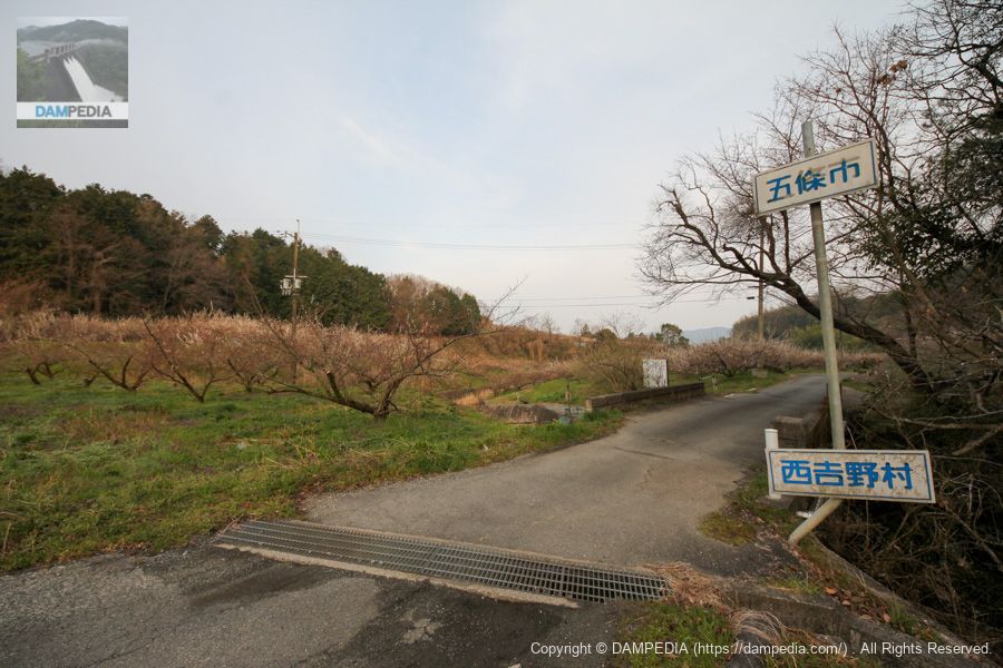
It is also a mystery why the sign for Nishiyoshino Village was still in place at this time when it became Gojo City; a Google Street View taken in October 2019 shows that the sign had been reoriented but was still attached.
Incidentally, the boundary of the former Yoshino Village may be compared with the current map by looking at the following page in the "Geoshape Repository - Geometric Data Sharing Site".
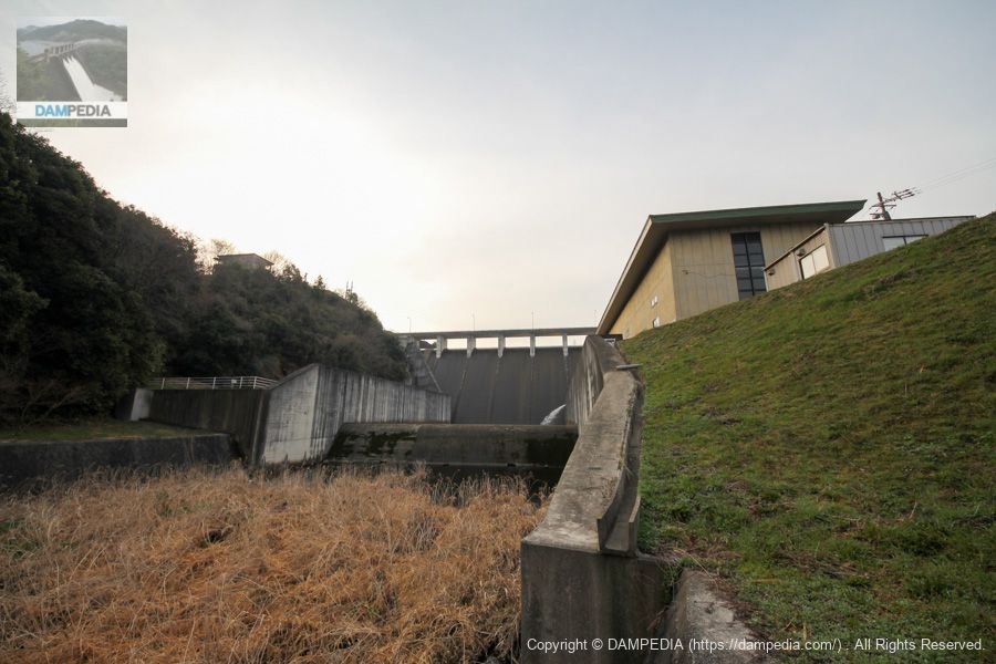
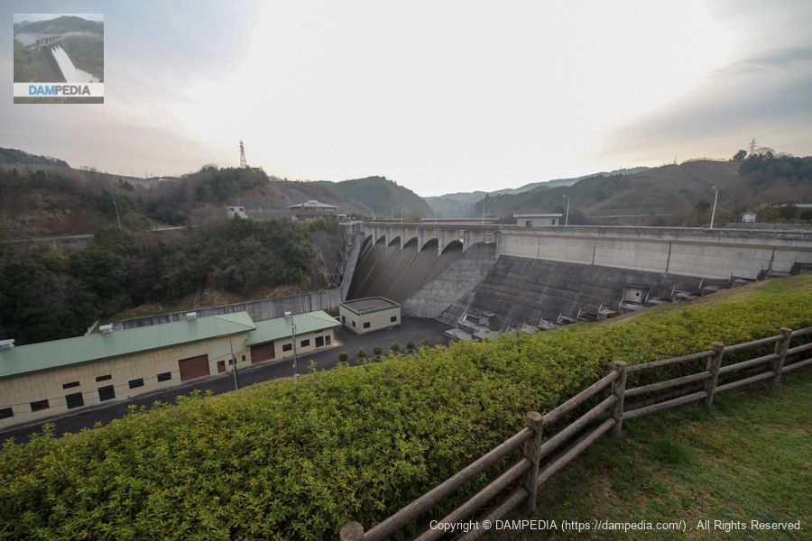
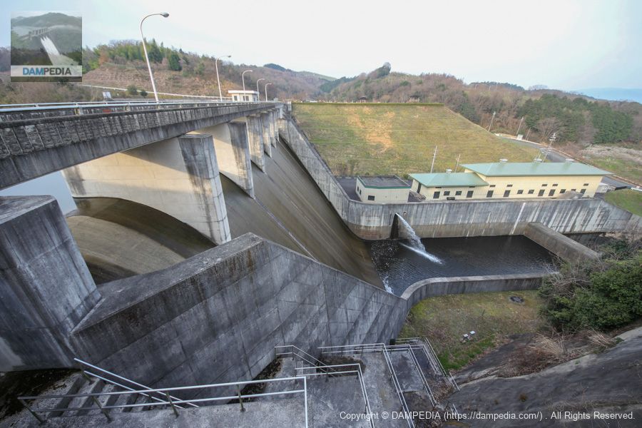
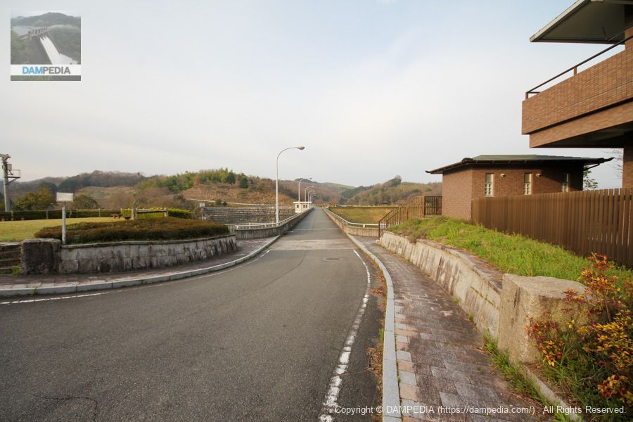
Downstream view of the levee from the left bank
Looking back at the boundary, the embankment of Ichinoki Dam can be seen. It was a little dark because it was just after 7:00 in the morning. It is a little regrettable that the scale of the reduction works is so large that there is a building on the left bank, making it difficult to see the full extent of the embankment.
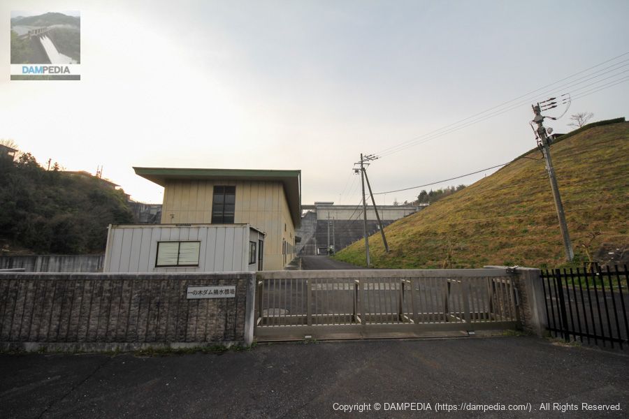
Ichinoki Dam pumping station
Pumping station to supply the beneficiary land. It appears to be quite large.
Downstream view of the levee from the left bank observation platform
We have come up to the top level. There is a viewing platform like a pavilion, from which you can see the levee from a slightly higher position.
View of the left bank observatory
The left bank is a park and quite well maintained.

View of the upstream face of the embankment from the left bank
It was almost full of water, and since it was around late March, it was probably storing a lot of water that it would need in the future. (This is supposed to be the non-irrigation season...)
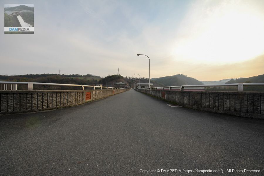
View of the top edge from the left bank
The top edge is open to vehicular traffic.
water intake facility
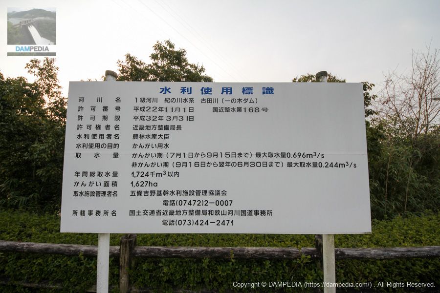
It is said that up to 1,724,000 m3 of water is withdrawn per year, with a maximum of 0.696 m3/s during the irrigation season (July 1 to September 15) and 0.244 m3/s during the non-irrigation season (September 16 to the following June 30).
Incidentally, the area around Ichinoki Dam is a major persimmon production area, so the irrigation season is shifted back a few months from the irrigation season in rice-producing areas. The water is for persimmons, so it is called "water for persimmons.
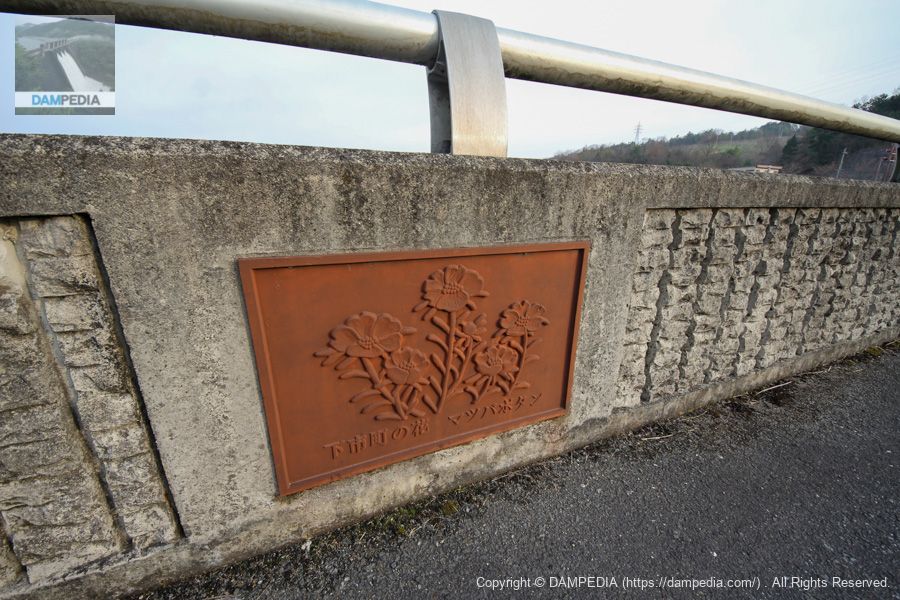
Flower of Shimoichi Town Matsuba-botan
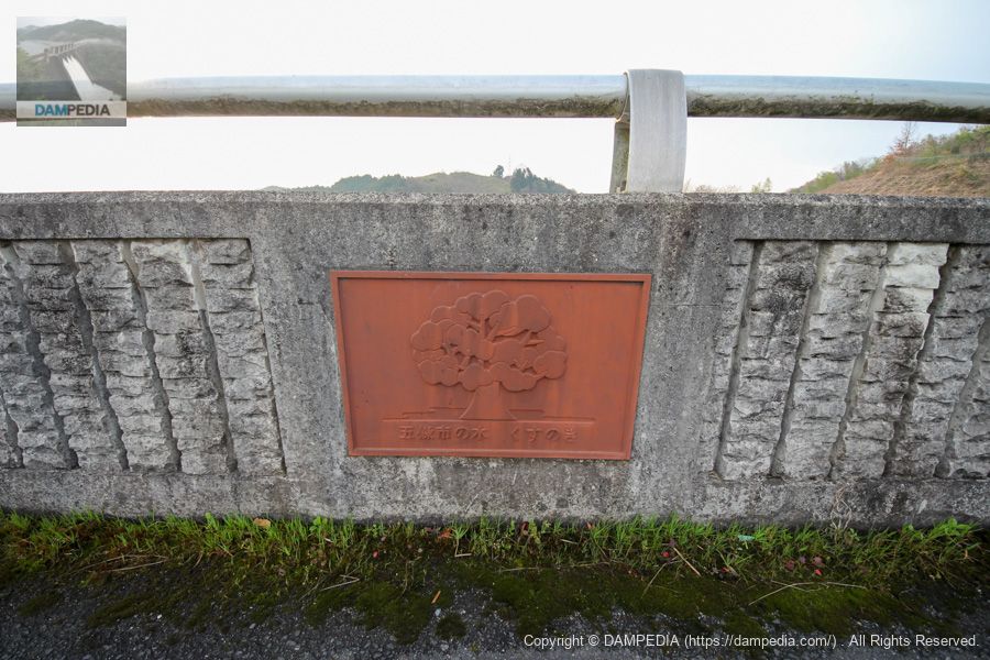
The top rail is decorated with reliefs of flowers and trees from Yoshino and surrounding municipalities.
Gojo City Tree Kusunoki
This is a tree in Gojo City.
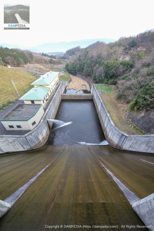
View downstream from the top
The remains of the overflow can be seen. It may have been overflowing until the previous day.
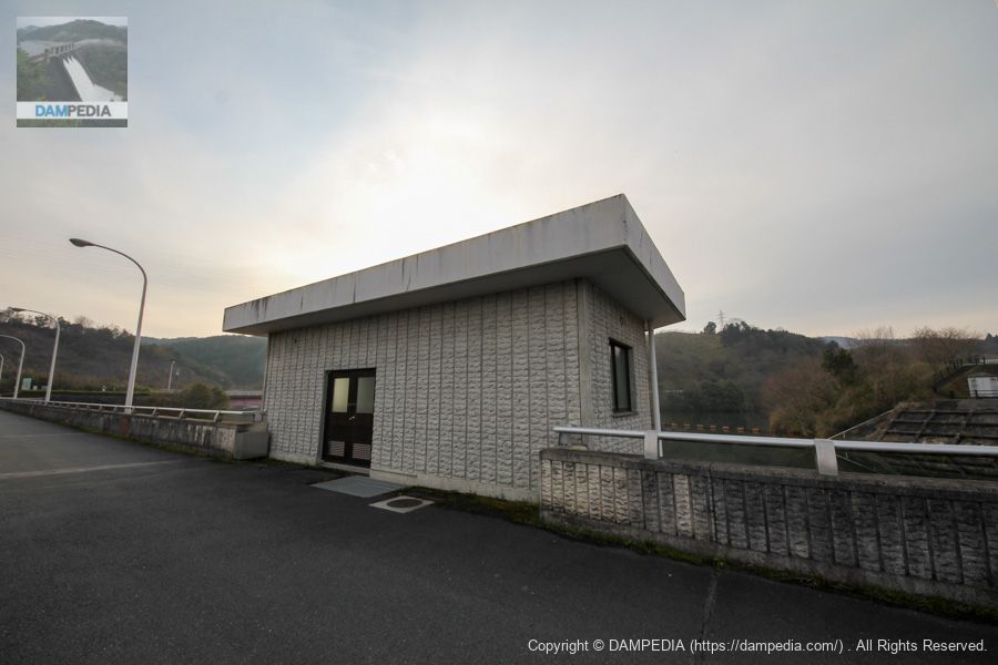
Management office and right bank footing entrance
The control center is also large in scale. Incidentally, the small building in front of the control center is a restroom. The footings are off-limits.

Downstream view of the levee from the right bank
Crestgate is a mainstream free overflow type.
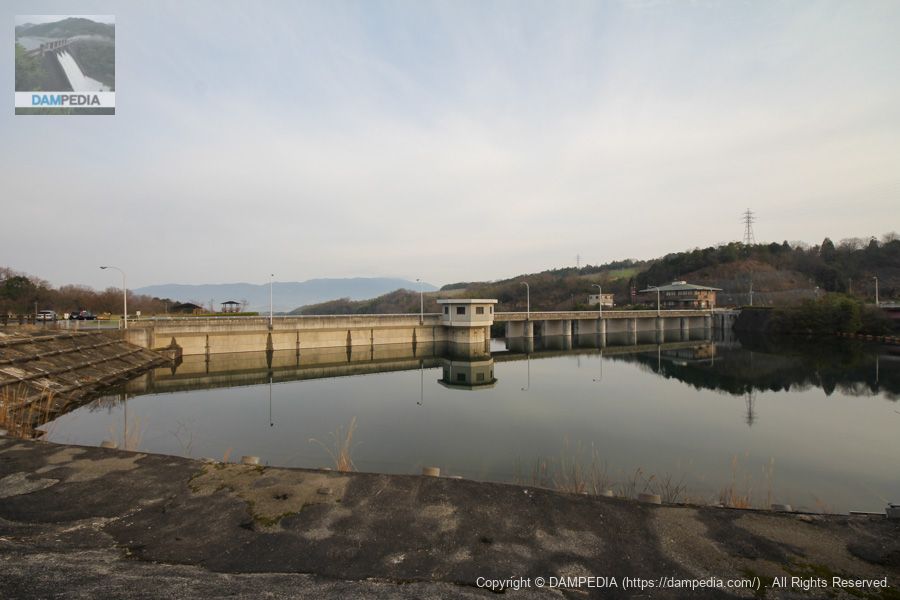
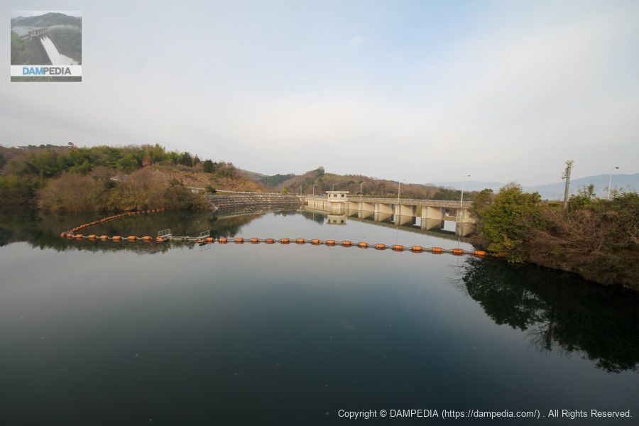
View of the dam lake from the bridge over the dam lake on the right bank (Deai Bridge)
A bridge divides the center of the dammed lake.

View of the upstream side of the embankment from the bridge over the dam lake (Deai Bridge)
It is nice that there are places where you can see the levee rather well except downstream.
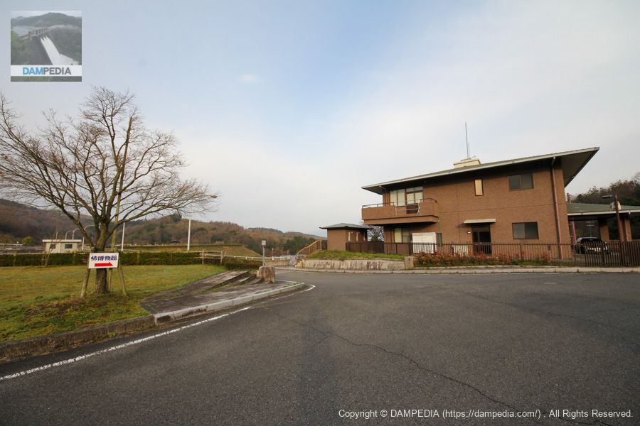
Right bank dam site
There is a signboard that reads "Persimmon Museum. The "Kaki Museum" is a dome-shaped building in the shape of a persimmon. I should have taken a picture of the exterior, but I did not.
Water Use Signs
This is a water use sign of a design not often seen.
View of the top edge from the right bank
The design of the embankment is a municipal-type gravity concrete dam, but the Ichinoki Dam was an enjoyable one with a good number of viewing points.
Ichinoki Dam Specifications
| Location | Nishiyoshino Town, Gojo City, Nara Prefecture |
| River Name | Kino River system Furuta River |
| Objective | A (irrigation water) |
| Model | G(gravity-fed concrete dam) |
| Bank height | 38.4m |
| Bank length | 150m |
| Dam volume | 65,000m3 |
| Watershed Area | 6.9 km2 |
| Reservoir area | 14 ha |
| Total storage capacity | 1,570,000m3 |
| Effective water storage capacity | 1,400,000m3 |
| Dam operator | Kinki Agricultural Administration Bureau |
| Main body constructor | Okumura-gumi, Mori-gumi |
| Year of launch | 1974 |
| Year Completed | 1995 |
| Name of Dam Lake | - |
Other facilities/observations
| Parking lot | ○ |
| Toilet | ○ |
| Park | ○ |
| PR Exhibition Hall | × |
| Fishing | × |
Comment