
Date of interview: Saturday, February 04, 2012
Location: Shikanoen-cho, Nara City, Nara Prefecture
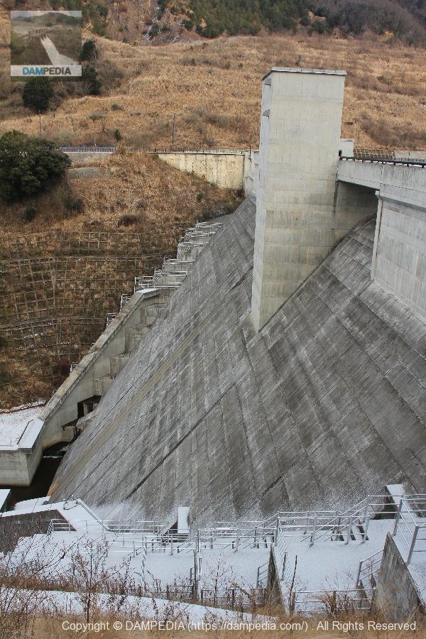
The Iwai River Dam, located near the entrance to the Koenzan Driveway, is a gravity-type concrete dam operated by the Nara Prefectural Government. Its role is to regulate flooding and maintain the normal function of flowing water.
I stopped by on my way to a meeting to talk with dam friends. In fact, I had passed by the adjacent prefectural road during construction, but because I didn't have my antennas up at the time, I didn't know they were building a dam, so I just passed by.
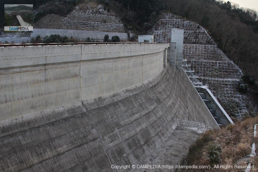
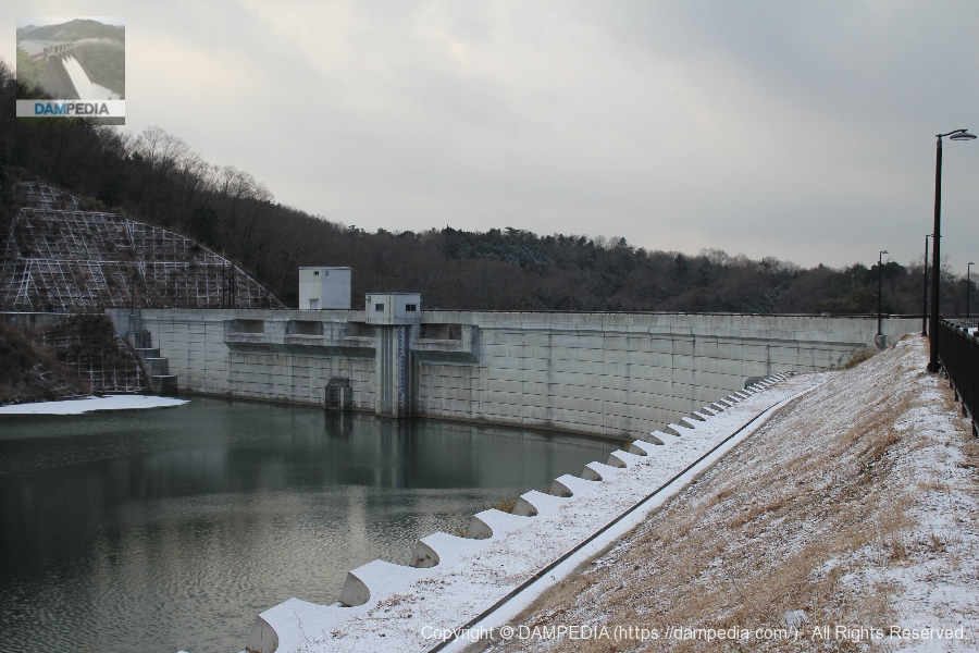
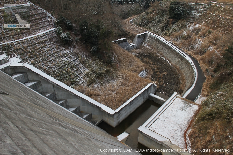
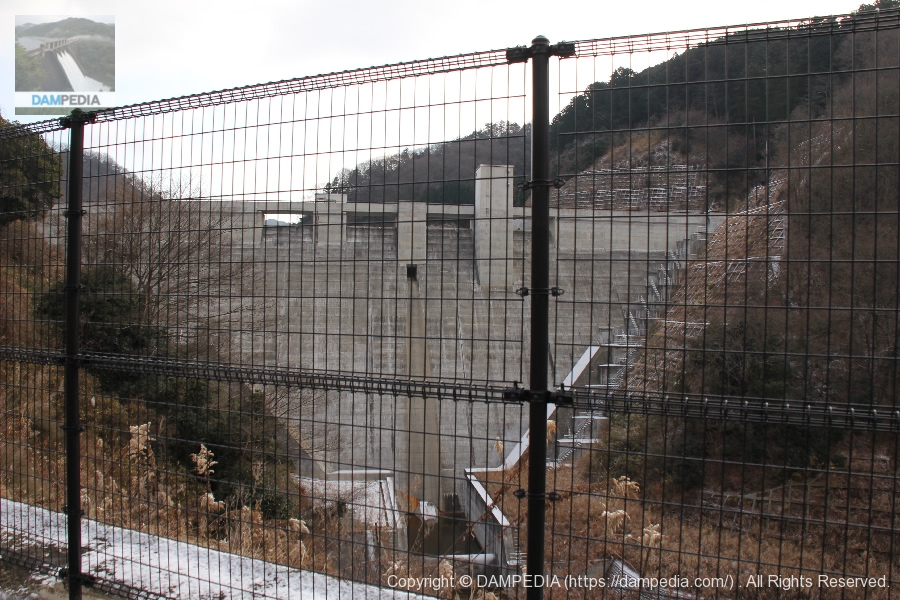
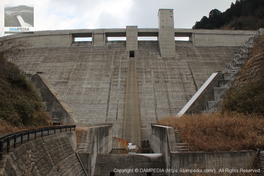
View of the levee downstream from the right bank
It was 8:30 in the winter, so it was a bit dim and backlit. Even so, the embankment looks a little strange at first glance. What is this discomfort?

View of the levee downstream from the right bank
The reason for this discomfort was the large curve of the embankment on the right bank. It is a mystery why it was not made straight, but was it a problem of bedrock or geology?
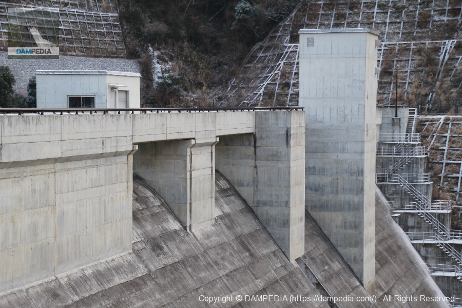
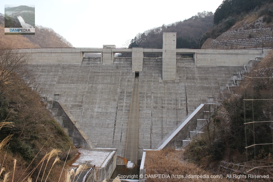
Free overflow crest gate
As is typical of a prefectural dam, it is a free overflow crest gate.
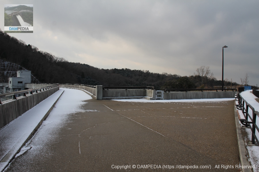
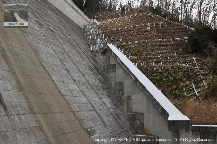
View of the top edge from the right bank
The top edge is accessible only on foot. There was a light dusting of snow on this day.
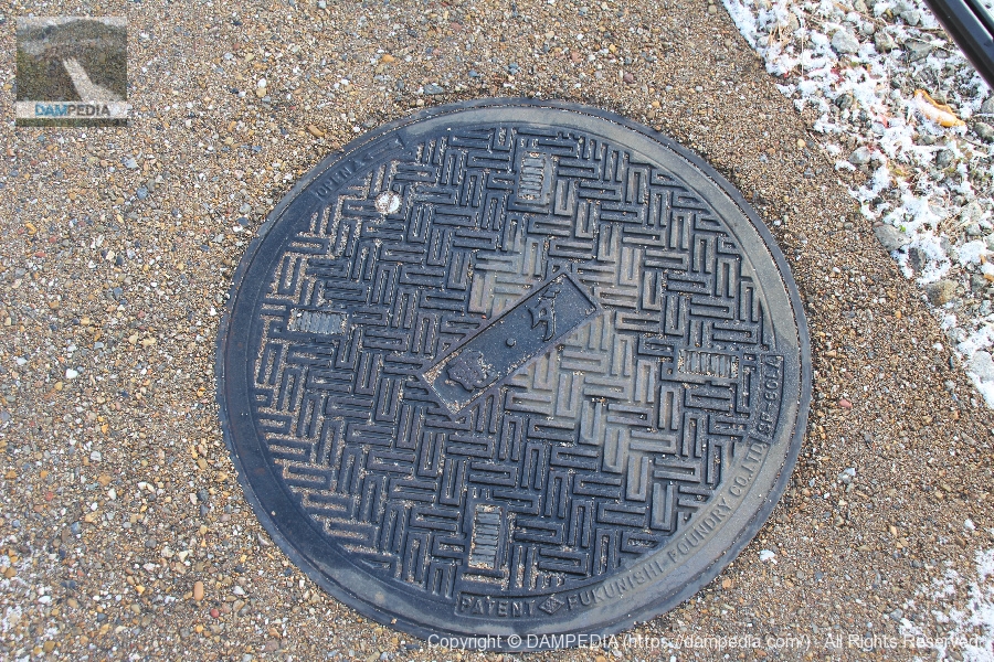
manhole cover
I'm sure "Den" stands for "electricity," but what does "da" stand for? Is it "dam"?
Iwai River Dam Management Center
It is a magnificent management office, but it seems that dam cards are distributed not here but at the Tenri Dam Management Section, Engineering Division, Nara Civil Engineering Office in Tenri City.

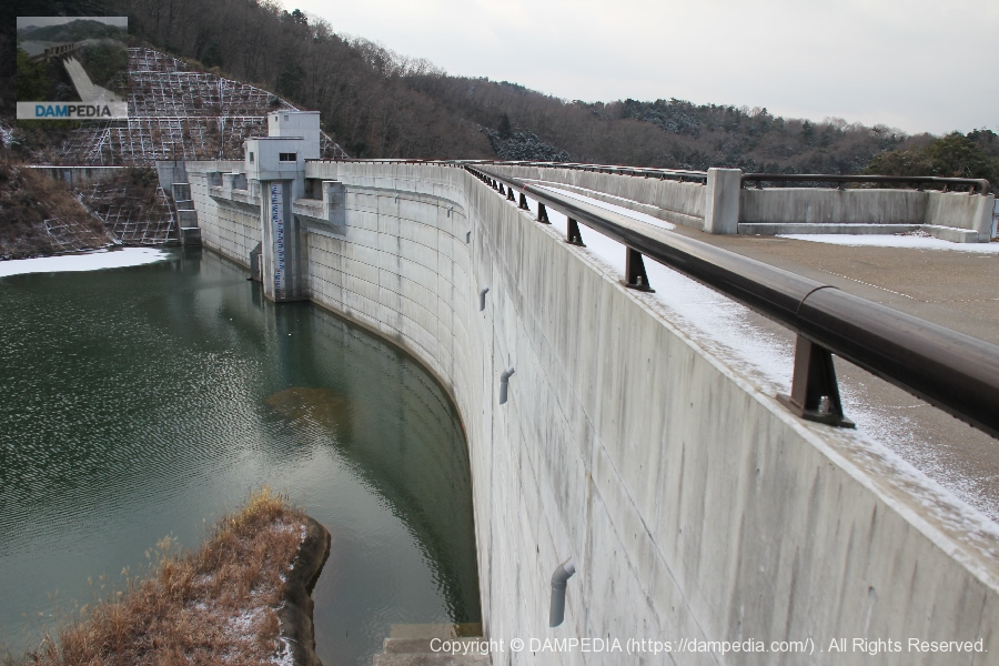
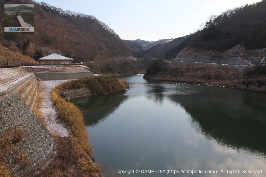
View of the embankment on the lake side from the right bank
I am more concerned about the structure on the slope in front than the dike. I wonder why it is shaped like this.
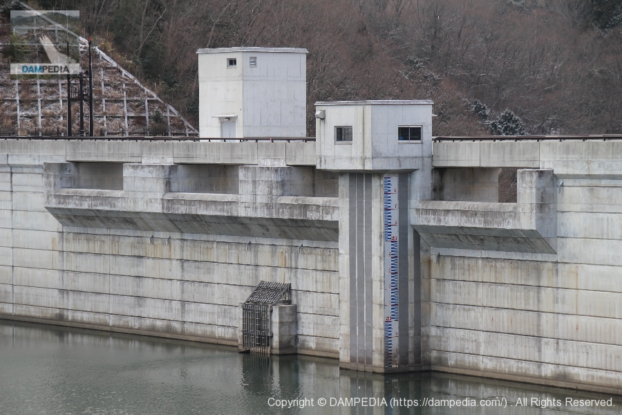
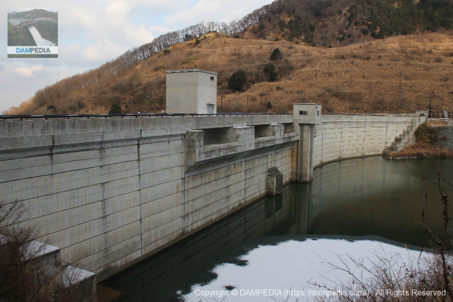
View of the gate on the dam lake side from the right bank
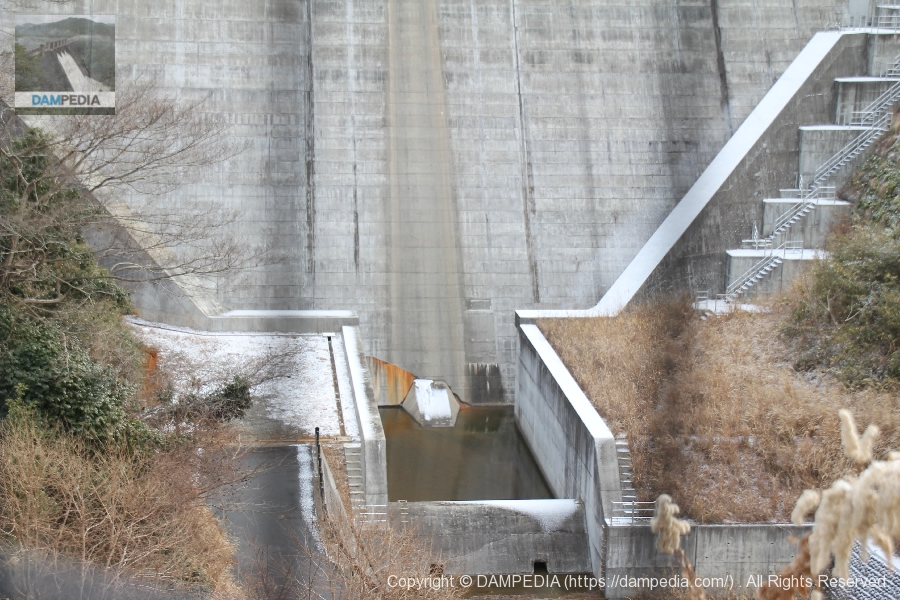
The water level at this time was 246 m E.L. There are four free overflow crest gates, a selective intake tower with a water level board on the right side, and a permanent flood discharge in the middle. The permanent flood discharge is also of the free overflow type.
Free overflow permanent flood discharge
The area is fenced to prevent driftwood and other debris from being washed away.

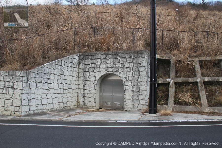
Right bank rim tunnel
The entrance to the tunnel seen on the way to the top edge. This will be the tunnel when the rim grouting is installed.
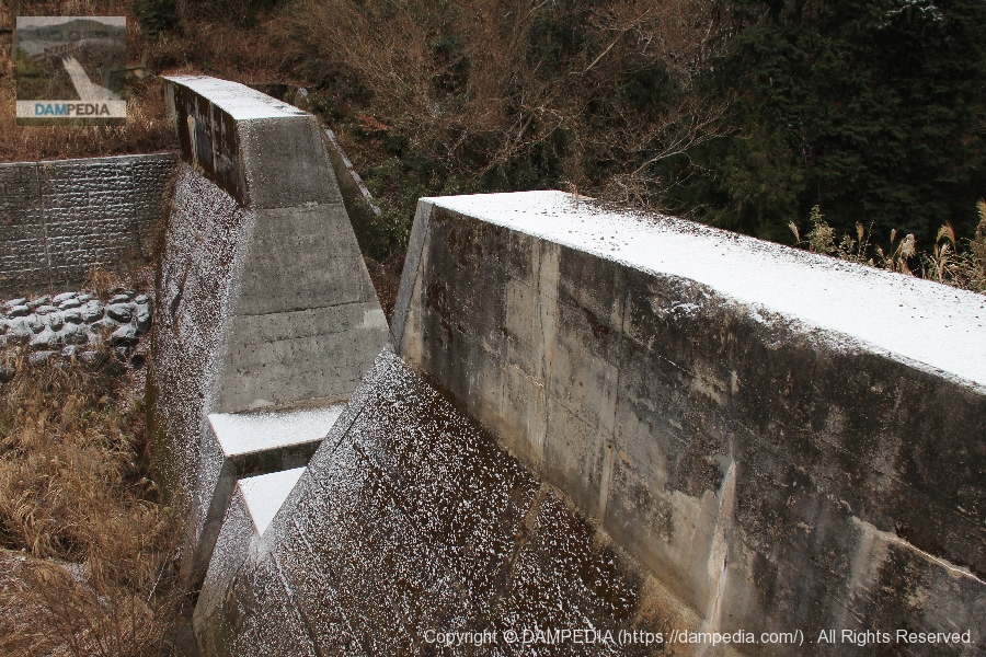
View of the embankment on the lake side from the right bank
You can see how the dike is bent.
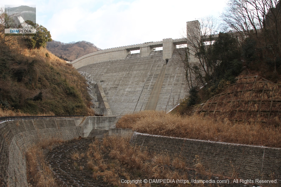
View downstream from the top
Downstream, the river makes an S-shape. Beyond the sub-dam, an erosion control dam can be seen.
Erosion control dam downstream
There is a slit in the center of the dike, which opens up to widen at the top. It appears to be fully prepared for the downstream.
View of the sub-dam
It is a very ordinary sub-dam.
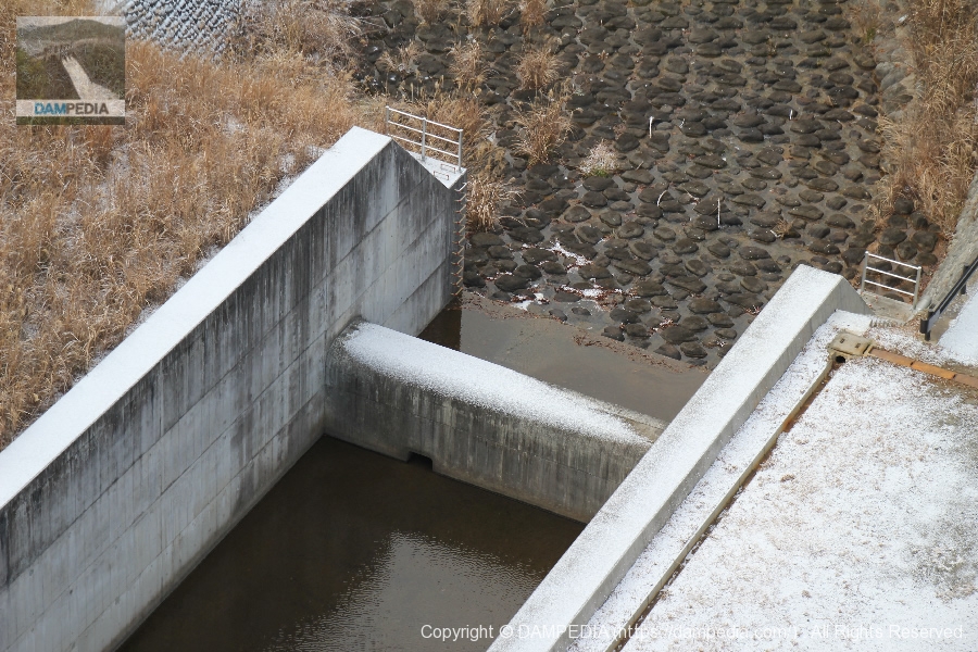
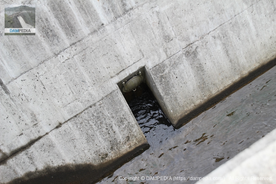
River Maintenance Discharge
There was a discharge outlet for river maintenance discharge on the right bank side.
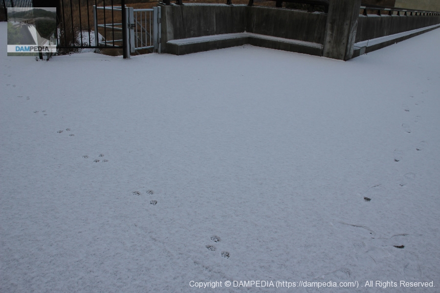
Animal Footprints
When we followed the top to the left bank, we found animal tracks. But we could not tell what kind of animal tracks they were.
View of the top edge from the left bank
The top edge is accessible only on foot.

View of the levee downstream from the left bank
Footings are not available. Incidentally, the tower attached to the dike in the foreground is an elevator tower.
Looking downstream from the left bank
The city of Nara can be seen in the distance.
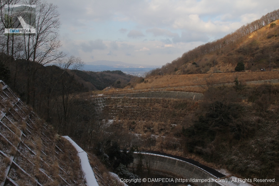
View of downtown Nara from the left bank
It is early in the morning and there is a haze, but I think the night view is beautiful at night.

View of the embankment on the lake side from the left bank
You can see that the dam lake is slightly frozen.
View of the dam lake from the top
The dam lake is not that large, so you may want to take a walk around the dam lake.
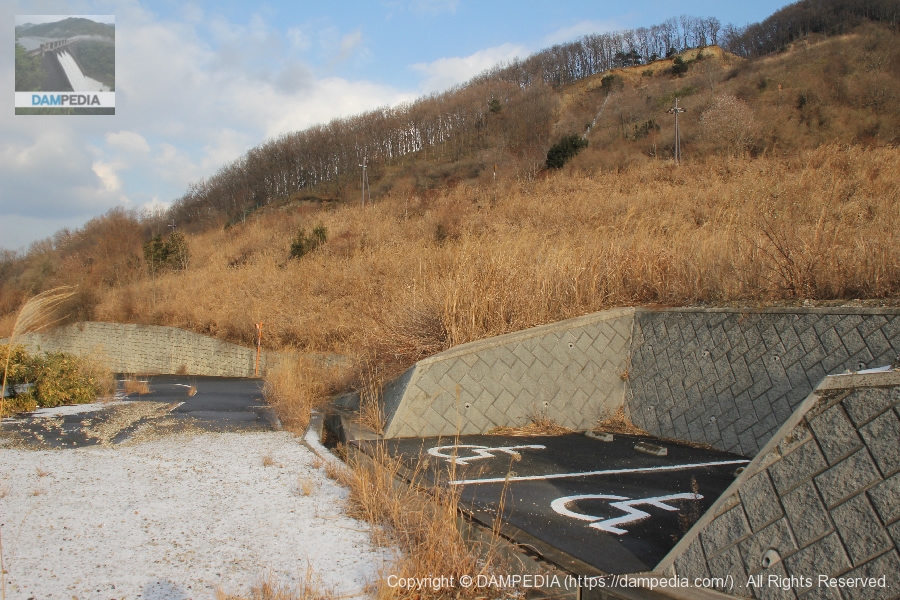
Ruins of wheelchair parking lot
A little further downstream from the top, there is a ramp that leads down to a parking lot like this. You cannot drive into the parking lot because there is a car stop, but it is a bit surreal to see the parking lot just beyond the gutter.
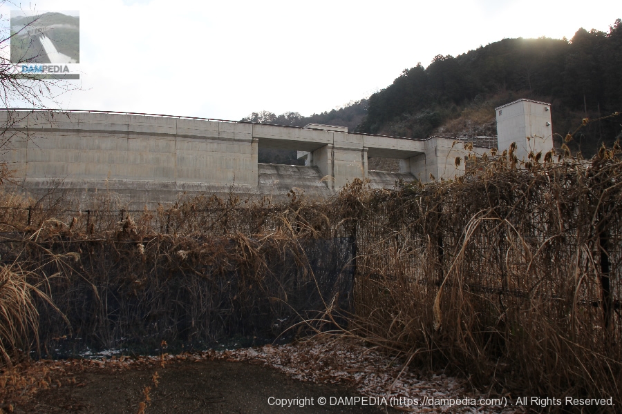
View of the levee downstream from the former wheelchair parking lot
It is built like an observatory, but the fence and other obstacles make it very difficult to photograph. I couldn't see the view from the front, so I had to angle the view a little.
View of the levee downstream from the right bank observation space
It is highly doubtful that the space was created for show, but there is a high fence and the grass is overgrown, as you can see.... A stepladder is necessary.
View of the levee downstream from the right bank
It is hard to fence this high.
View of the reduction work through a gap in the fence
I took this photo through a gap in the fence, but it left a black shadow.
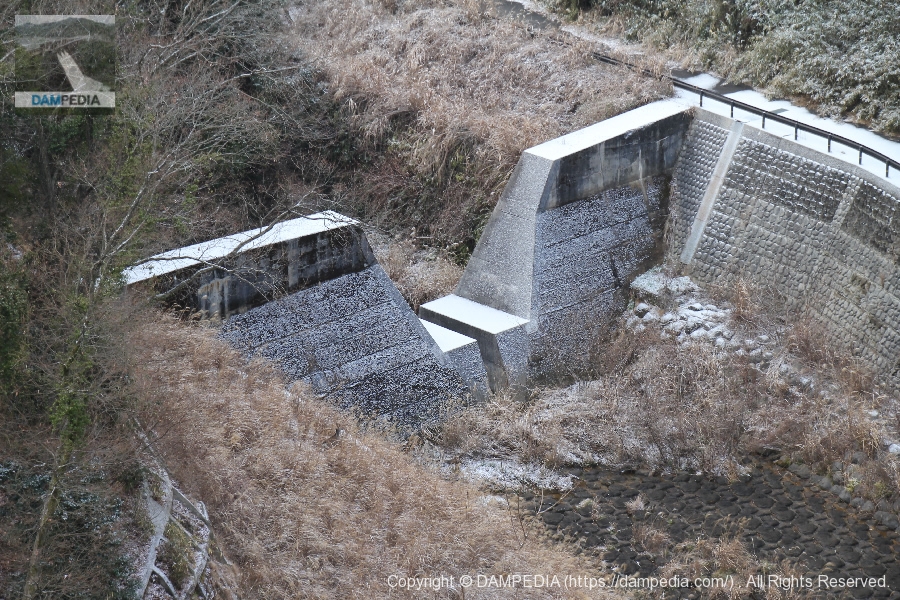
erosion-control dam
We found a path further downstream and came to the side of the river. The erosion control dam, which was visible from the top edge, looks bigger up close.
View of the levee downstream from around the erosion control dam
The levee is curved, which makes the photo look distorted.
View of the downstream levee from directly below
If the weather had been clear, the afternoon would have been better lighted and better photos could have been taken.
View of the sub-dam from downstream
The sub-dam is covered with snow like powder.
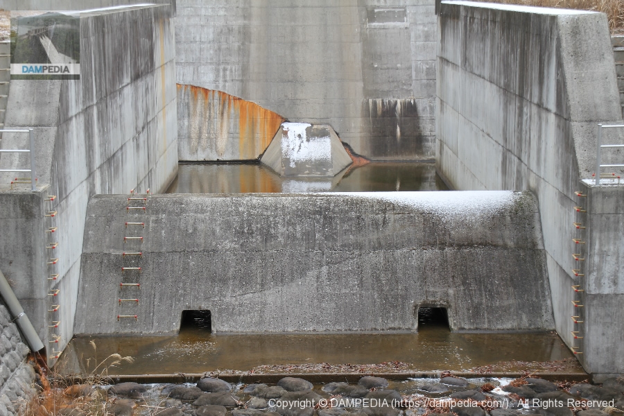
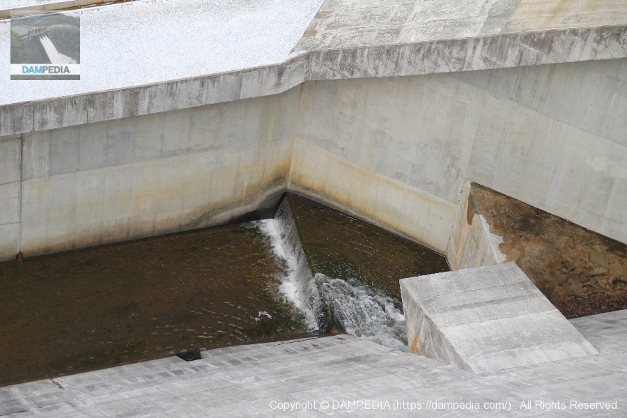
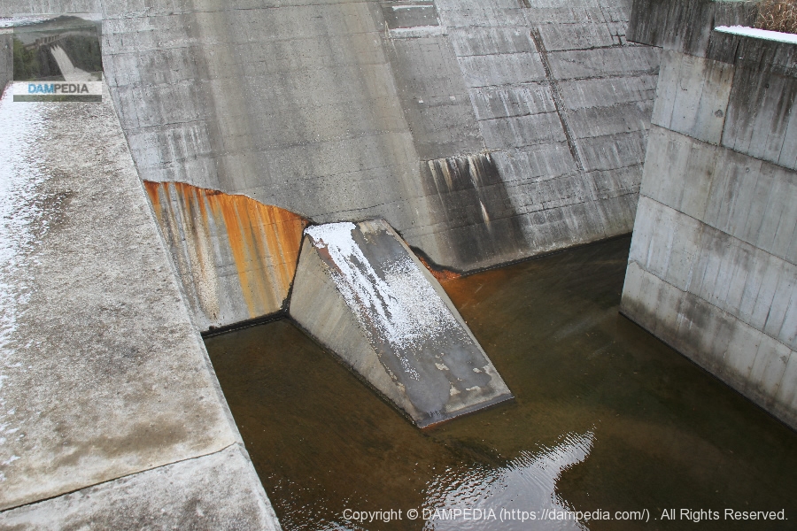
Structures located directly below the permanent flood discharge
It is thought that the water flowing down from the permanent flood discharge disperses and kills the momentum.
View of the right bank side conduit wall and river maintenance discharge
The discharge outlet for river maintenance discharge is hidden behind the flow guide wall. A deflector is installed above the discharge to prevent it from being blocked by the flow from the emergency flood discharge.
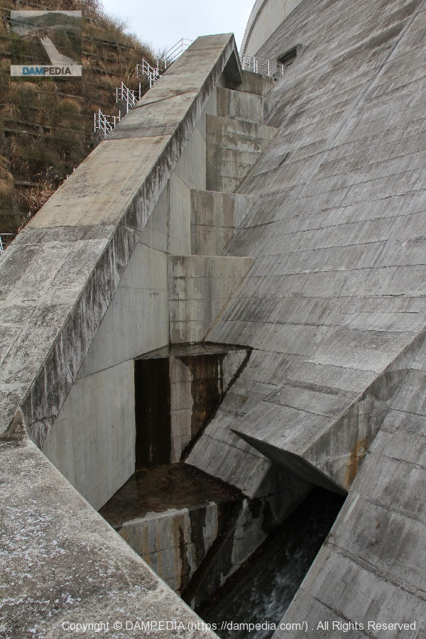
Holes to drain water stored in the dike?
The holes are probably designed to drain water that has accumulated in the dike due to leaks.
Left bank side conduit wall
The ledge wall is white with a light dusting of snow.
Although it is a simple embankment, the details are designed in great detail, especially on the downstream side, with some complexity, so you never get tired of looking at it. The dam is a quiet symbol that protects the city of Nara.
Unfortunately, there is no parking lot, so it is a bit difficult to park your car. There is a large parking lot by the administration office, so it would have been nice if they could have made a little more effort.
Iwai River Dam Specifications
| River Name | Yamato River System Iwai River |
| Objective | F (flood control, agricultural disaster prevention), N (unspecified water, river maintenance water) |
| Model | G(gravity-fed concrete dam) |
| Bank height | 55m |
| Bank length | 181m |
| Dam volume | 86,000m3 |
| Watershed Area | 3.3 km2 |
| Reservoir area | 5 ha |
| Total storage capacity | 810,000m3 |
| Effective water storage capacity | 690,000m3 |
| Dam operator | Nara prefecture (Kinki area) |
| Main body constructor | Okumura Corporation, Taisei Corporation, Toda Corporation, Taiho Corporation, Morimoto Corporation |
| Year of launch | 1974 |
| Year Completed | 2008 |
| Name of Dam Lake | - |
Other facilities/observations
The dam was completed in the 2000s, but it looks like it has a lot of things in place...and all it has is a dam. No, it is fine as long as there is a dam.
| Parking lot | × |
| Toilet | × |
| Park | × |
| PR Exhibition Hall | × |
| Fishing | △ |
Map around the Iwai River Dam
Accommodations that may be close to the Iwai River Dam

Comment