
Date of interview: Sunday, March 24, 2013
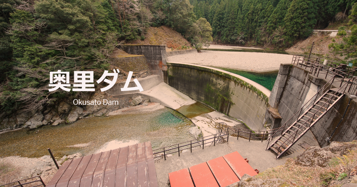
This Okuri Dam was the next dam we visited after the Kazaya Dam for our mission to pick up the dam enthusiast helmets that had been completed to the Nanashiki Dam. The Okusato Dam is a dam owned by the Japan Power Development Corporation and is used exclusively for power generation.
View of the downstream bank from the left bank
It looks like an erosion control dam, but it is a dam dedicated to power generation. The shed on the left bank is somewhat curious, but is it a material storage yard or something else?

A little closer to the levee, looking downstream of the levee
At the time of the visit, I thought that the red board-like object on the left bank was a hole for inspection, but upon closer inspection, it appears to be two steel frames placed between the floor and the bottom of the board, creating a gap for heavy machinery to fish it out. It also looks as if there is a gap for heavy machinery to fish it out.
Also, you can see a hole for sediment discharge on the downstream side of the levee, a little lower on the left bank side (beyond the stairs).
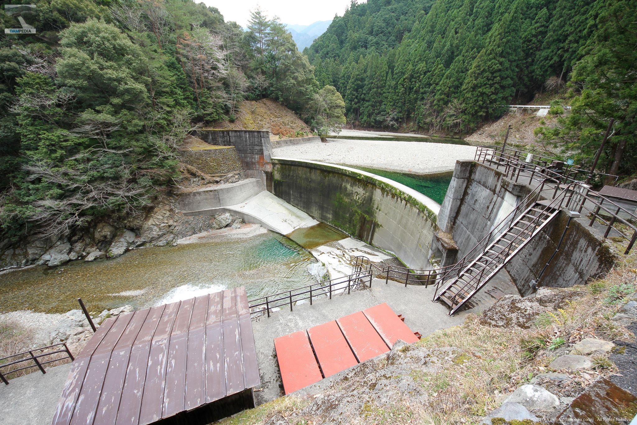
View of the embankment from the left bank
The river is discharged from below the hut to maintain the river. Perhaps the hut is its valve chamber or something. ...I think that the red plate-like thing is a spare gate.
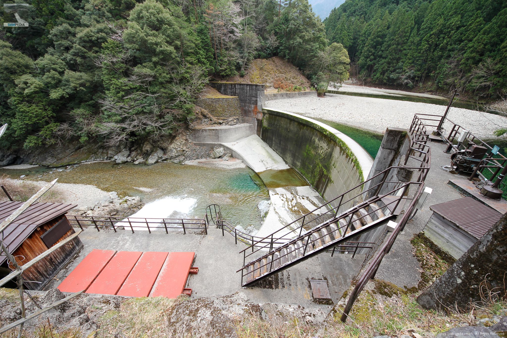
Fence on the left bank
Unfortunately, the area around the dike is closed to visitors.

Local Signboard
Okusato Dam is an arch dam, but the official type is a fixed radius arch dam. I am a liberal arts major who does not understand the meaning of fixed radius...

Water intake and sediment discharge
It is difficult to see from here, but in the foreground is the water intake. The top of the screen can be seen at a glance. The gate right next to the dike is the sediment discharge gate.
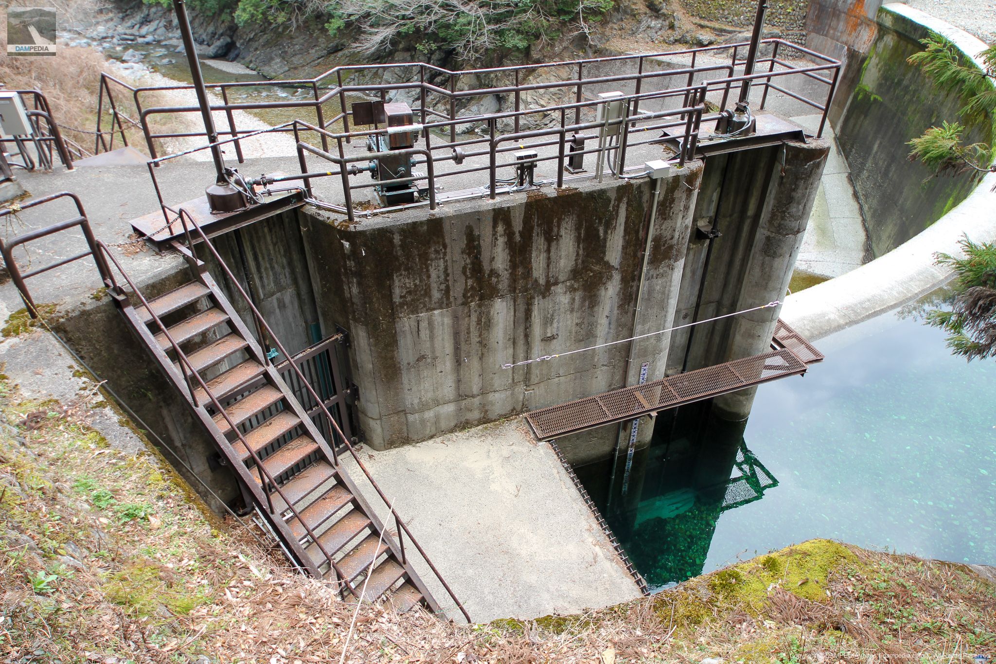
Water taken here is "crossed" downstream through a hydraulic iron pipe and pumped into the dam lake (Kazaya Reservoir) of the Kazaya Dam. What this means will be explained later.
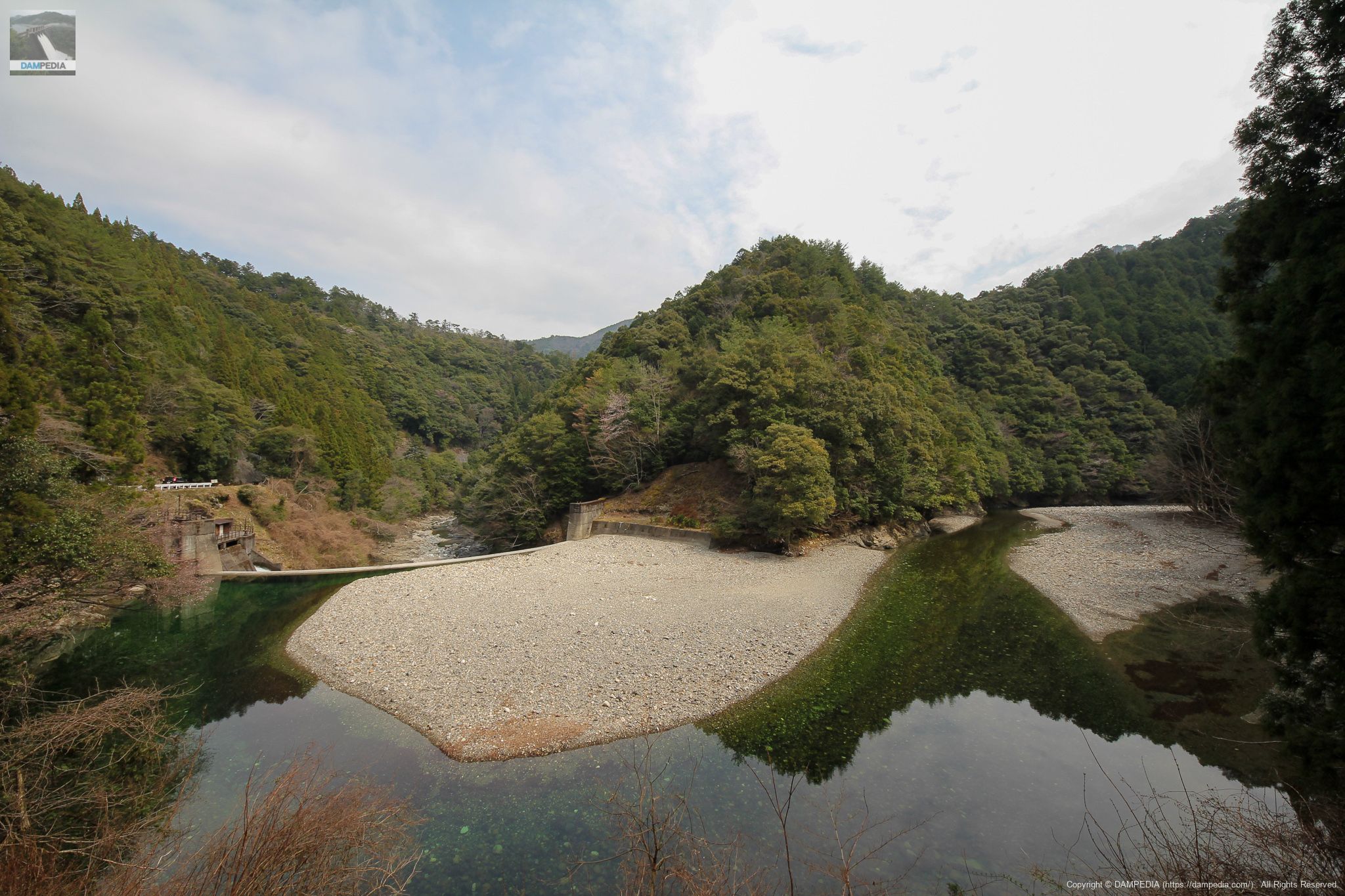
View of the dam lake
The sedimentation is severe, but as long as only the amount of water needed for power generation can be taken, it is probably not a concern.

View of the dam lake from further upstream
The dammed lake flows through a right-angle bend. The water is still a beautiful emerald green.
Hydraulic iron pipe located downstream
This water hydraulic pipe is located a little more than 2 km downstream from the Okuri Dam along the Taki River. Water taken from the Okuri Dam passes through this water hydraulic pipe. There is a bus stop for the community bus operated by Totsukawa Village, named "Suisuiro-mae.
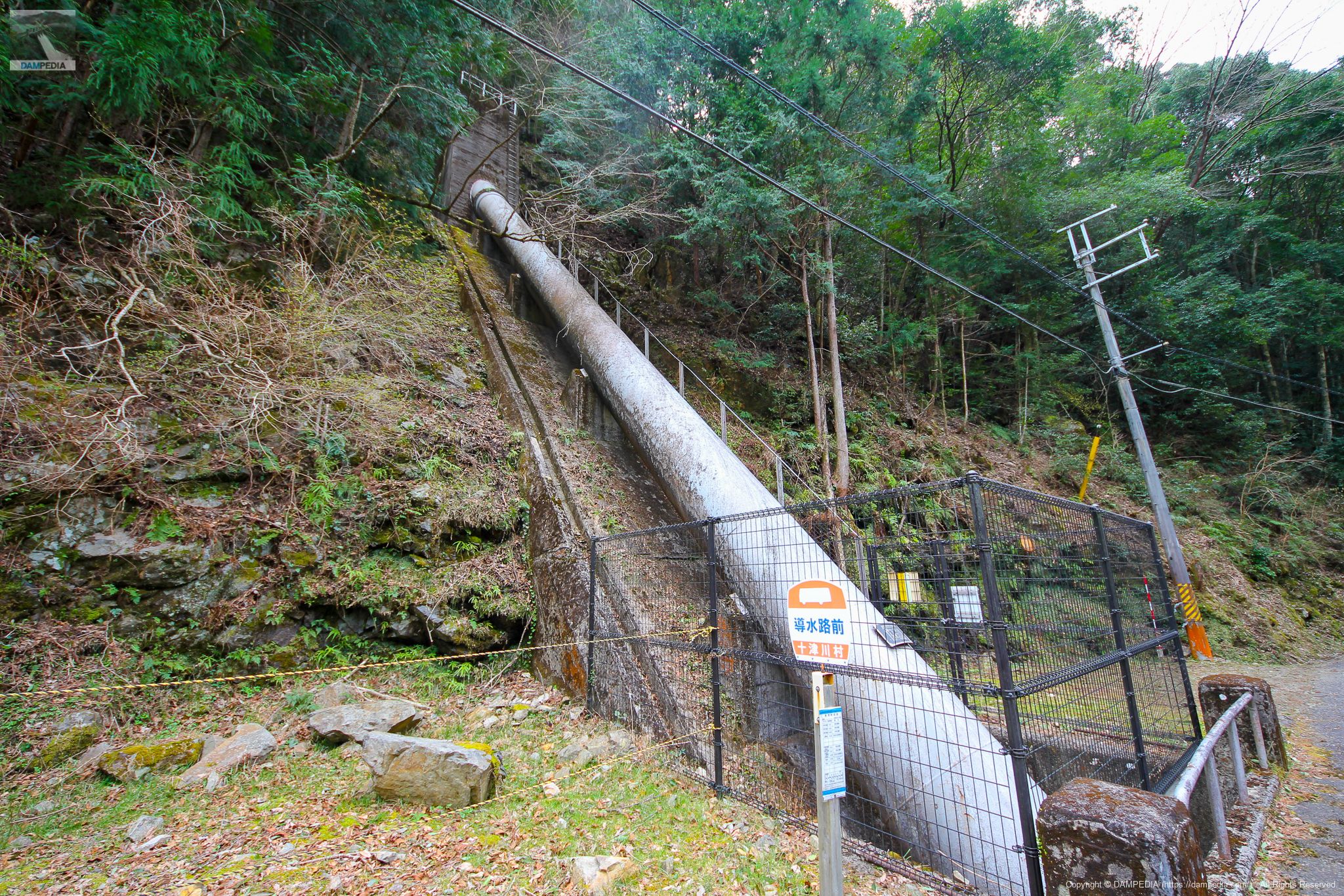
Hydraulic iron pipe crossing the Taki River
The water is lowered by a hydraulic iron pipe on the side of the road and crosses under the road to the other side of the river. This is what is meant by "crossing downstream. The water pipes cross the river, merge at various places, flow into the dam lake of Kazaya Dam, and finally flow into Totsukawa Daiichi for hydroelectric power generation, which is a very complicated route.
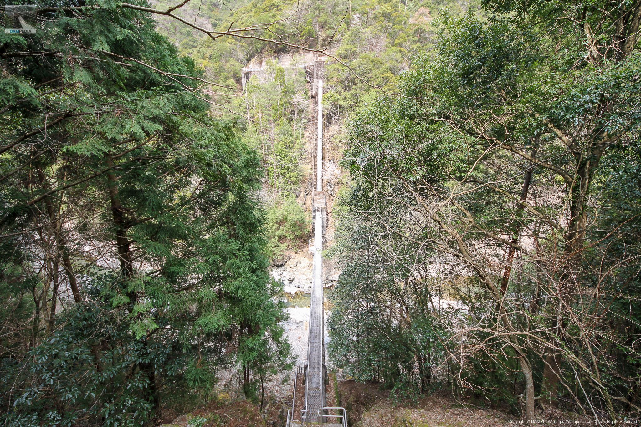
Takigawa conduit
This hydraulic iron pipe is called the "Takigawa Canal Pipe," and it follows this route. Incidentally, Google Maps does not clearly show the waterway, but the GSI map clearly shows it.

It conveys the desire not to waste even a little water by taking water from small rivers. The Okusato Dam is a small dam, but it is a very useful dam.
Okuri Dam Specifications
| Location | 121-5 Uchihara, Totsukawa-mura, Yoshino-gun, Nara |
| River Name | Shingu River System Taki River |
| Objective | P(Power generation) |
| Model | A(arch dam) |
| Bank height | 20.5m |
| Bank length | 81.3m |
| Dam volume | 2,000m3 |
| Watershed Area | 34 km2 |
| Reservoir area | 3 ha |
| Total storage capacity | 176,000m3 |
| Effective water storage capacity | - m3 |
| Dam operator | Power Development Co. |
| Main body constructor | Hoshino Civil Engineering |
| Year of launch | 1954 |
| Year Completed | 1960. |
| Name of Dam Lake | - |
Other facilities/observations
| Parking lot | × |
| Toilet | × |
| Park | × |
| PR Exhibition Hall | × |
| Fishing | ○○ (excluding restricted areas) |
Comment