
Date of interview: Saturday, 06/08/2013
After visiting Shintaki Pond, Takino Pond, and Inakura Pond, we entered the neighboring town of Kumatori from Izumisano City, and the fourth dam we visited that day was Eiraku Dam.
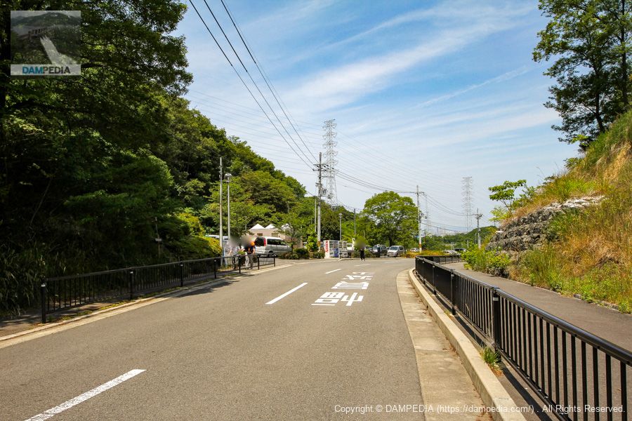
Parking lot on the left bank
Nagaraku Dam is located in Okuyama Ameyama Nature Park, adjacent to Nagaraku Dream Forest Park, which also has a hiking trail and a parking lot. Since it was a Saturday, we saw many hikers and joggers.
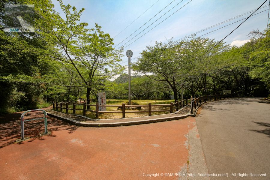
Entrance to the skyline
However, the dike is still not visible. From the parking lot, you will find the entrance to the top of the dike further to the south on foot.
The 100 Best of Osaka Greenery
Eiraku Dam has cherry trees planted around the dam lake, and it seems that the cherry trees and the rows of cherry trees are selected as one of the 100 best places for greenery in Osaka as well as Inakura Pond. It has also been selected as one of the 100 best water source forests.
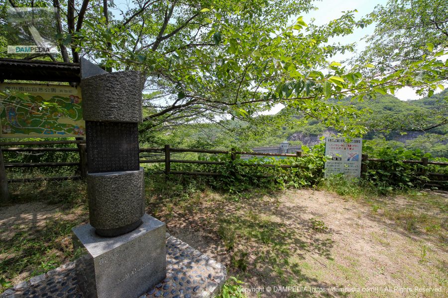
Stone monument showing the history of Kumatori Town
Stone monuments showing the history of Kumatori Town have been erected along the dam lakeside. Other such stone monuments seem to be scattered throughout the area.
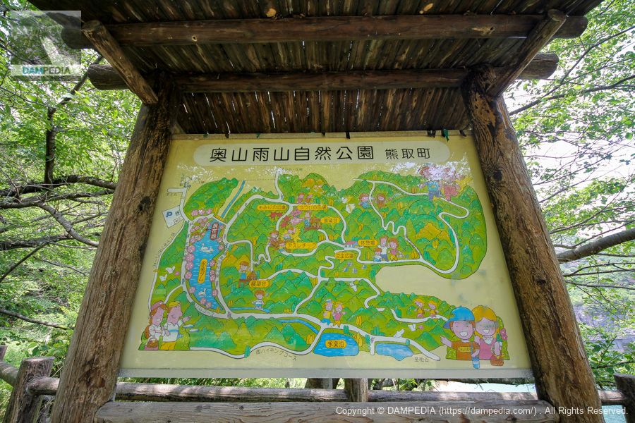
Okuyama Rain Forest Nature Park Guide Map
This is a walking map. I gave up because it was upstream and time was limited due to the high elevation, but I heard that there is an observation deck where you can see the upstream side of the levee. Also, there is a bus stop on the map...
Reactor bus stop!
The Institute for Nuclear Science and Technology of Kyoto University is located in Kumatori Town, and although the bus stop is now called "Atomic Energy Research Institute-mae", it used to be called "Nuclear Reactor Bus Stop". (Or perhaps it was a nickname.)

View of the upstream face of the embankment from the left bank
You can capture the upstream face of the dike from around the sign on the walking map. If the elevation were a little higher, it might have looked like it was supporting water.

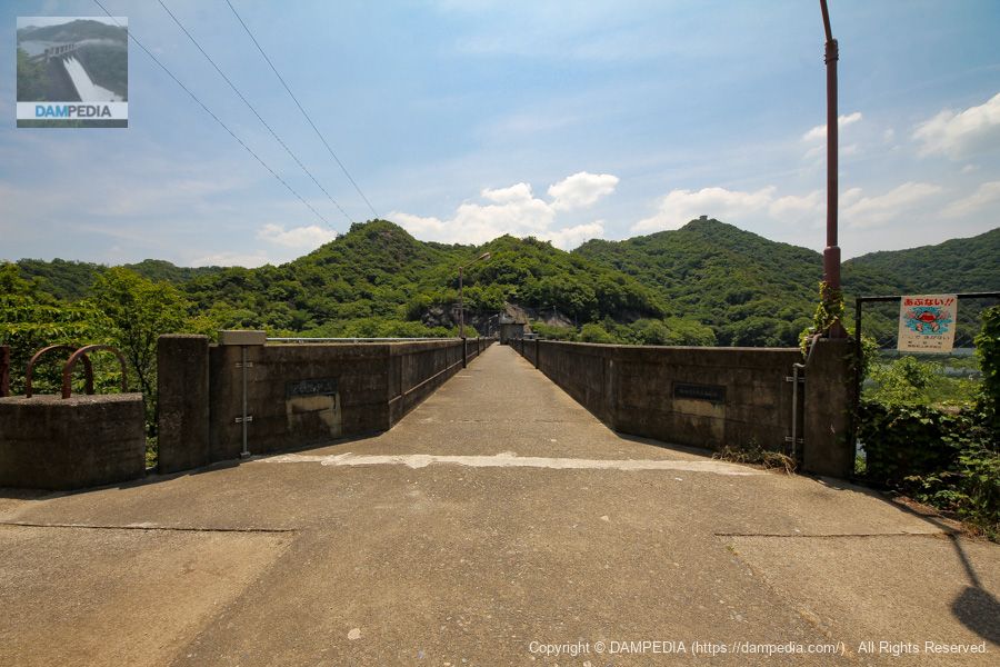
View of the top edge from the left bank
Since automobiles cannot enter from the left bank, the top of the bridge is naturally closed to vehicular traffic. The railings are still very sturdy and solid. Because of its height and thickness, it was a little difficult for me, a short person, to take a picture from the top edge.
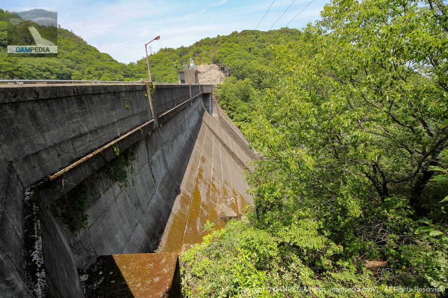
Downstream view of the levee from the left bank
It is a little difficult to see because of the overgrown trees, but the step that looks like a thin conduit wall in the center of the dike is not a conduit wall, but the concrete seems to be thicker only in the center part. This is why it is a step.
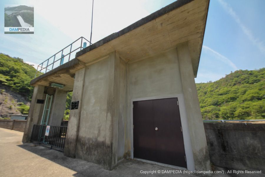
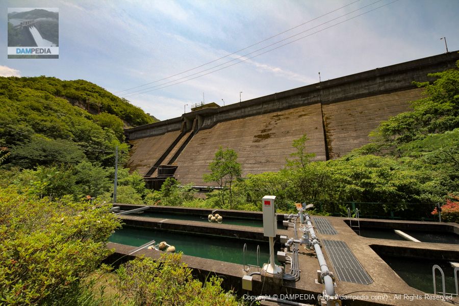
Water Intake Facilities and Residual Water Discharge
I am afraid that the photo is out of focus for some reason. Photo right (left bank (of a river)(left) is the intake gate (building) of the slide gate that opens and closes with a spindle system, and (right) is theright bank (shore)The "flood discharge" is a roller-gate spillway that opens and closes with a rack system. The Yongle Dam is not called a flood discharge but a spillway.
The specifications of the intake gates are as follows. The intake gate appears to have been completely renewed in 2003. In addition, the opening/closing device and the door rotating part of the residual water discharge also seem to have been renewed.
Model: Slide gate
From the local nameplate
Dimensions: Effective diameter No.1-3 0.4m
No.4 0.5m
Number of gates: 4
Opening and closing method: spindle type
Opening/closing speed: 0.3m/min
Completion date: January 2003
Production: Hitachi Zosen Corporation
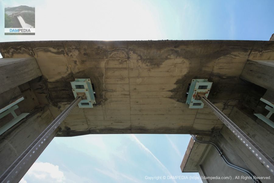
Looking up at the upper part of the residual water discharge
The rack type is often installed on small to medium-sized gates, but it seems to be more efficient and has the advantage of being able to descend under its own weight due to the weight of the door body itself, as well as being resistant to debris.
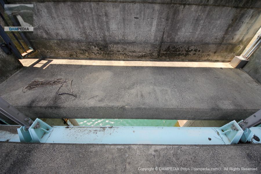
View of the after-water discharge from the top
This is the upper end of the gate. You can clearly see that the door body is thin.
The specifications of the residual water discharge gate are as follows
Model: roller gate
From the local nameplate
Dimensions: net diameter interval 4.5m, door body height 3.0m
Number of gates: 1
Opening and closing method: Rack type
Opening/closing speed: 0.3m/min
Maximum design depth: 3.00m
Hoist: 1.5 kW
Door weight: 2.51t
Completion date: March 1967
(In January 2003, the switchgear and the door rotating section were updated.)
Production: Maizuru Heavy Industries Co.
(As updated by Hitachi Zosen Corporation)
View of the top edge from the right bank
Moved to the right bank. The parapet between the top railings and the upstream and downstream parapets? I am concerned about the gap between the

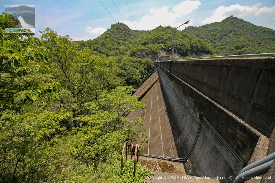
View of the upstream face of the embankment from the right bank
The top and railing protrude slightly from the top of the embankment, but I think this ruggedness is symbolic of the era in which it was completed in the 1960s. However, I feel that this ruggedness symbolizes the era of construction completed in the 1960s.
Downstream view of the levee from the right bank
The mossy appearance of the embankment is also nice.
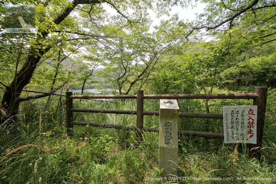
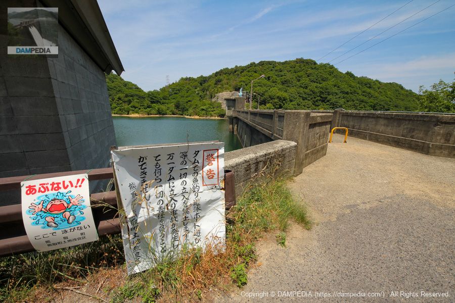
No Fishing
Fishing is prohibited. This is probably an unavoidable measure since it is the source of the water supply.
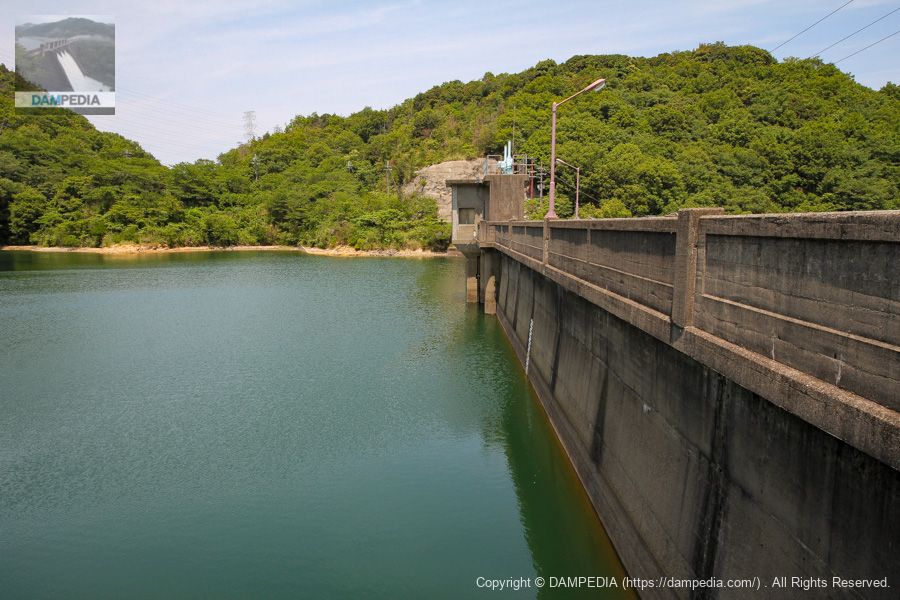
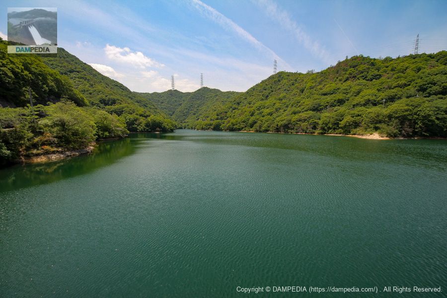
View of the dam lake from the top
It is a beautiful dammed lake. It is hidden by the watermark on the dam pedia, but you can see the observation pavilion at the top of the mountain on the left. If I have a chance, I would like to attack it in a cooler season.
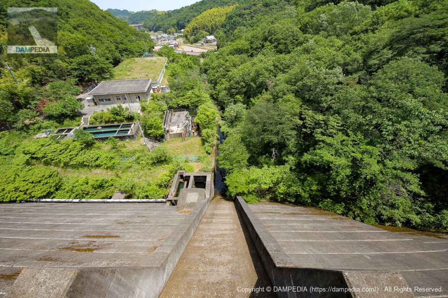
View downstream from the top
This is a fairly narrow conduit and abatement. The flow-conducting wall is also quite low. The facility on the left bank downstream is the Eiraku water treatment plant in Kumatori Town, which was in operation at the time of this report in 2013, but unfortunately it was suspended in 2015. Therefore, it seems that Nagaraku Dam has lost its purpose as a water supply facility, but the actual situation is unknown.
Eiraku Water Purification Plant
We drove to the Eiraku Water Filtration Plant from the top end. Although it is off-limits to the public, I approached the office, which graciously gave me permission to enter and take pictures. The suspension of the water purification plant seems to have been caused by a decrease in demand for water, but it is a little regrettable when I think of the staff members who gave their permission.

View of the downstream face of the levee from the Eiraku Water Filtration Plant site
From here, you can see, even vaguely, that only the center of the dike has increased in thickness. However, with the suspension of the water treatment plant, it is no longer possible to see it from this site, but I hope it will be possible to reopen it again someday.
Yongle Dam Specifications
(Added on 11/2/2020) When we inquired to Kumatori Town whether the purpose of water for water supply would be lost with the suspension of the water purification plant, we received the following response, which we would like to add.
The Nagaraku Water Filtration Plant was completed in July 1969, the year after the Nagaraku Dam was completed, and has supplied Nagaraku purified water (tap water) to some areas of Kumatori Town.
However, due to the aging of the facilities, it was suspended in February 2015, and now supplies tap water received from the Osaka Regional Waterworks Corporation from the Tsubasaoka-nishi water distribution reservoir.
The Eiraku Water Filtration Plant facility is not currently in use and will be retired.
As for the Yongle Dam, it will continue to be used for irrigation.
| Location | Kamitakada, Kumatori-cho, Sennan-gun, Osaka |
| River Name | Midegawa River system Midegawa River |
| Objective | A (irrigation water) |
| Model | G(gravity-fed concrete dam) |
| Bank height | 40m |
| Bank length | 133m |
| Dam volume | 46,000 m3 |
| Watershed Area | 10.4 km2 |
| Reservoir area | 6 ha |
| Total storage capacity | 729,000 m3 |
| Effective water storage capacity | 617,000 m3 |
| Dam operator | Osaka (metropolitan area) |
| Main body constructor | Kajima Construction |
| Year of launch | 1965. |
| Year Completed | 1968. |
| Name of Dam Lake | - |
The dam handbook lists the year of commencement as unknown and the year of completion as 1967, but we have reproduced the information from the Kumatori Town web page.
Other facilities/observations
| Parking lot | ○ |
| Toilet | ○ |
| Park | ○ |
| PR Exhibition Hall | × |
| Fishing | × |
Comment