
Location: Oaza-Ikejiri, Osaka-Sayama City, Osaka Prefecture
Date of interview: Saturday, May 07, 2011
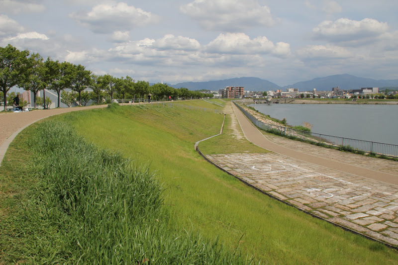
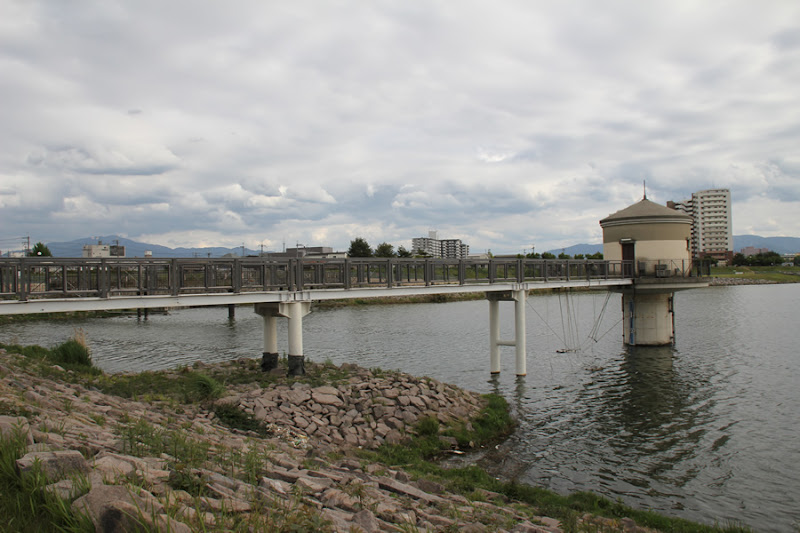
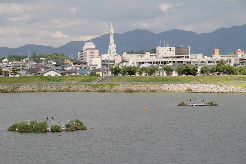
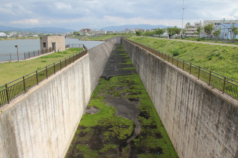
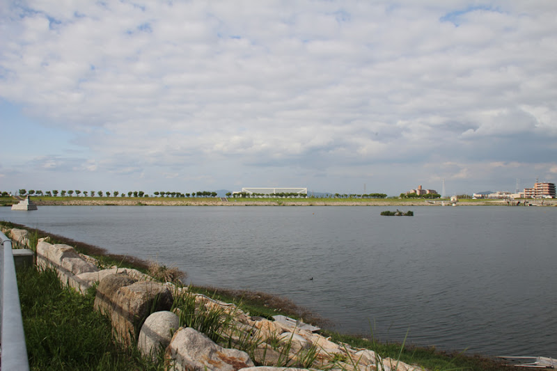
View of the north levee from the west levee
This was my first visit to a dam in Osaka Prefecture. (There is something in the photo, but I think it is a bird, not a UFO.)
Sayama Pond Dam has a long history of embankment construction, which is recorded in the Chronicles of Japan and the Kojiki (Records of Ancient Matters), and the first embankment was built in the first half of the 7th century. The Sayama Pond Dam was originally built as a reservoir for irrigation. Originally a reservoir for irrigation, flood control was added to the purpose of the dam during a major renovation in the Heisei era. The type of dam isearth dam. The official type name is "uniform earth-fill dam.
View of the intake tower and western flood discharge from the west side of the levee

Sayama-ike Dam supplies water to the Nishi-daike River and the Higashi-Daike River on the east and west sides, respectively. The photo shows the flood discharge that supplies water to the Nishi-Daike River and the irrigation intake tower in the foreground.
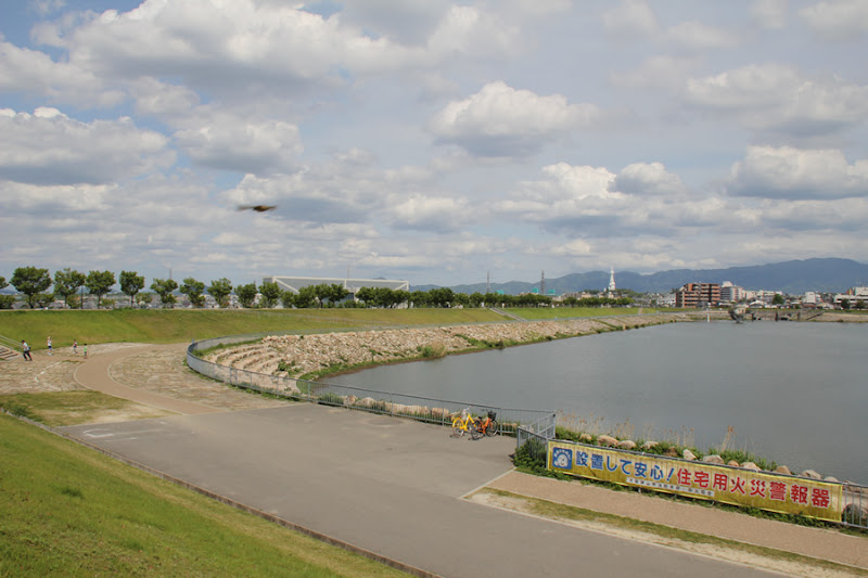
View to the south from the west levee
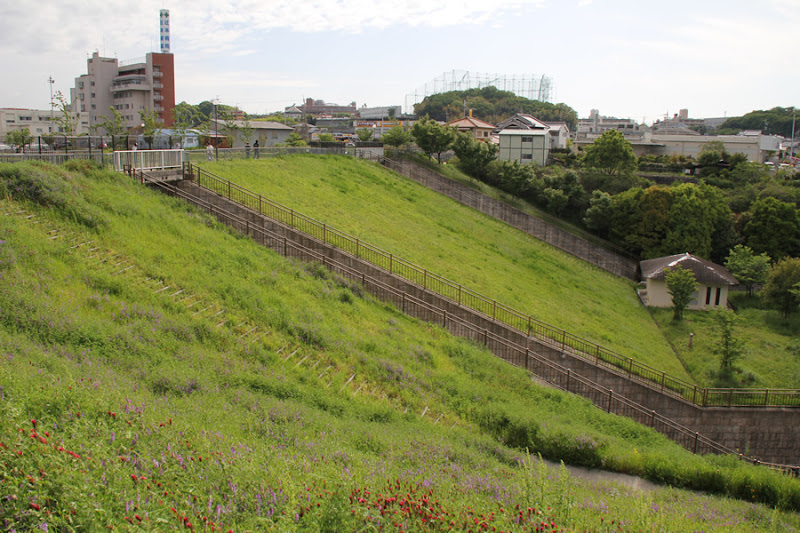
Sayama Pond Dam is not so high with its embankment height of 18.5m, but it is just wide. And it is a place for citizens to relax, and many people were walking and running. Some of them were playing with radio-controlled vehicles.
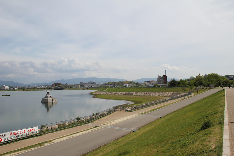
View of the Dragon Shrine from the west bank
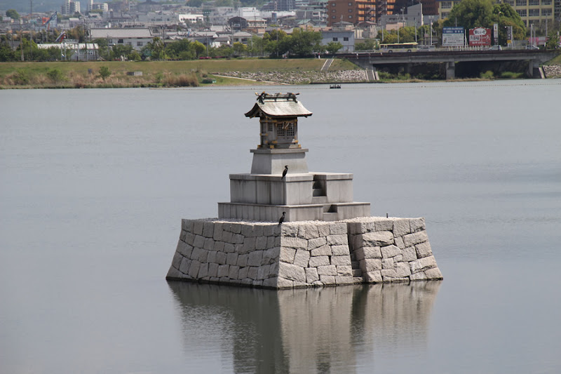
The Dragon God Shrine is enshrined in the dam lake near the western embankment. Of course, it is the god of water.
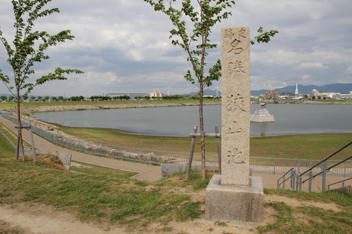
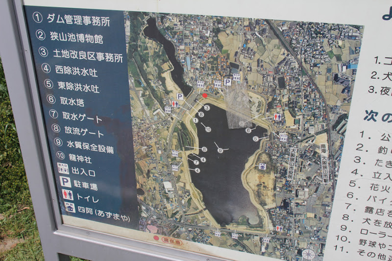
signboard
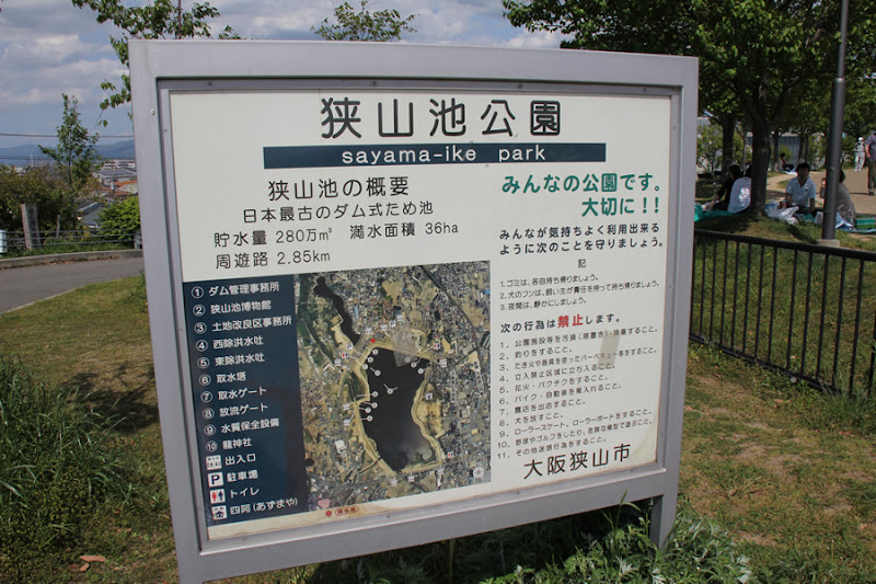
As the signboard reads "Sayama Pond Park," the area around the dam lake has been developed as a park.
Close-up of the sign
Can you see the whole picture of Sayama Pond Dam in this picture?
View of the north levee from the west levee
Earth dams are often referred to as "causeways," but Sayama Pond Dam is an embankment that circles the entire area and is well maintained here and there, giving it an atmosphere that makes it impossible to call it a causeway.
View of Sayama Pond Museum
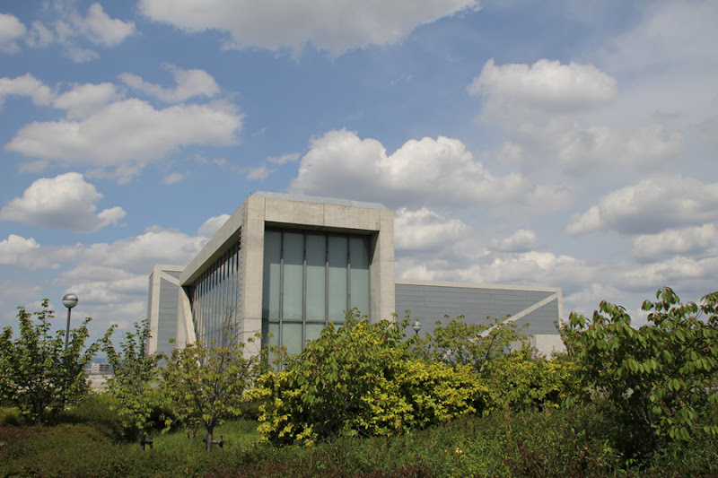
On the north bank of the dam is the Sayama Pond Museum, which is the main purpose of this visit. It was designed by Tadao Ando, an architect whose work I personally like.
Monument erected by Kobo-Daishi Godo
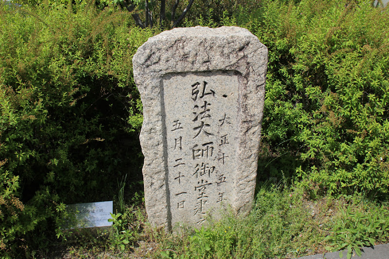
The embankment as well as the museum are modern structures, but there is also this stone monument by the dam lake that reminds us of the history of the dam.
Takakura Temple Hokkien Bodhisattva Monument

There are also these stone monuments, but I'm sorry. I have no idea what they represent, as I have not researched them.
Sayama Pond Museum Entrance

Now, let's enter the Sayama Pond Museum. The entrance is made of fair-faced concrete, which is typical of Tadao Ando.
Inside the entrance of Sayama Pond Museum
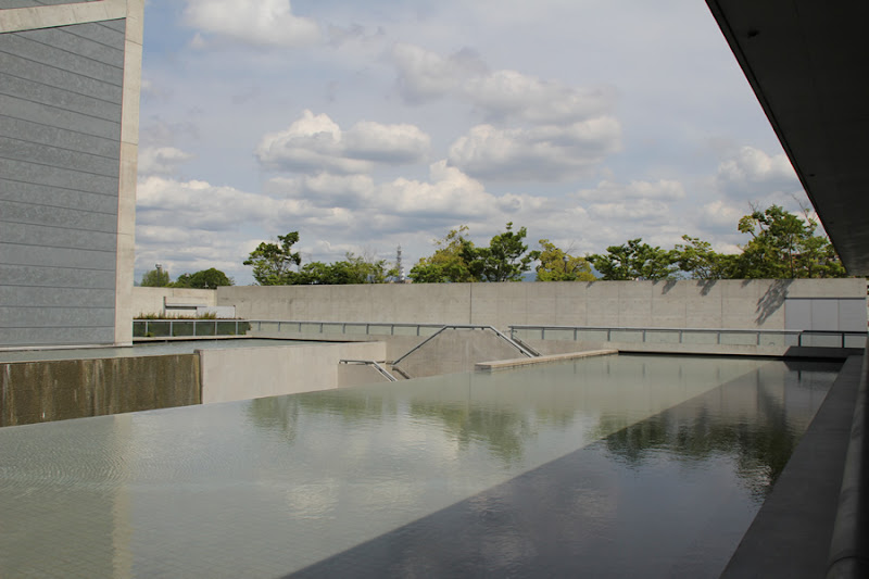
I would love to take pictures like the ones in "Shinkenchiku" magazine, but I was still new to SLR cameras at the time, so this is the best I could do. Still, I was often struck by the abundant use of water in the architecture.
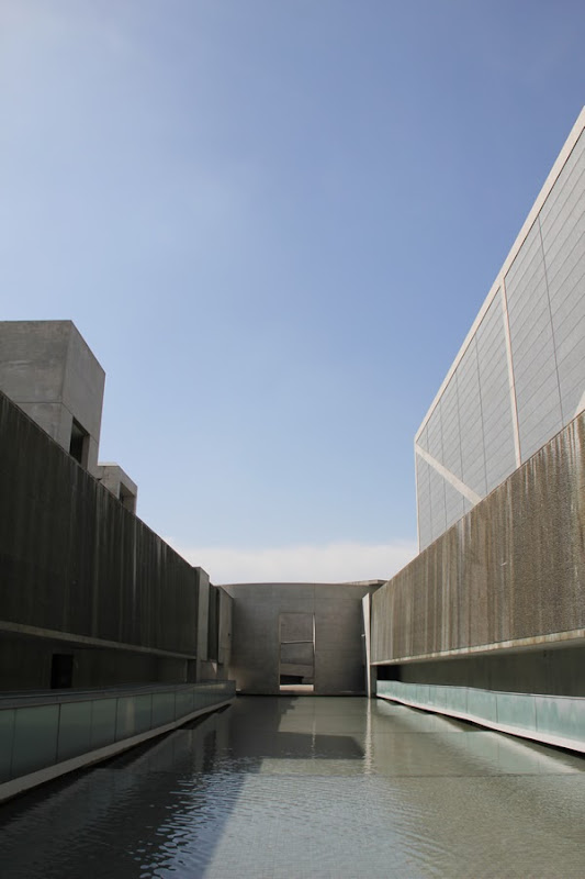
Sayama Pond Museum Passage

I say, "Wow, wow, wow," and press the shutter release button incessantly.
Sayama Pond Museum Courtyard
I was desperate to get the message from the world-famous architect, but unfortunately I didn't understand what he was trying to say. Well, anyway, the only word I can say is "amazing.
Sayama Pond Museum

At one point, we toured the museum, but my son wanted to leave immediately, so we couldn't see it properly and quickly walked out....
View of the levee on the north side
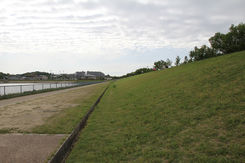
A long stretch of levee. Still, there are a great many people who come to play.
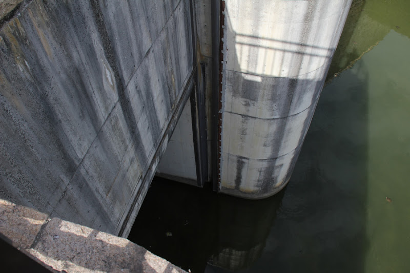
View of the water intake tower
After the tour of the museum, we will once again visit the east discharge flood discharge and intake tower. The intake tower, which was used before the renovation, is still on display at the museum, but it has undergone major changes during the Heisei Era (Heisei Era).
View of the East Flood Discharge

The flood discharge is compact but has a slightly unusual shape.
View of the East Flood Discharge
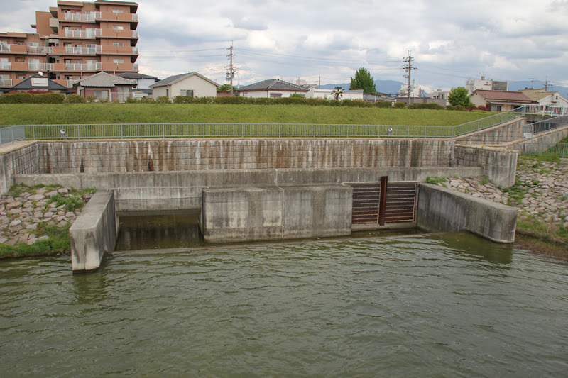
For some reason, only one side is blocked by a corner drop, is there a reason for this?
Sayama Pond Stone Monument

It is a magnificent stone monument. By the way, the composition is a little different from this picture.Dam Manga" by Mr. Yoshihisa InoueThe material is provided in the following table. If it is a single volume, it is the cut on p.65 (lol).
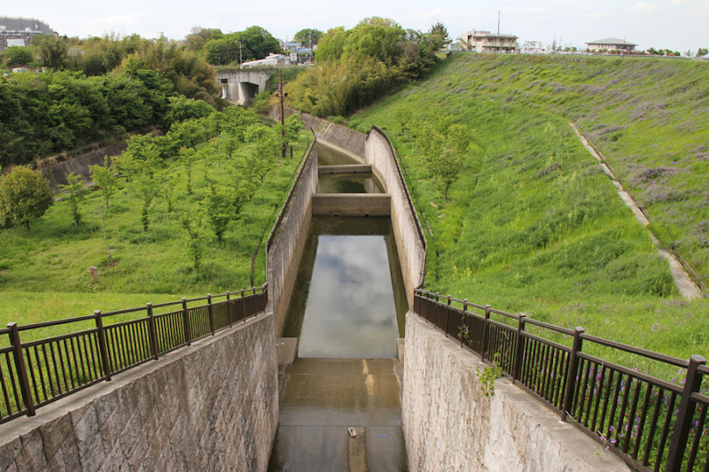
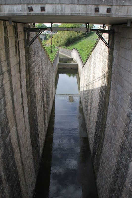
View of the West Flood Discharge Channel
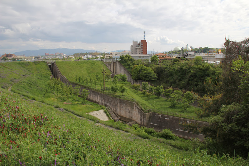
Next, we will move on to the West Flood Discharge. Unlike the East Flood Discharge, the West Flood Discharge is a much larger structure with a dam-like appearance.
Biotope? View of the
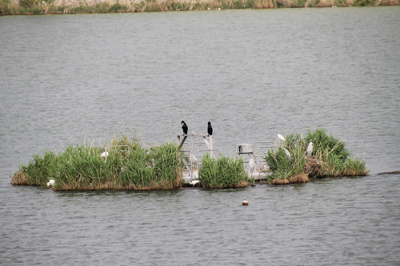
A sort of biotope was also set up in the dam lake, where birds were resting their wings.
Biotope? (The other side is Osaka Sayama City Hall and the Great Peace Prayer Tower.)
Then, an oddly shaped tower can be seen on the other side of the dam lake.
View of the Great Peace Prayer Tower

This figure is called the Great Peace Prayer Pagoda and is a facility of the Perfect Liberty Church, known for the famous baseball team PL Gakuen. What amazed me was that it looked exactly like the clay works I made when I was in elementary school. I thought I was dreaming. By the way, the official name of the building is the "Great Peace Prayer Pagoda for the Memorial of the Victims of the Super Sect's Universal War. If you want to know more details, please Google it.
View of the West Flood Discharge
Looking only here, the height seems to exceed the embankment height of 18.5 meters. There are two flood discharges, one in the foreground and one in the background.
View of the force reducing work at the West Flood Discharge
In addition, it is equipped with two sub-dams for each flood discharge, which is a luxurious feature.
View of the force reducing work at the West Flood Discharge
It is unknown if there is a sub-dam here or not lol.
View of the West Flood Discharge
It is a very huge flood discharge for the height of the levee. Is it because it is located in a residential area?
View of the overflow area of the West Flood Discharge

The scene of the Koshi-flow must be very dynamic.
View of the overflow area of the West Flood Discharge

This is a flood discharge located on the east side of the huge flood discharge mentioned earlier. It somehow reminds me of the Ao-Do Dam (1364-Ao-Do Dam/Ohzuchidamu).
Ducks resting their wings in the overflow area
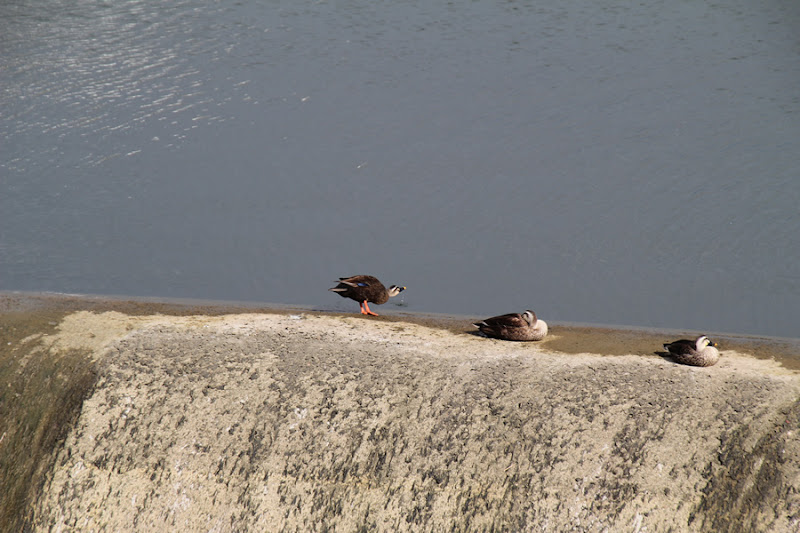
Ducks were resting their wings in the overflow area. It is nice to have a dam that is a paradise for birds.
Corner drop portion of the west-exposed flood discharge
These details also make it seem less like an earth dam with an embankment height of 18.5m.
View of the overflow area

This kind of place is also good for fine work. I think it was made to be seen.
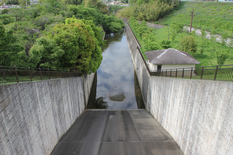
View of the West Flood Discharge
The structure allows a view of the flood discharge from under the bridge.
View toward Sayama Pond Museum from the West Flood Discharge
The reservoir, which has been passed down from generation to generation since the 7th century, has become an earth dam that protects the lives and property of not only farmers but also citizens, and has even been transformed into a place for birds and citizens to relax. It will be passed on to the next generation for another 100 to 200 years.
Sayama Pond Dam Specifications
| River Name | Yamato River System Nishiyaku River |
| Objective | Flood control, agricultural disaster prevention, unspecified water, river maintenance water |
| Model | earth dam |
| Bank height | 18.5m |
| Bank length | 997m |
| Dam volume | 605,000m3 |
| Watershed Area | 17.9km2 |
| Reservoir area | -ha |
| Total storage capacity | 2,800,000m3 |
| Effective water storage capacity | 2,800,000m3 |
| Dam operator | Osaka (metropolitan area) |
| Main body constructor | Obayashi Corporation, Sato Kogyo, Okumura Corporation |
| Year of launch | 1980 |
| Year Completed | 2001 |
Other facilities/observations
As one would expect from the oldest dam in Japan, it has become quite a tourist attraction. Various facilities are available without any complaints. There is also a café attached to the museum, so if you get tired of strolling, be sure to stop by.
| Parking lot | ○ |
| Toilet | ○ |
| Park | ○ |
| PR Exhibition Hall | ○ |
| Fishing | × |

Comment
Yoshimi Sumi liked this on Facebook.
Ryota Mochizuki liked this on Facebook.
Junko Kono liked this on Facebook.
Shiduka Sun liked this on Facebook.
Abe tea (Camellia sinensis) liked this on Facebook.
Oota Toshiaki Syunmyou liked this on Facebook.
Douken Norihiro liked this on Facebook.
Sachiko Irie liked this on Facebook.
[Auto-post] Damapedia Archives - Please take a look at it at your leisure. 1440 - Sayama Pond Dam http://t.co/PCl26Zsgqk