

Location: Hino Town, Gamo-gun, Shiga Prefecture
Date of interview: Monday, 12/06/2010
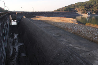
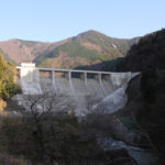
View of the flood discharge from the left bank
After visiting the Yasu River Dam, we visited this Zao Dam. The "Zao Dam" is a hollow gravity dam also in Yamagata Prefecture, which is somewhat confusing, but this is a rock-fill dam for irrigation only.
water intake facility
The Zao Dam was built to secure water for agricultural use for 4,986 ha of rice paddies and 225 ha of fields in Omihachiman City, Ryuoh Town, Gamo-gun, Hino Town, and Higashiomi City.

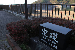
laying a cornerstone (foundation stone)
Therefore, it is under the jurisdiction of the Ministry of Agriculture, Forestry and Fisheries, and the foundation stone was written by the then Director General of the Kinki Agricultural Administration Bureau.
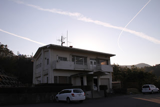
View Management Office
This is a photo of the control center, which has become impressive with its airplane clouds. Dam cards are also distributed, but since I came here without doing any research at all that day, I missed getting a dam card.
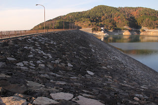
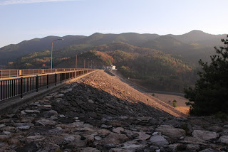
View of the top edge from the left bank
General vehicle traffic is prohibited from near the front of the dam site, and access to the top edge is also forbidden. Still, we always leave late, so it's already dusk this time of winter.
View of the embankment on the lake side from the left bank
The rock material is nicely laid out. I wonder if it is Zhang masonry.
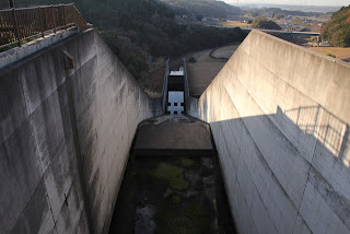
View of the conduit from the top edge
It is a long conduit, but relatively narrow. It is dark and hard to see, but you can also see a sub-dam ahead.
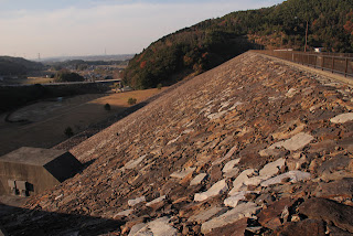
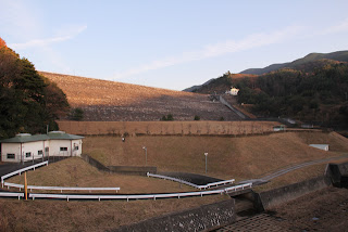
View of the levee downstream from the left bank
The rockfill embankment looks beautiful without grass. The downstream side is covered with grass and looks like an earth dam.
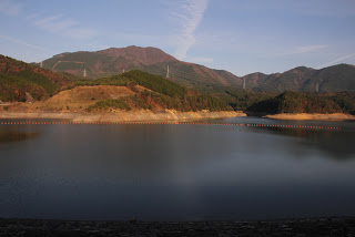
View of the dam lake from the left bank
Dam Lake. The water level was somewhat low because it was winter.
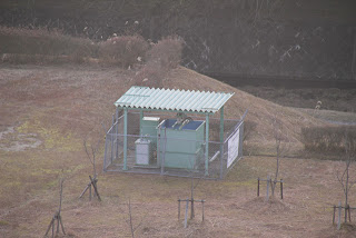
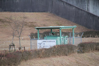
Downstream facilities
A mysterious facility was installed downstream. I wonder what it is.
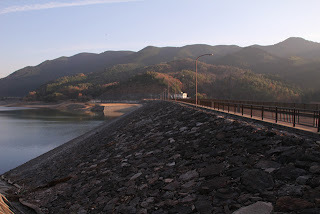
View of the levee downstream from the right bank
The levee illuminated by the setting sun.
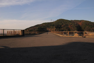
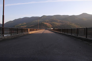
View of the top edge from the right bank
Wide top edge.
Speaking of which, there is a light at the top edge, but I wonder if it will be lit. If so, I think I can get a night view....
View of the embankment on the lake side from the right bank
It's dangerous because when I write an article and remember the night view, I want to go out and take pictures of it, lol.
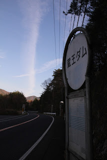
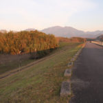
Zao Dam Bus Stop
Now, we will continue on to the nadir. And then, here we are.dam stopThe.
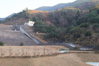
View of the levee from downstream
I tried to find a better spot, but this was it. And the sun was going down while we were looking for it, lol.
Sludge treatment facilities
The mysterious equipment visible from the top end was a sludge treatment facility. Is it reprocessing or something?
View of the conduit from downstream
From the top end, it did not seem very long, but when viewed from downstream, the conduit seems surprisingly long.
It is not a particularly remarkable dam, but it is one of the important agricultural water utilization facilities in the Higashiomi area, so it quietly watches over agriculture...that was the impression I got from the dam.
Zao Dam Specifications
| River Name | Yodo River System Hino River |
| Objective | irrigation water |
| Model | rockfill dam |
| Bank height | 56m |
| Bank length | 370m |
| Dam volume | 1,132,000m3 |
| Watershed Area | 9.4 km2 |
| Reservoir area | 33ha |
| Total storage capacity | 4,790,000m3 |
| Effective water storage capacity | 4,600,000m3 |
| Dam operator | Kinki Agricultural Administration Bureau |
| Main body constructor | Nishimatsu, Dainippon, Tekken |
| Year of launch | 1972 |
| Year Completed | 1990 |
Other facilities/observations
I think there was a restroom by the parking lot, but I have not confirmed this yet as I have been informed that it is not available.
| Toilet | △ |
| Park | ○ |
| PR Exhibition Hall | × |
| Fishing | × |
Comment