
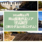
Date of interview: Wednesday, 1/28/2015
On this day, I came to Wakayama Prefecture because I heard that the Kirimegawa Dam, which was under test flooding, had reached its surcharge level and would be releasing water on a test basis. Looking back, I think this was the first time in my life to visit Wakayama Prefecture. It was before 7:00 a.m. on a winter morning, so the photos are a little dark and gloomy.
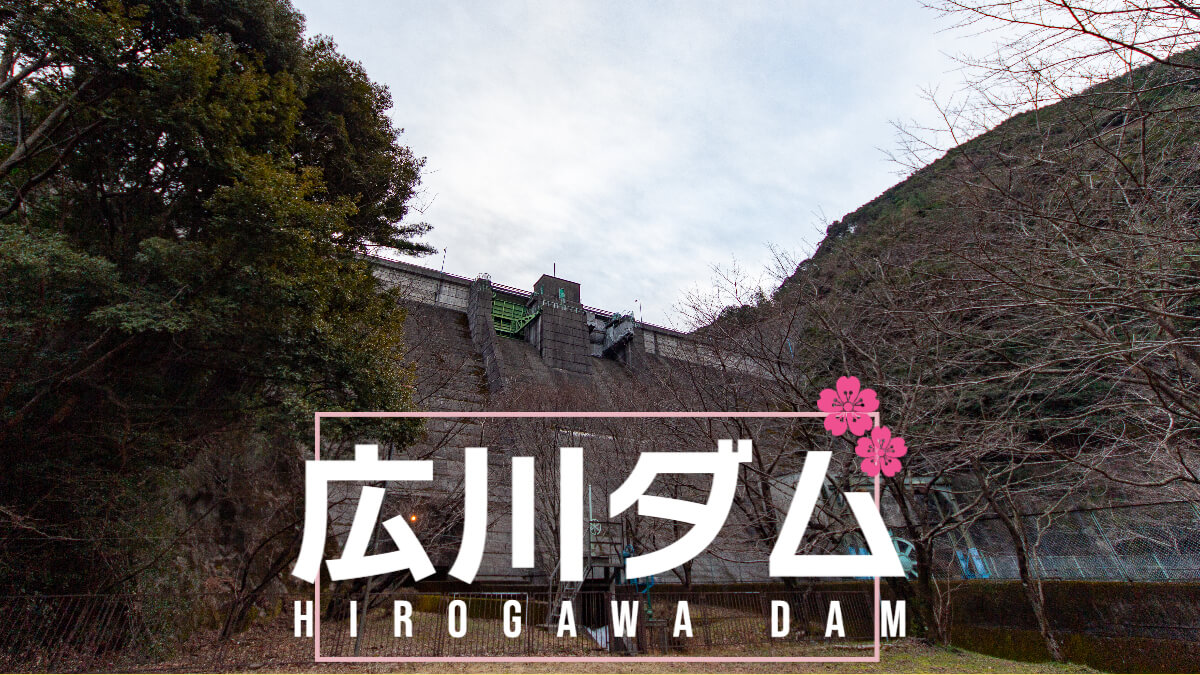
The Hirogawa Dam was constructed in 1953 in the wake of the Great Kishu Flood, and its main purpose is to control flooding. The town of Hirogawa, where the dam is located, is famous for the story of "Inamura no hi" (the fire in the rice field), and it may be said that the town has a high awareness of disaster prevention from such an anecdote.
Start with the right bank.
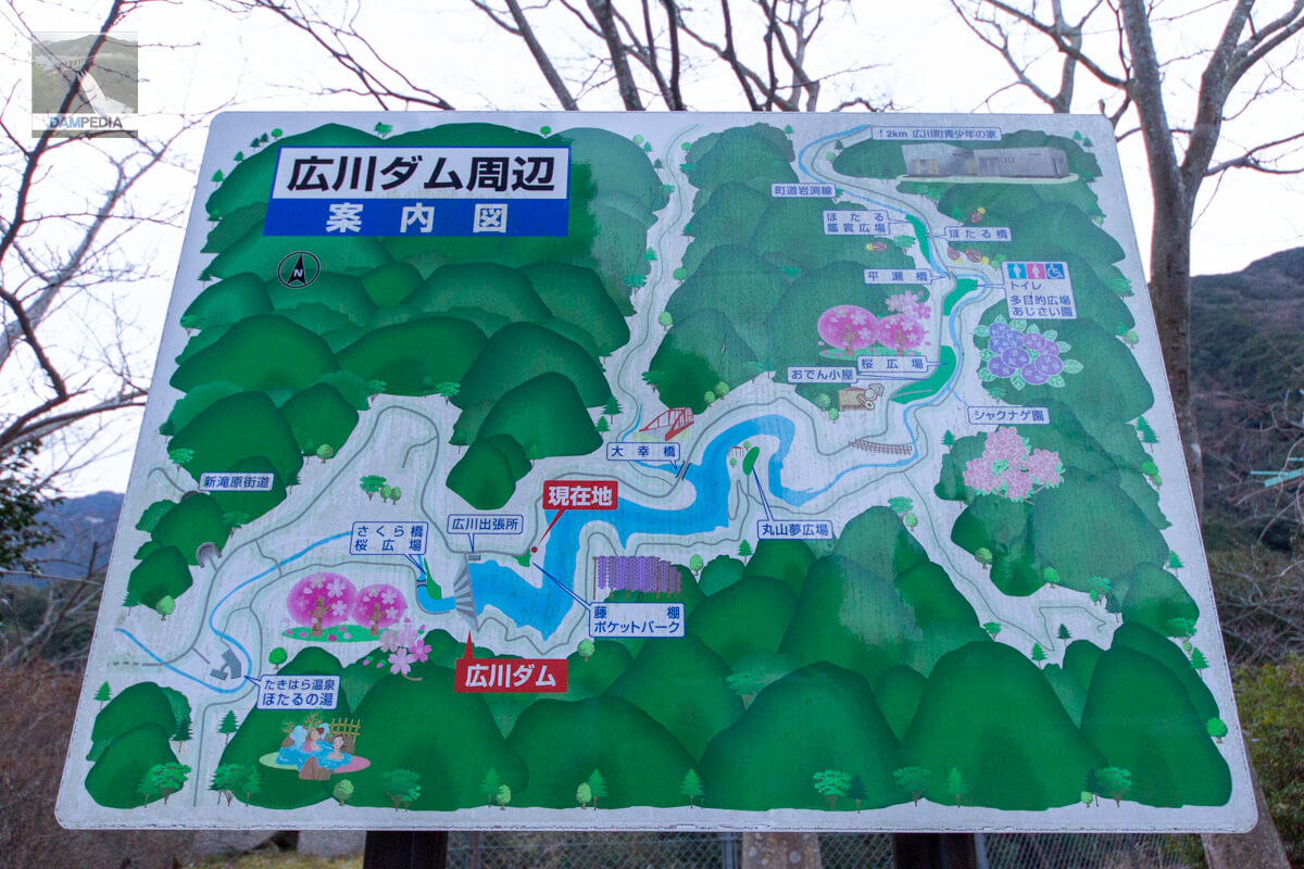
I will start from the right bank. The information map on the right bank shows illustrations of cherry blossoms downstream and upstream, and as the names "Sakura Bridge" and "Sakura Plaza" indicate, the area around the Hirogawa Dam is a popular spot for cherry blossom viewing.
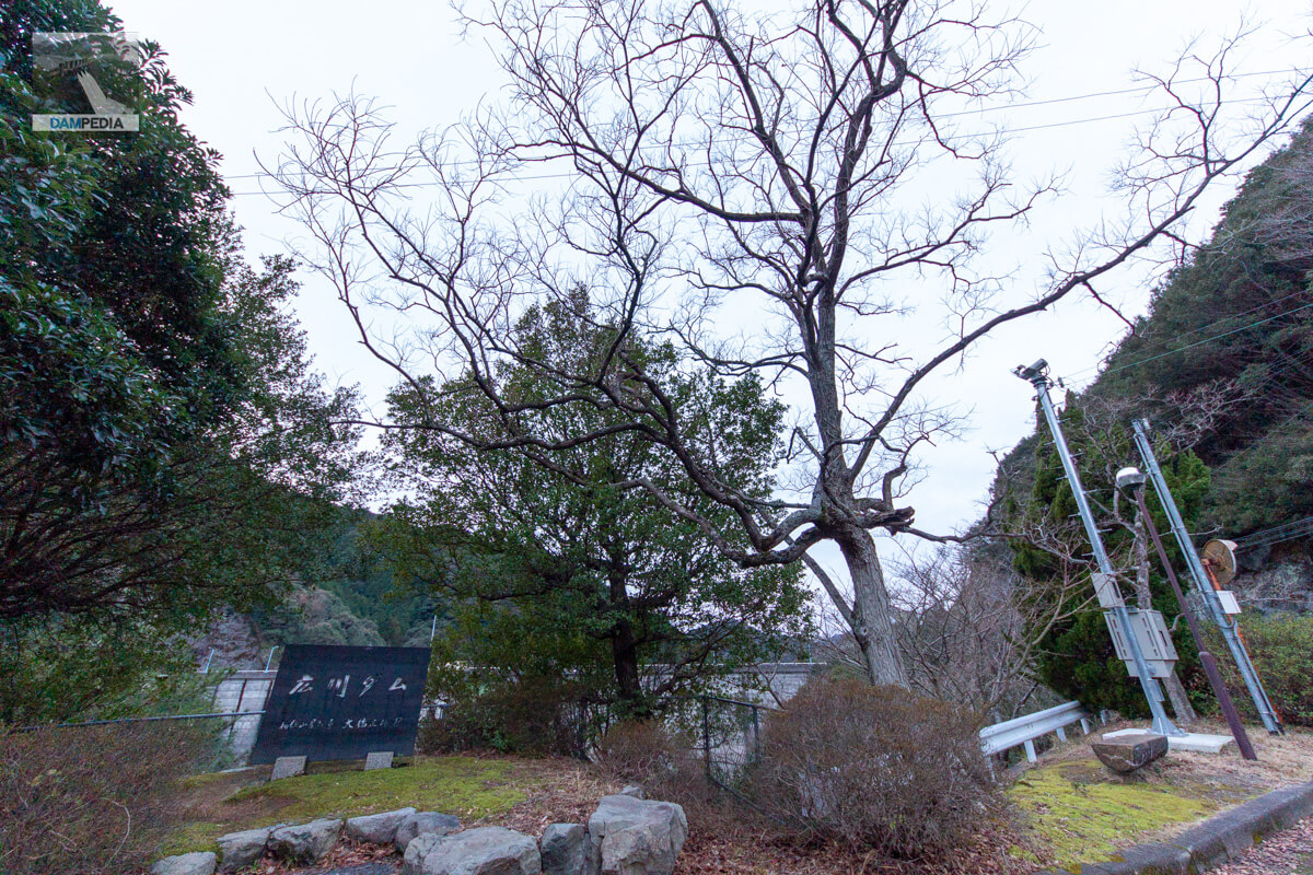
The stone monument on the right bank was written by Masao Ohashi, then governor of Wakayama Prefecture. Ohashi died suddenly in office the following year.
From the control center, there is a staircase leading to the reservoir, and mooring facilities are located at the end of the staircase. There is a semi-circular intake facility near the center of the embankment and another on the left bank across the crest gate. The semi-circular one is for unspecified water use, and I think the one at the back is the outlet of the flood discharge for regular use.
The red color on the pillars and railings is unusual for a dam management office. (Although it is called a management office, it also serves as the Hirogawa Sub-branch of the Construction Department of the Arita Promotion Bureau.)
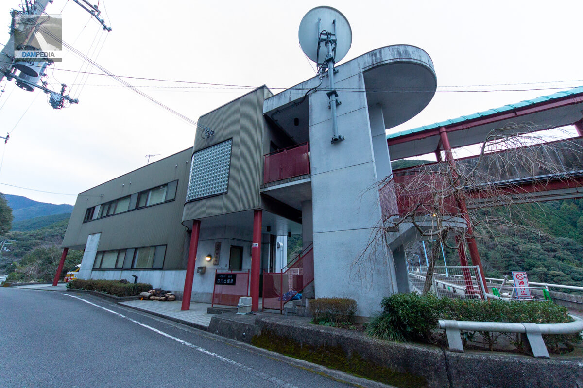
On the right is probably the old administration office, with the second floor connected by a walkway so that visitors can go under it to reach the top of the building. Also at this time, it seems that the crest gate was undergoing renovation.

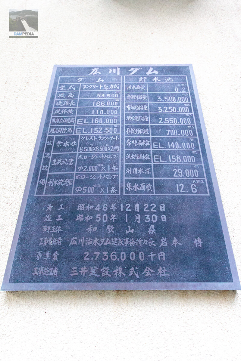
Spec nameplate on the wall of the former administration office. It is handwritten and very tasteful.
To the top
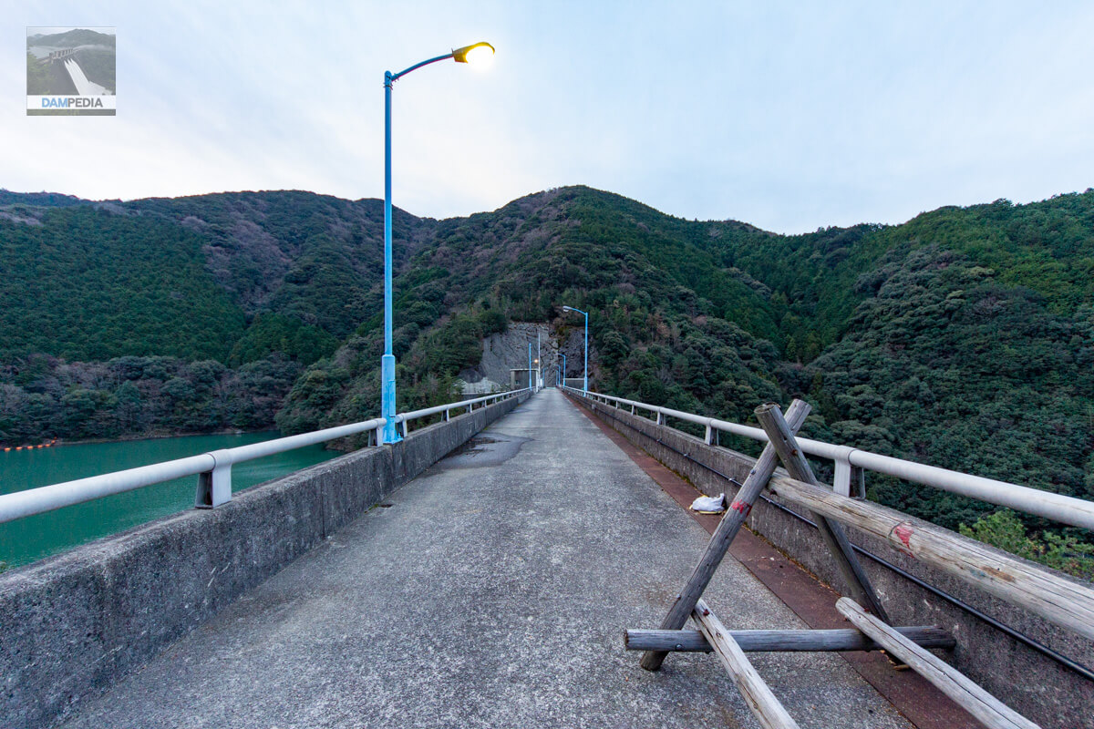
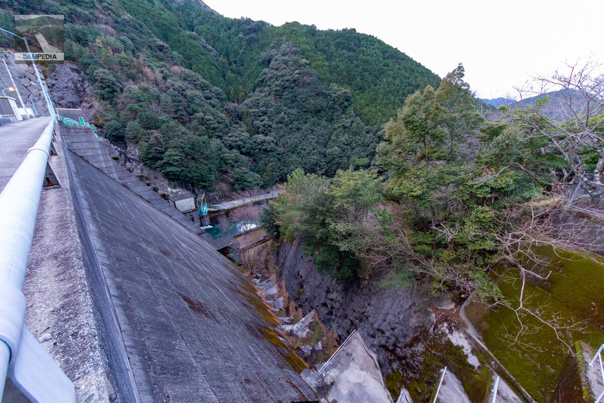
Originally, the top end of the Hirogawa Dam was supposed to be passable on foot, but at this time, perhaps due to renovation work on the crest gate, a single-pipe barricade prevented entry. Although the "No Entry" signboard reads "Vehicles," the way it was placed clearly indicates that people are not allowed to enter the dam, so I gave up.
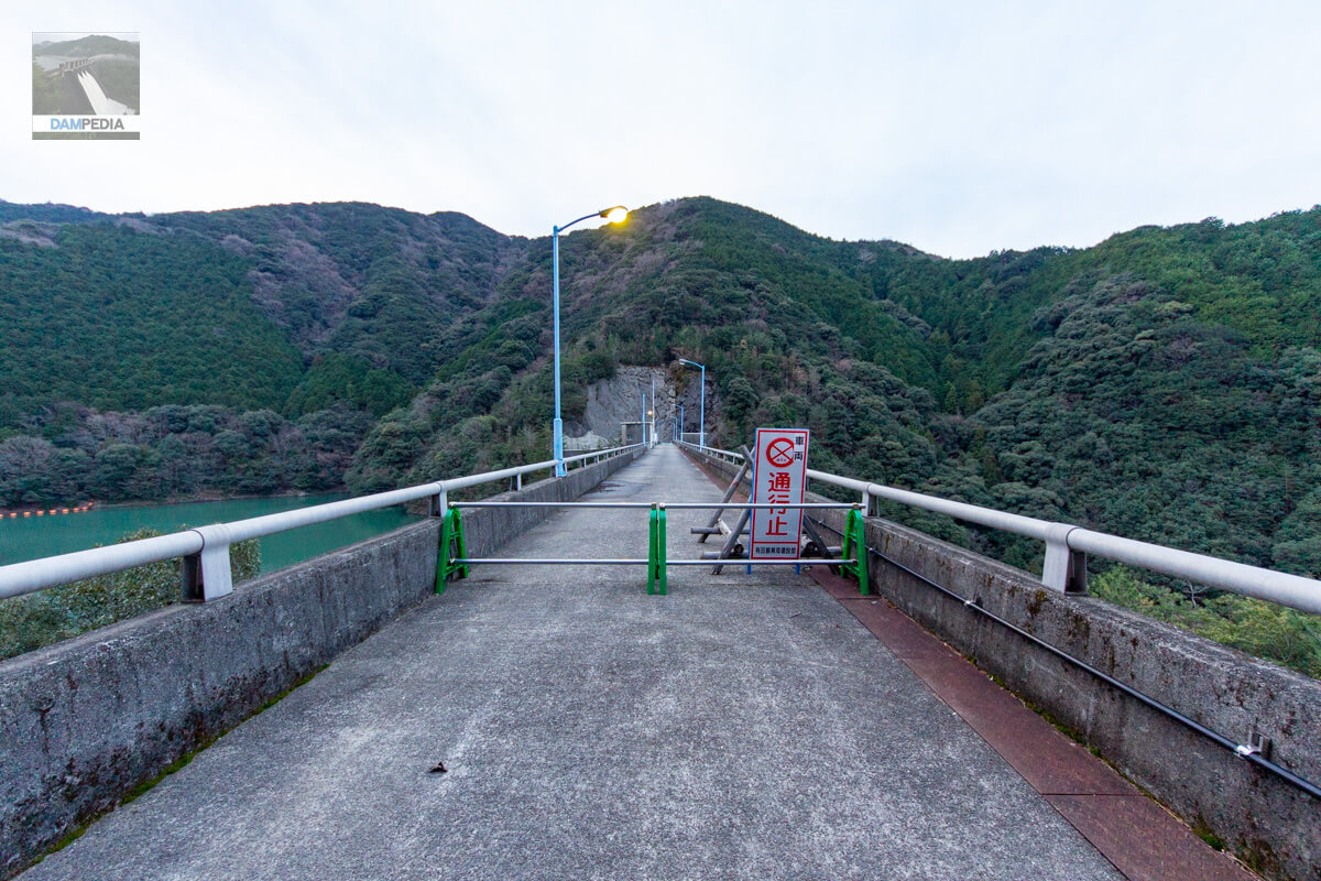
You can see the top edge with your finger in your mouth from the single pipe barricade. I'll have to revisit this one.
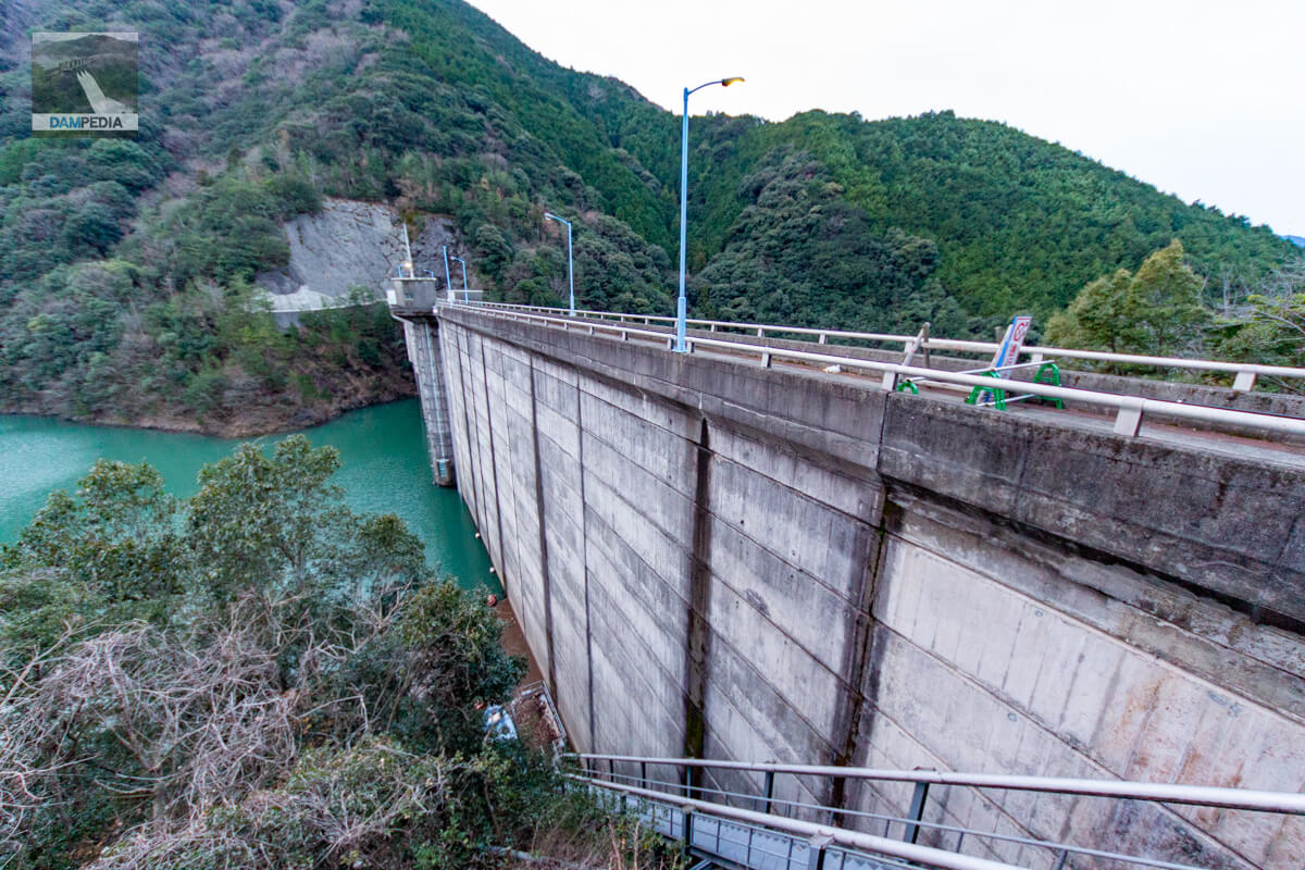
The reservoir is seen from almost the right bank, even though it is the top end. The semi-circular intake facility can be seen near the center of the dike. However, it is difficult to see the whole picture from here.
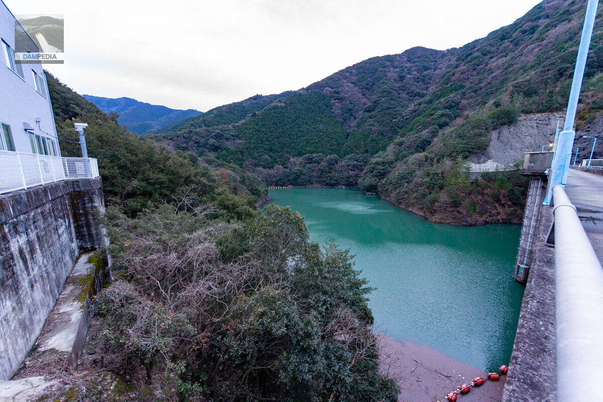
There is a landslide downstream on the right bank, and footings have been constructed between the embankments.
Downstream side of levee
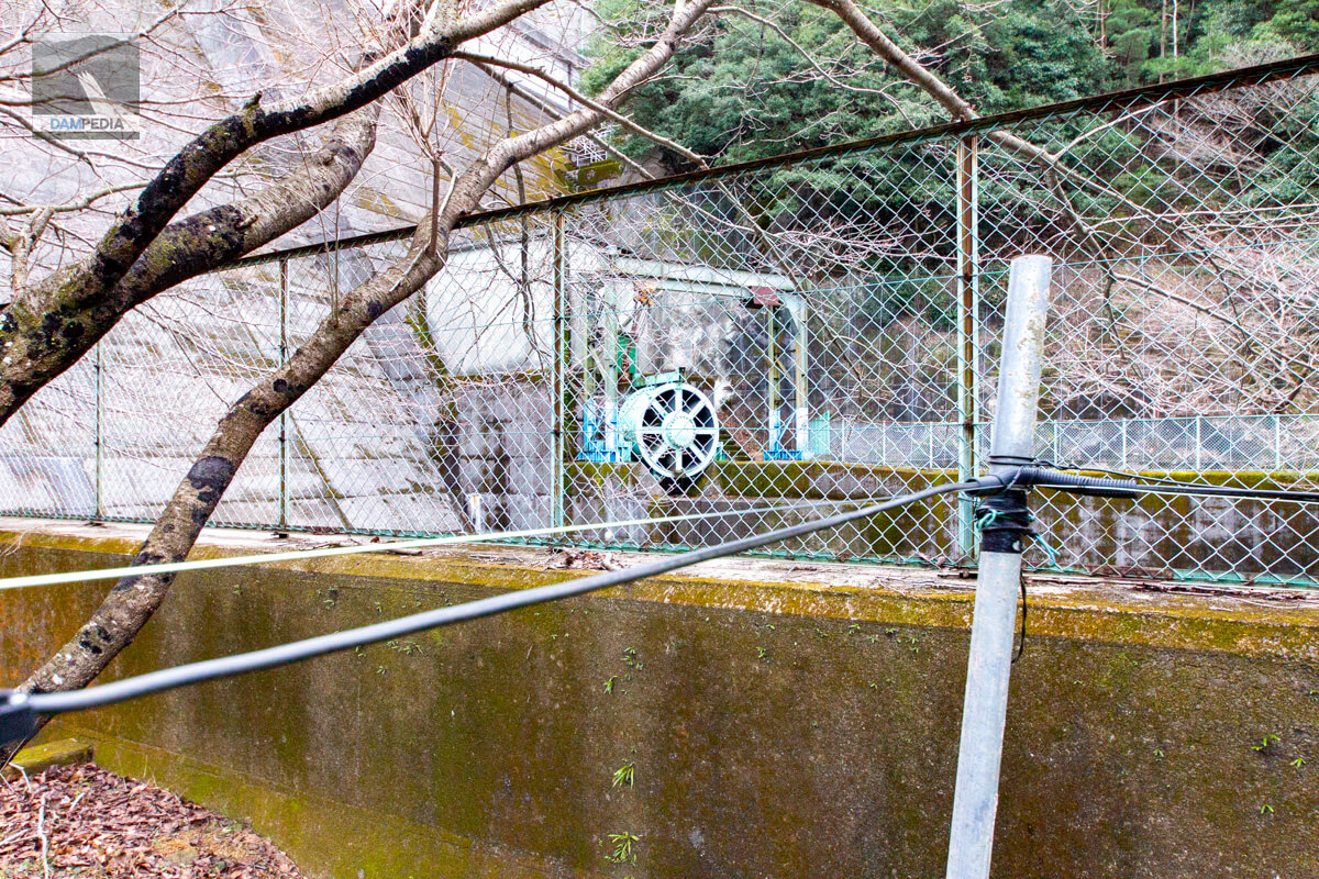
I moved downstream. The left bank was blocked by a fence, preventing us from entering the area.
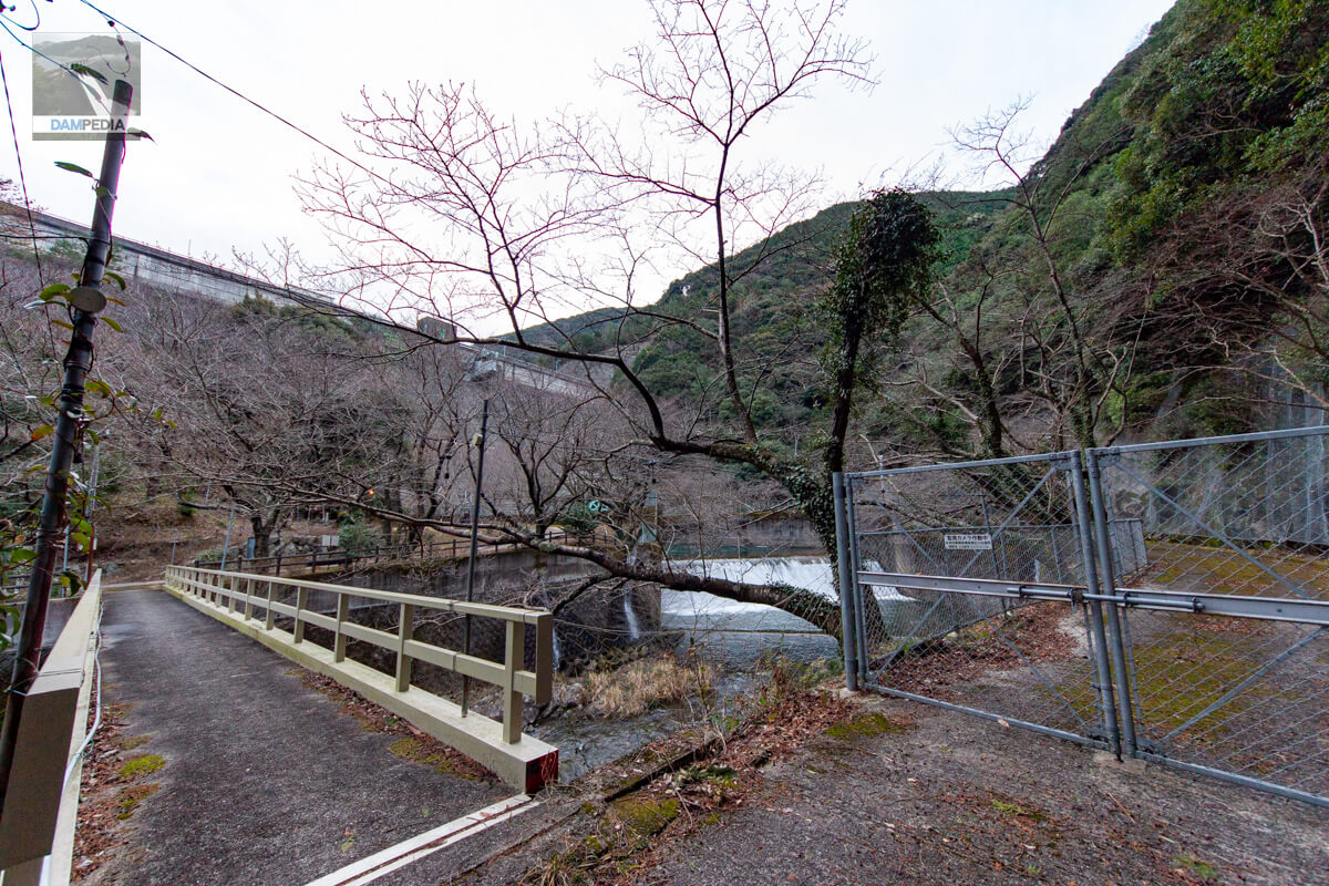
Since the water is discharged from the hollow jet valve (Φ500) for unspecified water use, you can see the flow overflowing nicely from the sub-dam as the dam is full of water. It is midwinter, so the atmosphere is cold, but I am sure it will be a wonderful sight during the cherry blossom season.
I crossed the bridge and came to the right bank side. On the right bank, there was a small shrine and a stone monument with the name "Mizuyama Myojin" written on it. The name suggests that it is a water god.
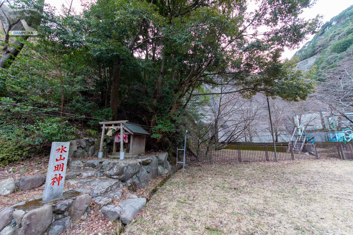
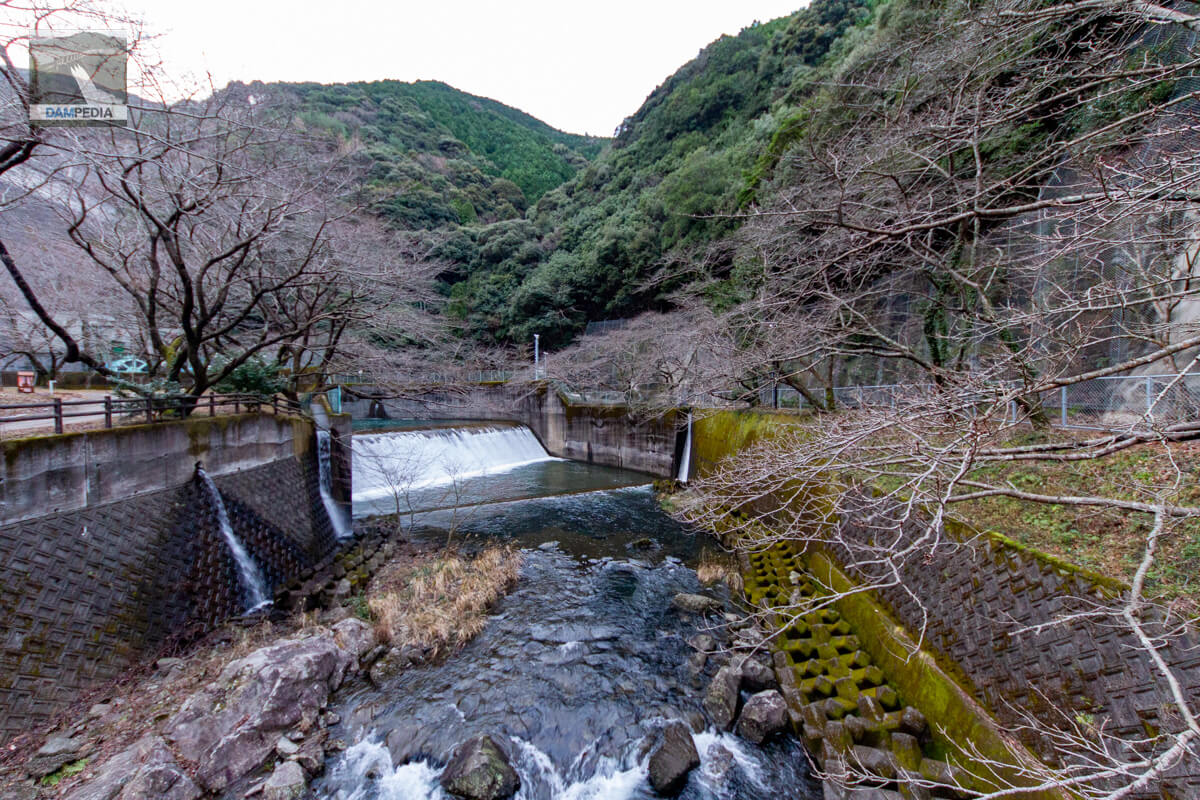
Although the fence prevents us from going any deeper, there is a facility for unspecified water use just downstream on the right bank side. The unspecified water from the Hirogawa Dam is mainly used during times of drought, but it seems to be discharged from this area into a flow-reducing structure to maintain the river.
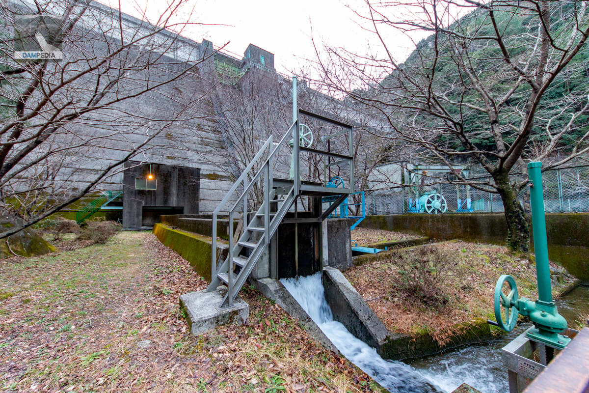
A hollow jet valve sits on the left bank as a permanent flood discharge.
By the way, that valve is the legendary DVD "The Dam Discharge" the valve appears in the "The Legend of the Valve" video. I won't bore you with the details, but that image itself is a legend.
![The Dam Discharge [ (Hobby/Education) ].](https://thumbnail.image.rakuten.co.jp/@0_mall/book/cabinet/0532/4532318400532.jpg?_ex=128x128)
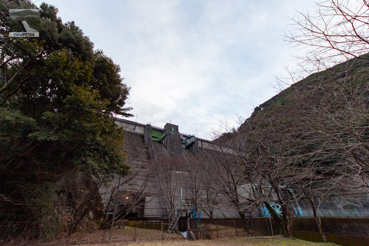
Looking up the embankment from downstream with a slight pull. You can see that the crest gate on the left bank is being cured for repair. Usually, one would think that the embankment would be hidden from view due to the many cherry trees planted here. But I am sure that this will be a beautiful sight in spring.
The Hirogawa Dam plays a quiet role in flood control to protect the towns of Hirogawa and Yuasa, and I would like to revisit the dam during the cherry blossom season.
Hirogawa Dam Specifications
| Location | Shimotsugi, Hirogawa-cho, Arita-gun, Wakayama |
| River Name | Hirogawa River System Hirogawa |
| Objective | F (flood control, agricultural disaster prevention) N (unspecified water, water for river maintenance) |
| Model | G(gravity-fed concrete dam) |
| Bank height | 53.5m |
| Bank length | 166m |
| Dam volume | 110,000 m3 |
| Watershed Area | 12.6 km2 |
| Reservoir area | 20 ha |
| Total storage capacity | 3,500,000 m3 |
| Effective water storage capacity | 3,250,000 m3 |
| Dam operator | Wakayama prefecture (Kinki area) |
| Main body constructor | Mitsui Construction Co. |
| Year of launch | 1971 |
| Year Completed | 1975. |
| Name of Dam Lake | - |
Other facilities/observations
There is space to park a few cars near the management office. I remember that the road is quite narrow on the downstream side, but if you are worried, it may be better to park at the parking lot of Takihara Hot Spring Hotaru no Yu and walk to the site. After the tour, take a bath to heal your tired body.
| Parking lot | △ |
| Toilet | ○ |
| Park | × |
| PR Exhibition Hall | × |
| Fishing | ○? |
| Viewing platform | × |
Map around Hirogawa Dam
Weather around Hirogawa Dam
Accommodations that may be close to Hirogawa Dam


Comment