
Date of interview: Saturday, 10/12/2019
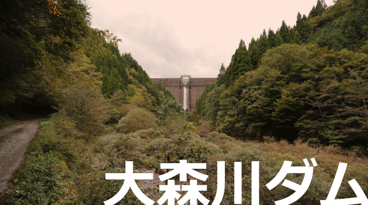
I came to Shikoku to participate in a tour of the Anauchi River Dam, and since I don't often come to Shikoku, I carefully planned my visit to the dam, the Omorigawa Dam.
However, the Omorigawa Dam is a dam that is difficult to conquer for those in the know. The reason for this is that it is a dam that cannot be reached without taking a very rough road through the forest.
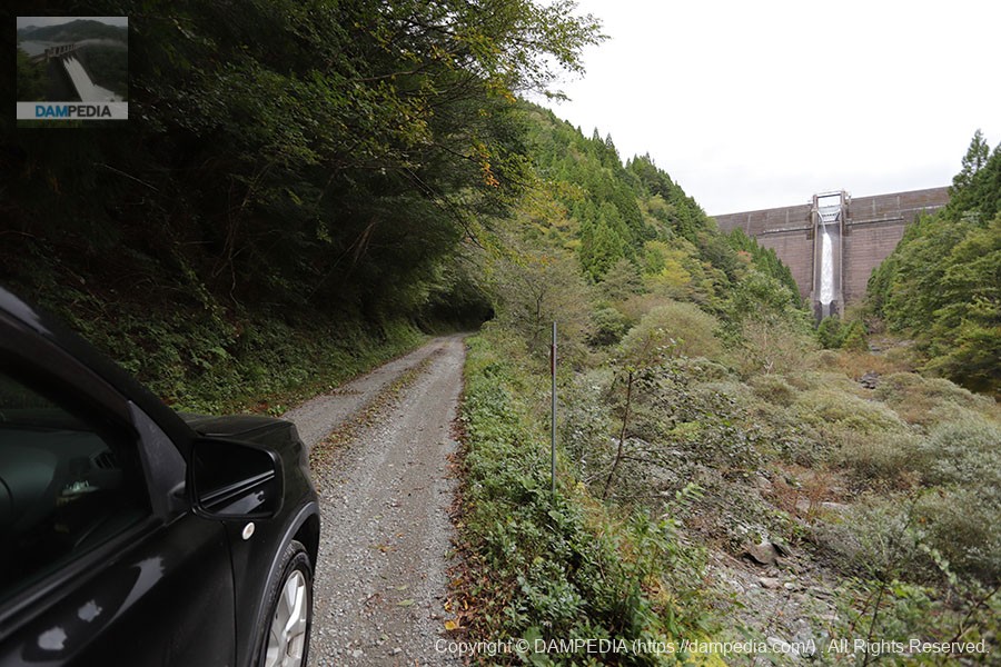
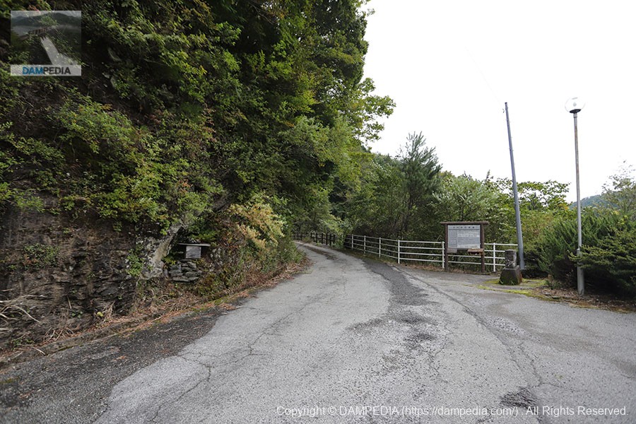
Okunamigawa Forest Road starting point
Moreover, the infamous Typhoon Hagibis of 2028, which inflicted tremendous damage to eastern Japan, was approaching Honshu.

We checked the weather forecast as well as the expected typhoon course and X-RAIN many times and expected that it would not be that rough. Furthermore, the roadside station633 BeautyAfter procuring food in the village of
Okunamigawa Forest Road
For the road surface condition of the forest road, please check here for the edited drive recorder video. We hope this will be helpful to those who are planning to visit in the future.
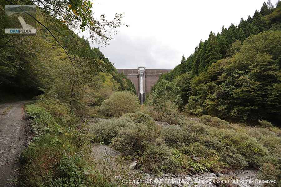
Arrived at the downstream side of the river after an hour of work.
It took us one hour to reach the 10 km distance from the starting point of the Okunamigawa forest road. The pace was slow, about 30 km/h at best. We drove more safely than usual because we were fighting a flat tire.
Looking directly downstream at the levee
Omorigawa Dam, built in the stunning valley of the Omori River, a tributary of the Yoshino River, is a dam dedicated to power generation by Shikoku Electric Power Co.
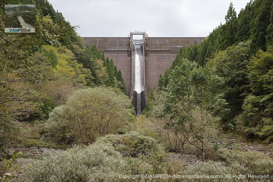
Zoom in a little more
The Omorigawa Dam, which sits at the end of a forest road that is inaccessible to the general public and is highly praised for its isolation, is deeply moving from the hardship of driving on a rough road for an hour.
Zoom in further
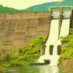
The white flowing water is discharged from a hose that was added as a retrofit to maintain the river. Unfortunately, it is not discharged from the crest.

View of Crest Gate
The crest gate is one radial gate 8.25m high by 9.20m wide.
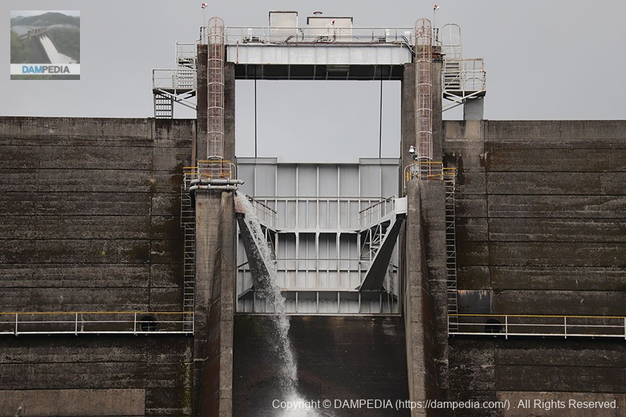
View of the tip of the jump platform
Compact jumps.

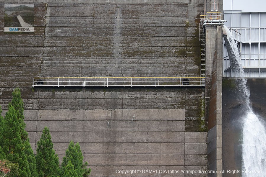
View of the left bank side ventilation passage for inspection
The Omorigawa Dam is a rare and precious hollow gravity concrete dam, one of only 13 in Japan, and the only other one in Shikoku, Kochi, is the Anauchi River Dam. The photo shows a hole for ventilation inside the hollow and a passageway for inspection.
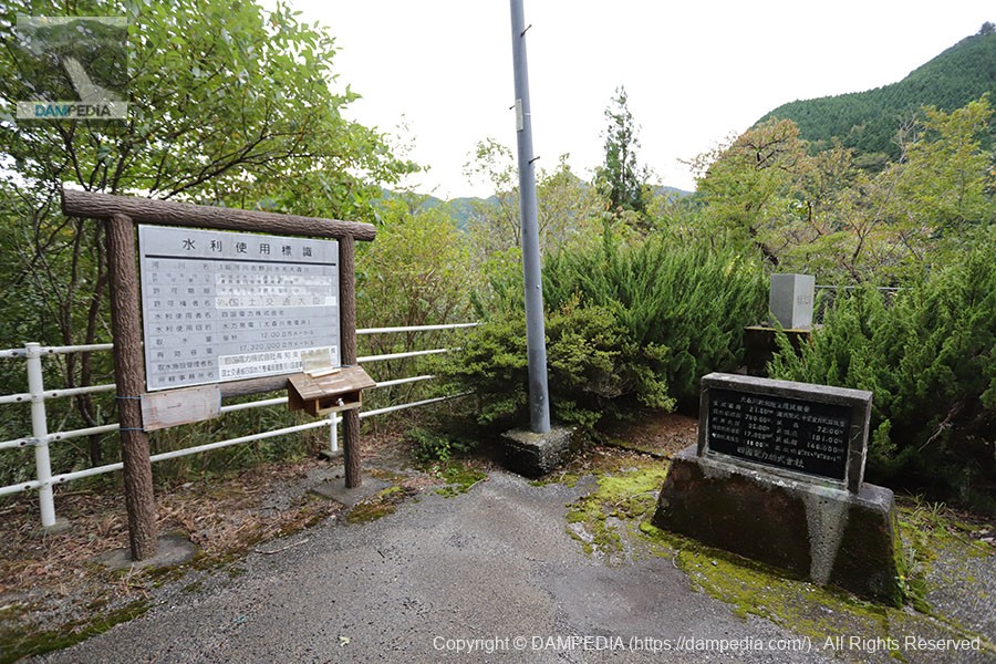
A corner of the left bank dam site
I came from the right bank to the left bank. It is too late now, but I should have looked at the right bank dam site properly. Well, I will probably go there again. Cenotaphs, water use signs, and stone monuments with various information are lined up.
View of the levee downstream from the left bank
The moss gives it a nice look. What is also unique is that there are no bucket curves, even though it is a hollow gravity concrete dam. It consists almost entirely of straight lines.
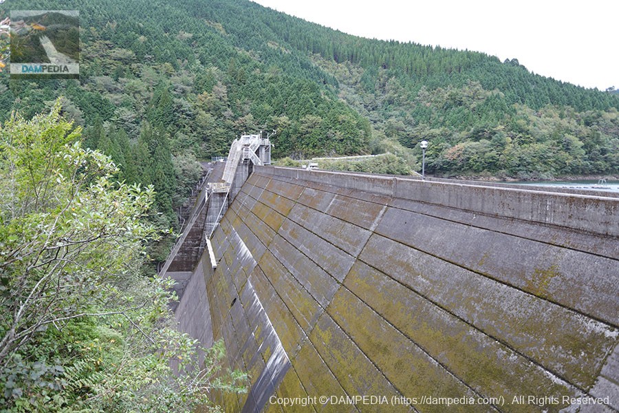
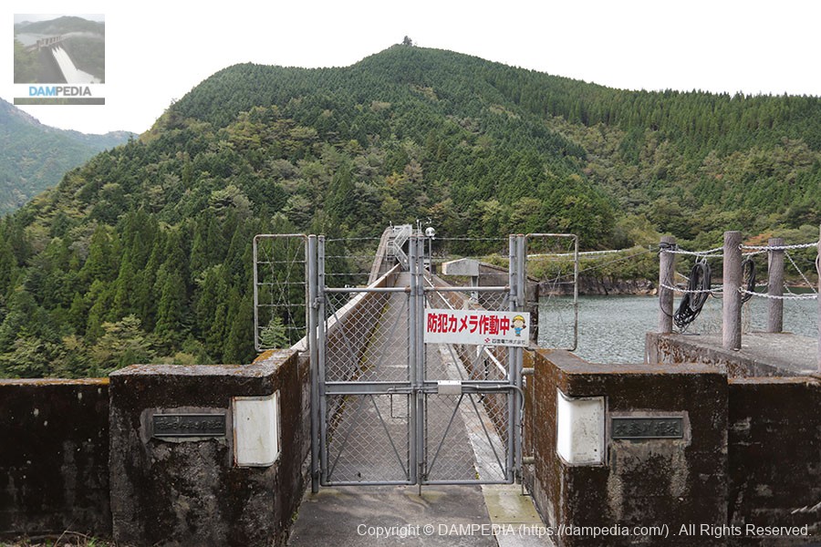
View of the top edge from the left bank
The top edge is off limits. Moreover, it is blocked by a double fence. We would love to have a tour including the inside of the hollow. The bottleneck would be the forest road...
Heading upstream on foot.
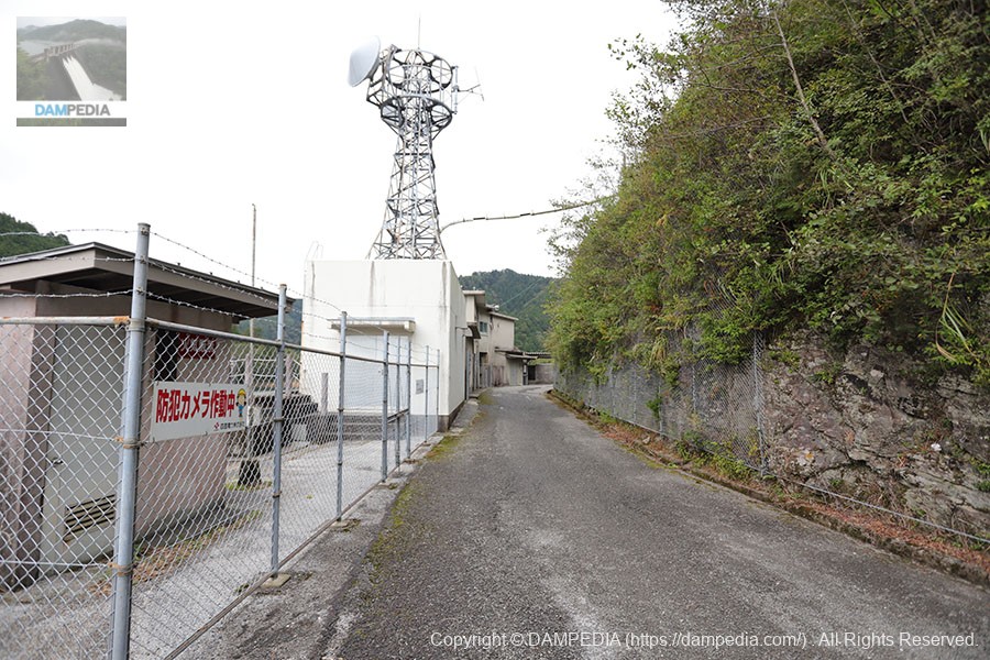
The river is now monitored unmanned, but in the past, of course, it was manned. The left bank is lined with buildings for management.
View of the dam lake from the left bank
Located deep in Kochi, the dammed lake is extremely quiet as there are no houses upstream from here. The only winds are somewhat strong due to typhoons.

Mysterious structure on the left bank
It appears to be a shaft for bringing in equipment to a power plant or other facility, but its identity is unknown.
Management office building
It must have been hard when you were packing here. Even now it's hard just to come here.

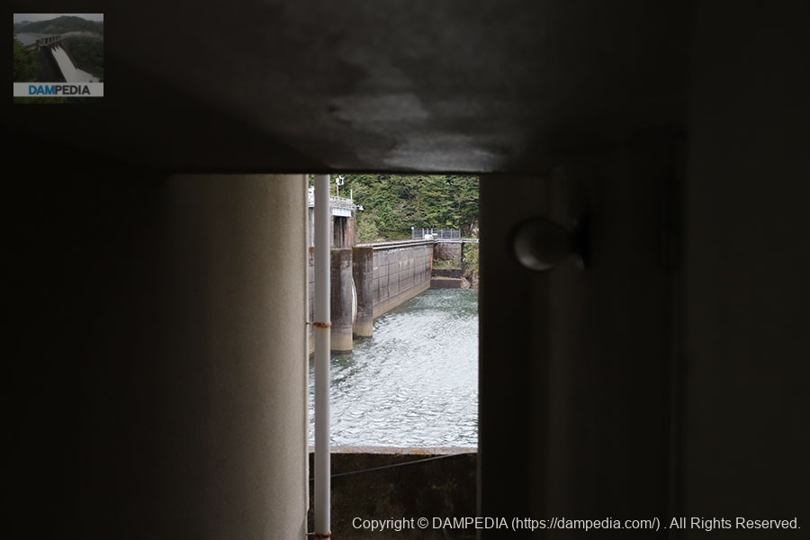
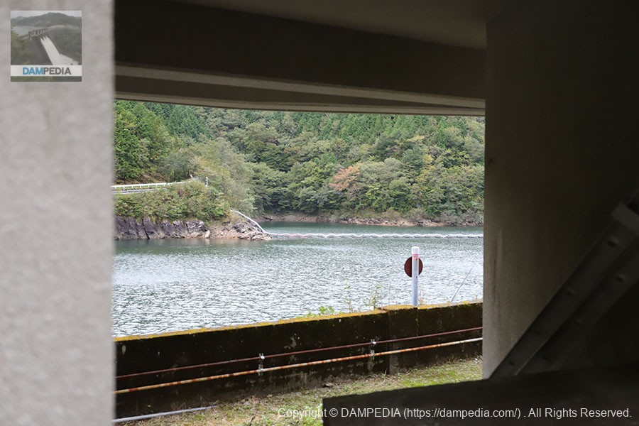
View of the embankment on the lake side of the dam through a gap in the building
Because of the buildings on the left bank, it is not possible to get a proper view of the embankment on the lake side of the dam. We can get a glimpse of it through a gap.
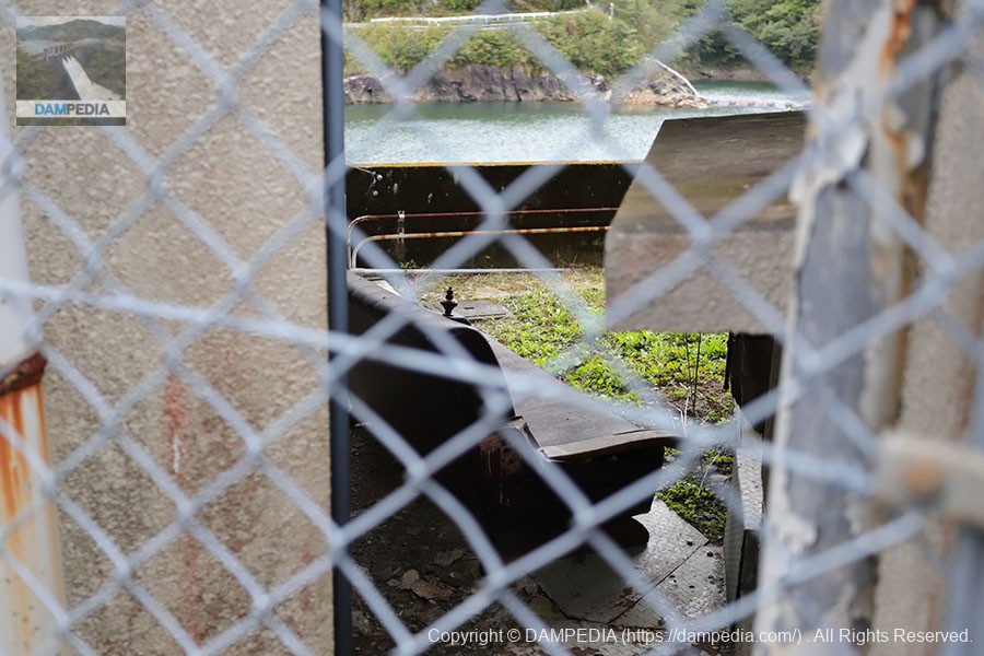
Yet another gap.
Is the first floor of the building a materials yard? A small space was spread out. The white line in the dam lake at the back is a hose extending from the water intake facility for river maintenance. It connects to the hose that was discharging water downstream.
sofa
A sofa that was abandoned. It may have been used in the administration office.
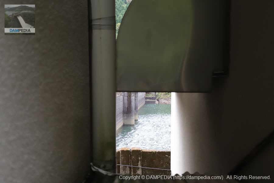
And furthermore, through the gap
Ventilation hood is in the way lol
Left bank dam site
The forest road is dirt, but the area near the dam site is asphalted all the way from the bridge downstream. As mentioned in the video, this is probably to prevent the ground from being scraped by vehicles that step on it because it is a hilly road.
We visited the Omorigawa Dam, which took us one hour each way from the starting point of the Okunan River Forest Road at a speed of less than 30 kilometers per hour. Although it is a dam that is difficult to approach, the excitement of reaching it is hard to be experienced at any other dam.
I can personally highly recommend this dam, but if you visit, be prepared.
Omorigawa Dam Specifications
| Location | Oaza Terakawa, Ino-cho, Agawa-gun, Kochi |
| River Name | Yoshino River System Omori River |
| Objective | P(Power generation) |
| Model | Hollow Gravity Concrete Dam |
| Bank height | 73.2m |
| Bank length | 191m |
| Dam volume | 146,000m3 |
| Watershed Area | 21.5 km2 |
| Reservoir area | 92ha |
| Total storage capacity | 19,120,000m3 |
| Effective water storage capacity | 17,320,000m3 |
| Dam operator | Shikoku Electric Power Co. |
| Main body constructor | set of staggered shelves |
| Year of launch | 1957 |
| Year Completed | 1959 |
| Name of Dam Lake | Omorigawa Reservoir |
Other facilities/observations
| Parking lot | △ |
| Toilet | × |
| Park | × |
| PR Exhibition Hall | × |
| Fishing | × |

Comment