
Date of interview: Sunday, 3/2/2014
After entering Tokushima Prefecture, the river along the national highway became the Nagawa River and moved downstream to the Ominozu Dam. The Ominozora Dam is an arch dam for power generation managed by Shikoku Electric Power Co.
Looking upstream from the left bank
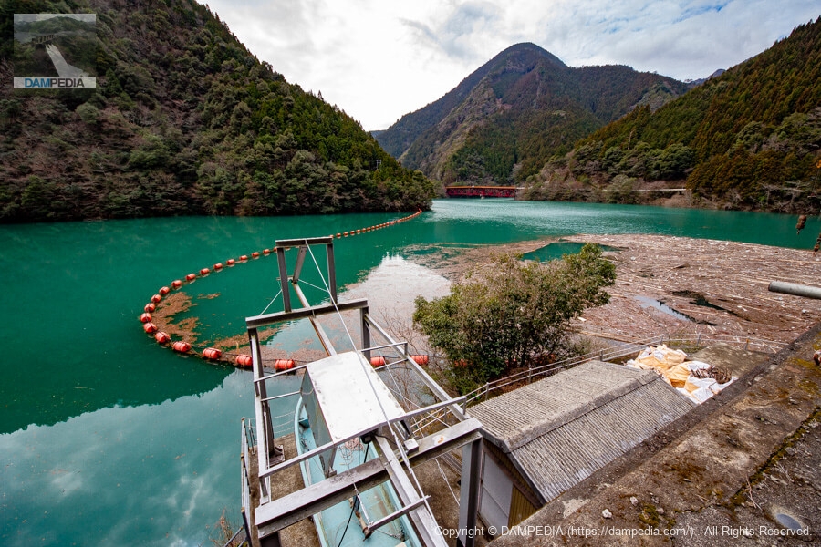
Since we are moving upstream on the Nagawa River, we will be approaching the Kominoso Dam from the reservoir side. The color of the reservoir is a deep green with some milky white. The reservoir is deep green with some milky white color, and the water is full of water. It is a good situation.

View of mooring facilities and reservoir
The drifts seem to have gathered here naturally rather than being grouped together. The red bridge and road in the background are Route 195.
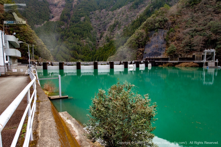
Looking further upstream from the left bank
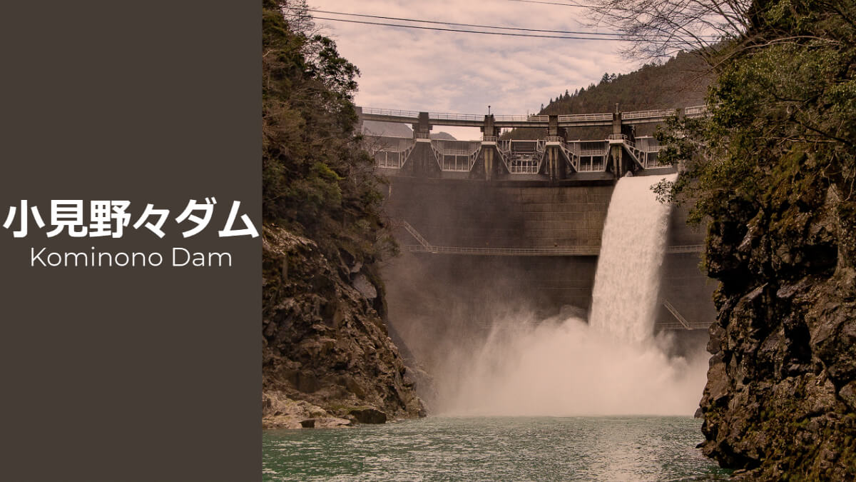
I was thrilled to see the Komino Dam for the first time. The third gate from the right bank has a breakwater plate attached to it. In addition, you can see a faint spray of water rising on the downstream side. Could this be?
Shikoku Electric Power Company, Incorporated Kominoso Dam Management Office
However, the biggest barrier blocked our way. I remember exchanging something with Kao-san, who accompanied us, about asking if we could go in through the intercom, but I don't remember whether we actually asked or not. However, the fact that there is no photo of us from behind the gate suggests that either we gave up or we were refused.

The power company's dam is strictly controlled, so there is no way around it. They cannot be held responsible for any problems that might occur. However, a few years later, a tour of the dam was held, and I was looking at the photos of the tour with my fingers crossed.
Structures downstream
On this day, we continued our approach from downstream. In the photo below, we can see some facilities on the right bank. It may be a facility related to a power plant.
This is a river maintenance flow outlet, and it appears that 150 kW of electricity is also being generated by utilizing it.
(Added 9/19/2021)

View of the downstream face of the dike
Finally, we catch a glimpse of the downstream face. We had reached the point where we could not get any closer, but even if we had released only one gate, we would not have been able to experience such an emotional experience.
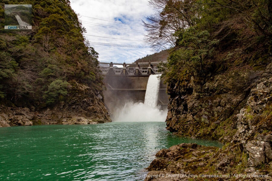
Most of the discharge was captured on film, but I also recorded it on video.
Although the Ominonoso Dam is a power generation-only dam, the Ominonoso Dam Rehabilitation Plan is being considered in order to secure a new flood control function. The plan is to remove sediment stored in the reservoir in order to secure flood control capacity, but even after this is done, the existing discharge facility is still too high to be used for flood control capacity, so they are considering installing the discharge facility at a lower location than the existing facility.
In addition, the relocation of the Kominoso Dam itself to downstream is said to be under consideration, and since it is not possible to move the dam like a house in tow, this means that a new dam will have to be built downstream of the Kominoso Dam. The relocation would result in the submergence of the Ominozawa Dam, and we will have to wait and see what will happen in the future.
So we are a little worried about the future of the Kominoso Dam.
Omino Dam Specifications
| Location | Kigashirasuke, Naga-cho, Naga-gun, Tokushima |
| River Name | Nagawa River System Nagawa River |
| Objective | P(Power generation) |
| Model | A(arch dam) |
| Bank height | 62.5m |
| Bank length | 151.8m |
| Dam volume | 40,000m3 |
| Watershed Area | 270.8 km2 (direct: 266.8 km2, indirect: 4 km2) |
| Reservoir area | 89ha |
| Total storage capacity | 16,750,000 m3 |
| Effective water storage capacity | 11,420,000 m3 |
| Dam operator | Shikoku Electric Power Co. |
| Main body constructor | Taisei Corporation |
| Year of launch | 1965. |
| Year Completed | 1968. |
| Name of Dam Lake | - |
Other Equipment/Specifications
| Parking lot | × |
| Toilet | × |
| Park | × |
| PR Exhibition Hall | × |
| Fishing | ? |
Map of the area around the Omino Dam
Weather around Omino Dam
Accommodations that may be close to Komino Dam
Comment