R (Rock-fill dam)

Dam in Okinawa Prefecture

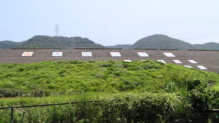
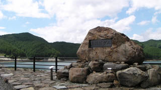
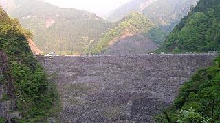
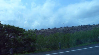
3340-Kannawaki Dam

As the name suggests, the Hanna Waki Dam is located on the side of the Hanna Dam. I was actually aiming for the main body of the Hanna Dam, but when I noticed it, I saw the side dam.... I know that no one will be satisfied if I upload such a picture, but I wanted to upload it as a proof that I saw it.... / rockfill dam / 37m
Nagano Prefecture Dam

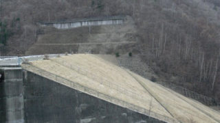
1030-Narai Dam

This Nagano Prefecture-owned multi-purpose dam is located near Naraijuku on the Kiso Road in Shinshu. Until now, visitors from Nagoya had to exit at the Nakatsugawa Interchange on the Chuo Expressway and drive north on Route 19 or exit at the Shiojiri Interchange and drive south, but with the opening of the Gonpei Tunnel, it is now possible to exit at the Ina Interchange. / Rockfill dam / 60m
Dam in Aichi Prefecture

1237-Ohara Adjustment Pond

It is located between the Mikkaichi Interchange and Toyokawa Interchange on the Tomei Expressway, so even those who are not interested in dams will probably think, "Oh, that's it," if they have ever driven through the expressway. That is the Ohara Adjustment Pond. On some maps, it is referred to as the Ohara Dam. The Ohara Regulating Pond serves as a regulating reservoir for the Toyokawa River water supply. / Rockfill dam / 47.9m
Niigata Prefecture Dam

0769-cassadam/kassadamu

We are pleased to participate in the "4th Dam Web Ring Kassa Dam Off-line Meeting" and this event was made possible by the cooperation of Denpatsu Kaihatsu (hereinafter referred to as Denpatsu). So, the Kassa Dam is accessed from the road at the back of the Mitsumata area parking lot of the Kagura Ski Resort. / Rockfill dam / 90m
Niigata Prefecture Dam

0773-Nii Dam

The lower dam, where pumped-storage power is generated between the upper dam, Kassa Dam, and the Nii Dam, is the Nii Dam. If you are coming from Gunma, drive north on the Mikuni Kaido road for a while after entering Niigata Prefecture, and you will see a sign on your right hand side. This is a great area for a drive, so please stop by. / Rockfill dam / 87m
Gunma Dam

0623-Naramata Dam

When that huge dike covers your field of vision, you are already in a world of amazement. How could such a man-made structure exist so deep in the mountains! Incidentally, the Tokuyama Dam was the largest embankment in Japan before it was completed. It is now the second largest, but it is so huge that it doesn't matter anymore. Compared to the Tokuyama Dam, where you cannot go directly under the embankment, the Naramata Dam is a more friendly dam. / Rockfill dam / 158m
Shizuoka Prefecture Dam

1175-Miyakoda River Dam/Miyakoda River Dam

This dam was guided by Mr. Abebe. I remember it was unusually hot in July. / Rockfill / 55m
Dam in Shiga Prefecture

1362-Usogawa Dam / Shiga Prefecture

Uzogawa Dam is located among the "Koto Sanzan" (three mountains in the Koto area): Ryueizan "Seimyoji Temple," Shobozan "Kongorinji Temple," and Shakayama "Hyakusaiji Temple," which are also famous for their autumn leaves. It may be a good idea to visit these temples when visiting the dam. Also, there are many national treasures and important cultural assets in the Koto Sanzan. / Rock fill / 56m
Dam in Gifu Prefecture

1074-Obuchi disaster prevention reservoir/Kobuchi Bousai Tameike

The prime minister is "Obuchi," but the dam is "Kobuchi. Moreover, on the map, it is called "Obuchi Dam," but in the dam handbook, it is called "Obuchi Disaster Prevention Reservoir. Incidentally, there is a dam called "Koizumi Dam" in Tajimi City, a neighbor of Kani City. And, to make matters tougher, there are two dams, No. 1 and No. 2. (This has nothing to do with this issue...) / Rockfill / 18.38m
Dam in Gifu Prefecture

1099-Oshirakawa Dam

The Ooshirakawa Dam is reached from the Mimogai Dam using Prefectural Road 451, which should be easy to find since it is the end of Prefectural Road 451. However, the prefectural road is narrow, so you need to be a little careful when passing through. The road is also closed in winter. The Ooshirakawa Hot Springs are located in front of the dam embankment and are crowded with many leisure travelers. The dam is located behind the hot spring. / Rockfill / 95m
Dam in Gifu Prefecture

1127-Agigawa Dam

By all means, drive around the dam lake as well as the embankment. There is a water park, putting golf course, cottages (I heard you can stay overnight), free tennis court (although no one uses it...), etc. It is very well-developed. I heard that you can eat Hida beef at the nearby Tono Farm. They also have a cave... / Rockfill / 101.5m
Dam in Gifu Prefecture

1095-Miboro Dam

I can think of no other rock-fill dams as good as this one, except for the Mimogai Dam and the Tedorigawa Dam. The dam side park on the downstream side of the dam is also magnificent, but I don't think you can really appreciate the enormity of the dam from there alone. The damside park located downstream of the dam is also magnificent, but you cannot get a sense of the enormity of the dam just from the damside park, so I highly recommend a visit to the embankment. / Rockfill / 131m
Dam in Gifu Prefecture

1116-Iwaya Dam / Gifu Prefecture

It was just the time of year for autumn foliage, and the fiery red colored leaves were impressive. Living in the Chubu area, "Asuke" comes to mind when I think of autumn foliage, but I also recommend the traffic jam-free Iwaya Dam. / Rockfill / 127.5m
Dam in Gifu Prefecture

1125-Kamiosu Dam/Kamiosu Dam

To reach Kamiosu Dam, get off at the Seki IC of the Tokai-Hokuriku Expressway, drive east on Route 248, and turn left at that intersection after getting off the elevated road. Go north on Prefectural Road No. 17, turn left at the Ohdoro intersection, and continue west on National Road No. 418 toward Kyu-Neo Village, famous for its Usuzumi cherry blossoms. Once in the former Nebo Village, turn right on the first Prefectural Road 255. Follow the road the rest of the way. / Rockfill / 98m
Dam in Gifu Prefecture

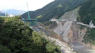
1130-Tokuyama Dam

Along with the Kawabegawa Dam in Kyushu, it is one of the dams whose construction is being questioned. When we visited the site, we found that the construction work was progressing surprisingly well, and we could even imagine what the embankment would look like after completion. When completed, it will have the highest total storage capacity in Japan, the third highest embankment height, the second largest embankment volume, and the third largest water area. / Rockfill / 161m
Nagano Prefecture Dam

1035-Miso River Dam

Since it is upstream of the Kiso River, it was named "Miso River" because it "has not yet become the Soso River," or "has not yet become the Kiso River. / Rockfill / 140m
Nagano Prefecture Dam

3321-Makio Dam

My home slope is nearby, and the dam is located at the foot of Mt. It is the source of the Aichi Waterworks and the water reservoir of Aichi. / Rockfill / 104.5m
Nagano Prefecture Dam

1026-Nanakura Dam

Can you be a man of character? An iron-clad rock-fill dam. Nanakura Dam is located further upstream from Omachi Dam. It is quite a large rockfill dam, and you can get a sense of its size by looking up at it from directly below the embankment. / Rockfill dam / 125m
Yamanashi Prefecture Dam

3106-Kami-hikawa Dam

Upper dam for pumped storage power generation. The effective drop-off between the lower dam and the upper dam is the largest in the world! Moreover, it is the dam with the best view of Mt. Kamihigawa Dam.
Shizuoka Prefecture Dam

1171-Misakubo Dam

Abandoned concession stands, dilapidated gates, falling rocks seen everywhere.... The dam is full of danger. The toilets are also in a state of neglect. This desolate atmosphere is a nice touch (heart)! Lonely and abandoned dam! / Rockfill / 105.0m
Copied title and URL