
Location: 2, Wakamiya-cho, Seto-shi, Seto-shi, Aichi / Seto-shi, Aichi
Date of interview: 2011/04/21 (Thursday)
I came here after hearing that there is an "abandoned dam" in Seto City that has lost its function as a dam.
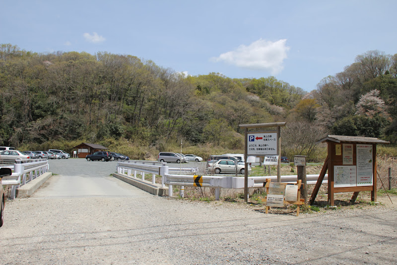
Parking lot of "Forest on the sea".
The location is "Kaijo-no-Mori", which is probably familiar to those of you of the generation who know about the Aichi Expo (Aichi, Japan). It is not "Kaijo-no-Mori. It is located near the "Kaijo-no-Mori" (meaning "the forest on the sea"). It is located near the Aichi Expo site. Kaisho no Mori was originally planned to be the site of the Expo, but due to opposition, it was decided to preserve it even after the Expo closed.
No parking beyond this point.
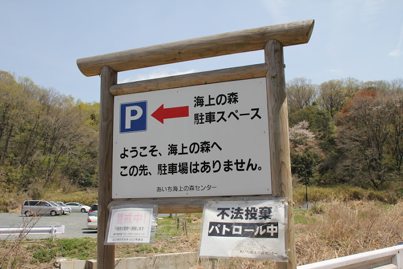
Since there is no parking lot in the marine forest itself, a parking lot was built at this somewhat remote location. Visitors park their cars here and walk to the abandoned dam.
Public restrooms in the Marine Forest parking lot

Restrooms are located in the parking lot. If you are going to the Marine Forest, you will be walking a considerable distance, so be sure to use the restroom beforehand.
The Road to the Abandoned Dam
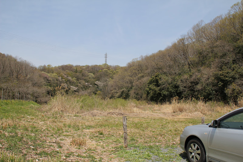
However, to get to the abandoned dam, you will have to go in a completely different direction from the forest above the sea. And there is no road anymore. You have to go through the bushes.
Road to Yamaguchi Dam
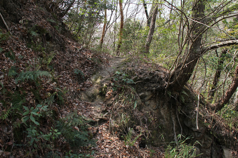
We push through the bushes and go through a little satoyama.
Road to Yamaguchi Dam
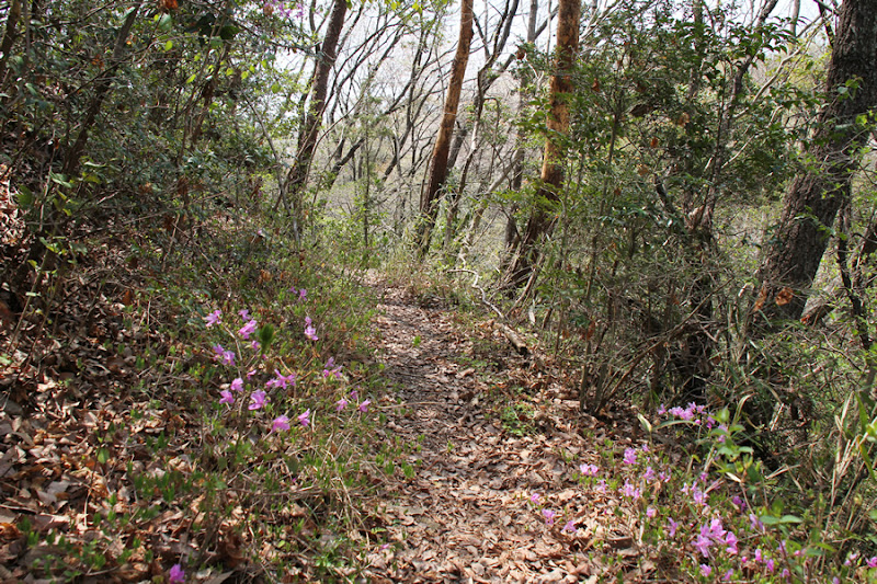
Incidentally, we made a wrong turn in the bushes and had to retreat once. Once through the bushes, the rest of the way is through satoyama like a monster trail.
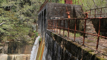
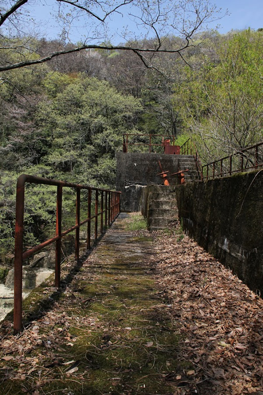
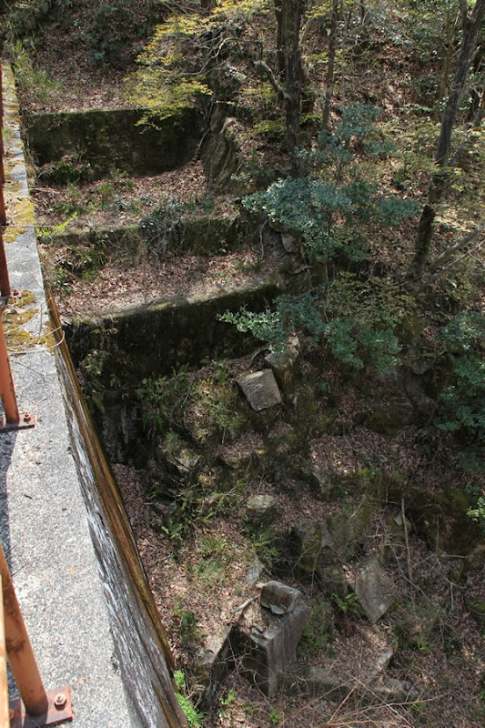
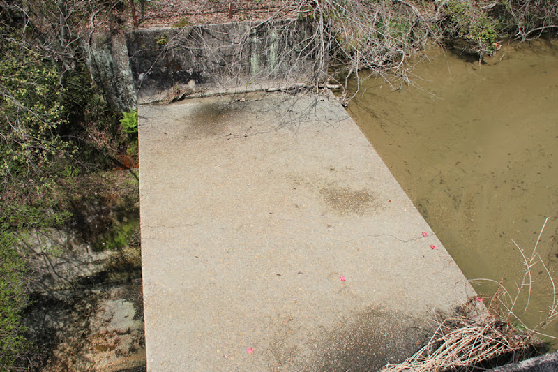
View of the levee downstream from the left bank
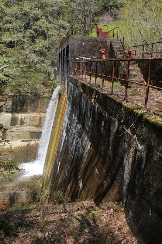
I managed to get there. The name of the dam, which used to function as a dam, is "Yamaguchi Dam. It is also called "Yamaguchi River Regulating Pond. The smooth downstream surface is rather reminiscent of an erosion control dam. The moss-covered embankment and rusty parapet create a nice atmosphere. In contrast to the time-stopped water, the water flowing white and white from the place where it once functioned as a gate.
View of the downstream gate pier from the left bank
The rough concrete is not bad. It is more like blending in with nature. There are some enthusiasts who do not like the Yamaguchi Dam, which has finished its role as a dam, but in fact, it originally served as an "erosion control dam" as well as a dam for "flood control," "irrigation," and "water supply. And now it exists as an "erosion control dam.
View of the top edge from the left bank
I admire this scene for a while.
View of the levee and reduction works on the downstream side from the left bank
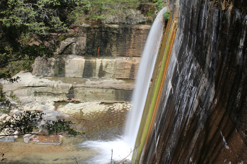
Play with ND filters. When the water is flowing, I just want to do it. The scaly water slapping against the mossy bank and the white thread-like discharge (or perhaps "overflow" would be more accurate, since it is not an intentional discharge) looks really beautiful.
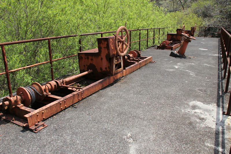
View of the manual valve at the top end
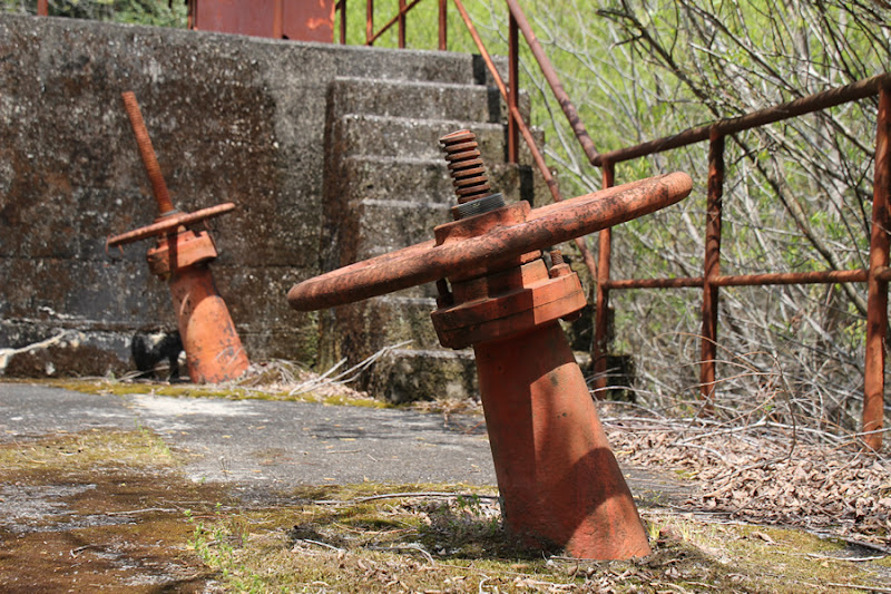
We return our eyes to the top of the dam. The slanted manual valve looks strange, but I wonder if it was originally like this or if it was done on purpose when the dam finished its role as a flood control/irrigation dam.
View downstream from the top
The downstream is quite nice as well.
Footing on left bank from top edge? View from the top
I would have liked to see the dike from the downstream side, but it seemed to have quite a few steps, so I decided not to push it and gave up.
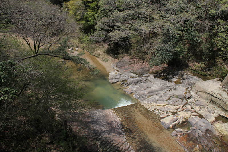
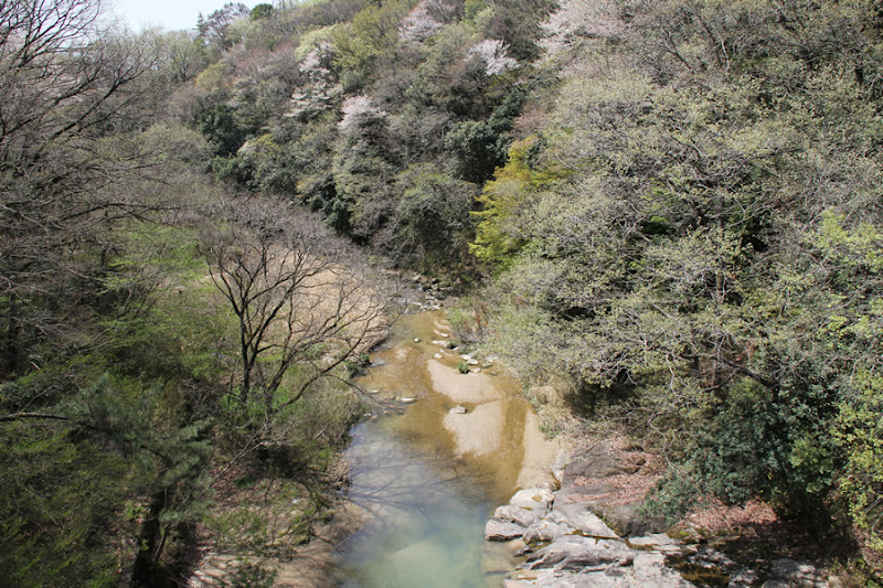
View of the dam lake from the top

At present, it only functions as an erosion control dam, so I am not sure if we can really call it a dammed lake, but at any rate, it used to be full of water here.
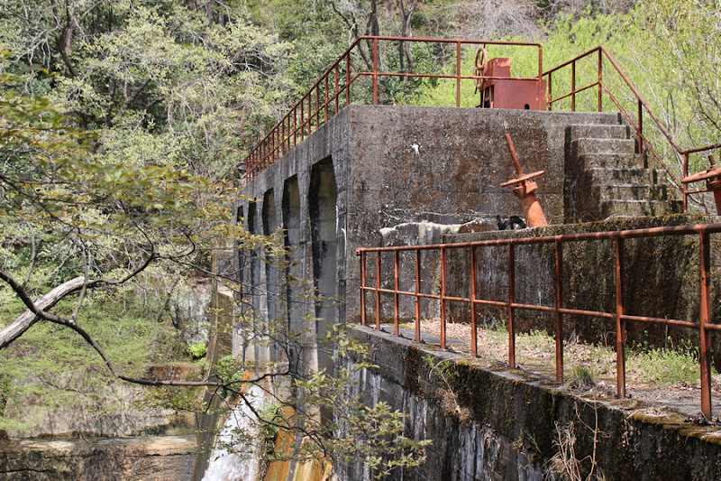
View of the gate control unit at the top end

These gate controls are like the rudder of a ship. Having fulfilled their role, how long can they stay like this?
View of the reduction work from the top edge
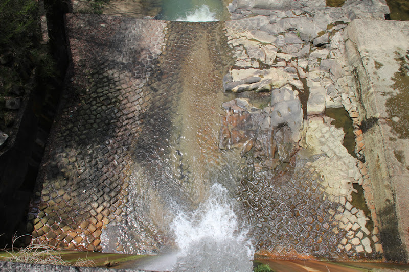
The scale-like slapping of the water is impressive no matter how many times you see it. It looks more and more like scales when wet with water.
View downstream from the top
Seto is a bedroom town of Nagoya City, but it is a nice place with a lot of nature. However, the bushes seem to be keeping people away from this area.
View of the discharge from the top
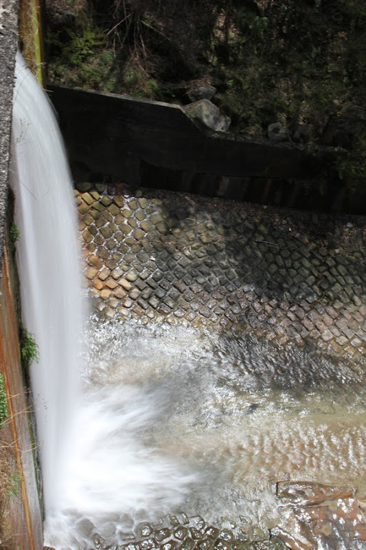
I'll play with ND filters again.
In hindsight, I should have taken a video as well.
Overflow flood discharge on the right bank? Overflow flood discharge on the right bank?
Somehow, it looks like this is the only place that has been newly remodeled, but what do you think?
View of the dam lake
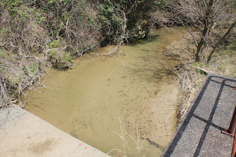
Since it now functions only as an erosion control dam, I am not sure if it can really be called a dam lake.
View of the gate control unit at the top end
I look around from the top edge, avoiding the occasional bee.
View of the gate through a gap in the gate winder
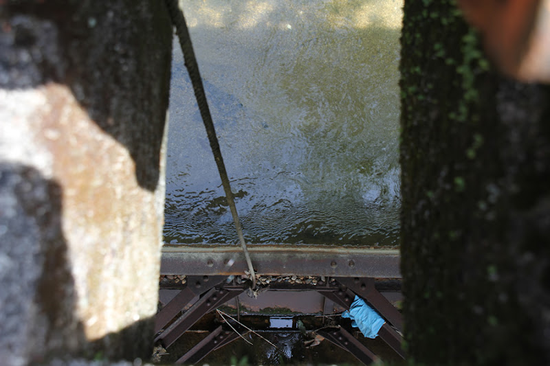
There was a gap in the gate winder and we looked down through it. The steel gate, which should have finished its role, seemed to be holding the water firmly in place.
View of the gate through a gap in the gate winder

This is the part of the gate that looked like it was discharging earlier.
View of the gate through a gap in the gate winder
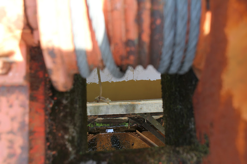
This one also seems to be leaking a little while stopped by the gate.
The Yamaguchi Dam is a dam that will continue to serve as an erosion control facility even after its role as a flood control and water utilization facility has been completed. Visiting the dam is at your own risk, but I am sure it is the perfect place to relax and think. If you have the chance, I highly recommend a visit.
Yamaguchi Dam (Yamaguchi River Regulating Pond) Specifications
| River Name | Yamaguchi River in the Shonai River system |
|---|---|
| Objective | Flood control, irrigation water, water supply |
| Model | gravity-fed concrete dam |
| Bank height | 17.1m |
| Bank length | 56.1m |
| Dam volume | -m3 |
| Watershed Area | 17.28km2 ( Direct: -km2 Indirect: -km2 ) |
| Reservoir area | 5.3 ha |
| Total storage capacity | 178,000m3 |
| Effective water storage capacity | 115,000m3 |
| Dam operator | Aichi prefecture (Chuubu area) |
| Main body constructor | - |
| Year of launch | 1933 |
| Year Completed | 1934. |
| Name of Dam Lake | Yamaguchi River Flood Control Basin |
Other facilities/observations
| Parking lot | ○ | Use the parking lot of the Maritime Forest. Restrooms are available. There is nothing more to say, but continue on through the bushes. The fishing is low on water, but is it possible to catch fish? |
|---|---|---|
| Toilet | ○ | |
| Park | × | |
| PR Exhibition Hall | × | |
| Fishing | ○? |
Comment
Atsushi Shimizu liked this on Facebook.
Sachiko Irie liked this on Facebook.