
Location: Uemura, Hakusan-cho, Tsu City, Mie Prefecture
Date of interview: Tuesday, May 17, 2011
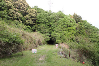
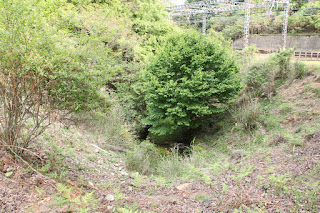
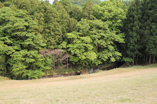
Down side of Soya Tunnel of former Kintetsu Osaka Line
Sodani Dam is an earth dam dedicated to irrigation water located in Tsu City, Mie Prefecture. However, the first thing this dam reminds me of is the "Kintetsu Osaka Line train collision accident" (commonly known as the Aoyama Tunnel accident) that occurred on October 25, 1971. Since I usually use Kintetsu for commuting, I was quite shocked when I learned about this accident.
The Kintetsu Osaka Line now runs on a new line, while the old Osaka Line was a single track. The accident occurred on that single line. I will not go into details about the accident, but you can see it at the respective links.
interpoint (interword separation) Kintetsu Osaka Line train collision (Wikipedia)
interpoint (interword separation) The Iron Road of Time Episode 9
And now, right in front of my eyes was the very scene of the accident. I could not believe that such a serious accident had occurred a few years before I was born.
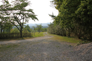
Abandoned site of the former Kintetsu Osaka Line
I can still hear the terrible screams when I think of the Otsu Express running out of control here at 120 km/h when the brakes stopped working.
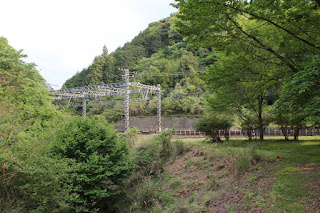
Current Kintetsu Osaka Line
And here is a view of the current Kintetsu Osaka Line, now fully double-tracked.
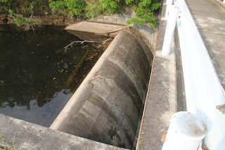
Looking downstream
The water flowing from the Sodani Dam's spillway seems to once flow here through a culvert under the abandoned rail line, but soon passes under the new line and flows downstream.
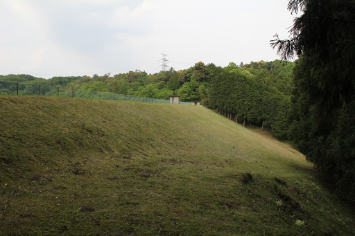
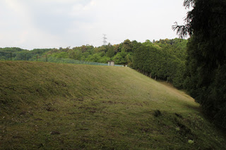
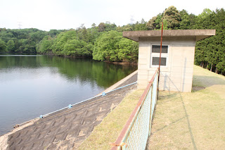
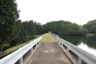
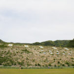
View of the levee downstream from the right bank
The embankment can be seen after a short walk from the Souya Tunnel. Although slightly depressed about the train accident, I was impressed by the clean condition of the embankment, which was well mowed.
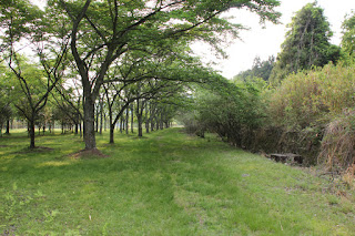
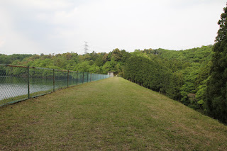
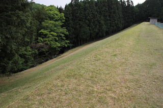
View of the top edge from the right bank
The embankment looks like a lawn. The top edge appears to have had a good amount of grass growing on it, and it appears that no one walks here, even though the grass is mowed well.
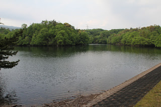
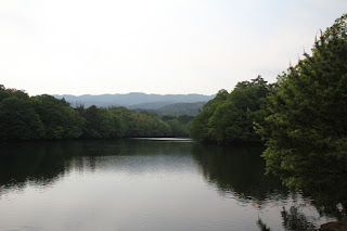
View of the dam lake from the right bank
The dam lake is very quiet. It's not a bad place to indulge your thoughts. Forgetting the hustle and bustle of the city" is exactly what we are talking about here. Although there is a Kintetsu line running nearby, the sound of the train is not so noticeable. It is that quiet.
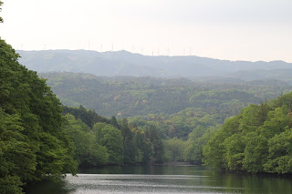
View of the windmills of the Aoyama Kogen Wind Farm from the top edge
Looking at the mountains beyond the dam lake, a large number of wind turbines line the ridges. Apparently, they are called "Aoyama Kogen Wind Farm" and are intended to generate wind power on a plateau blessed with wind.
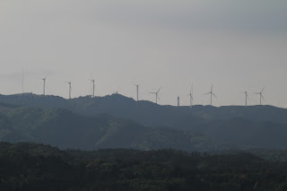
Aoyama Kogen Wind Farm
I don't know about being friendly to nature, but going to the trouble of cutting and building a mountain ridge to earn a small amount of electricity seems somehow not cost-effective...well, that's just my personal opinion.
View of the slant-flume intake system and building
This type is common in earth dams, but it may be a little unusual to find it in the middle of the embankment.
Slant-flume intake system
The scale is very small.
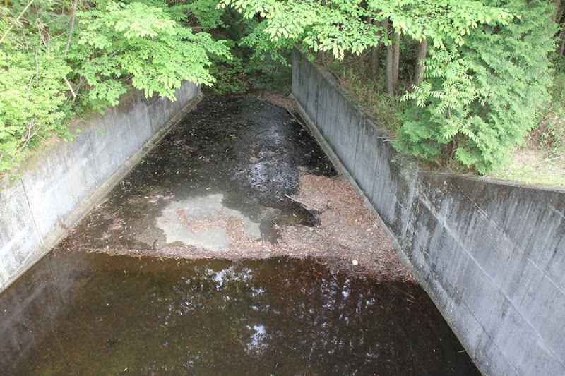
View downstream from the top
The water flowing from the spillway on the left bank is designed to flow horizontally down the side just below the levee.
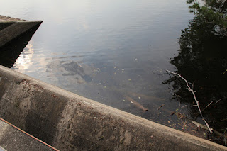
View of the after-water discharge from the top
A small residual water discharge.
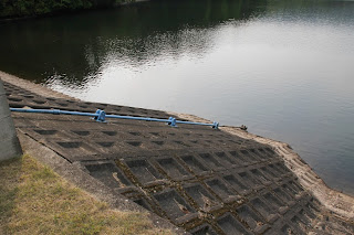
View of the spillway from the top edge
It is well maintained. It is never overgrown and neglected. It must be an important water source for farmers.
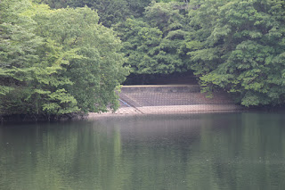
View of the spillway on the lake side of the dam
There is almost no garbage, probably because there are no private houses upstream.
View of the dam lake
It is really quiet. Right next door is a park called "Four Seasons Village," and it is a wonder that boats are not allowed there.
View of the top edge from the left bank
The top edge is also very beautiful. The season of fresh greenery is the best for earth dams.
View of the levee downstream from the left bank
It may have just been mowed, but it feels very carefully worked.
View of the side dam and slant-flume intake system on the right bank from the top edge
The name "Waki Dam" may seem a bit too sensitive, but we decided to call it so because of its concrete barrier. There is also a slant-flume intake system on the right bank.
View of the old abandoned Kintetsu Osaka Line
Having finished looking at the embankment at one point, we returned to the parking lot, but it was still a mystical feeling to see the remains of the abandoned railway line.
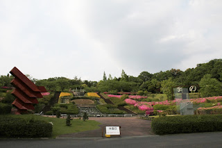
Higashiaoyama Shikinosato
A nature park called "Higashi Aoyama Shikinosato" is spread out beside the dam. It was after business hours, so it was deserted, but several families were still playing there. However, when I think of the accident that occurred in the past, I even think that the park was created for the repose of the souls of the dead.
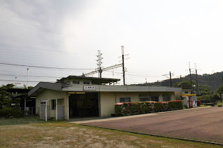
Kintetsu Higashi Aoyama Station
This Higashi Aoyama Station is a new station built in 1975 after the accident, and is the closest station to Shiki no Sato.
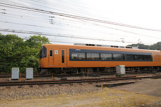
Kintetsu Limited Express ACE
Nowadays, it is hard to believe that there was an accident in this neighborhood, but a Kintetsu limited express train, which I am personally familiar with, was galloping past right next to the dam. It was a bit of a sobering visit to the dam.
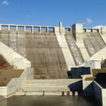
Sodani Dam Specifications
| River Name | Unde River system Omura River |
| Objective | irrigation water |
| Model | earth dam |
| Bank height | 19m |
| Bank length | 85m |
| Dam volume | -m3 |
| Watershed Area | -km2 |
| Reservoir area | -ha |
| Total storage capacity | 260,000m3 |
| Effective water storage capacity | 260,000m3 |
| Dam operator | Mie prefecture (Kinki area) |
| Main body constructor | - |
| Year of launch | 1975. |
| Year Completed | 1979 |
| Name of Dam Lake | Sodani Pond |
Other facilities/observations
Parking is available at the Shiki no Sato parking lot, but there is a fee. (I think it was about 1000 yen.)
| Parking lot | ○ |
| Toilet | ○ |
| Park | ○ |
| PR Exhibition Hall | × |
| Fishing | ×x? |
Comment
Marubashi Satoru liked this on Facebook.
Junko Kono liked this on Facebook.
Oota Toshiaki Syunmyou liked this on Facebook.
Norihisa Uchiyama liked this on Facebook.
Abe tea (Camellia sinensis) liked this on Facebook.
Keizo Imai liked this on Facebook.
Douken Norihiro liked this on Facebook.
Ryota Mochizuki liked this on Facebook.
Sachiko Irie liked this on Facebook.
Shiduka Sun liked this on Facebook.
Keizo Imai liked this on Facebook.
Douken Norihiro liked this on Facebook.
Ryota Mochizuki liked this on Facebook.
Sachiko Irie liked this on Facebook.
Shiduka Sun liked this on Facebook.
Norihisa Uchiyama liked this on Facebook.
Kazue Abe liked this on Facebook.
Oota Toshiaki Syunmyou liked this on Facebook.
Junko Kono liked this on Facebook.
Marubashi Satoru liked this on Facebook.