
Date of interview: Saturday, November 9, 2013
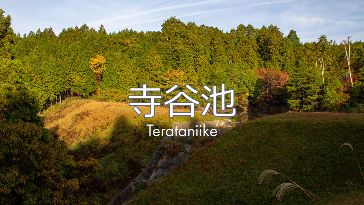
On the way to the tour of Kawakami Dam in Mie Prefecture before the construction of the main body started, we visited Teradani Pond next to Takeya Pond. Teradani Pond is also an irrigation reservoir and earth dam in Iga City.
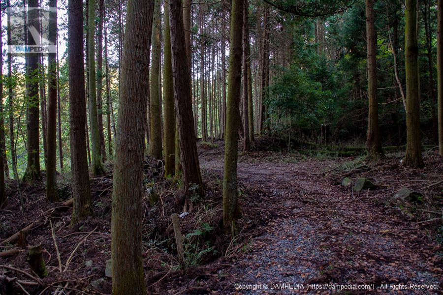
Approach to the dam
It's a short walk to the dike, but it looks like you might get lost. By the way, Google Maps does not show the path, so it would be better to look at GSI's map.
Therefore, I embedded the GSI map. There are two ponds in a row, and the pond on the north side is Teradani Pond. The pond on the south side is called Yamanokami Pond, and we will approach from this side.
I thought I would check the specifications of the pond said to be Yamanokami Pond here, so I checked the Mie Prefecture Reservoir Database and found some surprising data. First of all, the pond is named "Yamanojin Pond" in the reservoir database. The bank height of Yamanokami Pond (Yamakami Pond) is 8.3m, which is not a dam under the River Law, but what was most surprising was that Teradani Pond also has a bank height of 9.1m...!
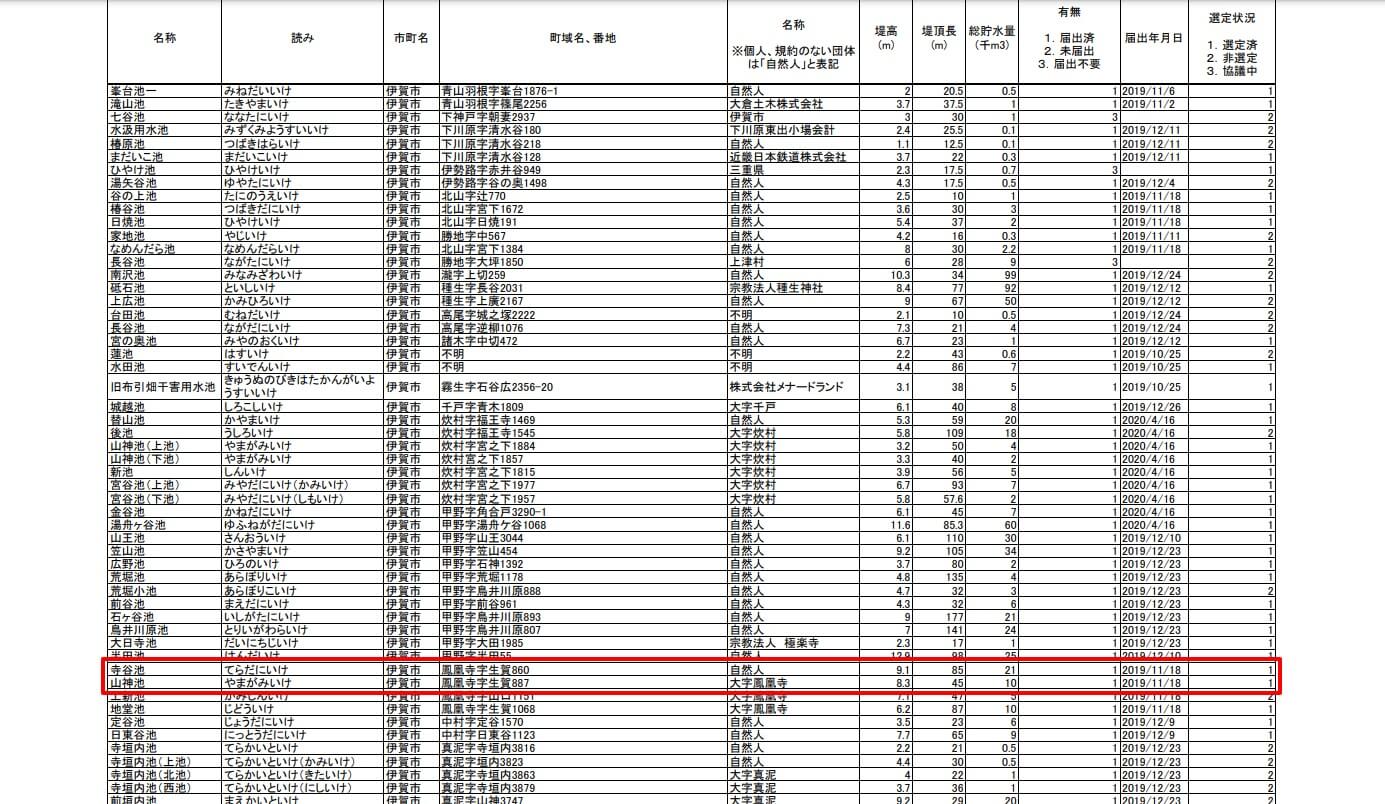
The 2001 dam yearbook I have is 15.5m, but the dam handbook on which the dam yearbook is based was corrected to 15m in 2006. Which is correct... The dam association has long acknowledged that some of the data is incorrect, so we first inquired by e-mail to the Mie Prefectural Government.
This resulted in a disappointing reply.
Lady Jimba.
Thank you for your continued understanding and cooperation in the agricultural and rural development projects of Mie Prefecture.
My name is ■, Agricultural Infrastructure Development Division, Mie Prefecture.
We are pleased to respond to your inquiry.
(1) The bank height of Teradani Pond
The database we are currently releasing is based on the data from the simultaneous reservoir inspections conducted by Iga City from FY 2013 to FY 2015.
As a result of the simultaneous inspection, the bank height of Teratani Pond was 9.1 m. Therefore, Mie Prefecture entered the bank height as "9.1 m" in its database.(2) The Name of the Mountain God Pond
Upon checking the reservoir ledger for 1998 and with Iga City, we confirmed that the ledger lists the pond as "Yamakami Pond" and that Iga City also refers to it as "Yamakami Pond". Therefore, Mie Prefecture has listed the pond in its database as "Yamagami Pond.That is all.
Please check with us.Agricultural Infrastructure Development Division, Agriculture, Forestry and Fisheries Department, Mie Prefecture
Email from Mie Prefecture: (Response) Regarding information in the reservoir database.
Agricultural Land Disaster Prevention Team
TEL: 059-224-2604
FAX: 059-224-3153
The reservoir roundup will include detailed surveys and hazard mapping for earthquakes and torrential rains. The numbers are probably rigorous because not only will geological surveys and seismic calculations be conducted, but also a detailed survey will be conducted to determine if there is sufficient levee height.
Furthermore, in the dam handbook, the river name is the Hattori River in the Yodo River system, but on the GSI map, it was the Takasago River. Hattori River is the name of the river at the downstream confluence and flows along Route 163. The Takasago River is also divided into a right branch and a left branch, and it is unclear which is the main stream, but I will use the Takasago River as the river in this article.
It is also possible that there are many other data errors. With such a vast amount of data on dams, it is not surprising that the information may be outdated, and moreover, with prewar earth dams, there may be errors and misconceptions.
So, Teradani Pond is no longer a dam with a bank height of 15 m or higher as defined by the River Law. However, since we are here, we would like to introduce what kind of dam/reservoir Teradani Pond is.
Yamajin Pond Residual Water Discharge
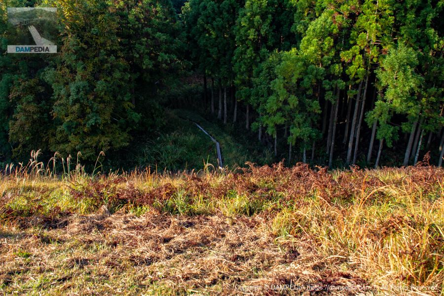
The only way to get to Teradani Pond is to go over the after-flow of this Yamajin Pond. If the timing is bad, it may be overflowing, in which case, give up.
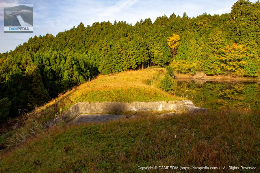
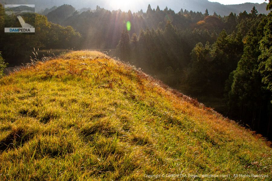
View of the downstream face of the bank of Teradani Pond from the top of Yamajin Pond
Due to its structure, a fill dam should not be able to have a flood discharge on top of the raised embankment, but for some reason, the excess water discharge of Teratani Pond (Flood dischargeThe dam is located on top of the embankment with all its might. Since this is a prewar dam, it is unclear to what extent safety considerations were taken into account, but the ground may have originally been a landslide or the ground may be of good quality.

View of the top edge from the left bank
The after-water discharge of Teratani Pond is also of the type without a bridge. The morning sun shining in is still amazing.
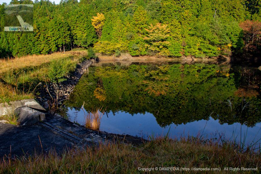
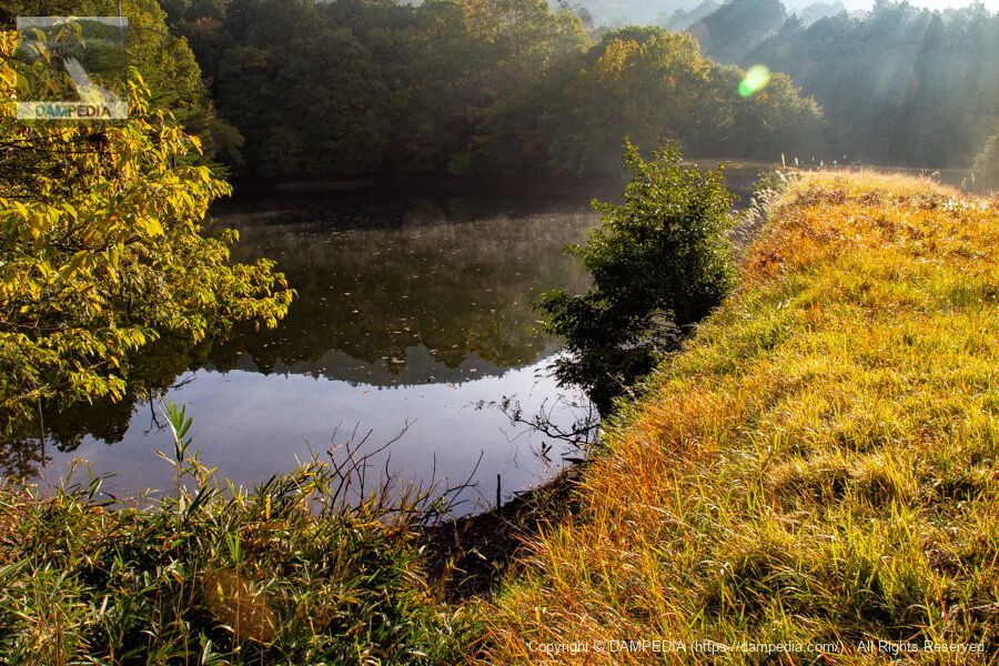
View of the after-flow water discharge, the upstream face of the embankment, and the reservoir from the left bank
The upstream face of the embankment was constructed of rough stones. The surrounding trees are reflected on the surface of the water, making it look a little rough. Incidentally, Yamakami Pond and Teradani Pond are connected by a channel (open culvert) and seem to flow into each other from Yamakami Pond.
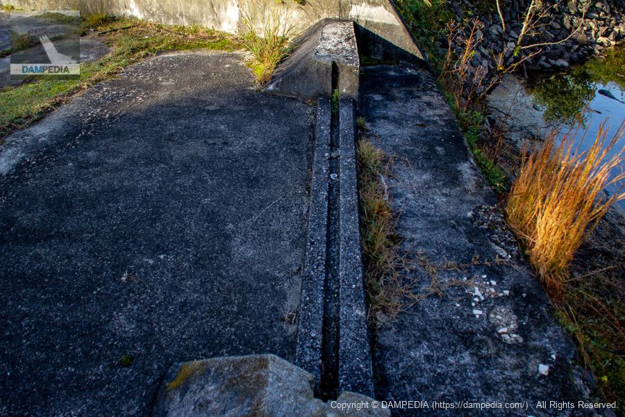
corner drop at the residual water discharge
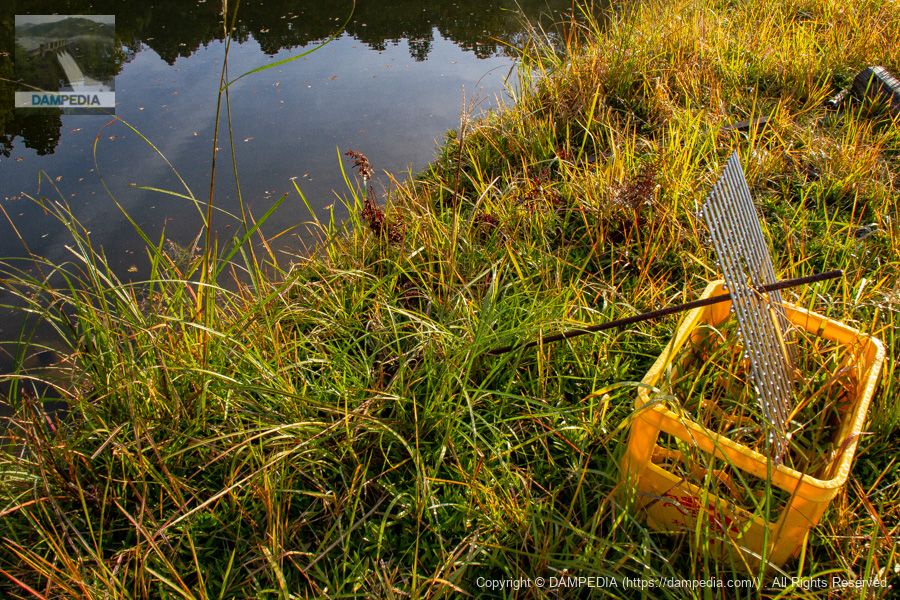
I don't know if they actually use it, but there is a ditch upstream of the excess water discharge that has a corner drop-off. I don't see any water stop boards in the vicinity, but when they want to dam it up, do they make it out of compa-nen or something? Or do the beneficiary farmers keep them?
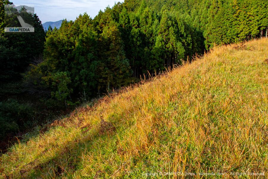
View of the top edge from the spillway
The grass at the top is wet with morning dew, and my feet get wet when I walk on it, but I do not mind and take pictures. The shadow in the foreground is not of the lantern, but of me taking the picture.

Downstream view of the levee from the area of the residual water discharge
To be honest, it is hard to tell from the appearance whether it is 9.1m or 15m.
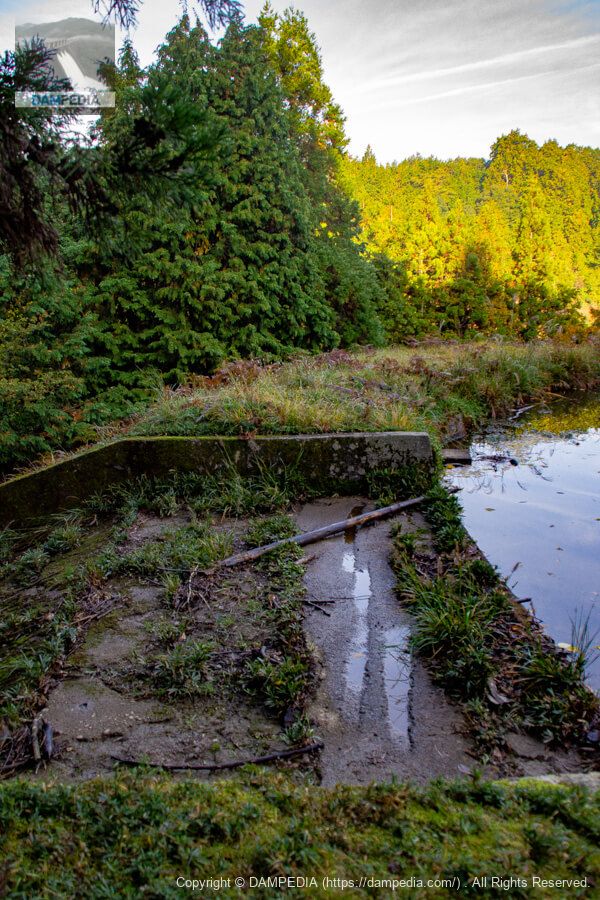
Water intake facilities...?
The part where the handle and other parts are normally located was in the state shown in the photo, as if it were a temporary installation. It is a mystery whether the handle is inserted and turned only when necessary, but in any case, this is the first time I have seen such a thing.
Looking downstream from the top
The downstream side seemed to be connected to a pipe, so I think the photo above is definitely the water intake facility.
Looking downstream from the right bank
The backlighting was glaring, but the grass wet with morning dew was sparkling. The bank of Yamakami Pond can be seen at the far end, but the top elevation does not look much different from that of Teratani Pond. In fact, Yamakami Pond appears to be higher than Teratani Pond. I wonder if the height of the embankment is also about the same.
View of the upstream face of the embankment and reservoir from the right bank
The reservoir was steaming with steam as if it had been exposed to sunlight and the temperature had risen.
Teradani Pond was found to have an embankment height of less than 15 m, and its fate was almost certain to be removed from dam handbooks and dam yearbooks in the future. In addition, the flood discharge on the embankment, the different names of the adjacent reservoirs, and the water intake facility with only metal rods sticking out of it, all add to the mystery of Teradani Pond.
Teratani Pond Specifications
*Marks are taken from the Mie Prefecture Reservoir Database. River names are taken from GSI maps.
| Location | 860 Hououji Ikiga, Iga City, Mie Prefecture * |
| River Name | Yodo River system Takasago River * |
| Objective | A (irrigation water) |
| Model | E(earth dam) |
| Bank height | 15m (9.1m *) |
| Bank length | 100m (85m *) |
| Dam volume | 21,000 m3 |
| Watershed Area | - km2 |
| Reservoir area | - Ha. |
| Total storage capacity | 15,000 m3 |
| Effective water storage capacity | 15,000 m3 |
| Dam operator | Oyamada Village Arable Land Consolidation Association |
| Main body constructor | Directly managed by dam operator |
| Year of launch | - year |
| Year Completed | 1935. |
| Name of Dam Lake | - |
Other facilities/observations
| Parking lot | × |
| Toilet | × |
| Park | × |
| PR Exhibition Hall | × |
| Fishing | ? |


Comment