
Date of interview: Saturday, May 25, 2013
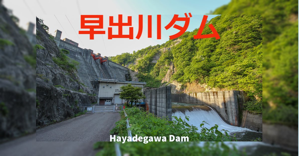
After the Shimojogawa Dam, we came to the Hayadegawa Dam. Like the Shimojogawa Dam, the Hayadegawa Dam is also operated by Niigata Prefecture, but its purpose is flood control, irrigation water, and power generation.
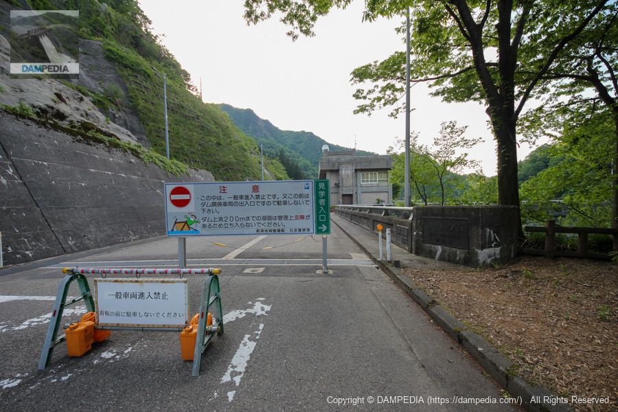
Entrance to the dam site
General vehicles are not allowed to enter the dam site, so park in the parking lot in front of the dam and walk to the site.
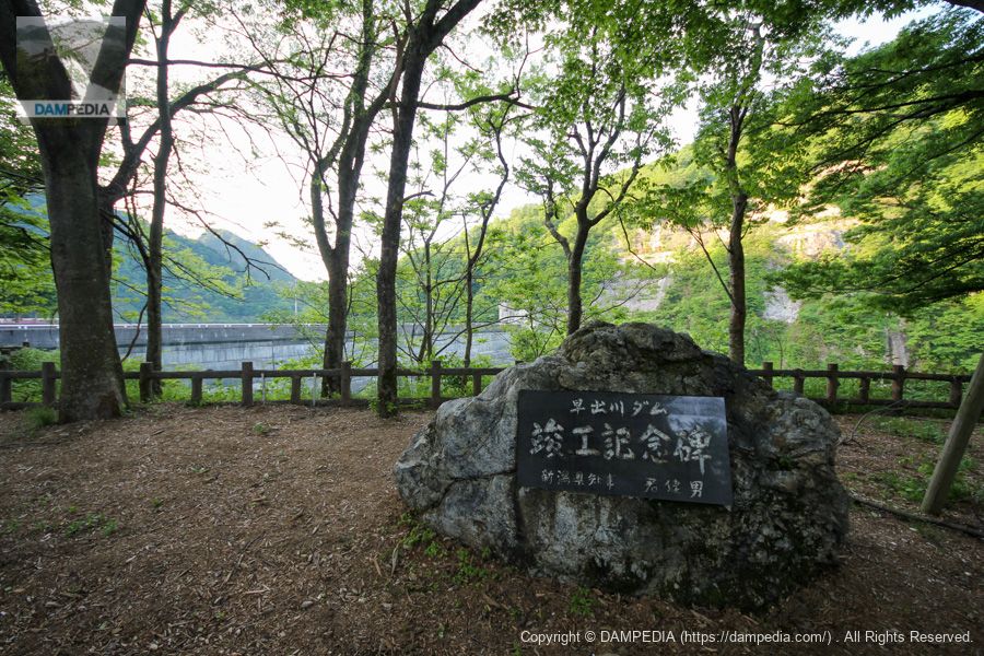
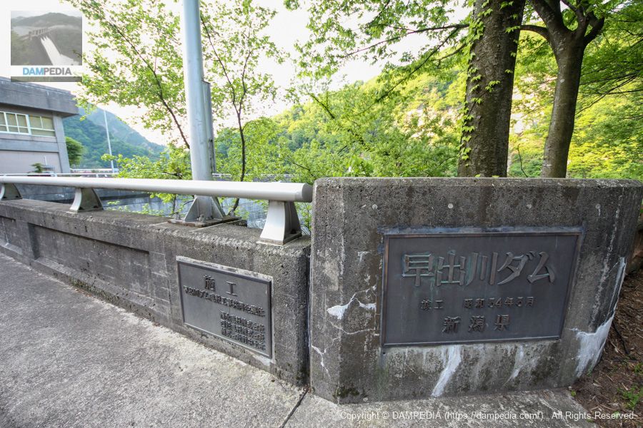
Completion monument at the dam site
A monument to commemorate the completion of the project bears the name of the governor of the prefecture at the time of its construction.
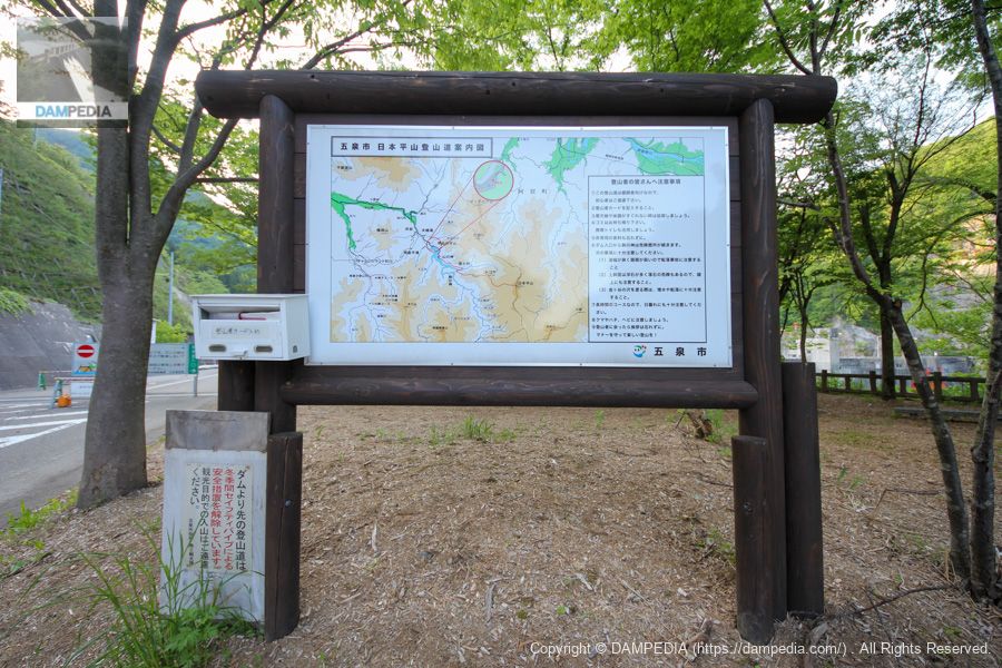
Gosen-shi Nihondaira-yama Trail Guide Map
There seems to be a nearby mountain called Mt. Nihondaira, which seems to be connected to the trail if you follow the right bank. A climber's card slot was also set up.
nameplate
Nameplate showing the name of the dam and its construction, housed in a high column. The Mincho font is austere and tasteful.
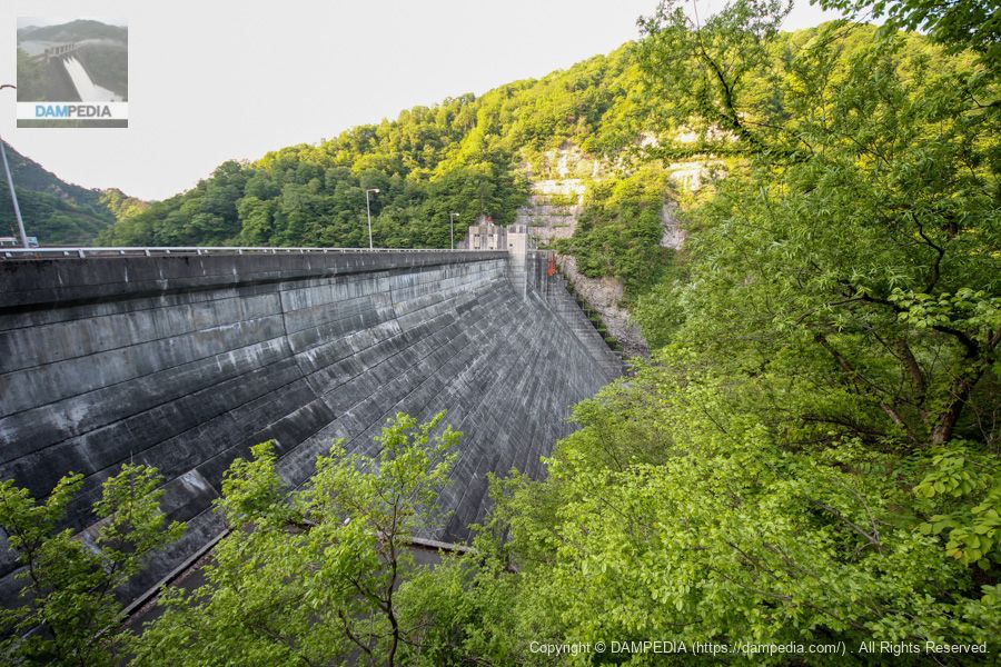
Downstream view of the levee from the right bank
Although the trees have grown too thick to get a full view of the embankment, it is clear that it is larger in scale than the Shimojogawa Dam.
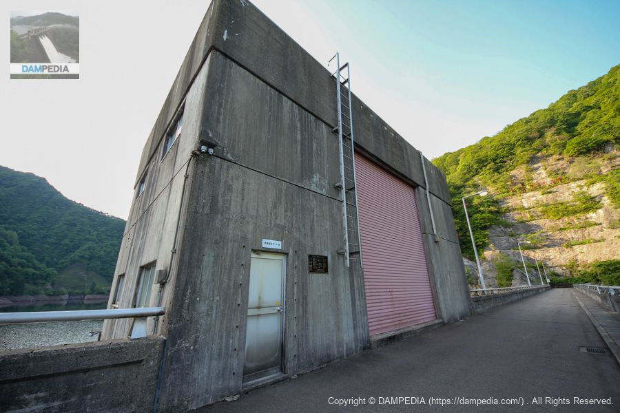
View of the management office and the top from the right bank
It is still around 6:30 in the morning, so it is in the shadow of the surrounding mountains. Like the Shimojogawa Dam, it is named "Dam Management Division, Hayade Branch, Niitsu Regional Development Department, Niigata Regional Development Bureau, Niigata Prefecture.

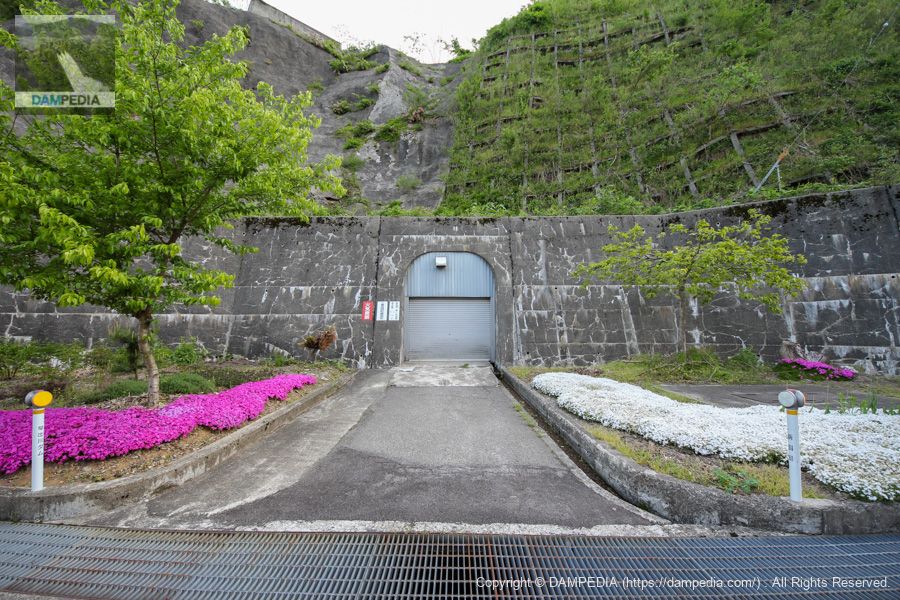
Rim Tunnel on the right bank
This is the rim tunnel portal on the right bank. It is very bright with purple and white flowers on both sides.
View of the upstream face of the embankment from the right bank
This photo was taken from the parking lot behind the control center. The red area is the surface intake gate.

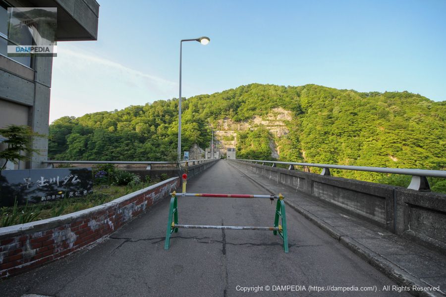
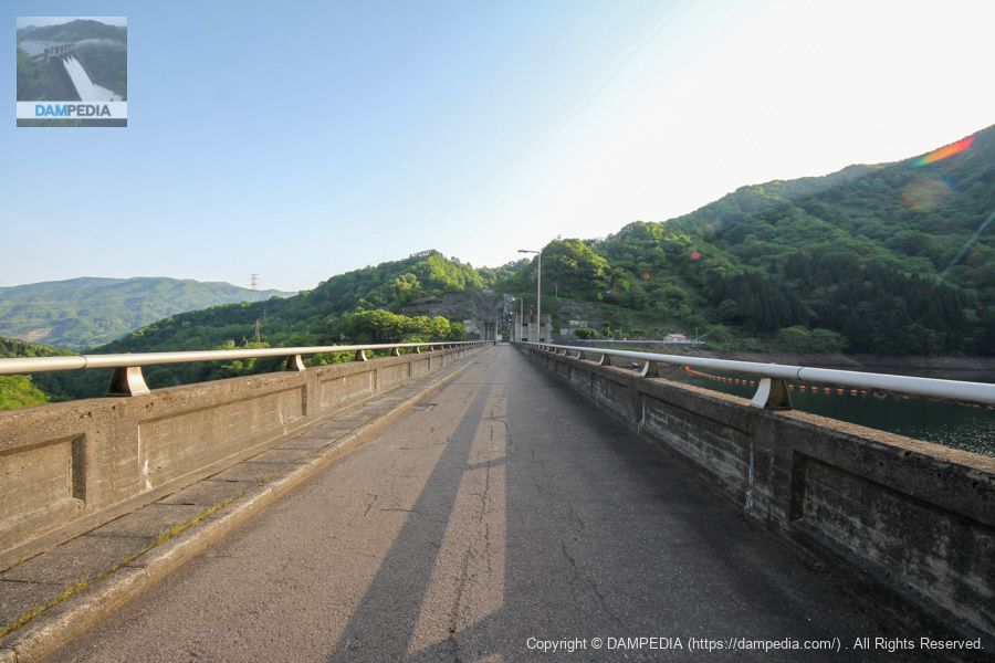
View of the top edge from the right bank
The top edge is also closed to vehicular traffic because cars cannot come this far.
Surface Intake Gate Building
The surface intake gate is a multi-stage surface intake gate measuring 6.0 meters wide by 9.0 meters high and consists of four gates.
Detailed specifications are as follows
| name | Surface Intake Gate | security gate | Water intake control gate |
| form (something takes) | Steel roller gate | Steel roller gate | Steel roller gate |
| volume | 1 gate (4-stage) | (one) gate | (one) gate |
| straight-radius interval | 6.000m | 2.500m | 2.520m |
| door height | 9.000mx4 steps | 3.200m | 2.520m |
| Opening and closing speed | 0.3m/min | 0.3m/min | 0.3m/min |
| Door body dead weight | No.1 19.0t No.2 19.0t No.3 21.8t No.4 21.3t | 6.9t | 10.6t |
Date of production: October 1979
Production: Marusei Heavy Industries Co.
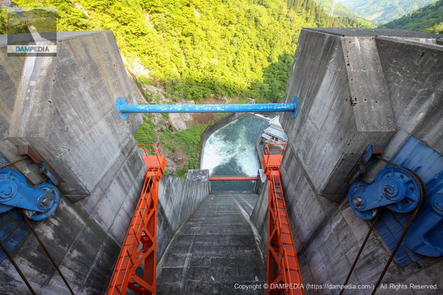
View downstream from Crest
The door body of the crest gate is red to match the surface intake gate, but for some reason the pulleys and other components are blue. The crest gate is equipped with two 9.000x9.742m wide by 9.742m high radial gates.
View of the top edge from the left bank
The sun is finally starting to peek out from the mountains.
Looking downstream from the top of the left bank
The white area in the reduction works is the discharge from the conduit gate. It is equipped with one gate on each side of the bank. It is 3.160 x 3.968 m wide and has one valve (Φ700 mm) for low water management.
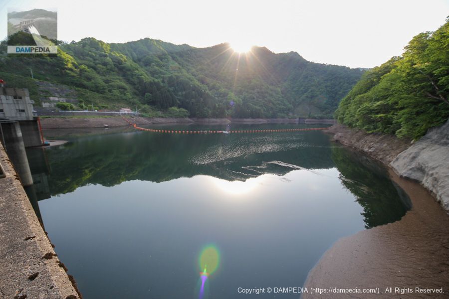
View of the dam lake from the top
The Hayade River, like the Shimojo River, has suffered damage from torrential rains many times in the past. The basic high water flow rate at the dam reference point (at the confluence of the Niegang River) is 2,460 m3/s, and the planned high water flow rate is 1,850 m3/s, which is 610 m3/s for regulation.
Of the 910 m3/s base high water flow rate at the dam, 300 m3/s will be released to control flooding of 610 m3/s.
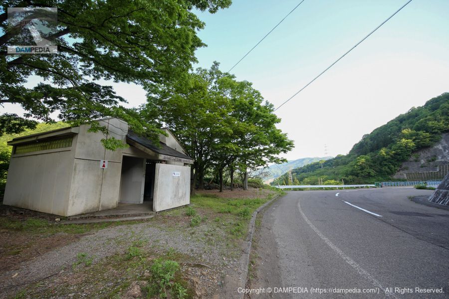
Restrooms by the parking lot
There is a restroom at the entrance of the trail. This is helpful not only for climbers but also for those of us who are touring the dam.
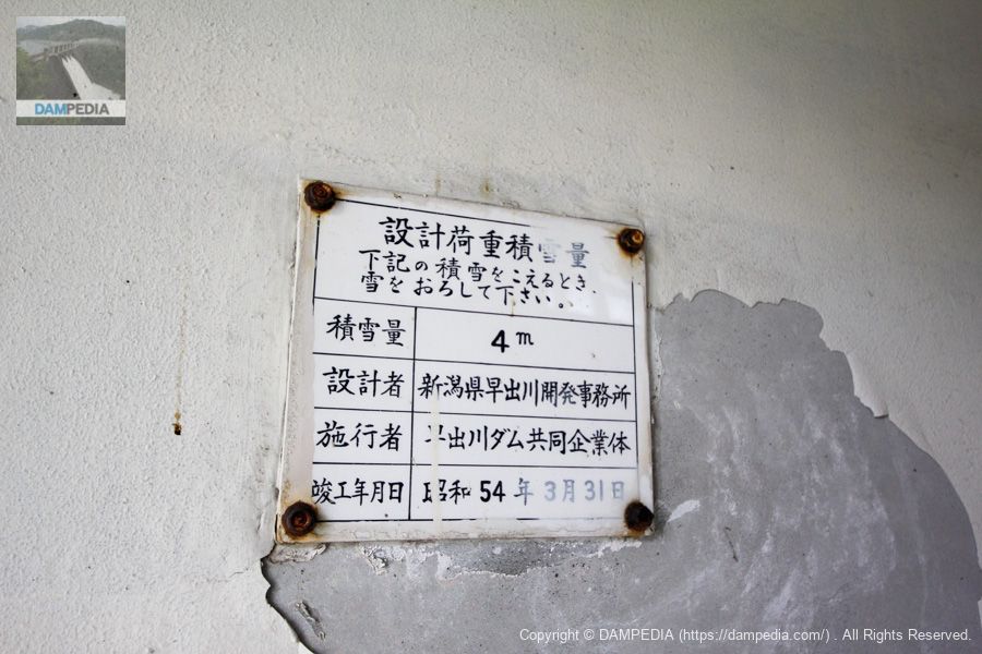
Design load snow capacity
I involuntarily click the shutter at the notation I see for the first time. It shows how hard it is to live in a snowy country.
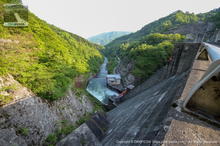
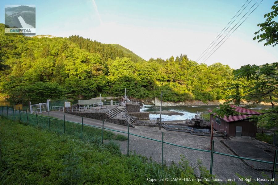
View of the downstream face of the dike and the power plant from the right bank
We moved downstream. The building just below the dike isArenicola brasiliensis (species of lugworm)The power plant takes in up to 12.0 m3/s of water from the surface intake gate to generate up to 7,100 kW of electricity.

Although you cannot see the levee directly in front of you, you can see the huge conduit wall andsub-damThe red crest gate is also very impressive. The red crest gate is also impressive.
The Hayadegawa Dam is quietly located deep in the mountains of Gosen City, Niigata Prefecture, but it serves for flood control, agricultural water, and power generation.
bonus
On the way to the Hayadegawa Dam is the Hayadegawa Headworks.
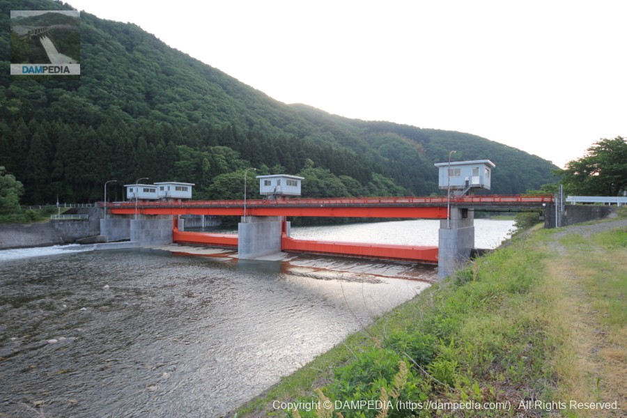
There is also a water intake weir of the Tohoku Electric Power Company's Hayade Power Plant, which is also a good place to visit.
Hayadegawa Dam Specifications
| Location | Tobiishi, Komendani, Gosen-shi, Niigata |
| River Name | Agano River System Hayade River |
| Objective | F (flood control, agricultural disaster prevention) A (irrigation water) P(Power generation) |
| Model | G(gravity-fed concrete dam) |
| Bank height | 82.5m |
| Bank length | 240m |
| Dam volume | 357,000 m3 |
| Watershed Area | 83.2 km2 |
| Reservoir area | 54ha |
| Total storage capacity | 14,900,000 m3 |
| Effective water storage capacity | 11,500,000 m3 |
| Dam operator | Niigata prefecture (Hokuriku area) |
| Main body constructor | Shimizu Corporation, Nishimatsu Corporation, Takenaka Civil Engineering |
| Year of launch | 1969. |
| Year Completed | 1979 |
| Name of Dam Lake | - |
Other facilities/observations
| Parking lot | ○ |
| Toilet | ○ |
| Park | × |
| PR Exhibition Hall | × |
| Fishing | ○○ (excluding no-take zones) |
Comment