
Location: Kamekubo, Mori-machi, Shuchi-gun, Shizuoka Prefecture
Date of interview: Friday, November 08, 2010
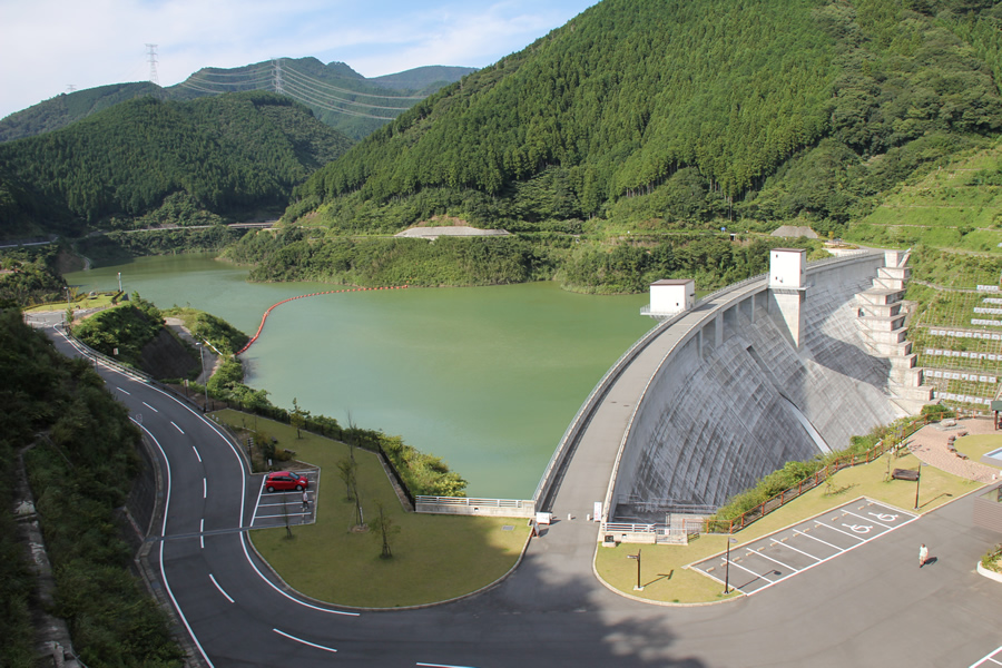
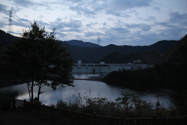
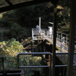
View of the embankment on the lake side from the right bank

Cooperated in the recording of Chukyo TV's news program "news every.We were to meet at Senkashira Station on the Oigawa Railway on the day of the tour, but we were afraid of being late, so we planned to leave before dawn and arrive there a few hours earlier while visiting a dam. We chose the Ootagawa Dam as our napping area. It was early in the morning, but still a little dark. We arrived at dawn, took a nap, ate sandwiches we had bought at a convenience store, and took pictures of various places.
The Ota River Dam is a gravity concrete dam operated by Shizuoka Prefecture and was completed in 2008. Therefore, I expected to see the pure white embankment, but it was a little too dark (laugh).
Gate blocking the passage to the top edge
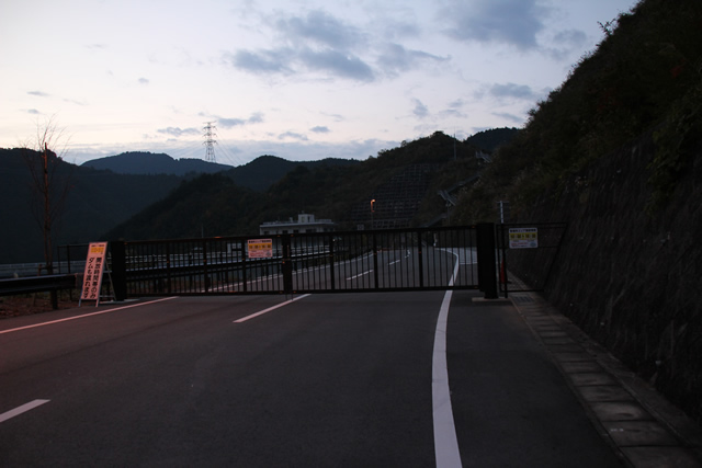
And we knew in advance that the road to the skyline was tightly closed by a gate at this time of day.
Management Office Area Opening Hours
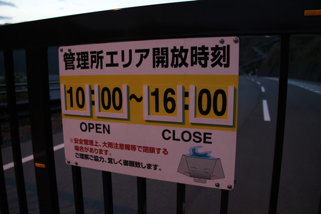
The museum is open from 10:00 a.m. to 4:00 p.m. If we wait for the opening time, we will be late for the meeting, so this time we will just look at the museum from afar. I would have been late for the meeting if I had waited for the opening time, so this time I will just look at it from a distance. Well, it is in a neighboring prefecture, so we have an excuse to visit again next time.
The character on the sign appears to be "DAMZo," though,Official SiteI think it's a little different from the illustration in ....
View of orifice gate drinking fountainhead and selective intake system

The normal flood discharge has one orifice gate of 4.80m high x 4.80m wide, of the natural adjustment type. The emergency flood discharge is a free overflow type, 2.40m high x 12.50m wide, with five gates. In addition, the low water discharge system includes a set of circular multi-stage selective intake system, one 1,000mm diameter discharge pipe, one 800mm diameter jet flow gate, and one 300mm diameter gate.
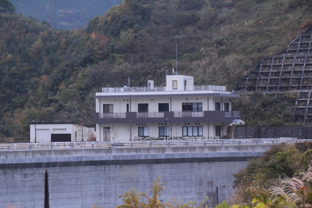
Management office...
Can you please just open the door for me for a minute!" I shout out loudly in my mind.
Right bank parking lot

Clean and well maintained parking lot.
View of the monument and dam lake from the right bank parking lot
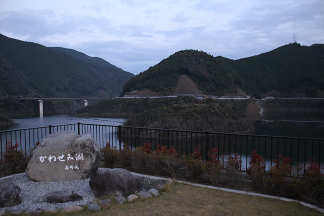
The name of the dam lake is "Kasegami Lake. The name was decided through public solicitation for the following reasons: it is a bird of Mori Town where the Ota River Dam is located, the name evokes the rich nature of the surrounding area, the name is easy to imagine as the same name as the lake bridge, and it is easy to remember, read, and write.
View of Cape Saiyori from the parking lot
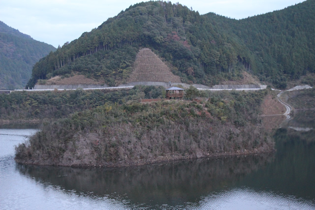
There is an observation deck in the center of the dam lake called "Cape Sairimisaki," which is like a peninsula at the confluence of the Ota River and the Sugisawa River. Let's go there later.
View of the administration office and stairs to the observatory from the parking lot

If I could, I would have climbed up to this observation deck to see the gravity-fed but beautifully spread wings of the dike, but there was no way around it.
Entrance to Cape Saiyori

We have come to Cape Saiyori. Woodchips are laid, and it is gentle on the feet, knees, and back (laugh).
I go to the tip of the cape, breathing in the fresh early morning air as much as I can.
View of the embankment on the dam lake side from the observation platform at Cape Sairimisaki
An observatory is set up in the center of Cape Sairi, from which the embankment can be seen. The tree on the left is a bit in the way...
The Ota River Dam seems to be full of attractions. This is all for now, but I would like to revisit the dam again someday and report on it.
Movie of Ota River Dam discharge Part 1 (Taken from the right bank side)
Movie of Ota River Dam discharge No.2 (taken from the top end)
dam characteristics
| River Name | Ota River system Ota River |
|---|---|
| Objective | Flood control, agricultural disaster prevention, unspecified water, river maintenance water, water supply water |
| Model | gravity-fed concrete dam |
| Bank height | 70m |
| Bank length | 290m |
| Dam volume | 238,000m3 |
| Watershed Area | 20km2 |
| Reservoir area | 59 ha |
| Total storage capacity | 11,600,000m3 |
| Effective water storage capacity | 10,800,000m3 |
| Dam operator | Shizuoka prefecture (Chuubu area) |
| Main body constructor | Taisei, Obayashi, Nippon Kokudo |
| Year of launch | 1986 |
| Year Completed | 2008 |
| Name of Dam Lake | Lake Kawsemiko |
| link | dam handbook |
Other facilities/observations
It is well maintained in many ways. The restrooms were also built with the environment in mind.
| Parking lot | ○ |
|---|---|
| Toilet | ○ |
| Park | ○ |
| PR Exhibition Hall | × |
| Fishing | ? |
Comment