

Location: Oaza Myogadani, Wakazakura-cho, Hachigashi-gun, Tottori Prefecture
Date of interview: 2011/04/04 (Monday)
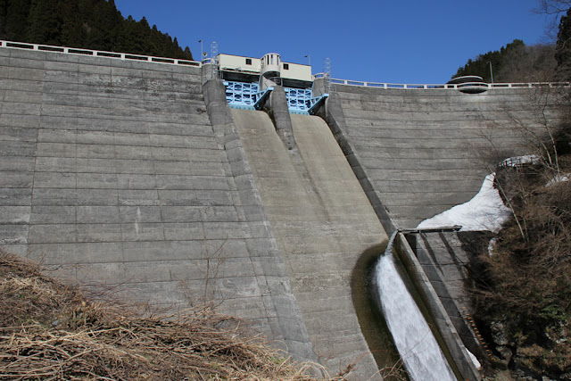
View of the levee downstream from the right bank
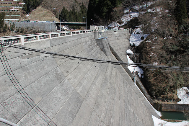
After visiting Tono Dam, I decided to go on a dam tour with Miyajima-san of "Dam Mania" and Ryukun of "Dam Japan," who were with me at Tono Dam (2931-Tono Dam/Tono Dam). Myogadani Dam is located in the southeast direction from Tono Dam. It is a gravity-fed concrete dam, operated by the Tottori Prefectural Government and dedicated to power generation. It is a little regrettable that an electric line has boldly crossed the dam.
View of the reduction work from the right bank
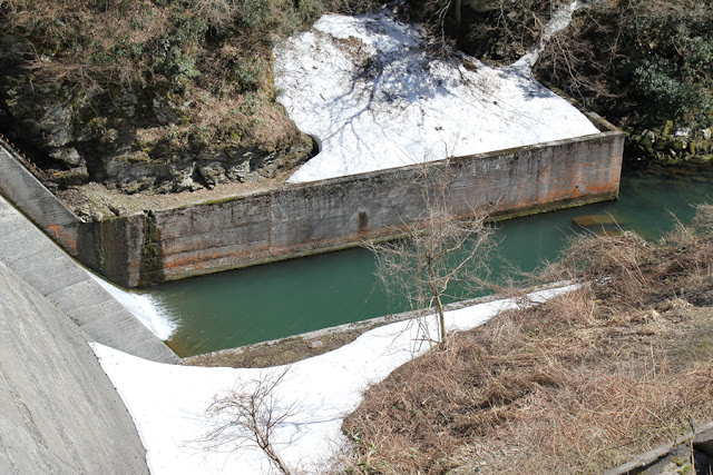
Perhaps because the crest gate does not discharge so much, the reduction structure is built simply.
Stone slab of "Myogadani weir
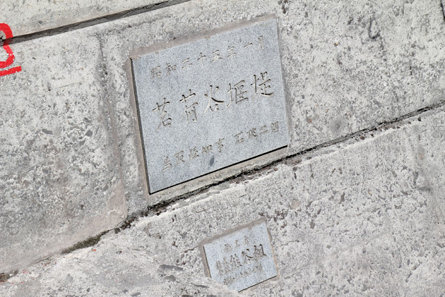
The stone tablet is quite austere. The "Governor of Tottori Prefecture, Jiro Ishiba" written on the tablet is the father of Shigeru Ishiba, Secretary General of the Liberal Democratic Party (as of January 2014).
View of the embankment on the lake side from the right bank
The dam lake side is a slender dike.
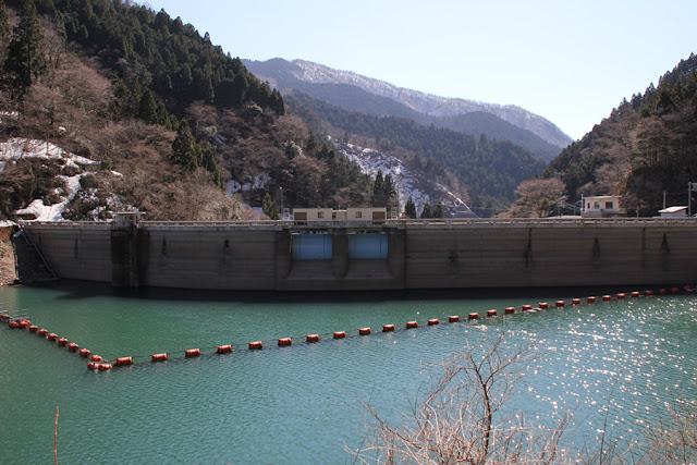
View of the dam lake from the right bank
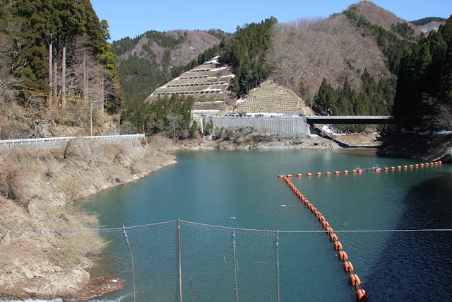
This is a small dam lake. The bypass of Route 482 (under construction) can be seen on the left bank. It seems to have been opened by the time of this writing, so the atmosphere in the vicinity may have changed a little.
View of the water intake tower
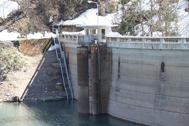
It is a cute cylindrical water intake tower.
View of the crest gate on the dam lake side
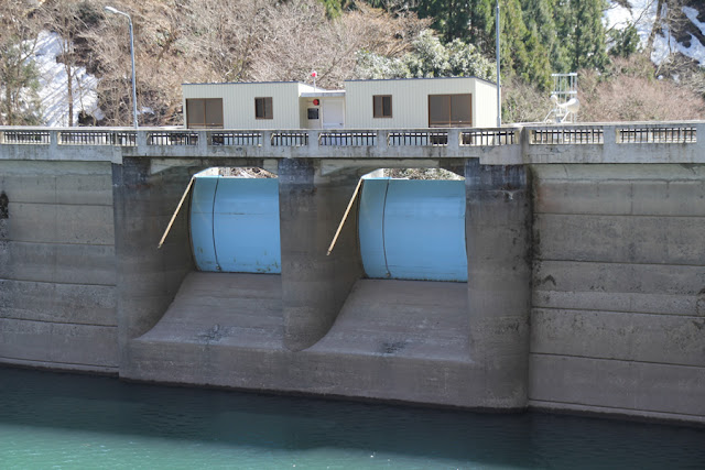
The crest gate is also compact and somewhat cute.
View of the sign
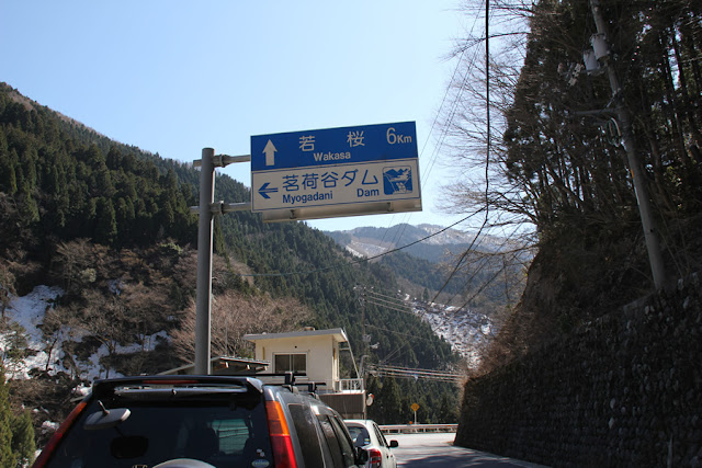
Although it is now an old road, the dam was originally located along the national road and a sign has been erected.
View of the administration office

It seems unmanned, but I think there were cars parked in the management office parking lot on this day.
View of the crest gate on the downstream side
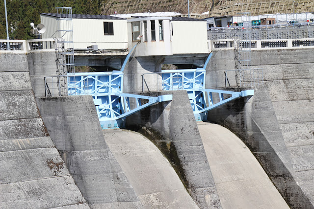
The downstream view reveals more and more how small the crest gate is. The small room protruding from the pier is also semi-circular and somewhat cute.
View of the hairpin curve downstream
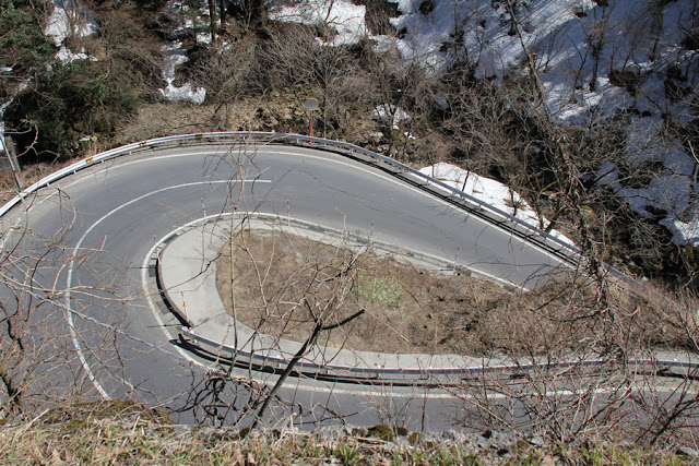
Move further downstream. The hairpin curve is amazing.
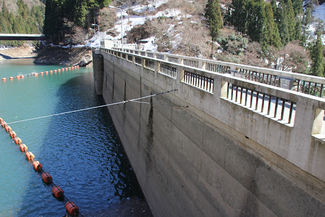
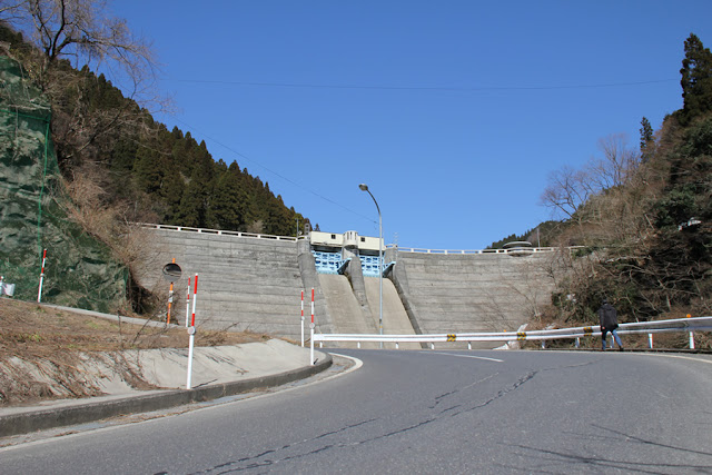
View of the top edge from the right bank

We are back near the top edge again. The top end is off-limits. The ceiling railings also have a cute, early Showa period look to them.
View of the embankment on the lake side from the right bank
The embankment appears to curve when viewed from the dam lake side.
View of the levee from the hairpin curve downstream
It's like a big bang. Still, it is an unusual blue sky for me.
View of the levee from downstream
It appears to be a river maintenance discharge, but it is unusual in that the pipe is attached to the dike so that it flows directly into the conduit wall.
View of the reduction work

It is a simple abatement.
View near the intake tower from downstream

The top edge of this section protrudes like a terrace only in accordance with the cylindrical intake tower.
Entrance to the audit corridor? View of the entrance to the audit corridor
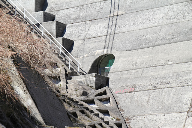
This appears to be the entrance to the audit corridor. A wire netting seems to be stretched over the top of the fence to prevent bird damage.
The above is the Myogadani Dam, which is small, old, and cute in key places.
Myogadani Dam Specifications
| River Name | Chiyogawa River system Harumai River |
|---|---|
| Objective | generation (e.g. power) |
| Model | gravity-fed concrete dam |
| Bank height | 40m |
| Bank length | 124.5m |
| Dam volume | 42,000m3 |
| Watershed Area | 50.4km2 ( Direct: 17.4km2 Indirect: 33km2 ) |
| Reservoir area | 5 ha |
| Total storage capacity | 612,000m3 |
| Effective water storage capacity | 400,000m3 |
| Dam operator | Tottori prefecture (Chuugoku area) |
| Main body constructor | Kumagai Gumi |
| Year of launch | 1958 |
| Year Completed | 1960. |
| Name of Dam Lake | - |
Other facilities/observations
| Parking lot | × | I believe the bypass national road has been completed, so the traffic has been drastically reduced. So parking at the dam site will be much easier. |
|---|---|---|
| Toilet | × | |
| Park | × | |
| PR Exhibition Hall | × | |
| Fishing | ○? |

Comment