
Date of interview: Sunday, March 24, 2013
This Kazaya Dam was the next dam we visited after the Asahi Dam for our mission to pick up the dam enthusiast helmets that had been completed to the Nanashiki Dam.
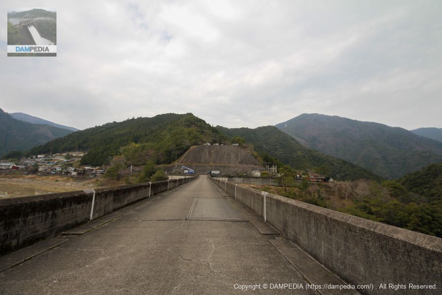
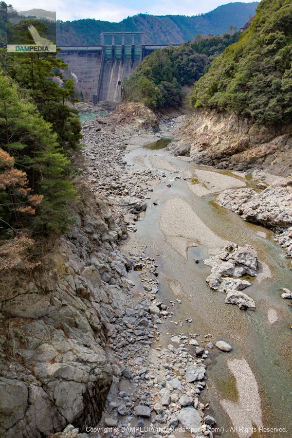
Downstream view of the levee from the left bank
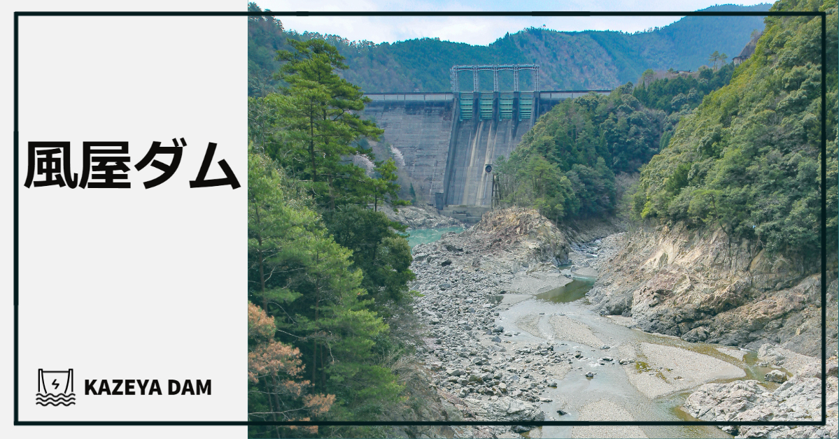
The Kazaya Dam is a power generation-only dam owned by J-Power Development, but it is huge, with a 101-meter-high embankment and a 329.5-meter-long crest. However, it is a sleek and cool dam.
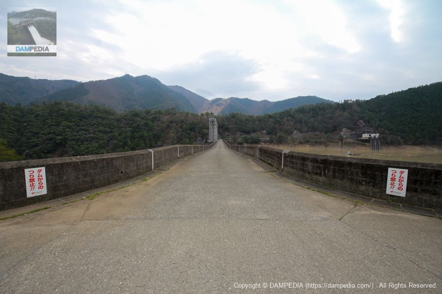
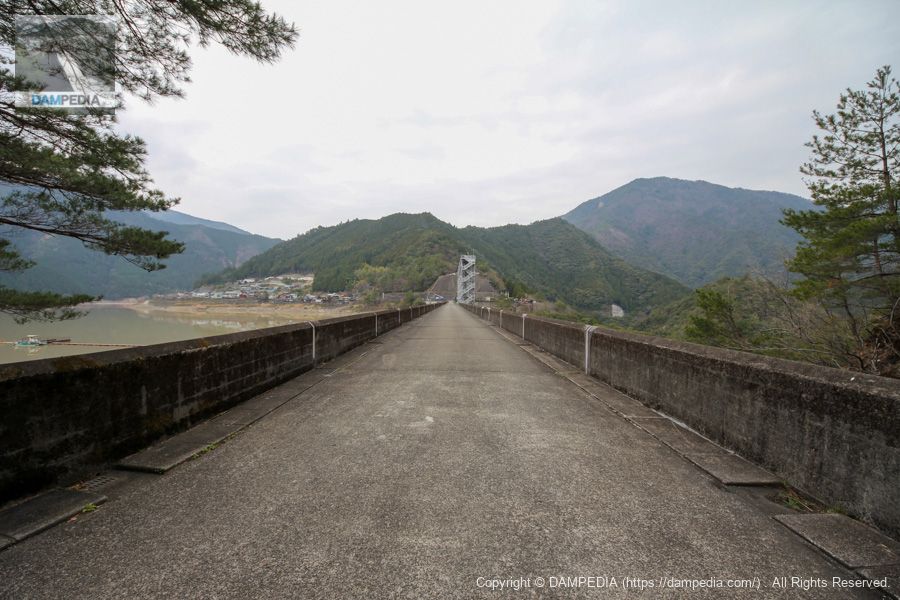
View of the top edge from the left bank
The left bank is slightly higher and drops one step a few meters further. I thought for a moment that this was done in consideration of overflow of the embankment, but since the right bank remained the same height, it seems that it was simply to match the height of the left bank.
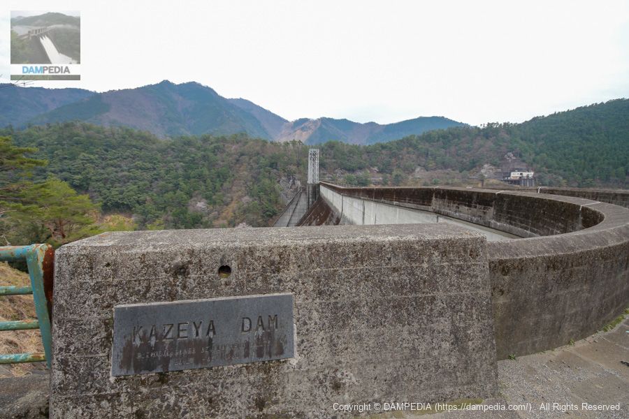
View of the nameplate of the upstream parent column from the left bank
The "Kazaya Dam" in line typeface is cool. By the way, the collapsed area of the mountain seen beyond the gate piers is amazing. This was also caused by the 2011 Kii Peninsula flood.

View of the nameplate of the downstream parent column from the left bank
The downstream side has "KAZEYA DAM" written in alphabetical characters, which is also cool.
View of the upstream face of the embankment from the left bank
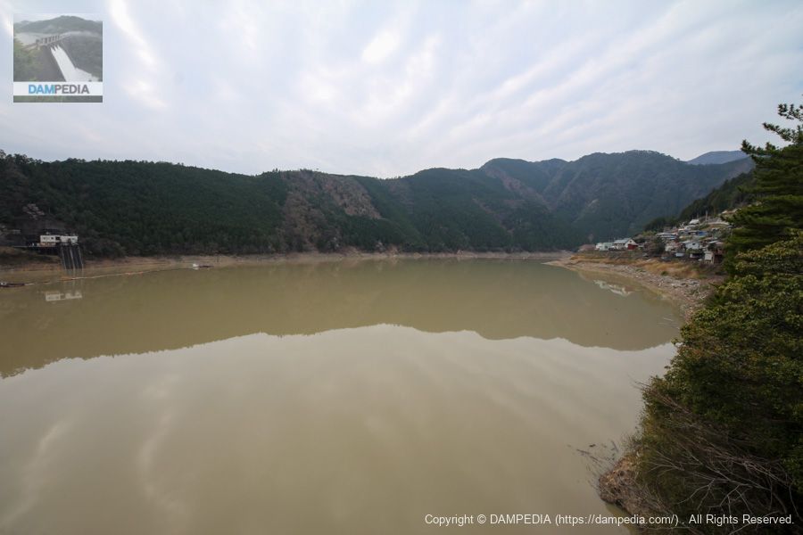
The water is very muddy. This may be due to the construction work being done upstream (and downstream, of course) for the reconstruction of the Kii Peninsula flood. And the water level is also high.

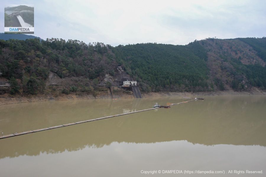
View of the dam lake from the left bank
On the right is the town of Kazaya area and on the left is the water intake of the Totsukawa No. 1 Power Plant. It is set with the management office.
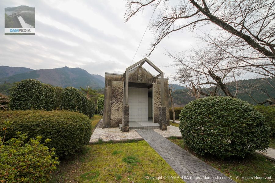
Toilet
Toilets are located in the downstream direction on the left bank.
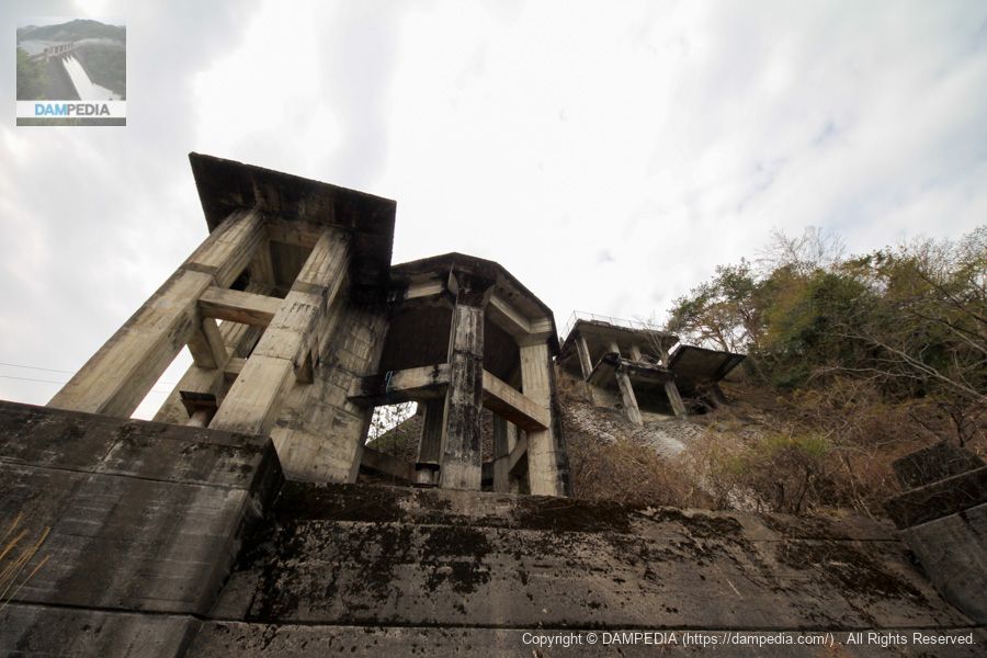
concrete plant remains
There are also remains of a concrete plant above the abutment on the left bank. One can only imagine what it must have looked like during construction.
Downstream view of the levee from the left bank
We will move to the more downstream side of the river, but it would be nice if you could maintain it a bit more.
View of the left bank from the center of the dike
There are some dump trucks on the upper left bank, and I would like to climb up there to see the embankment. Unfortunately, it looks like private property unrelated to the Kazaya Dam, so we have to give up.
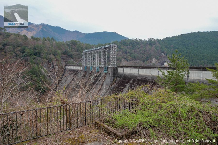
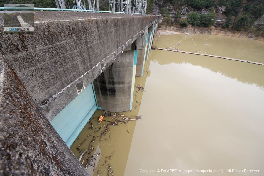
View of the upstream crest gate from the top edge
The water level is high and reaching the gate.
View of the water intake and control center from the top
Is the float in front of the water intake a netting station?
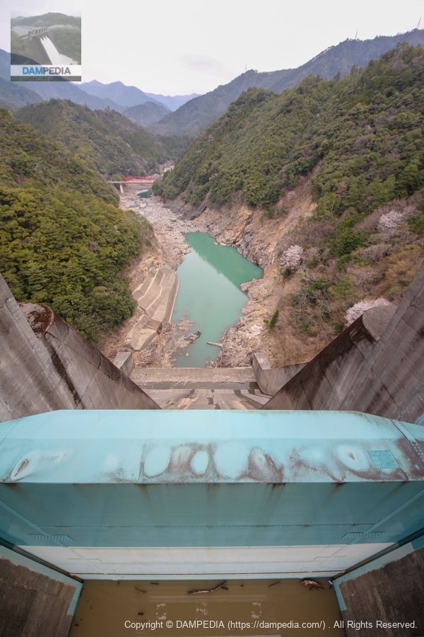
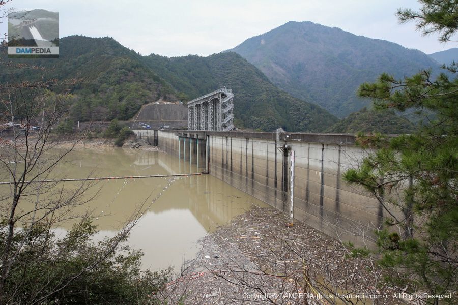
View of the crest gate and downstream from the top
Rough downstream side with a thick-walled crest gate. The ledge is a small jump-off and there are no secondary dams downstream. The only concrete revetment is on the left bank. Is the bedrock so solid that there is no danger of scouring?
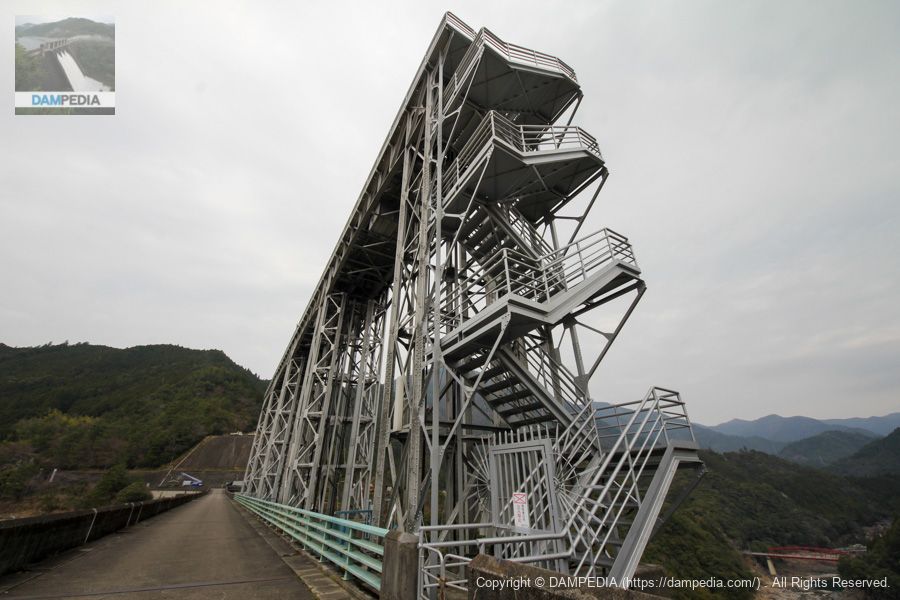
Gate peer
This gate pier is a steel truss structure like the Hayamoura Dam and Ikeda Dam. Rugged concrete is good, but steel frame is also very good.
Downstream view of the levee from the right bank
Unfortunately, this is the limit of the right bank, as it is not possible to move further downstream. You can see what looks like the entrance to the audit corridor just below.

View of the top edge from the right bank
The top end is accessible to vehicles because of the management office located on the upstream side of the right bank, but it is a dead end there.
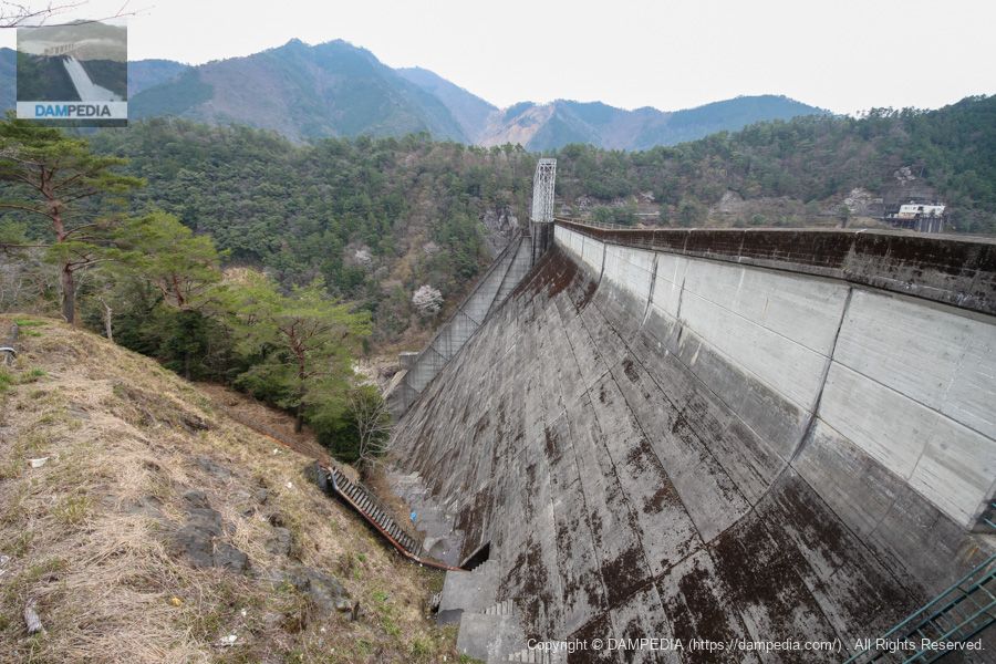
View of the upstream face of the embankment from the right bank
The large, masculine embankment allows the upstream face to be captured well from the right bank side.
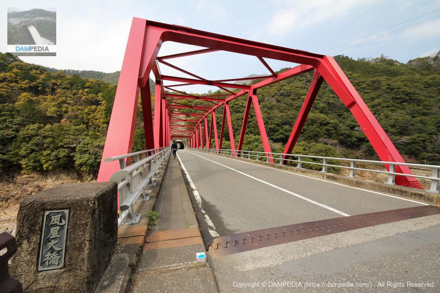
Kazaya Bridge downstream
We moved downstream of the embankment to the Kazaya Bridge. (Technically, we stopped at the Okusato Dam first, since we were making an efficient tour.)
Downstream view of the levee from Kazaya Bridge
It is a pity that the embankment is a little hidden by the ground, but it is a wonderful point where the contrast between the wildness of the nature downstream and the man-made structure of the embankment can be felt very well.
...and it was a manly windy dam that I would like to revisit again and again.
Kazaya Dam Specifications
| Location | 896 Kazaya, Totsukawa Village, Yoshino-gun, Nara Prefecture |
| River Name | Shingu River System Totsukawa |
| Objective | P(Power generation) |
| Model | G(gravity-fed concrete dam) |
| Bank height | 101m |
| Bank length | 329.5m |
| Dam volume | 588,000m3 |
| Watershed Area | 553 km2 (direct: 445 km2, indirect: 108 km2) |
| Reservoir area | 446ha |
| Total storage capacity | 130,000,000m3 |
| Effective water storage capacity | 89,000,000m3 |
| Dam operator | Power Development Co. |
| Main body constructor | Obayashi Corporation |
| Year of launch | 1954 |
| Year Completed | 1960. |
| Name of Dam Lake | Kazaya Reservoir |
Other facilities/observations
There is no clear parking area, but the left bank dam site is large enough that it is possible to park without interfering with other vehicle traffic.
| Parking lot | △ |
| Toilet | ○ |
| Park | × |
| PR Exhibition Hall | × |
| Fishing | ○○ (excluding no-take zones) |

Comment