
Date of interview: 2006/03/23
Location: Kitanoyama-cho, Nara City, Nara Prefecture
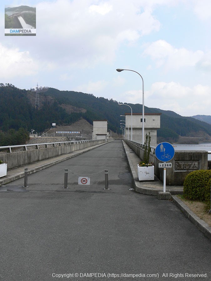
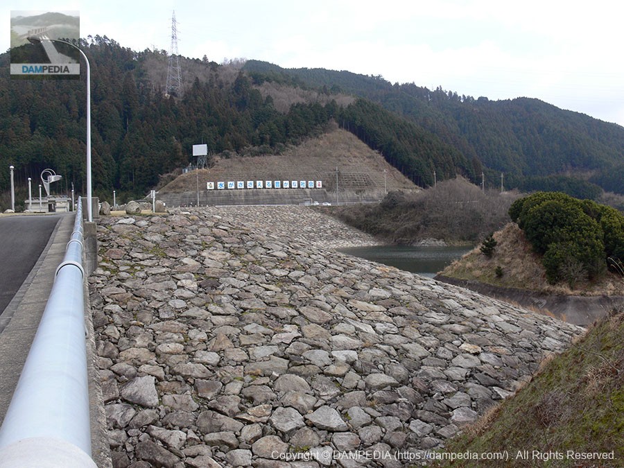
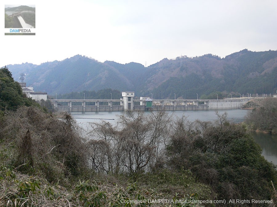
View of the top edge from the right bank
Here we are at the Nunome Dam. I used to pass by this area often, but for some reason I never had a chance to go there.... As usual, it was mostly cloudy, although blue skies were visible. It was as if it was the middle of winter.
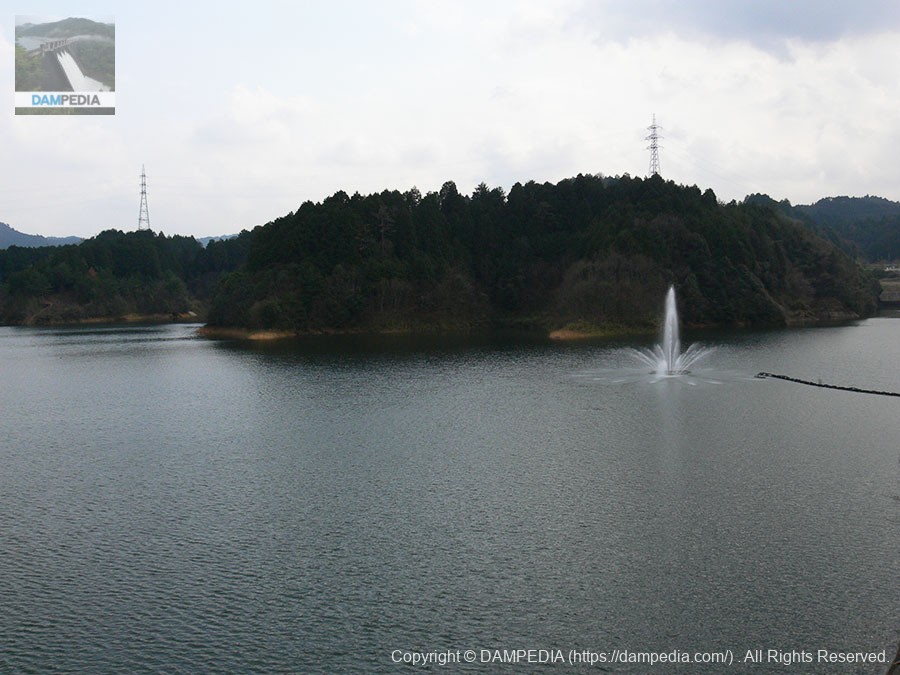
View of the dam lake from the top
The picture is somewhat slanted.... The fountain is for surface aeration.
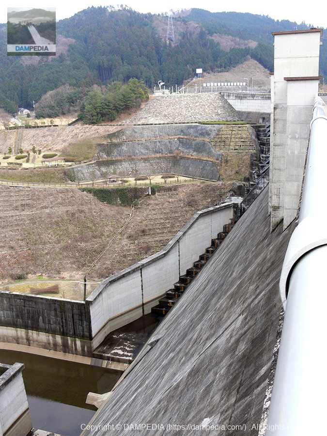
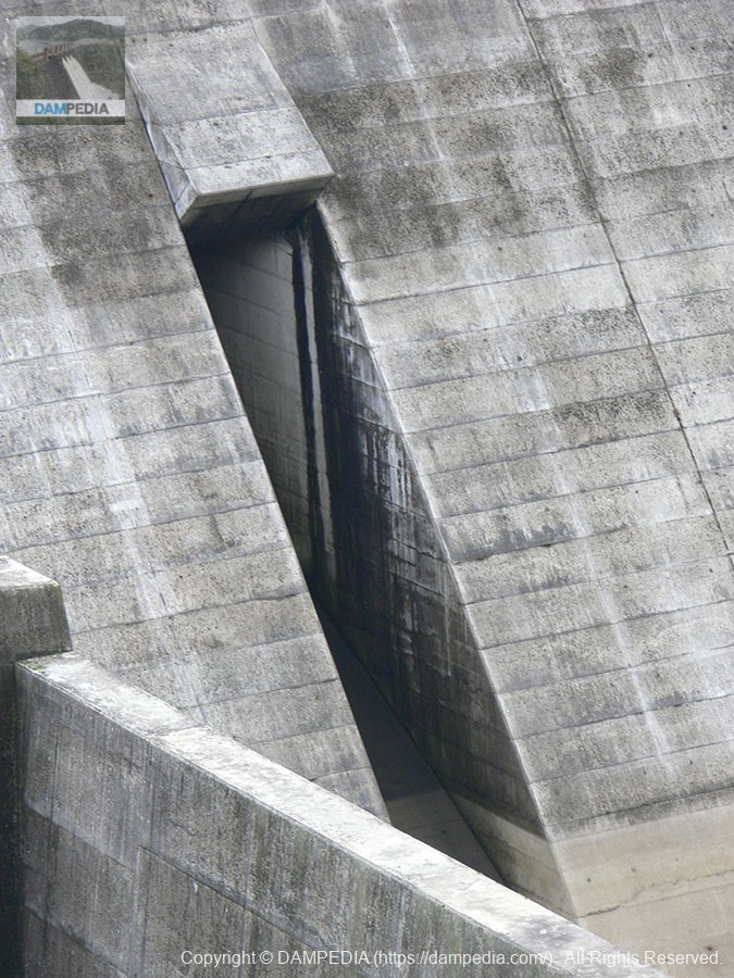
View of the downstream bank from the right bank
The embankment itself is relatively simple, but the emergency flood discharge is of the natural overflow type, and the flow-conducting walls extend to the footings and are high.
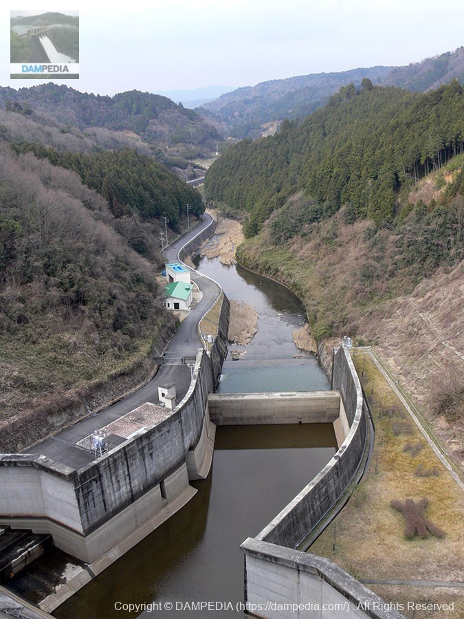
View downstream from the top
The Nunome River downstream will join the Kizu River as well as the Takayama Dam if it continues downstream, but there is a considerable distance to the confluence point.
View of the right bank saddle stop water treatment works
I thought it was a combined dam because there is a rockfill dam on the right bank, but I was told that it is called a saddle stopwater treatment works (from the Dam Handbook).
View of the embankment on the lake side from the right bank
It was getting cloudy. The embankment is gravity-floored, but it is bent in the middle, so the center of the embankment cannot be seen from the right bank side.
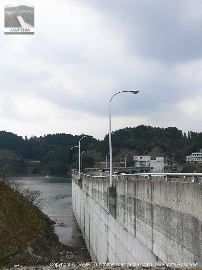
View of the downstream bank from the right bank
The right bank has a park like this, where the levee can be viewed from almost directly below. It is lonely and empty because of the cold season.

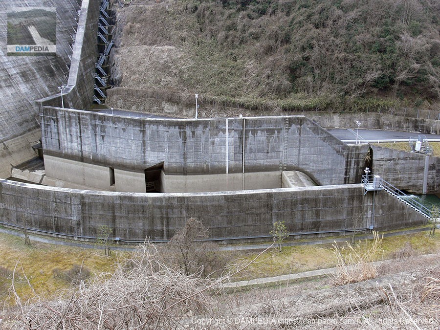
View of the reduction work from the right bank
You can see that the abatement works are slightly curved. The central slit isValve for power generationMain gate for low water management.
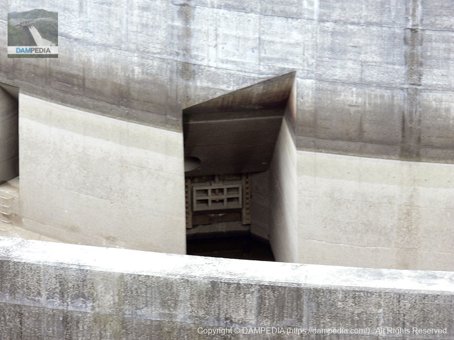
From the right bankValve for power generationView of main gate for low water management
Here is a close-up of that slit. (Added below) The slit on the left is a branch pipe gate for low water management.
View of the permanent flood discharge from the right bank
this way (direction close to the speaker or towards the speaker)ordinary flood dischargeThe slit is also slit-shaped. This one is also slit-shaped.
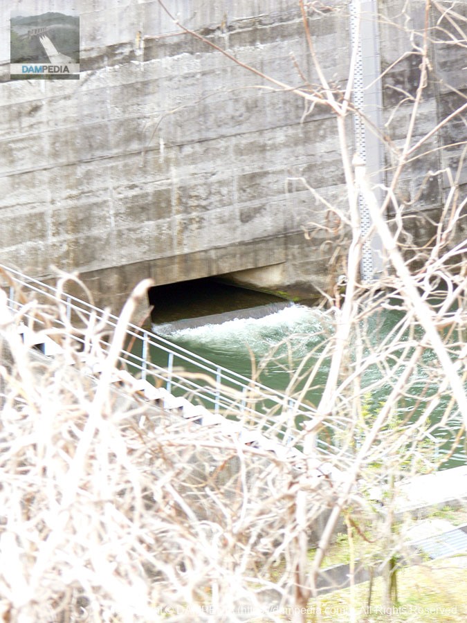
From the right bankWater diversion facilities (?)View of the outlet for hydropower generation
Discharging in a matter of minutes.Perhaps this is a water discharge facility for irrigation.This is a discharge outlet for hydropower generation. This one is a horizontal slit.
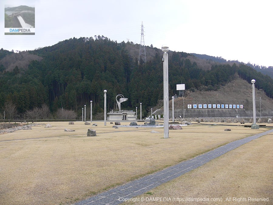
Park
It is a fairly large park. It is not clear if ball play is OK, but it is a park where children can stretch out and play.
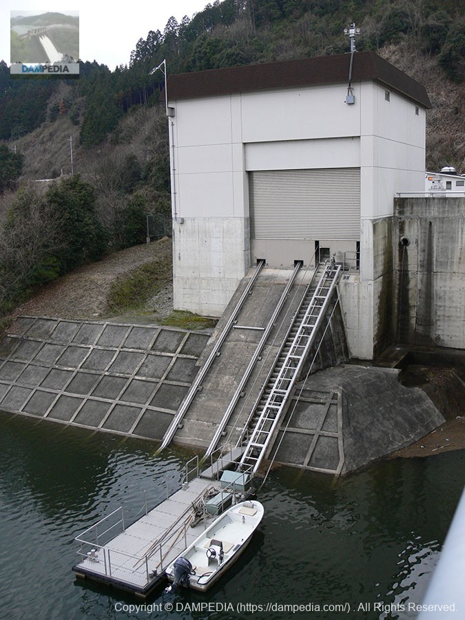
incline
The incline is located on the left bank.
View of the embankment on the lake side of the dam from the left bank
Proceeding upstream, you can see the embankment on the lake side of the dam. There is a park further upstream. There is also a sub-dam, which seems to be quite a magnificent sub-dam. Unfortunately, we missed it on this day.
Please refer to the article on Nunome Dam as well as the tour held in conjunction with the "Nunome Lakeside Cycle Festa 2012" held in 2012.
dam characteristics
| River Name | Yodo River system Nunome River |
| Objective | F (flood control, agricultural disaster prevention) N (unspecified water, water for river maintenance) W(Water for water supply) |
| Model | Gravity Concrete |
| Bank height | 72m |
| Bank length | 322m |
| Dam volume | 331,000m3 |
| Watershed Area | 75km2 |
| Reservoir area | 95 ha |
| Total storage capacity | 17,300,000m3 |
| Effective water storage capacity | 15,400,000m3 |
| Dam operator | Public corporation for water resources development, one construction |
| Main body constructor | Taisei Corporation, Morimoto Gumi |
| Year of launch | 1975. |
| Year Completed | 1991 |
| Name of Dam Lake | Nunome Lake |
Other facilities/observations
Perhaps because it was cold like winter, although the season was spring, there were no visitors in spite of various improvements. By the way, I heard that black bass can be caught in the dam lake. I would like to go there with a lure. I also heard that it is a marathon course and also good for road biking.
| Parking lot | ○ |
| Toilet | ○ |
| Park | ○ |
| PR Exhibition Hall | × |
| Fishing | ○ |

Comment