
Location: Oaza Kayahara, Taga-cho, Inukami-gun, Shiga Prefecture
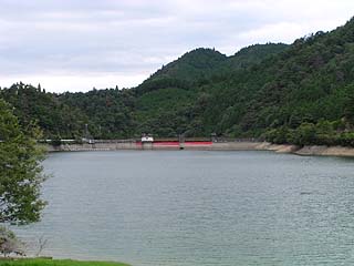
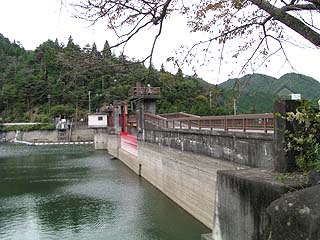
View of the embankment (lake side) from the left bank

From the Hikone IC, take National Route 306 south, pass through Taga Taisha Shrine, and drive along a long, narrow prefectural road until you see the Inukami Dam. The village downstream of the Inukami Dam has a very nice atmosphere.
However, despite the atmosphere, there were about three guys on a motorized bicycle smoking cigarettes on the embankment (and apparently high school students). A dam is always next to danger (mystery).
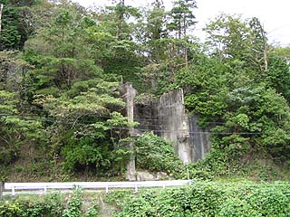
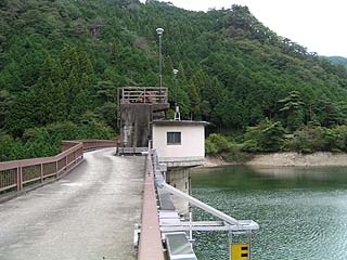
View of the gate from the left bank
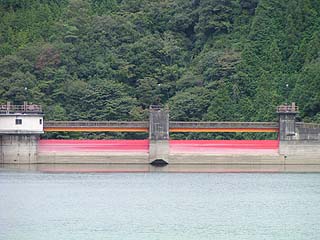
The red roller gate is very impressive. However, it also looks a bit dirty with mud adhering to it.
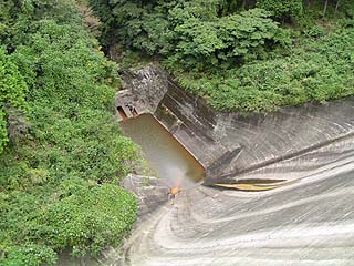
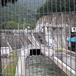
View of the water intake from the top
Now that the motor scooter boys are gone, we will continue our coverage.
There is no parking lot on the embankment and the prefectural road is too narrow to park on the street, so we backed into the top end of the left bank and borrowed a space to park our car there for a while. As you can see in the photo below, the top end of the embankment is closed to cars and blocked off to prevent entry.
View of the dam lake from the top
It is quite a scenic place. I felt the small dam and this scenery matched very well. If it were a hot spring resort, there would be nothing to say.
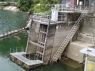
View of the remains from the top
I believe these are the remains of the foundation of a construction crane. It is difficult to see in the photo because it is a little decayed, but on the left side of this structure, earth and sand were about to collapse.
View of the reduction work from the top edge
The abatement work was slightly rounded and gave an unusual impression.
View of the gate operation room from the top edge
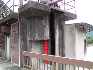
The gate operation room is also rounded and finished in an art nouveau style (a lie), giving it an old-fashioned yet cute (?) impression. It is a cute (?) impression.
Nameplate on the gate
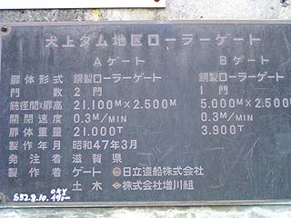
The gate was manufactured in 1972...which means the dam was completed in 1946, so it was built much later than that. Or was the existing gate renewed in that year?
Incidentally, I found the same graffiti in the lower left corner at Uzogawa Dam and Eigenji Dam, so I was strangely moved by the fact that people have been visiting dams for a long time.
View of the gate from the top
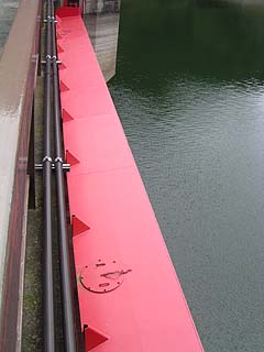
I had a hard time getting it into the viewfinder because it is a horizontal gate. I guess the gate must be red.
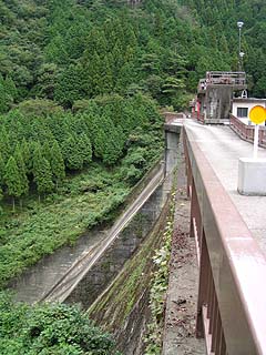
View downstream from the top
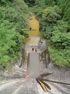
The water is muddy brown, probably due to the geology. Nevertheless, I think the color matches this scenery. It looks better than the beautiful green of the Kurobe Dam.
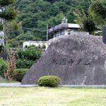
monument
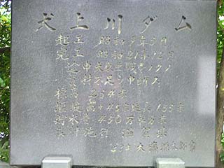
Moving to the right bank, we found a monument.
It is a stone monument that somehow feels the weight of history.The dam is called "Inukami Dam" in the dam handbook, but according to this stone monument, it is called "Inukami River Dam.It is said that the construction was halted due to the war, which reminds us of the hardships of the time.
Inukami River Dam
Groundbreaking May 1934
Completed December 1946
On the way to the Greater East Asia War
Material Shortage Suspension
Elevation: 254 meters above sea level
weir Height Sa 45 m. Extension 135 m.
Water storage capacity: 4.5 million square meters
Design and construction Shiga Pref.
Written by Gentaro Ohsumi, age 88.
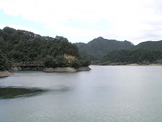
View of the embankment from the lake side of the right bank
Furthermore, in the early Showa period (early 20th century), this area was the subject of constant disputes over water rights, which became a source of conflict among farmers. The construction of the dam was intended to settle such disputes, but the war, land acquisition, and compensation negotiations in the submerged area made the construction difficult.
View of the top edge from the right bank
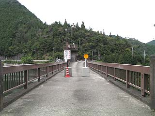
As you can see, the top edge is closed to automobile traffic. There are also these blocks on the left bank.
View of the top edge from the left bank
View of the levee from the downstream side of the left bank
dam characteristics
| Model | Coarse stone concrete linear gravity dam |
|---|---|
| Objective | Irrigation water, power generation |
| Bank height | 45m |
| Bank length | 135m |
| Dam volume | 69,650m3 |
| Overflow Elevation | 254m |
| Watershed Area | 32.3km2 |
| Reservoir area | 3 ha |
| Total storage capacity | 4,500,000m3 |
| Effective water storage capacity | 2,500,000m3 |
| Flood discharge | Steel shell structure roller gate (1) Diameter 21.10 m, door height 2.5 m, 2 gates (2) Diameter 5.00m, Door height 2.5m, 1 gate |
| River Name | Yodo River System Inukami River |
| Year of launch | 1934. |
| Year Completed | 1946 |
| Access | Meishin Expressway Hikone IC exit and turn left→Route 306 south Pass under the elevated Meishin Expressway twice and turn left at the next signal intersection after the Toshimanji intersection. Heading south on Prefectural Road 226 There is a two-way road to County Road 34 on the way. Turn it to the right direction -> then straight on the road. Please be careful when passing through the area around the village near the embankment, as the road is narrow. |
Other facilities/observations
It is a small dam with no particular facilities, but it is a good dam to visit from a variety of perspectives. I personally recommend this dam.
| Parking lot | × |
|---|---|
| Toilet | × |
| Park | × |
| PR Exhibition Hall | × |
Comment