
Date of coverage: 2021/10/9 (Sat) & 10/31 (Sun)
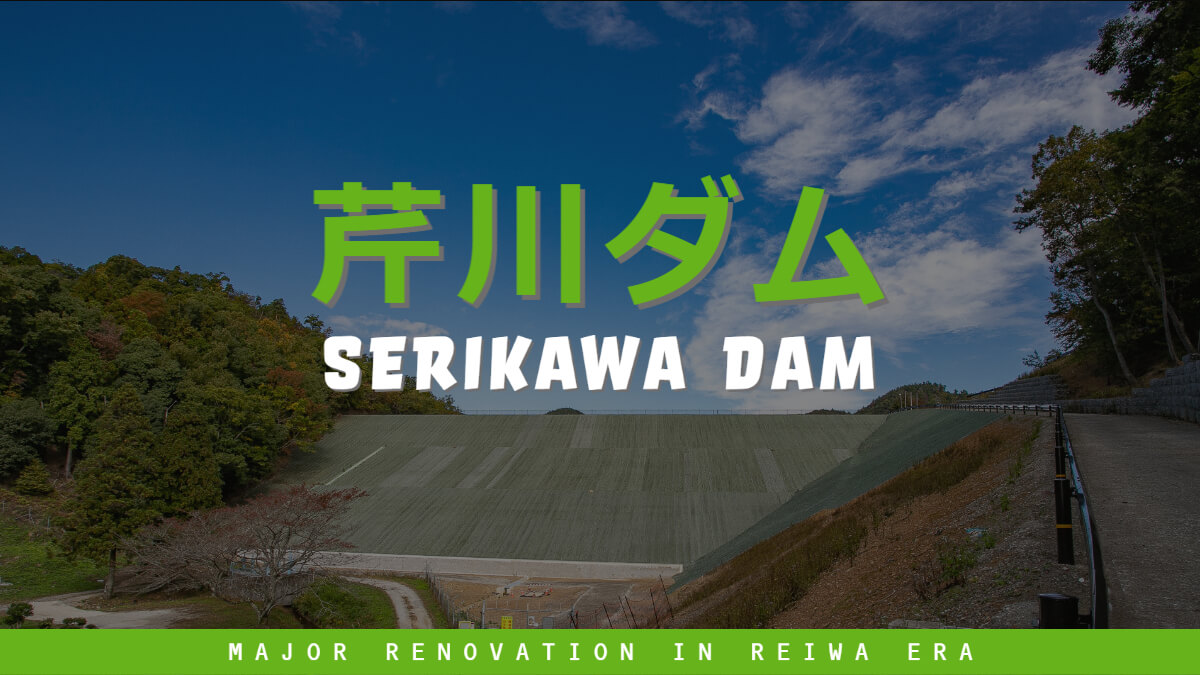
The Serikawa Dam has been undergoing seismic reinforcement and equipment repair work for several years as part of the "2022 Great Repair" project. Personally, I had not visited the Serikawa Dam in the Koto area of Shiga Prefecture, but since the construction of the main body of the embankment seemed to have been recently completed, I decided to take this opportunity to visit the dam.
Serikawa Dam is located in the Ichien area of Taga Town, Shiga Prefecture, and is sometimes called "Ichien Dam" by the locals.
Incidentally, we went to Serikawa Dam for the first time via Kuramake Pass on Route 306. I had an image of Kurakake Pass being closed due to snow accumulation in winter and landslides in rainy season, so I had avoided the pass.
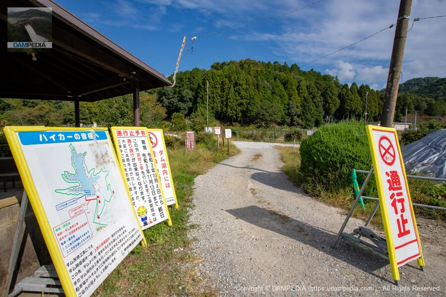
In the parking lot
As soon as I arrived, a person who seemed to be the site supervisor of the JV talked to me, probably because he saw the "dam tour" and "discharge caution" stickers on my car and realized that I was a dam enthusiast. Unfortunately, however, he told me that I could not approach the embankment.
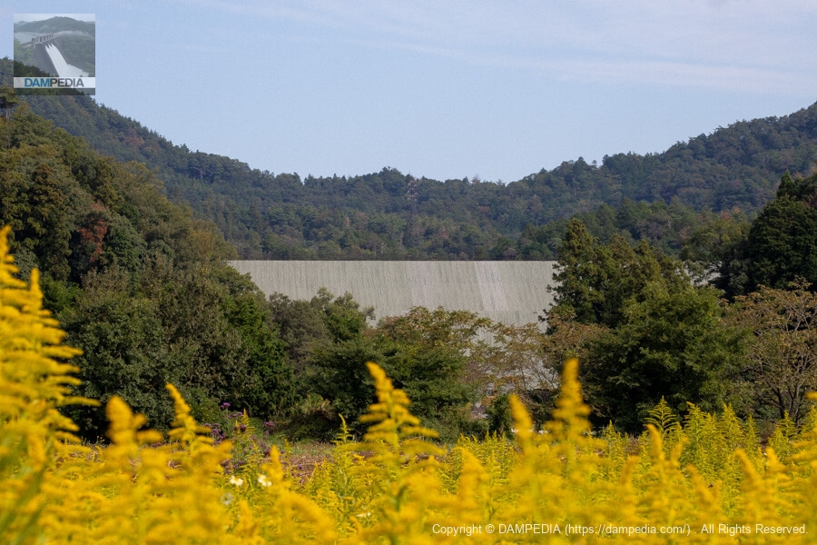
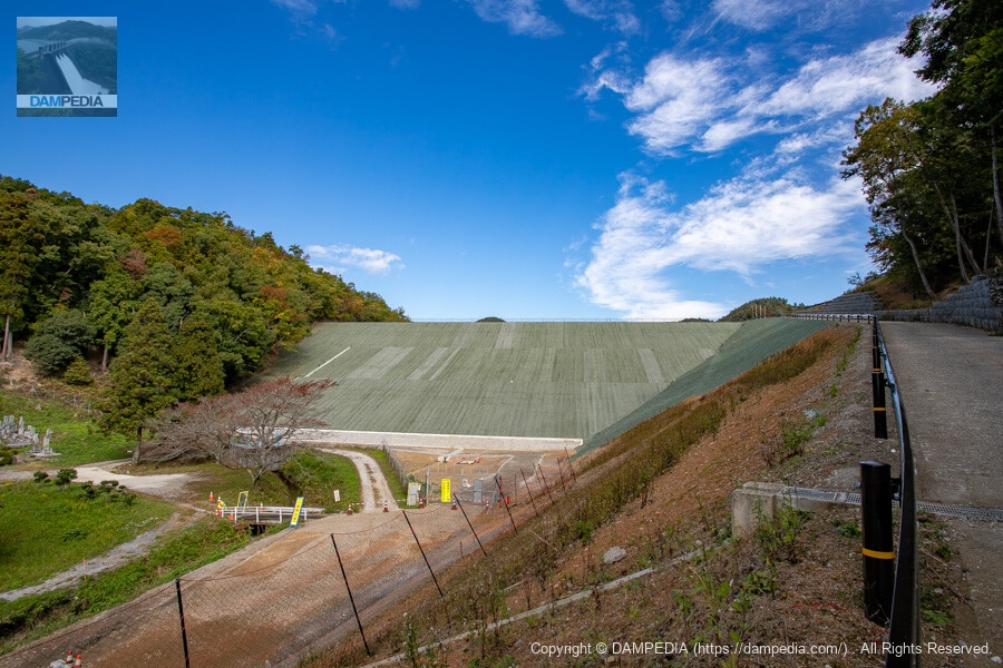
View of the downstream face of the levee from a field of rape blossoms downstream
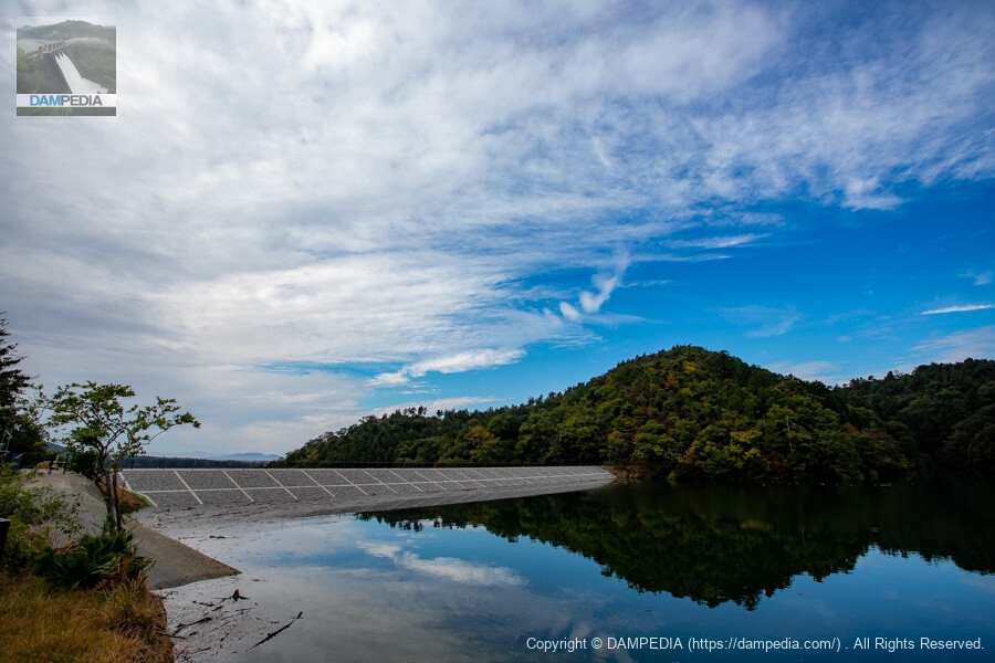
I had no choice but to take a light walk around the area and move to a place where I could see the embankment and take pictures. It is an earth dam, but there is not much impression of soil or grass at all.
Looking downstream from the left bank
Three weeks later, I visited the Serikawa Dam again. I received information from a follower on Twitter that the dam was about to reach its full capacity during the test flooding, and that there was a possibility of overflowing the overflowing water from the overflowing water discharge. We received special permission to enter the site.
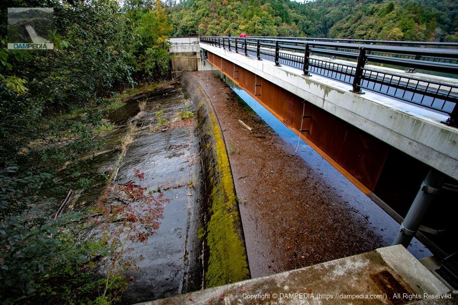
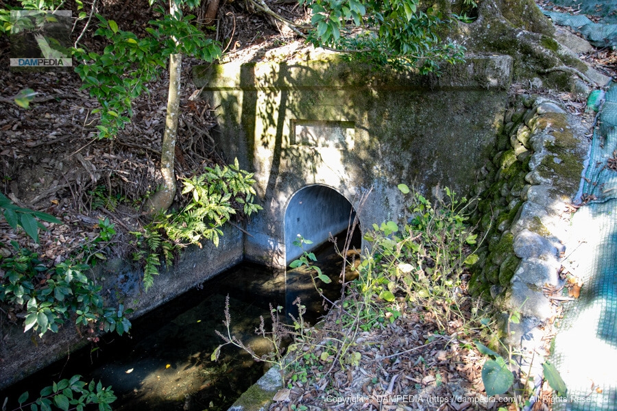
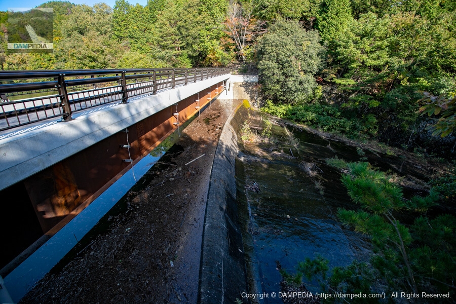
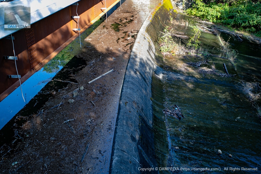
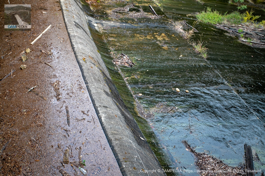
View of the conduit from the bridge downstream
Basically, it seems that only the embankment was to be repaired, and the spillway and conduit sections were not to be repaired. As you can see, the conduit section remained old. This may be a good thing, as it has a certain flavor.
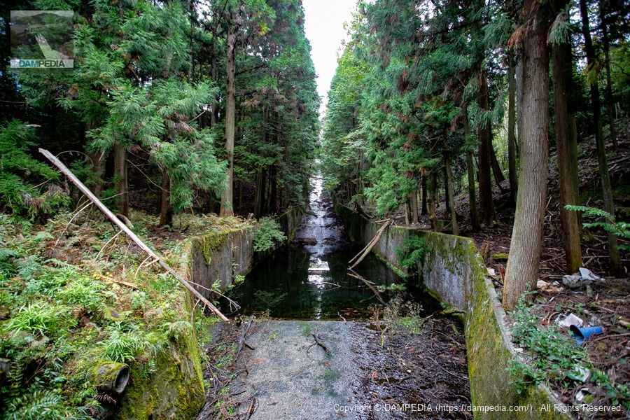
Bridge downstream of the residual water discharge
This bridge is also quite old and tasteful.
Incidentally, Serikawa of Serikawa Dam is the name of a river, but the main Serikawa River does not flow into the reservoir. In fact, water taken from an intake weir on the main Serikawa River flows into the Serikawa Dam reservoir through a channel (Serikawa Shouzujiro).
It is difficult to understand in writing, so I will quote from the outline chart found on the Shiga Prefecture website.
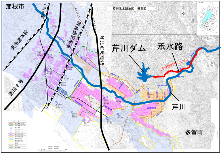
According to information provided by a follower, the Serigawa Dam and the Shougou Canal were planned by Unosuke Tsuchida (1867-1939), who contributed to the development of agriculture in the Taga region before the war, but he died without seeing the completion of the project.
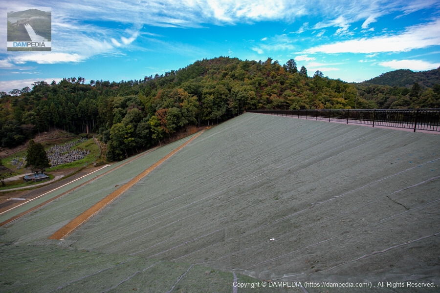
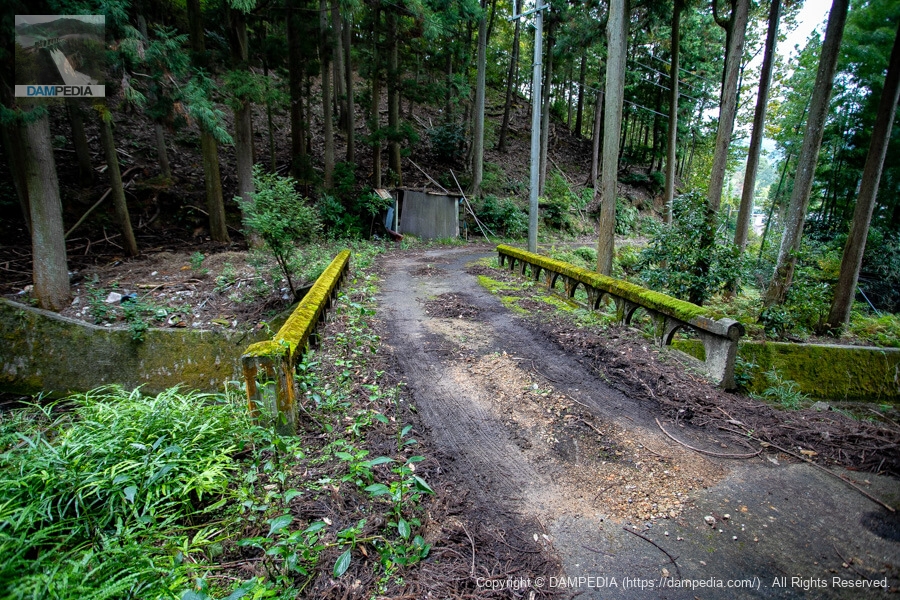
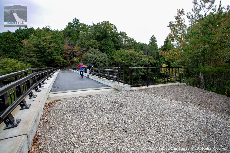
View of the top edge from the left bank
Unfortunately, the top edge could not yet be entered on this day, but it had already been paved and the high railings installed.
Looking upstream from the left bank
The upstream face of the embankment is concrete frame work + filling work, which is the mainstream in recent earth dams. It looks beautiful.

View of the upstream face of the embankment from slightly upstream on the left bank
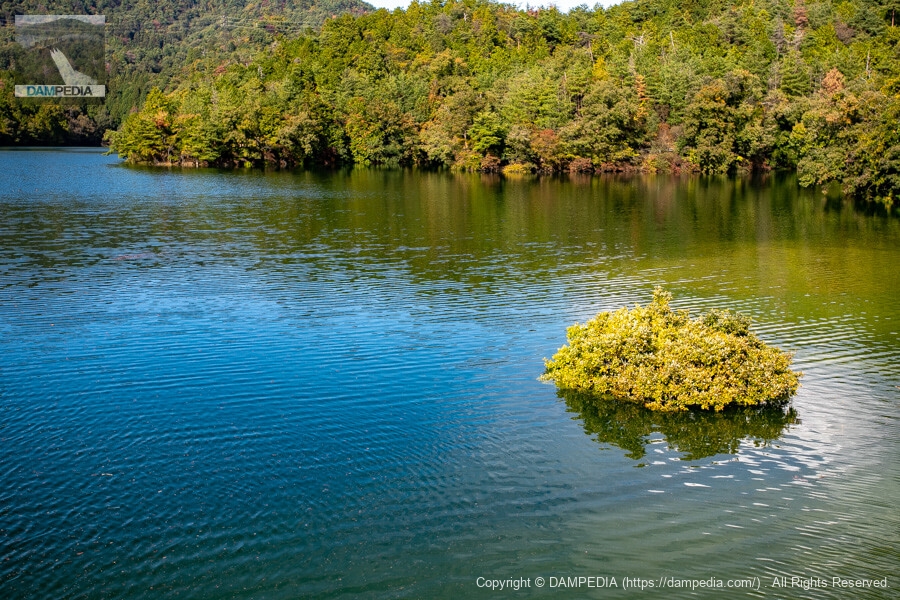
The lake water is generally clean, although there is some driftwood and wood chips floating in the water due to the rain. The reflection of the green of the mountains and the blue of the sky on the surface of the lake was very impressive.
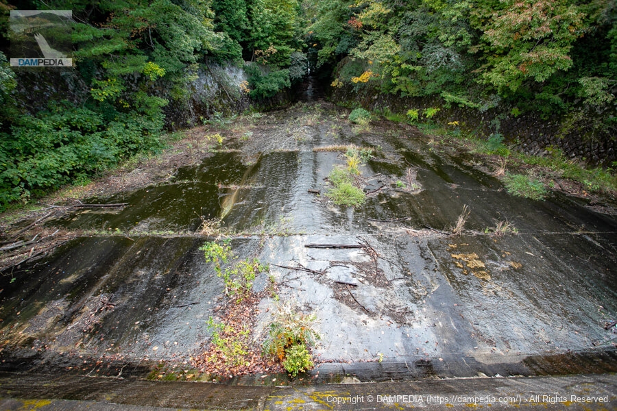
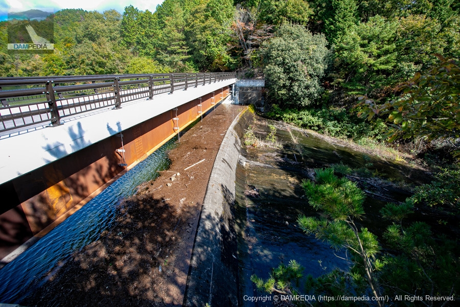
Bridge over spillway
The bridge over the spillway was originally constructed with trusses, although it was updated in conjunction with the levee renovation.
View of the conduit from the bridge above the spillway
As of the morning, it had not yet overflowed.
View of the spillway from the left bank
The water is stored up to the very edge of the overflow bank, but it looks like it will overflow in a few more minutes.
See inflow construction
We came to see the inflow upstream to see if the water would still overflow for the time being. The water was flowing in a zabazaba.

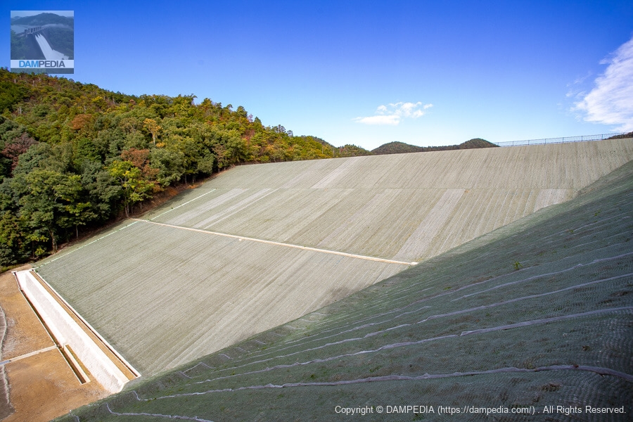
View of the downstream face of the dike
Returning from the inflow construction, we admired the downstream face of the embankment. The newly completed embankment has no grass yet, so it has a completely different atmosphere from the earth dam.
Looking upstream from the left bank
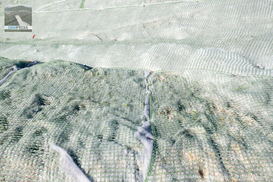
Incidentally, the sheet stretched over the slope of the embankment is not a weed prevention sheet but a vegetation sheet.
Vegetation Sheet
The seeds will be planted in this sheet to green up the area. It will surely turn a beautiful earth dam-like green color in time.
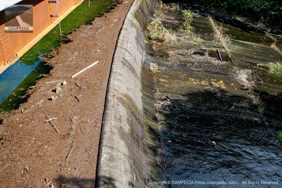
Residual water discharge at about 11:30 a.m.
It has been more than two hours since we arrived, but the situation does not seem to have changed much... Moreover, there is a crack in the lower part of the overflow bank, and it looks as if water is leaking from there.
View of the embankment from just below the downstream face
We had no choice but to eat lunch to kill some time, and then went back to the bank. This time, we approached from just below the downstream face.

Culvert portal from water intake facility
There is a water intake facility on the right bank, and the water taken there flows through here. A "gurgling" sound can be heard in the back. There was a nameplate on the top, but unfortunately it has been removed.
Residual water discharge around 1:00 p.m.
It looks like the water level has risen just a little bit...
Residual water discharge up
Hmmm...I still think there is a crack at the bottom of the overflow dike and the inflow is leaking from there.

View of the reservoir from the bridge above the spillway
If you look at the reservoir, you can see many waterfowl resting their wings and a submerged forest, which is beautiful and lovely.
View of the upstream face of the levee from the upstream walking trail
Since the reservoir was not overflowing, we decided to walk around the reservoir to the right bank. So we decided to walk around the reservoir to the right bank. The photo shows the upstream side of the dike. There are some trees in the way.

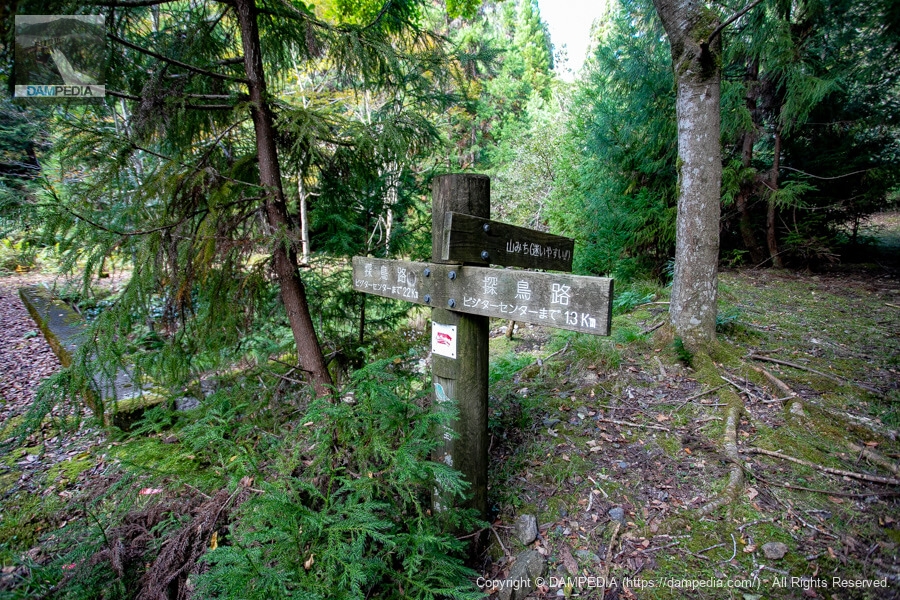
Branch of walking trail
ところどころ足場が悪く靴が汚れてしまうほどでした。結構歩いたのですがそれでも半分も行かなくて結局途中であきらめて引き返しました💦
View of the residual water discharge at about 2:30 p.m.
The sun has gone down and about half of the excess water discharge is now in shadow. And not much seems to have changed in the situation...
Close-up of residual water discharge
I don't think so...
Is it still crack?
We are really close! I'm almost there, but there is still so much water seeping out of the cracks that it doesn't look like it is going to overflow. If the wind blows..." or "Someone come into the reservoir! I think it is only in the test waterlogging that we joke with other enthusiasts like "If the wind blows..." or "Someone should come into the reservoir! If the wind blows..." or "Someone come into the reservoir!
feeling of half-hearted resignation
The mood among the assembled dam enthusiasts was one of resignation. Since it was the voting day for the House of Representatives election, I had no choice but to leave at daylight because I had not yet cast my ballot before the election.
The improvement district seemed to be aware of the cracks, but since the excess water discharge is rarely used, only the embankment was repaired. The amount of water leaking from the cracks was not known, but depending on the results of the test flooding, it may be repaired.
The downstream side of the reservoir is gradually being developed and will be open for free tours, so why not visit it in combination with this clean and pleasant reservoir?
Last but not least, to all the land improvement districts in the Ichien area, and to a certain follower who acted as an intermediary, thank you very much for your help this time!
Serikawa Dam Specifications
The name of the river is not actually Serikawa, but for convenience it has been adapted from the dam handbook. It is possible that some of the specifications may have changed due to the renovation, but we have left them as they are. (I have heard that the height of the embankment has not been changed.)
| Location | All around Taga Town, Inukami-gun, Shiga Prefecture |
| River Name | Serikawa, Yodo River system |
| Objective | A (irrigation water) |
| Model | E(earth dam) |
| Bank height | 27m |
| Bank length | 135m |
| Dam volume | 158,000 m3 |
| Watershed Area | 38.7 km2 (direct: 1.2 km2, indirect: 38 km2) |
| Reservoir area | 14 ha |
| Total storage capacity | 1,781,000 m3 |
| Effective water storage capacity | 1,751,000 m3 |
| Dam operator | Shiga prefecture (Kinki area) |
| Main body constructor | Directly managed by dam operator |
| Year of launch | - |
| Year Completed | 1955 (old levee) |
| Name of Dam Lake | - |
Other facilities/observations
Park in the "Wild Bird Forest" parking lot downstream and walk to the site. Restrooms are also located adjacent to that parking lot.
| Parking lot | ○ |
| Toilet | ○ |
| Park | period |
| PR Exhibition Hall | × |
| Fishing | ? |
Map around Serikawa Dam
Weather around Serikawa Dam
Accommodations that may be close to Serikawa Dam
Comment