
A closed dam compared to the Yahagi No. 1 Dam.
Location: Tokise-cho, Toyota City, Aichi Prefecture, Japanright bank (shore)Gifu Prefecture]
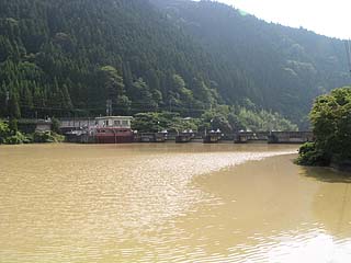
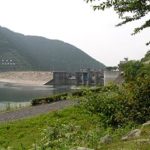
View of the embankment from the lake side of the right bank

Yahagi No. 2 Dam is located downstream from Yahagi No. 1 Dam. Since many runners and bikers drive on the lakeshore road, I hesitated to park every time and could not easily take pictures, but I took the plunge.
The water in the dam lake is very muddy due to heavy rain until the previous day.
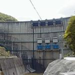
View of the levee from the downstream side of the right bank
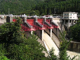
The four red tenter gates are very attractive. The second gate, counting from the left bank, is discharging water.
View of the levee from the downstream side of the right bank
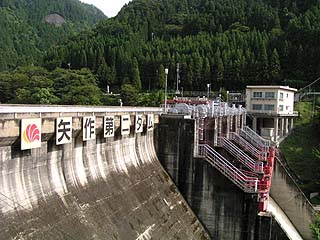
This is a little closer than the previous photo point. It is very neat and tidy. Unlike the Yahagi No. 1 Dam, the top of the dam is off-limits.
View of the embankment from the lake side of the right bank
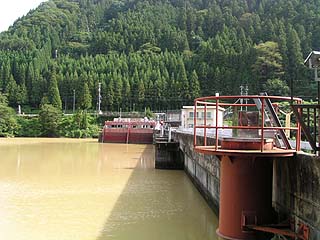
The white building on the right is the administration office and the left is the water intake.
dam characteristics
| da mu | form (something takes) | gravity-fed concrete dam |
|---|---|---|
| Objective | generation (e.g. power) | |
| Bank height | 38m | |
| Bank length | 149.2m | |
| Dam volume | 56,000m3 | |
| savings water (esp. cool, fresh water, e.g. drinking water) pond | Watershed Area | 514.2 km2 |
| Reservoir area | 41ha | |
| Total storage capacity | 4,354,000m3 | |
| Effective water storage capacity | 968,000m3 | |
| River Name | Yahagigawa River System Yahagigawa River | |
| Year of launch | 1967. | |
| Year Completed | 1970 | |
Other facilities/observations
| Parking lot | × | I always just passed through. It was nice to be able to see it up close and personal. I just wish there were more points to visit.... |
|---|---|---|
| Toilet | × | |
| Park | × | |
| PR Exhibition Hall | × |
Comment