
Date of interview: 2013/04/29 (Mon.)
We moved from the Futatsuya Diversion Weir to the Masugaya Dam. We were told in advance at the Hirono Dam management office that the road on the right bank of the Masudani Dam was closed due to construction, so we visited the dam from the left bank first.
The Masuya Dam was constructed by the Ministry of Agriculture, Forestry, and Fisheries as part of the Hino River Basin Water Resources Development Project in combination with the Futatsuya Diversion Weir. Initially, the dam was to be under the direct control of the Ministry of Agriculture, Forestry and Fisheries (MAFF), but later flood control was added as an objective, and the dam has been managed by Fukui Prefecture since its completion. The Yaotome Headworks and other structures were also constructed as part of this project.
Incidentally, the Hino River Basin Water Resources Comprehensive Development Project involves the joint implementation of the following four projects.
- National Hino River Irrigation Land Improvement Project (Main body: Ministry of Agriculture, Forestry and Fisheries; Purpose: irrigation water)
- Hinogawa District Water Supply Project (Entity: Fukui Prefecture, Purpose: Water supply for drinking water)
- Hinogawa Area Industrial Water Supply Project (Entity: Fukui Prefecture, Purpose: Industrial water)
- Fukui Hino River Comprehensive Development Project (Entity: Fukui Prefecture, Purpose: Flood control)
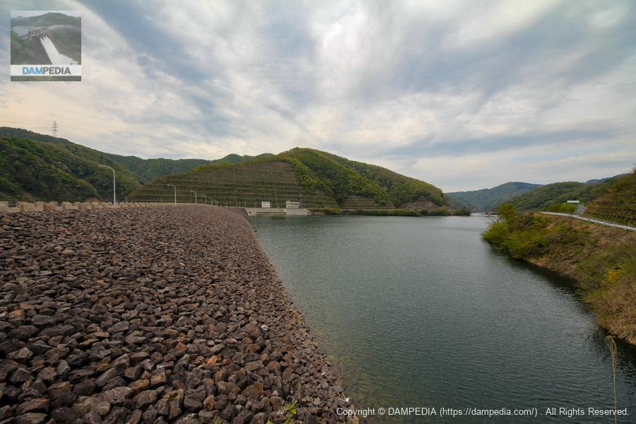
Downstream view of the levee from the left bank
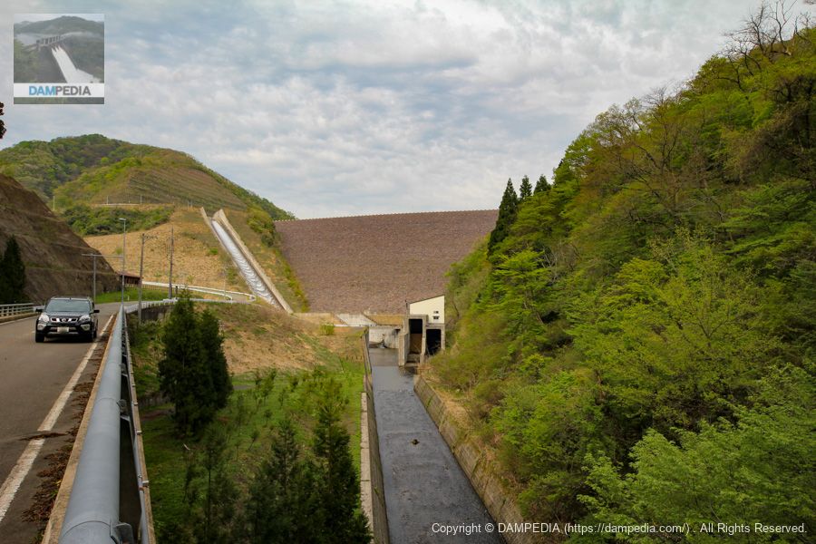
I was told by the Hirono Dam management office that the right bank was closed due to construction, so I came to the left bank first. The riprap is still very clean, with almost no vegetation. It seems to be well managed. Also, the embankment height is 100.4 m, which is so large that it is hard to believe that it was constructed by the Ministry of Agriculture, Forestry and Fisheries and managed by Fukui Prefecture.

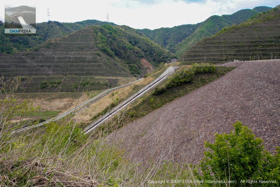
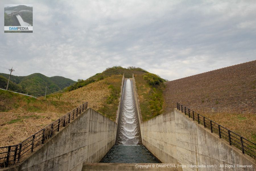
View of the flood discharge from the left bank
The flood discharge of a rockfill dam is a perfect example of building on top of a landslide.
View of the top edge from the left bank
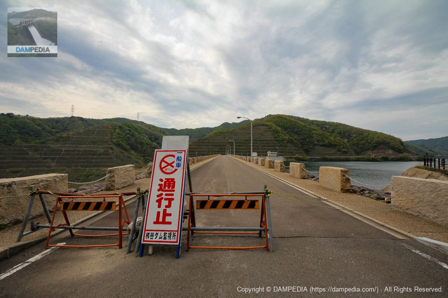
As you can see, there was a "No Passage" sign at the top end, but we were told that passage on foot was possible, so we decided to walk to the management office to obtain a dam card.
View of the top edge from the left bank
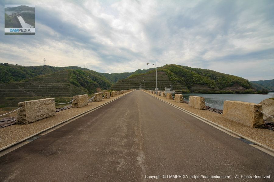
However, the top of the embankment is 345.9m long, which makes it seem a bit far away.
View of the upstream face of the embankment and dam lake from the right bank
The upstream surface is also beautiful. The water in the dam lake is also clean.
View downstream from the top
The slope of the mountain downstream of the right bank looked like it had been artificially cut, so I wondered if it might be Mt. The downstream area on the right bank is named "Harasekiyama Hiroba" (Mt. Haraseki Plaza).

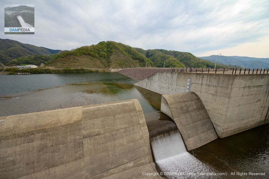
View of the permanent flood discharge
The flood discharge is a free overflow side channel type, which is common in rockfill dams. The cutout in the side channel serves as a permanent flood discharge, which was overflowing on this day. The white building on the far left is the administration office. The building on the far right, beyond the dam lake, is the Masudani Dam Training Center, which can be rented for 1,000 yen in the morning and 1,500 yen in the afternoon.


I would like to rent this place and turn it into a cafe.
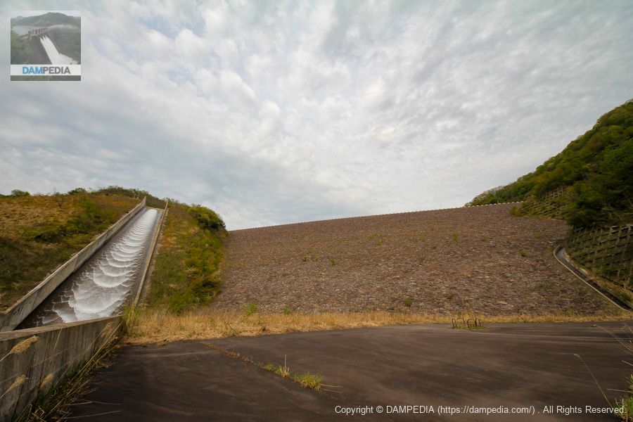
View of flood discharge and embankment
It looks like there is one level dug straight down from the dam lake to the permanent flood discharge. The sign seems to say what that is, but I was taking a picture of the sign for notes, but it is unclear due to lack of resolution. I will have to go to the site and check again.
We also missed photographing the training building on the other side of the river and the discharge from the Futatsuya diversion weir, so revenge is a must.
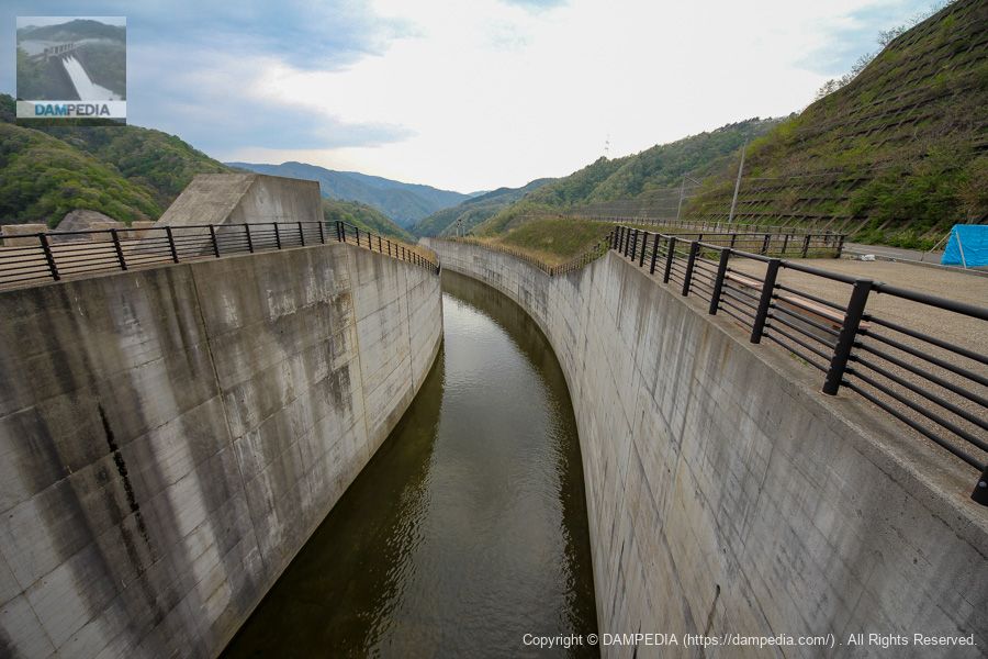
Flood discharge viewed downstream
The flood discharge is not straight but curves to the left, then the chute section follows the V-shaped embankment.
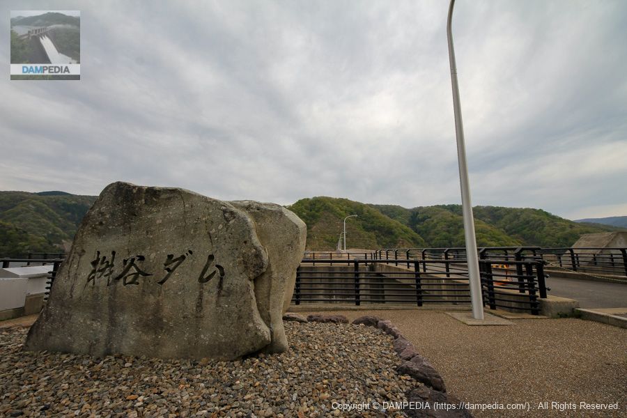
View of the monument on the right bank
It is a stone monument, but is it a stone taken locally?
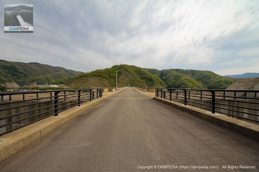
View of the top edge from the right bank
Normally I would have crossed this distance by car, but I had no choice but to return on foot.
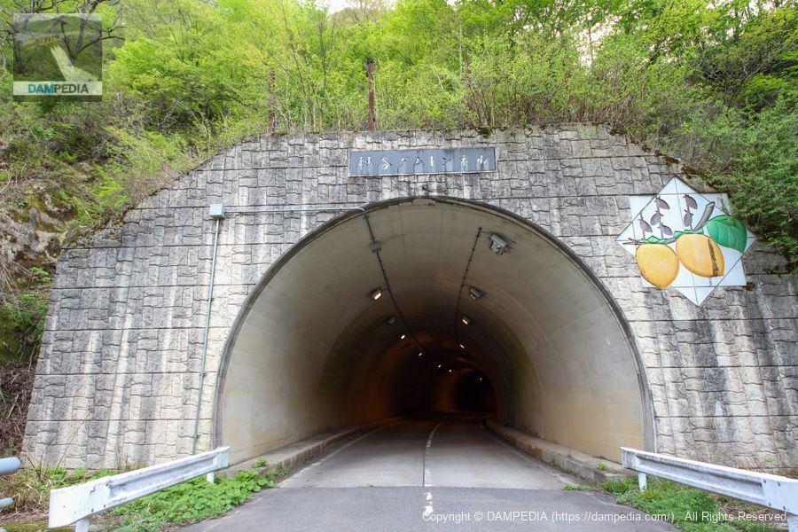
Masuya Dam Tunnel
To get here, we had to go through the right bank road, but we were told that we could pass through the tunnel for a while, so we passed a roadblock sign that blocked one lane and went further through the tunnel. The fruit depicted on the portal is Imajo vine, a specialty of Minami-Echizen TownkakiIt seems that the
View of the chute from downstream
We were able to see the discharge scene from downstream.
View downstream from the bridge
On the left is the water discharge facility. Although not photographed this time, there is a water intake facility on the upstream left bank, and water flows to this point using a channel that was a temporary drainage tunnel at the time of construction.

The discharge system consists of one each of an emergency discharge gate, a water diversion gate, and a small-flow discharge gate of jet-flow gates, each equipped with a spare gate of a high-pressure slide gate. The project was manufactured by Ishikawajima-Harima Heavy Industries, Ltd.
View of the levee from just below the levee
What? ! It's good! You can get so close to the embankment. It is quite an open dam.
View of the levee from downstream
It is also a very good point that when you exit the tunnel, Dawn and it's also a dam that is discharging water right in front of you.
If there is a tour, I would like to look here and there...such was the Masutani Dam.
Masutani Dam discharge animation
Masutani Dam Specifications
| Location | 25-5, 96 Aza-Kuchitaka, Utsuo, Minami-Echizen-cho, Nanjo-gun, Fukui, Japan |
| River Name | Masutani River, Kuzuryu River System |
| Objective | F (flood control, agricultural disaster prevention) A (irrigation water) W(Water for water supply) I (industrial water) |
| Model | R (Rock-fill dam) Central impervious zone type rockfill dam |
| Bank height | 100.4m |
| Bank length | 345.9m |
| Dam volume | 3,447,000m3 |
| Watershed Area | 30.5 km2 (direct: 10.2 km2 indirect: 20.3 km2) |
| Reservoir area | 89ha |
| Total storage capacity | 25,000,000m3 |
| Effective water storage capacity | 23,100,000m3 Water for agriculture: 13,670,000m3 Water for water supply: 3,550,000m3 Industrial water: 1,530,000m3 Flood control: 3,450,000m3 Unspecified water: 900,000m3 |
| Dam operator | Hokuriku Agricultural Administration Bureau |
| Main body constructor | Maeda Corporation, Kumagai Corporation, Tobishima Corporation |
| Year of launch | 1979 |
| Year Completed | 2005 |
| Name of Dam Lake | mountain Japanese apricotlake |
Other specifications are as follows
Foundation Ground:砂岩・粘板岩・チャート及びその互層
Width of embankment crest: 10.00m
Ceiling elevation:EL=343.40m
Slope: Upstream 1:2.90 Downstream 1:2.10
Flood discharge
| Model | Free overflow side channel type |
| design flood volume | 460m3/sec |
| overflow depth | 2.00m |
| overflow extension | 60.0m |
| Total length of flood discharge | 475.0m |
| momentum reducer | 強制跳水USBRⅡ型+sub-dam |
temporary drainage channel
| Model | Jizan Tunnel Formula |
| design flood volume | 175.0m3/sec |
| Tunnel Cross Section | Standard horseshoe shape 2R=4.50m |
| Tunnel Extension | 616.5m |
corridor connecting an annex to a pond-side building (in traditional palatial-style architecture)
| Model | Culvert type |
| extension | 420.0m |
| cross-section | Inner air H=2.5m B=2.0m |
water intake facility
| Model | Inclined straight multi-stage gate |
| Maximum Water Withdrawal Volume | 9.748m3/sec |
Other facilities/observations
| Parking lot | ○ |
| Toilet | ○ |
| Park | ○ |
| PR Exhibition Hall | × |
| Fishing | ○○ (excluding no-take zones) |
Map around Masutani Dam
Accommodations that may be close to Masudani Dam
References

Comment