
Date of interview: Wednesday, 12/10/2014
This was the last dam tour of the day. After leaving the Yubara Dam, I headed south along the Asahigawa River, stopping at the Yashiroguchi Dam on the way to the Yubara IC. There is an area called Yashiro (Shrine) to the east of the Yashiroguchi Dam, and as the name implies, there are eight "Shikinai-sha" (Shinto shrines) in the area, and the name "Yashiroguchi" comes from its entrance.
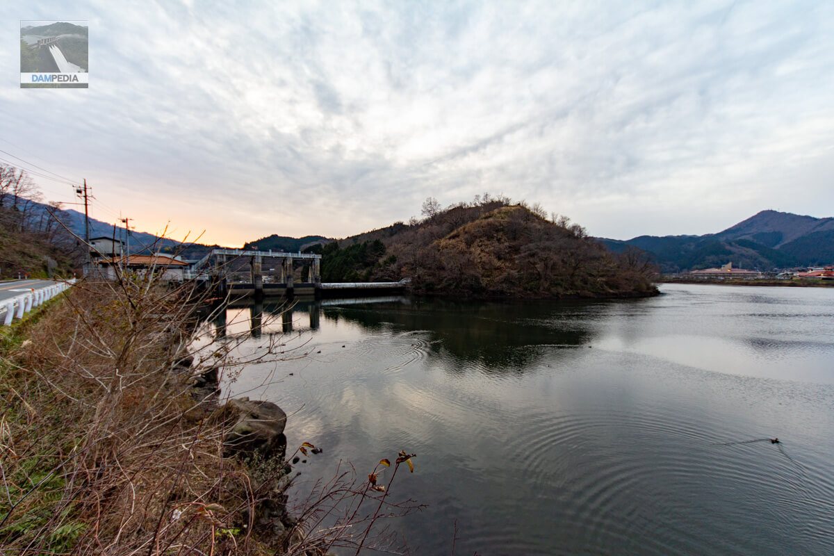
View of the upstream face of the levee and the reservoir from the left bank
I will look at it from the upstream side as I am going from upstream to downstream. The Yashiroguchi Dam is a dedicated power generation dam for the Chugoku Electric Power Company, and water taken from this dam is sent to the Yubara No. 2 Power Plant for hydroelectric power generation. The Yashiroguchi Dam can also be said to be a reverse regulating reservoir for the Yubara Dam and Yubara No. 1 Power Plant, due to its location.
The time is just before 17:00. It is already dark. The right half of the embankment is a free overflow type overbank dike, and the left half is equipped with three radial gates. The tops of the overflow embankment and radial gates seem to be at the same height.
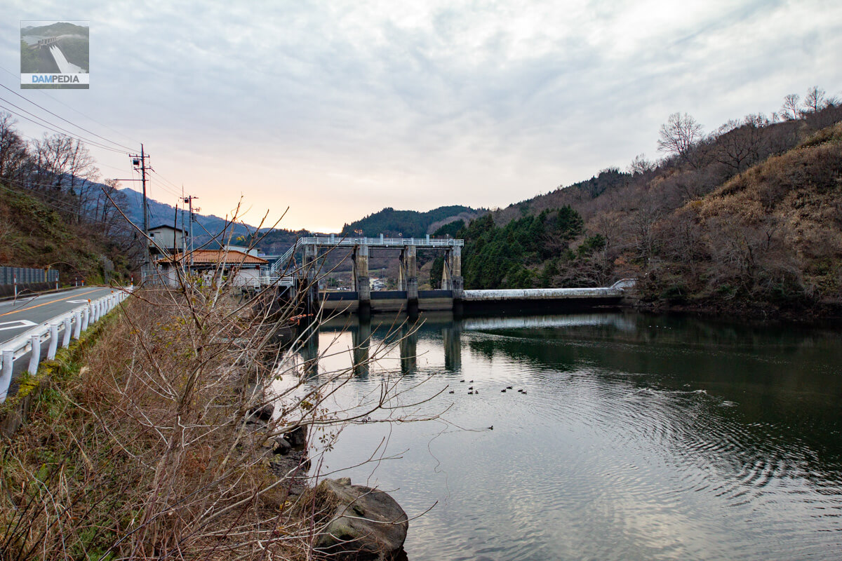
Further approaching the upstream face of the embankment
I am gradually approaching the embankment. The brown roof was the administration office, I think, and there were mooring facilities in front of it. The boat was just floating on the lake.
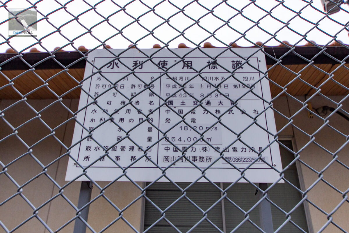
Water Use Signs
The maximum water intake is 18.20 m3/s.
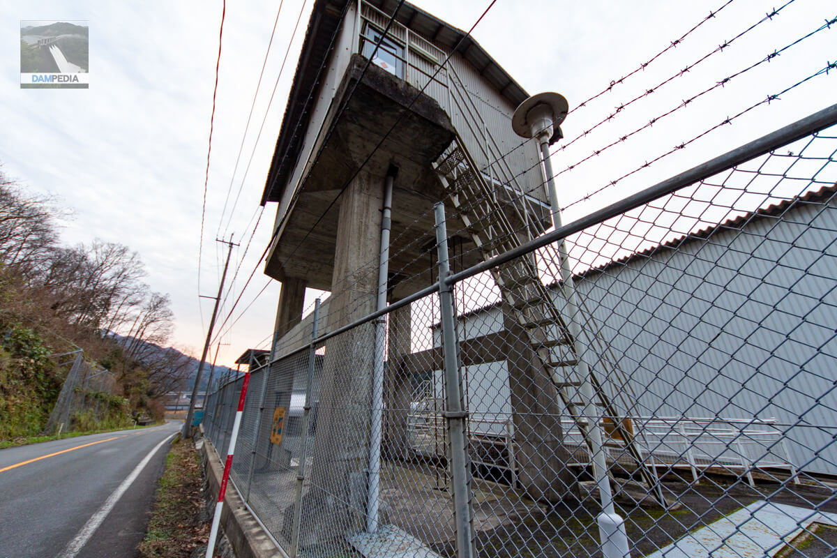
Water intake gate
The location of the conduit on the GSI map is slightly off, but I am pretty sure this is the intake gate (peer of).
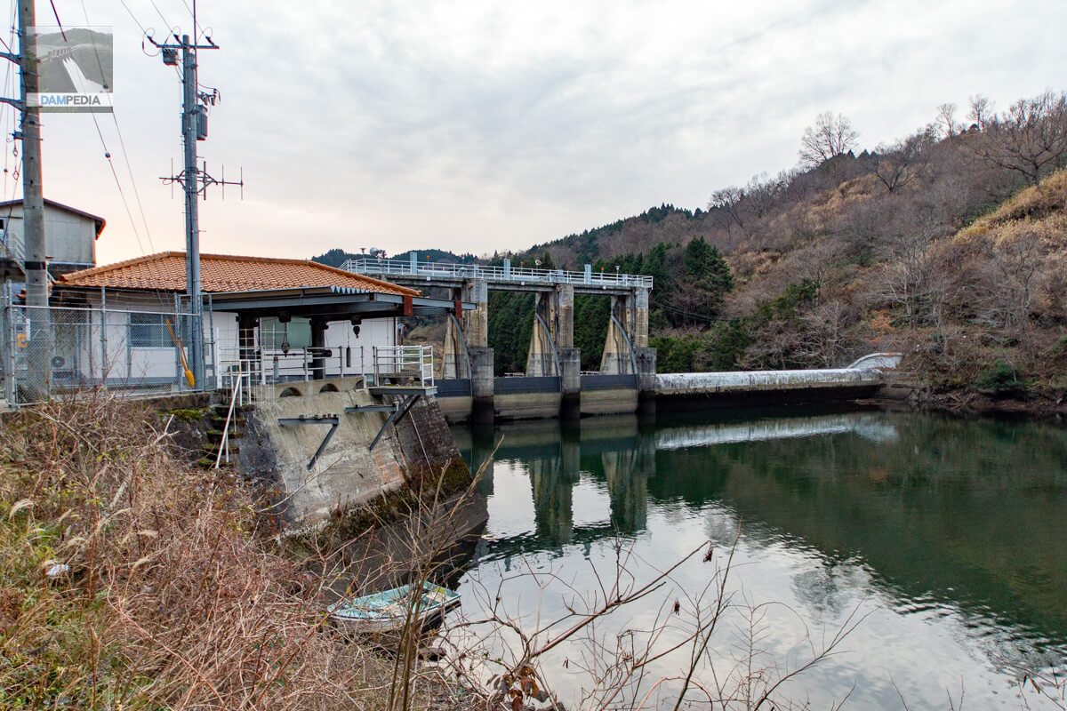
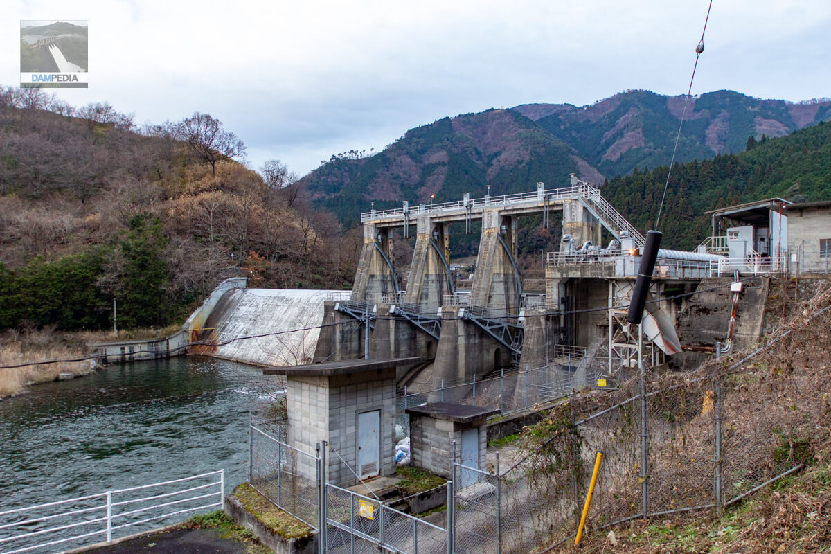
Looking downstream from the left bank
I have moved to a position where the downstream face of the embankment is visible. The left bank is straight and complex with a mechanical look, while the right bank is simple and curvy. The contrast between the two may also enhance the coolness.
Move downstream to capture the downstream face of the dike as straight as possible.
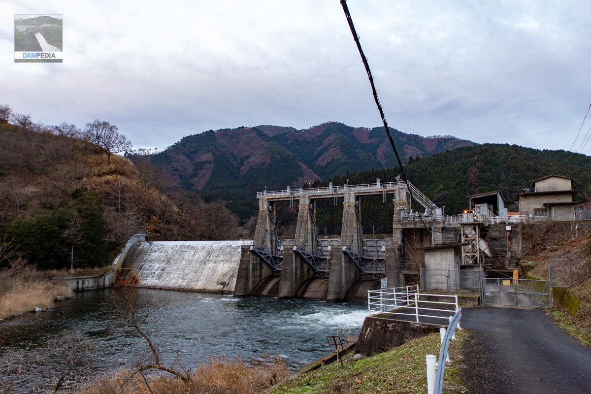
I am descending the slope and approaching the downstream face of the embankment. The three radial gates on the left bank are located at a lower height than expected. There also seems to be a sediment discharge gate on the leftmost bank, although it is a little hidden by tree branches and difficult to see. The water flowing in a gurgling stream is probably a river maintenance discharge. I am concerned about the strange white color of the overflow bank on the right bank. I am not sure if it was originally that color, if it was scraped off during the overflow, or if it was painted.

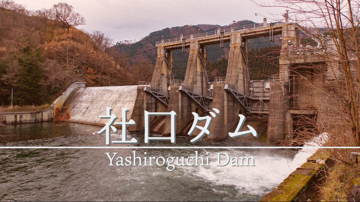
It was the Yashiroguchi Dam, a small power generation dam that had the best of both mechanical and curvaceous glamour.
Yashiroguchi Dam Specifications
| Location | Yashiro, Maniwa City, Okayama Prefecture |
| River Name | Asahigawa River, Asahigawa River system |
| Objective | P(Power generation) |
| Model | G(gravity-fed concrete dam) |
| Bank height | 16.15m |
| Bank length | 75m |
| Dam volume | 12,000 m3 |
| Watershed Area | 283.5 km2 |
| Reservoir area | 24ha |
| Total storage capacity | 960,000 m3 |
| Effective water storage capacity | 854,000 m3 |
| Dam operator | The Chugoku Electric Power Co. |
| Main body constructor | Aisawa Kogyo |
| Year of launch | - |
| Year Completed | 1954 |
| Name of Dam Lake | - |
Other facilities/observations
| Parking lot | × |
| Toilet | × |
| Park | × |
| PR Exhibition Hall | × |
| Fishing | ○ (fishing fee required) |
| Viewing platform | × |
Map of the area around Yashiroguchi Dam
Weather around Yashiroguchi Dam
Accommodations that may be close to Yashiroguchi Dam


Comment