
Date of interview: Saturday, March 31, 2012
Construction of the Otaki Dam began in 1962, but when a crack was discovered in the upstream area during a test flooding in 2003, just before completion, the test flooding was suspended. The completion of the dam was postponed. The purpose of the test flooding was to confirm that there were no abnormalities in the dam itself or its surroundings, so it should have been a good thing that the abnormality was found before construction was completed.
Reported incorrectly.I remember that many of them were funny, especially the program "B" on N-TV.
On March 31, 2012, the Otaki Dam was to conduct a test discharge.
View of the embankment on the lake side from the left bank
Since this is a test discharge, the water level is naturally full.
View of the crest gate on the dam lake side from the left bank
This sight may not be seen again in our lifetime.

View of the selective intake system from the left bank
The selective intake system of the Otaki Dam is a circular multi-stage gate, and the wire drums and other machinery seem to be stored inside the embankment. Therefore, there is no building on top, and the appearance is quite neat.

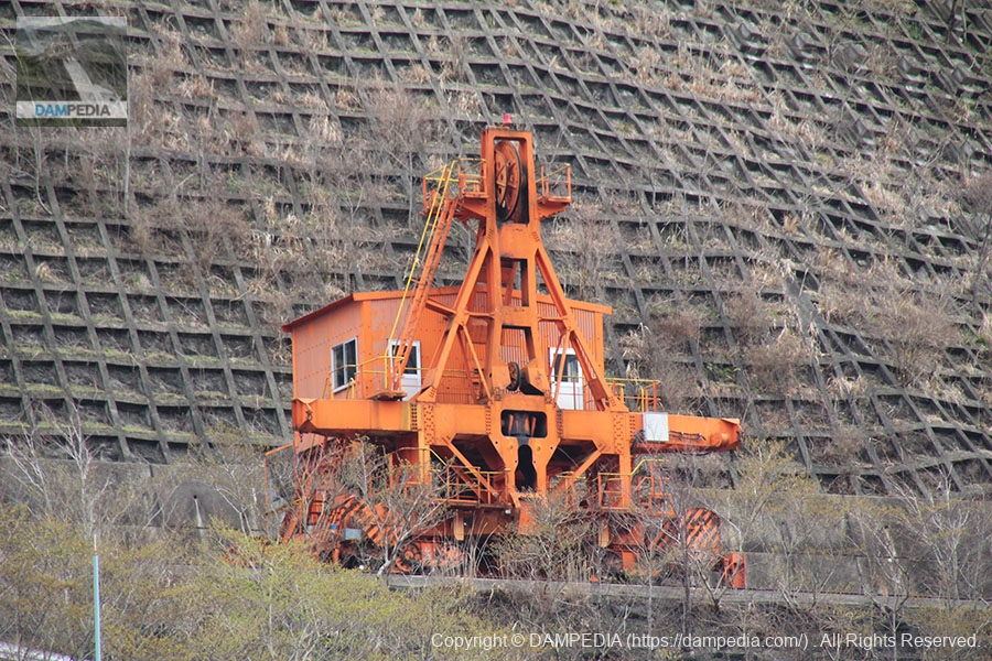
View of Kurobenoeki from the left bank
Kurobenoeki is a cable crane used during the construction of the Otaki Dam, and was originally used at the Kurobe Dam (Toyama), which was converted and remodeled. The name was given to the station because it connects the Otaki Dam and the Kurobe Dam in the same manner as a railroad.

cable crane
A cable crane that has completed its role is parked at such a crovenoequipment.
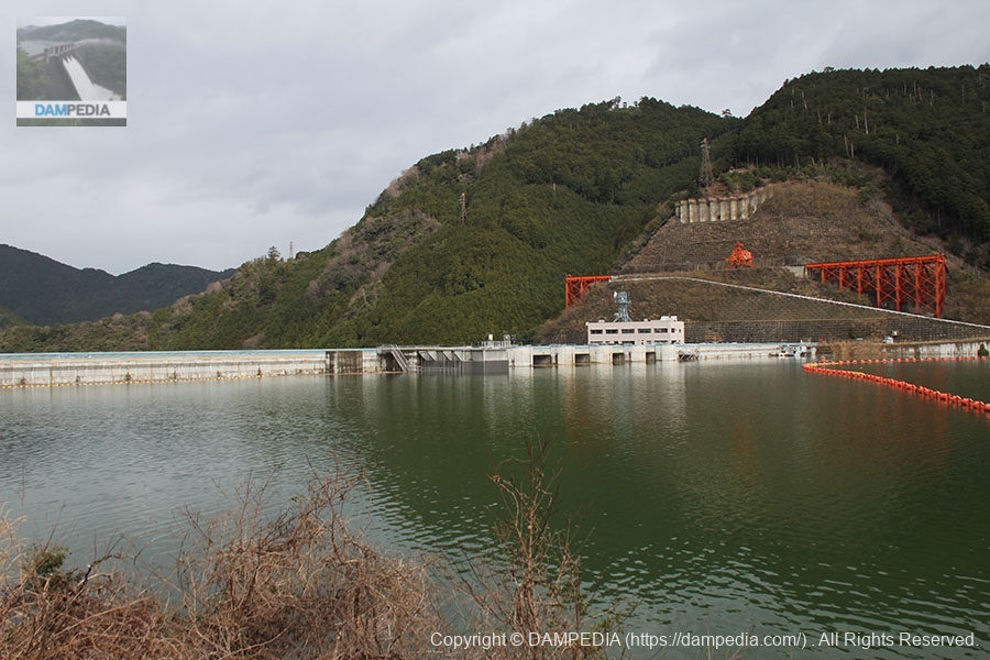
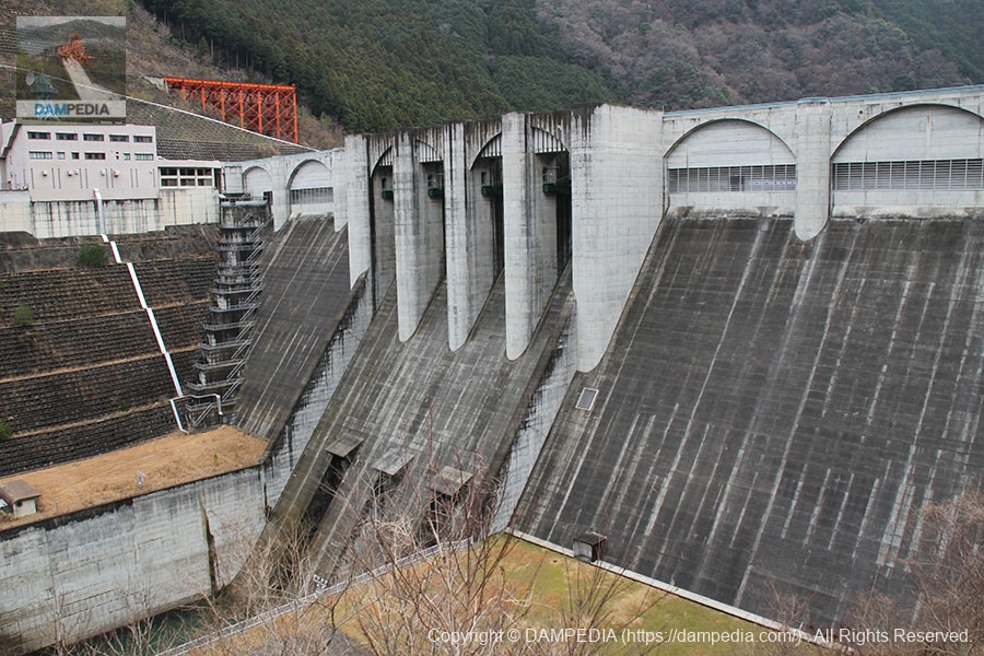
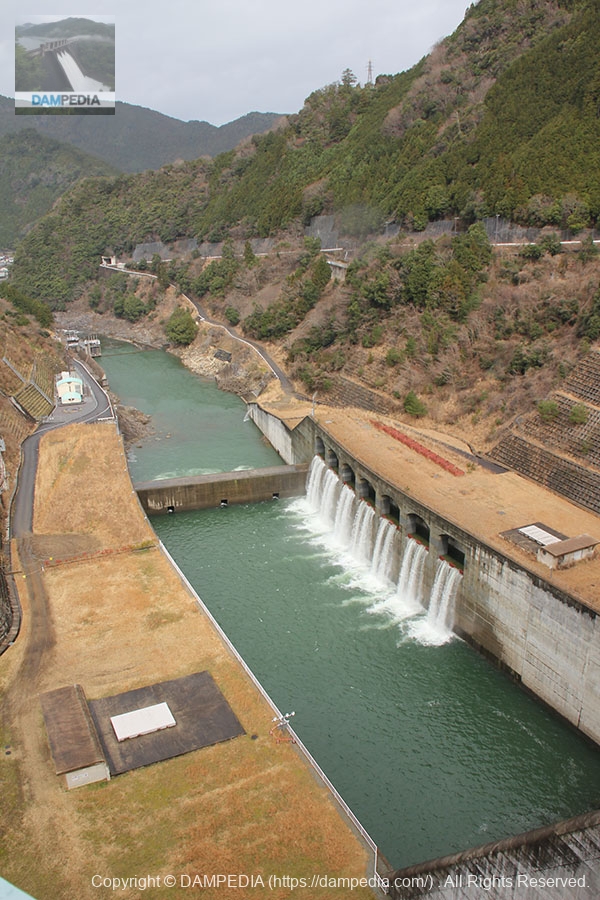
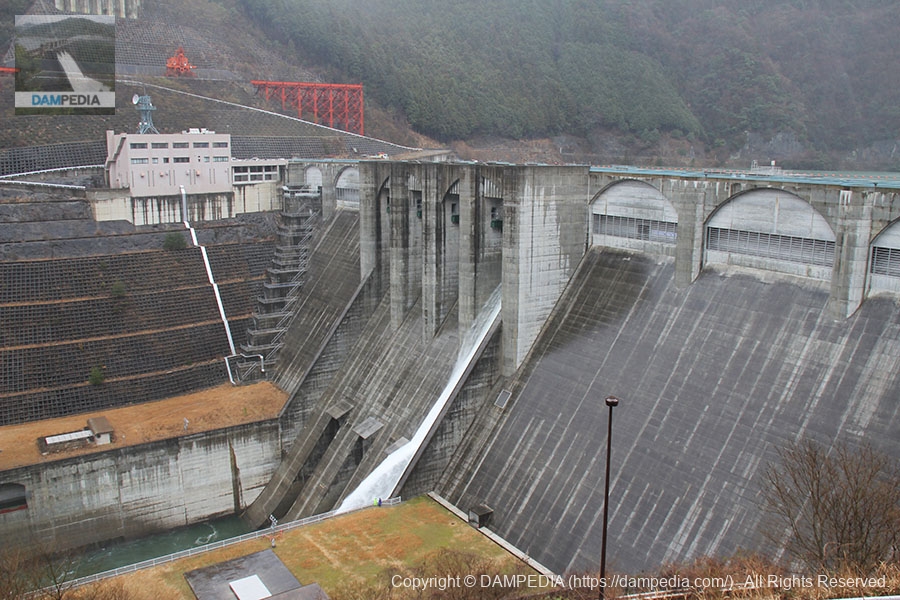
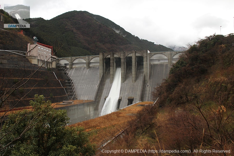
View of the levee downstream from the left bank
It is a massive embankment. It has four crest gates and three conduit gates. The arched design of the embankment wall was designed with the input of local residents.
View of footing on left bank
The footings looked like they could be climbed down, but they could not be climbed down freely.
I also remembered that I dropped the lens hood of my camera at this shooting location. I did not pick it up and gave up, but everyone should be careful.
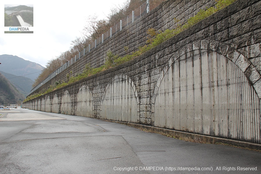
Retaining wall on left bank
Hearing that we can get a laminated card at the control center, we once finished taking pictures on the left bank and headed for the control center. On the way to the management office, we saw the retaining wall on the left bank, which, like the embankment, is an unusual retaining wall with arched blocks.
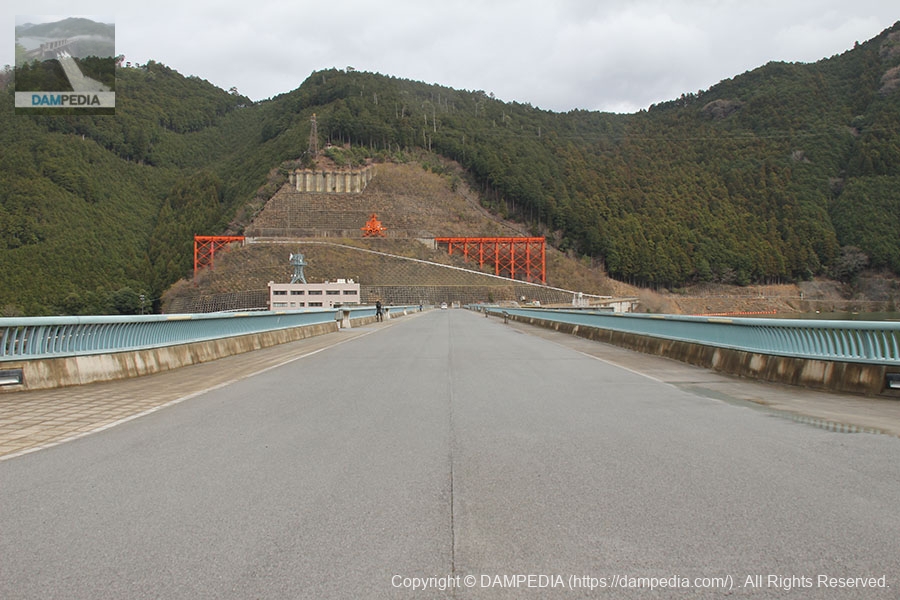
View of the top edge from the left bank
It is a very wide top. The top of the embankment is 315 meters long, which makes the other side of the river seem quite far away.
View downstream from the top
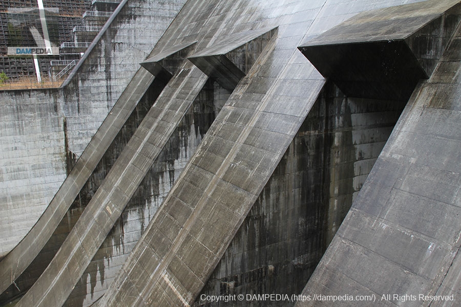
The "planned water level maintenance discharge facility" was introduced to solve the problem of low discharge for irrigation, but too much discharge for normal flood discharge. The cascade-type flow reducer was installed on the downstream side of the right bank. The structure is exactly like a waterfall, and is probably unique to the Otaki Dam.
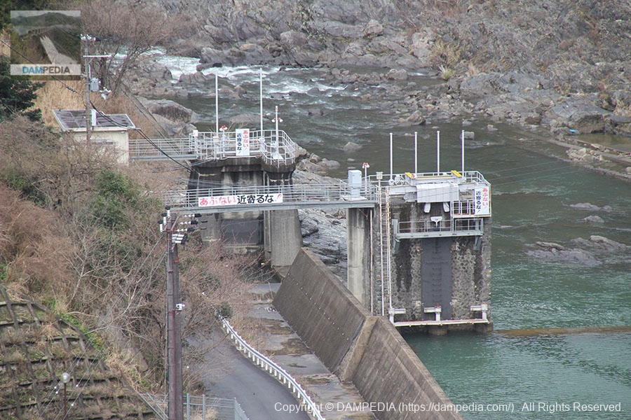
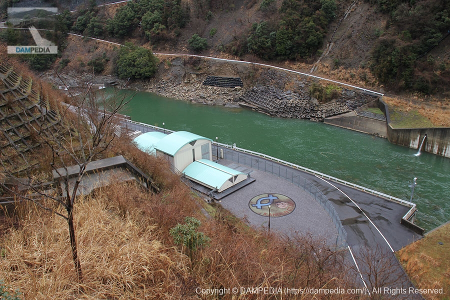
Water intake by the Otaki weir at the Kashio Power Plant
Downstream of the Otaki Dam is an intake dam called the Otaki Weir.weir(The water taken here is used by the Kashio Power Plant downstream through culverts and open culverts.
The Master and his car
The master and his car were found on the right bank on the downstream side of the river. This is a shot that will never be seen again.
View downstream from the top
It is a little difficult to see from this photo, but the crest gate of the Otaki Dam is hydraulically operated. Most dams use a wire rope system, which has a low initial cost, but the Otaki Dam was the first dam in Japan to use a hydraulic cylinder system, both from a scenic point of view for its clean appearance and from a running cost standpoint.

View of the levee downstream from the right bank
This is a view of the dike from the parking lot of the control center on the right bank. It might look better if we move a little further downstream.

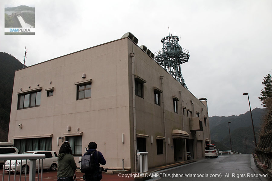
dam control center
Finally arrived at the management office. We received our laminated cards safely.
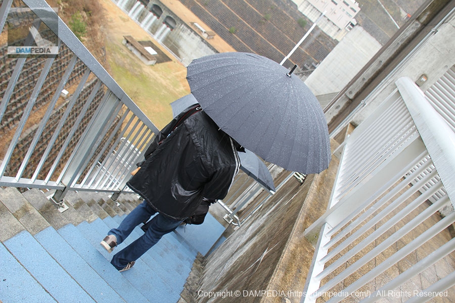
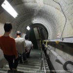
Stairs leading to the middle road of the dam
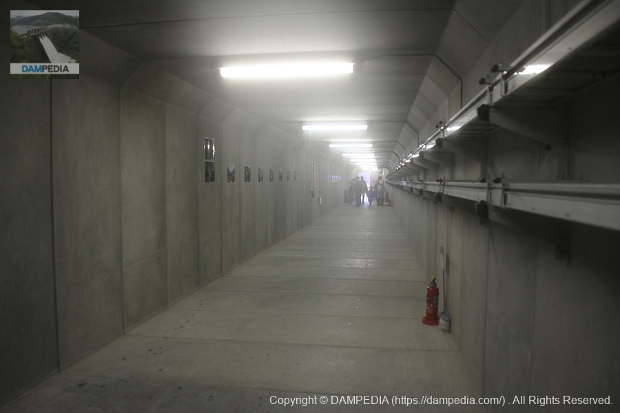
Returning to the left bank, we headed for the "middle way of the dam," a passageway inside the embankment, in order to get to the "dynamic plaza," a plaza downstream. Incidentally, I had broken two umbrellas at this point and had to get one from a fellow dam enthusiast.
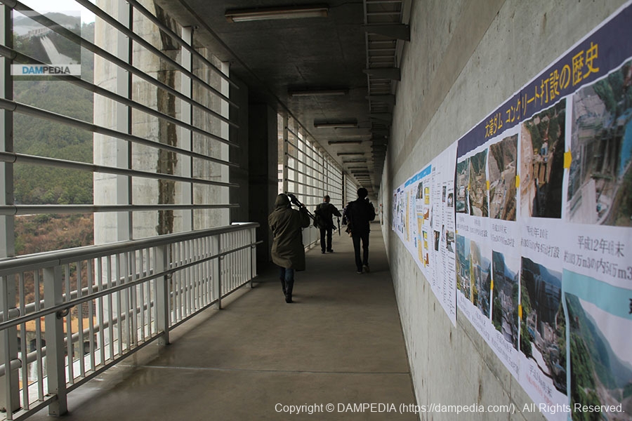
inside measure of a dam
The "middle way of the dam" is not an audit corridor like a tunnel, but a passage facing outward on the downstream face.
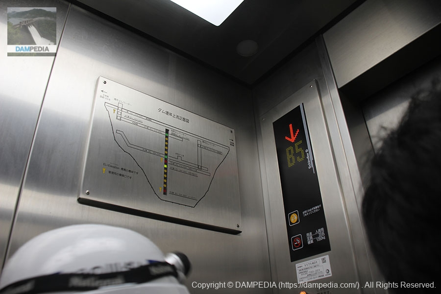
In the elevator
Follow the path through the dam to the end of the path, then use the elevator downstream to the dynamic plaza.
View of the conduit area from the dynamic plaza on the left bank
As you exit the elevator and go outside at the end of the corridor, a large embankment opens up before you. You can see the conduit right in front of you like this.
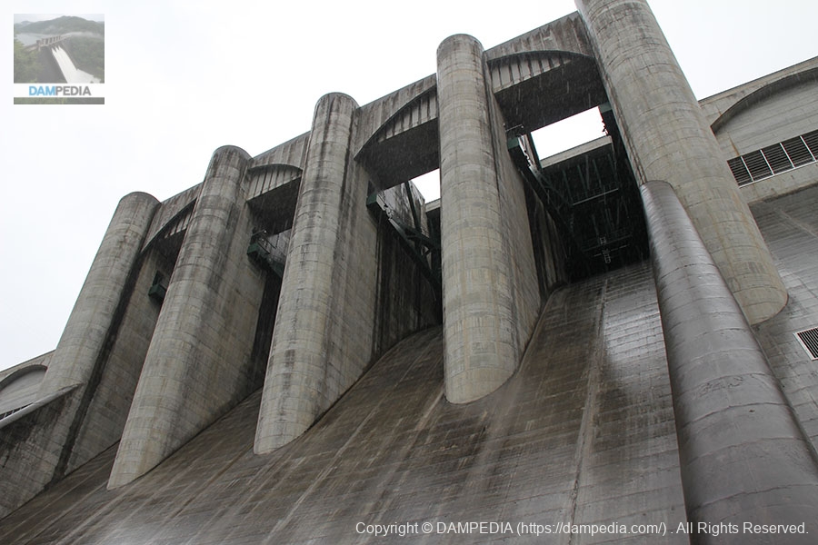
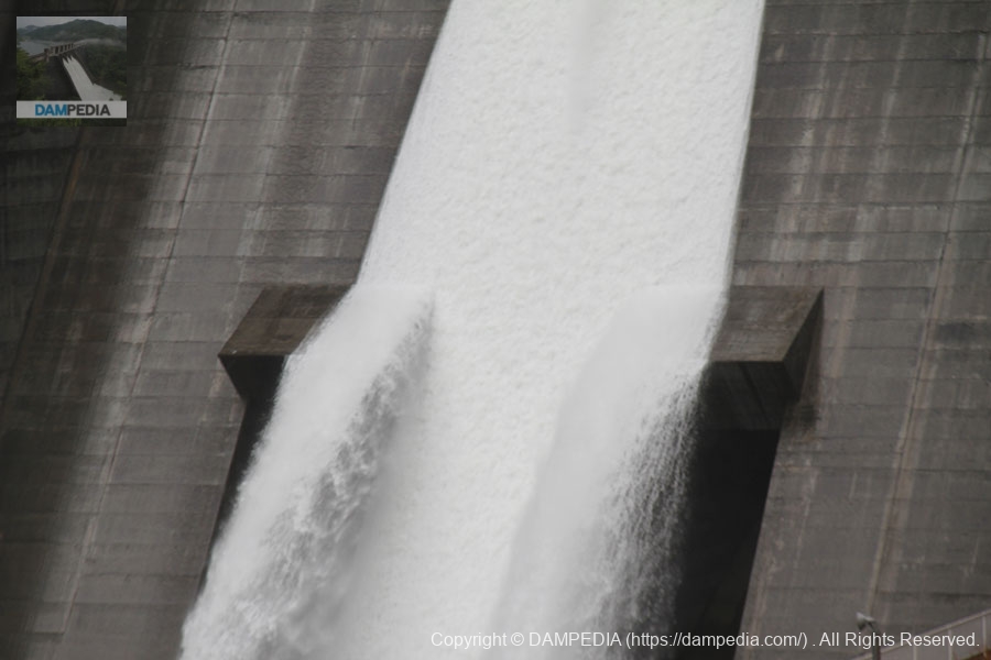
View of Crestgate from Dynamic Plaza on the left bank
Naturally, when you look up, you are looking up at the crest gate, and it is nothing short of breathtaking.
View of the cascade reduction works on the right bank from the dynamic plaza on the left bank
Cascade abatement works can also be seen before your eyes.
View of Crestgate from Dynamic Plaza on the left bank
The discharge from the crest has begun. The rain was heavy, and the wind pressure from the discharge made photography extremely difficult. Incidentally, the inspection discharge at Otaki Dam was in the style of releasing water one crest gate at a time.

Passage in the dam to Dynamic Plaza
However, the wind and rain were so strong that even dam enthusiasts had to take shelter in a passageway inside the embankment. It was unprecedented for dam enthusiasts to give up on observing the inspection and discharge of water directly downstream.
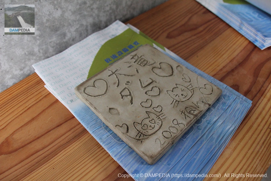
Cute brochure weights
We gave up on the tour at the Dynamic Plaza and returned the way we came. The photo shows a pamphlet and its weights that were placed on the way to the middle of the dam.
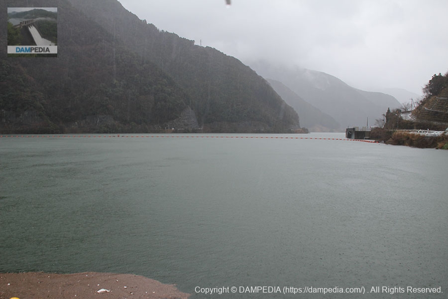
View of the dam lake from the top
The rain only got worse...
View of the levee downstream from the left bank
We had to move to the disaster prevention station where we could all learn together. I snapped this photo on the way there.
In Disaster Prevention Station
Enter the Disaster Prevention Station. There are various exhibits to keep you busy.
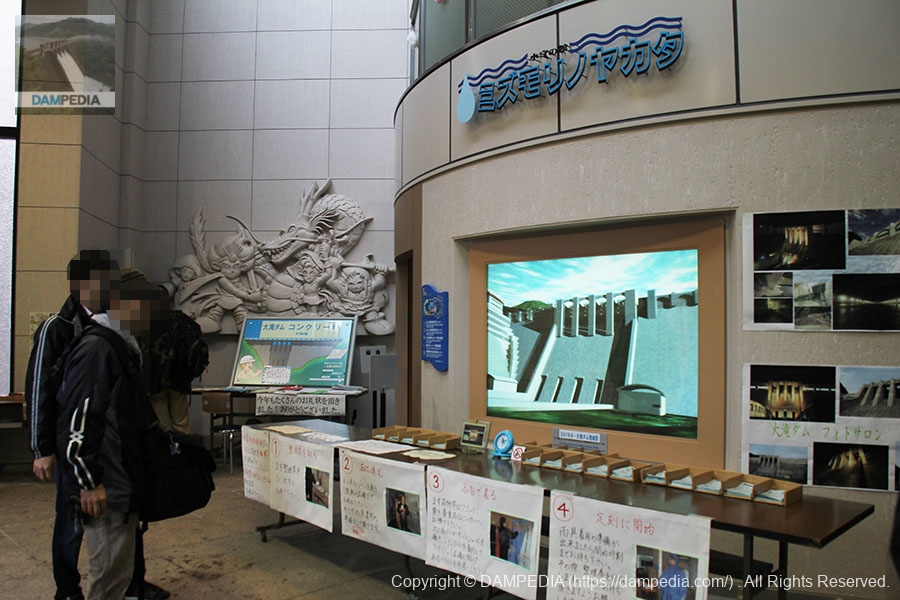
Model of Otaki Dam in the disaster prevention station
I think it was a moving model...
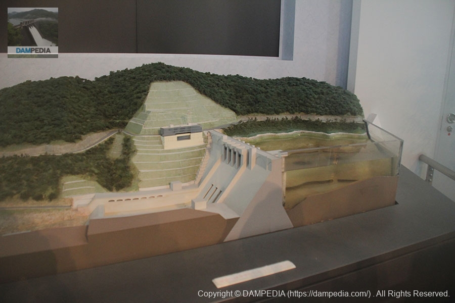
Diorama in Disaster Prevention Station
It is such a large scale diorama model.

View of the levee downstream from the pavilion on the left bank
At the disaster prevention station, we all experienced heavy rainfall together. Then we moved to the pavilion on the left bank to see the levee.
Otaki Power Station of Kansai Electric Power Co.
Looking in the opposite direction from the embankment, the Otaki Power Plant of Kansai Electric Power Co.
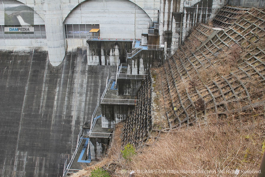
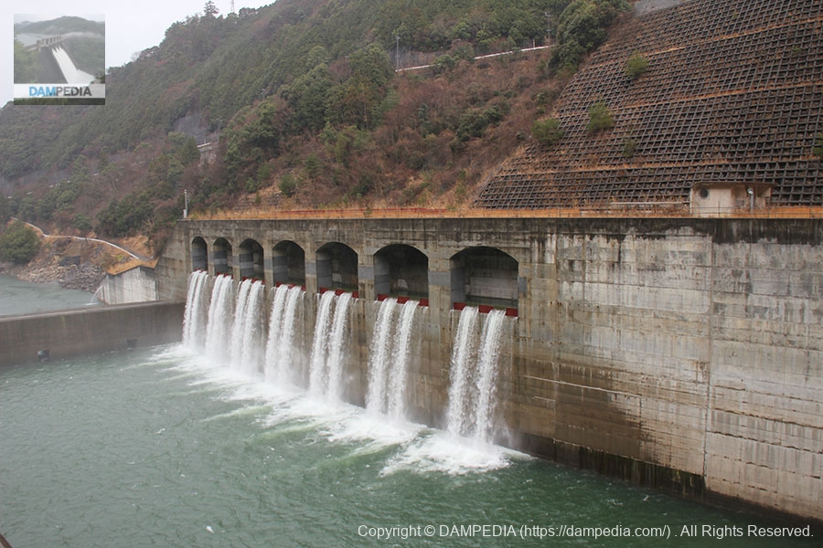
View of the deflector on the conduit gate from the pavilion on the left bank
I think this photo clearly shows how the deflector works.
View of the crest gate from the pavilion on the left bank
Although not directly in front of the building, Crescent Gate can be seen clearly.

Construction of the Otaki Dam began in 1962, was temporarily halted due to the risk of landslides, and was finally completed in 2012. Today, the Otaki Dam can be seen in its active and heroic role as the key to flood control for the Kino River (Yoshino River) in the Kii Peninsula, where frequent and heavy rainfall occurs. We are very happy that the construction was successfully completed.
Tsuburo Dam Specifications
| Location | Oaza Otaki, Kawakami-mura, Yoshino-gun, Nara-ken |
|---|---|
| River Name | Kino River System Kino River |
| Objective | F (flood control, agricultural disaster prevention) N (unspecified water, water for river maintenance) W(Water for water supply) I (industrial water) P(Power generation) |
| Model | G(gravity-fed concrete dam) |
| Bank height | 100m |
| Bank length | 315m |
| Dam volume | 1,034,000m3 |
| Watershed Area | 258km2 |
| Reservoir area | 251 ha |
| Total storage capacity | 84,000,000m3 |
| Effective water storage capacity | 76,000,000m3 |
| Dam operator | Kinki Regional Development Bureau |
| Main body constructor | Kumagai Corporation, Japan Land Development Co. |
| Year of launch | 1962 |
| Year Completed | 2012 |
| Name of Dam Lake | Lake Otaki Ryujin |
Map around Otaki Dam
Other facilities/observations
It is a fairly well maintained dam due to the fact that it is under direct control. As for the park, it is not what we would call a children's park, but we gave it a △ because we judged that it has park-like elements as a whole, such as a crovenoeki and a disaster prevention station.
| Parking lot | ○ |
|---|---|
| Toilet | ○ |
| Park | △ |
| PR Exhibition Hall | ○ |
| Fishing | ○ |
Comment