
Date of interview: Sunday, 3/2/2014
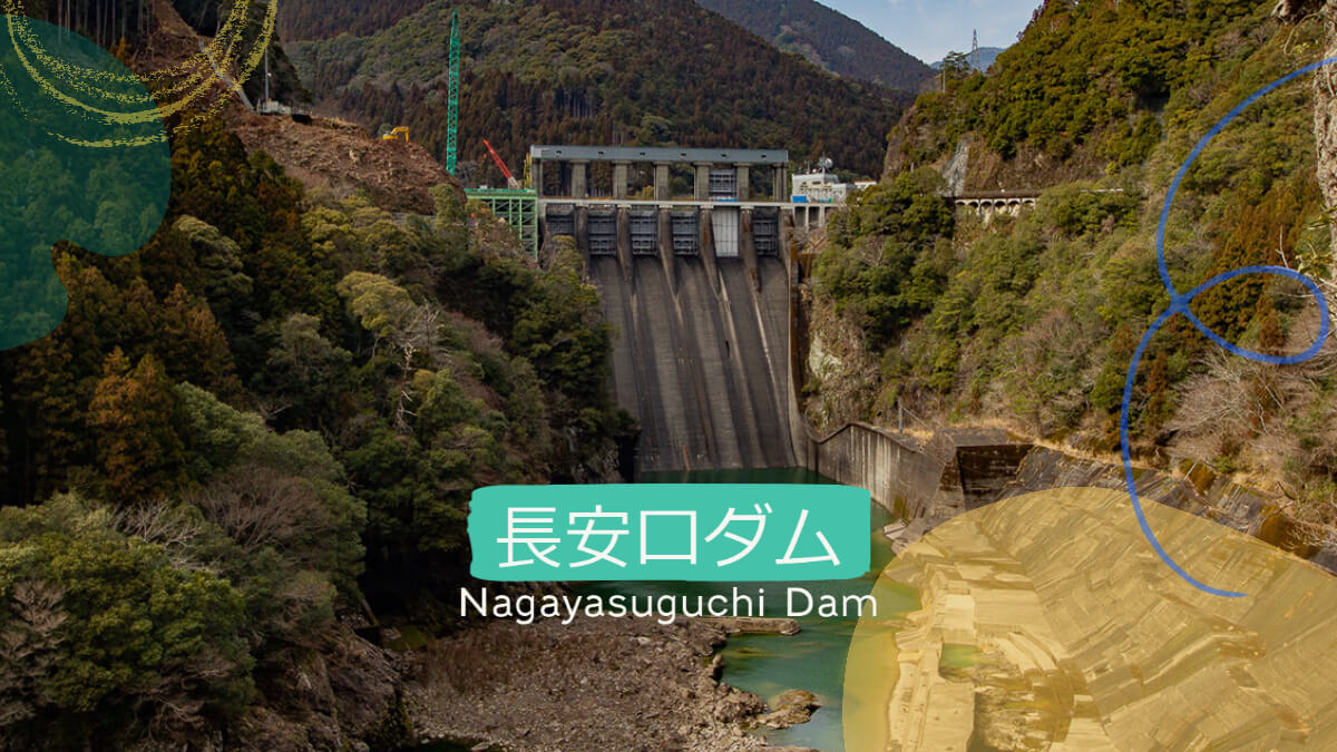
One of the dams I have always been curious about in Shikoku was this Chouankou Dam. The Chinese character "Chouan" looks like "Chouankou," but "Nagayasuguchi" is the correct name. Nagayasu" is the name of a place, and the dam was named "Chang'ankou" because it was built at the entrance to the place.
Note that this article is from 2014, but the levee has now undergone a major transformation due to a remodeling project. We hope you will read this article and remember the past. We hope you will read the article and remember the past.
Beaver Museum (Choyasuguchi Dam Museum)
Since we are moving from the Omiya Dam, we will approach from upstream. In front of the embankment, there is a museum, so we will stop by. The signboard of the museum reads "Tokushima Prefecture Enterprise Bureau. The Choyanguchi Dam was originally a prefectural dam, but the management of the dam was transferred to the Ministry of Land, Infrastructure, Transport and Tourism in 2007 (Heisei 19) to cope with the frequent floods and droughts that plague the area.
This museum has been in existence since the prefectural dam was operated by the Tokushima Prefectural Government, but the fact that it is a rare museum for a prefectural dam, and the fact that it continues to be managed and operated by the Tokushima Prefectural Government even though it is now under direct control of the Tokushima Prefectural Government, shows how important this dam is to the prefecture.

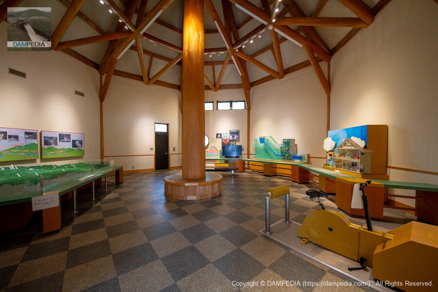
Inside the Chang'ankou Dam Museum
Inside the museum, there were several exhibits where visitors could learn about the dam, including a diorama.
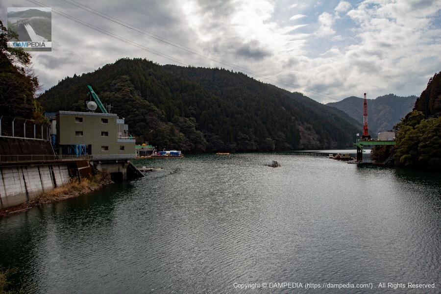
View from the museum toward the upstream face of the embankment
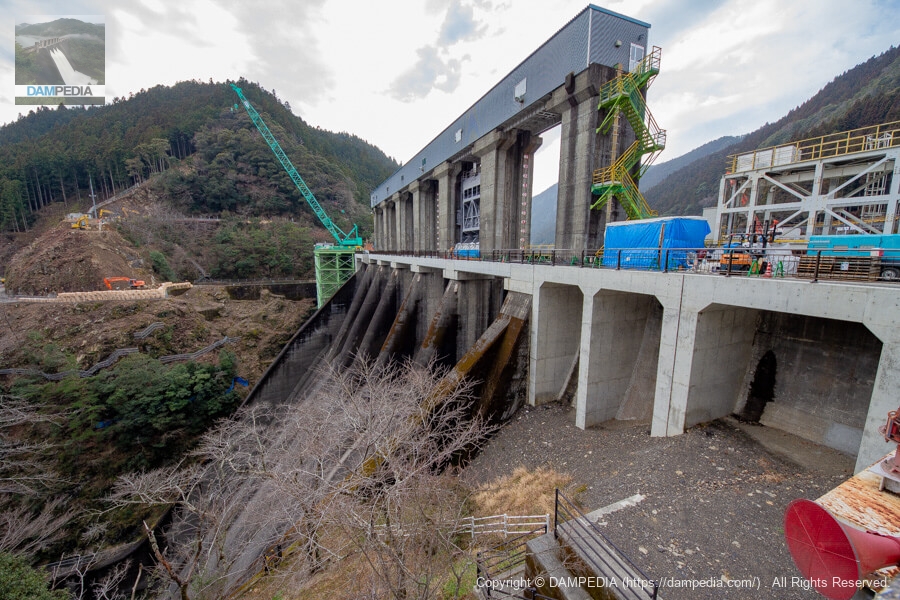
This is a view from the parking lot of the museum toward the levee over the reservoir. The gray building on the left is the administration office, and the levee is hidden behind it. On the right are temporary platforms and cranes installed for renovation work.
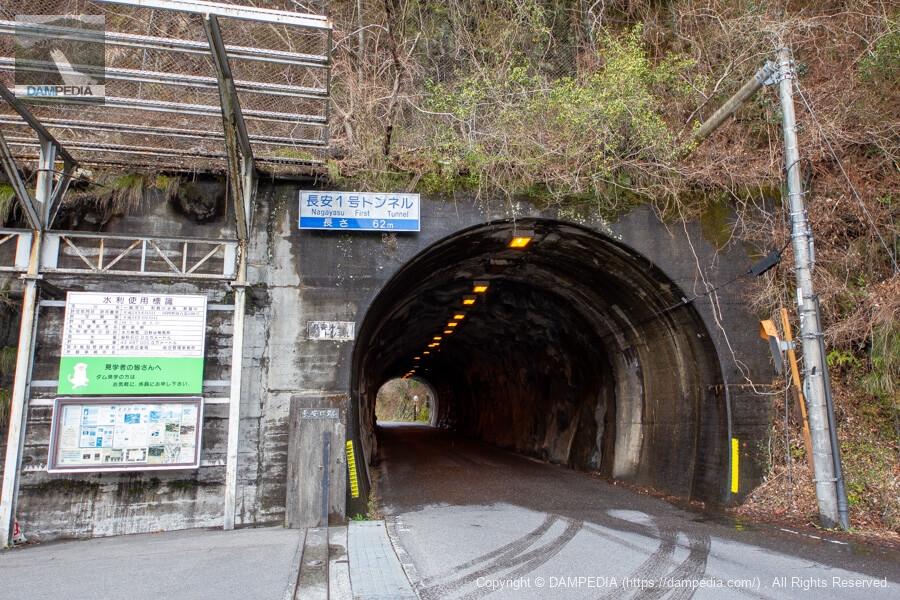
Changan No. 1 Tunnel and Changan Kuchi Dam Entrance
A short distance south of the museum, there is a tunnel, through which you will soon reach the Chang'ankou Dam. However, you can also reach the embankment by walking along the lakeshore from the museum.
It is very nice to see the sign on the left that reads, "Please feel free to ask an attendant if you would like to visit the dam. However, since the dam was in the middle of renovation work, there were many areas that were off-limits to visitors, so this time we just looked at the dam from the outside.
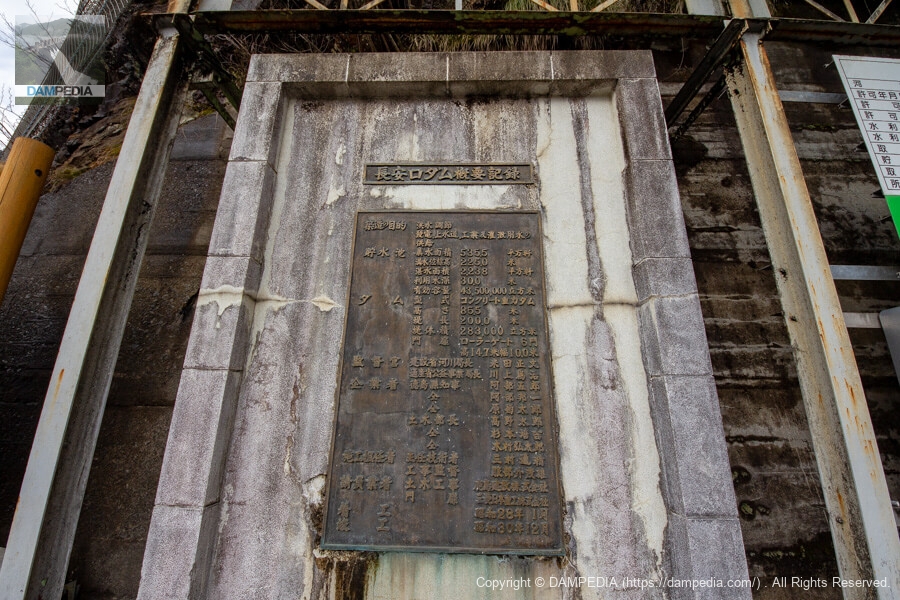
Summary record of Changankou Dam
A historical and stately nameplate written in Ming Dynasty script is housed to the left of the water use sign.
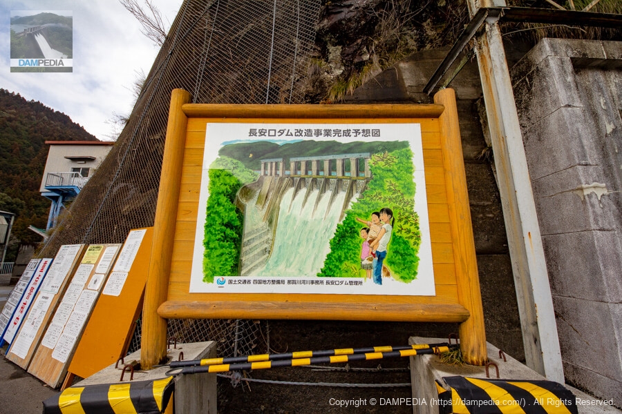
Rendering of the Chang'ankou Dam Modification Project
Furthermore, next to it, there was an illustration of the completion of the remodeling project. It is unclear whether the illustration is still in place after the dike remodeling project is completed, as I have not revisited the site since then, but it is a very tasteful illustration.
I found out that it is by Hajiri Toshikado, a picture book artist living in Anan City, Tokushima Prefecture. I would love to display this illustration in my home.
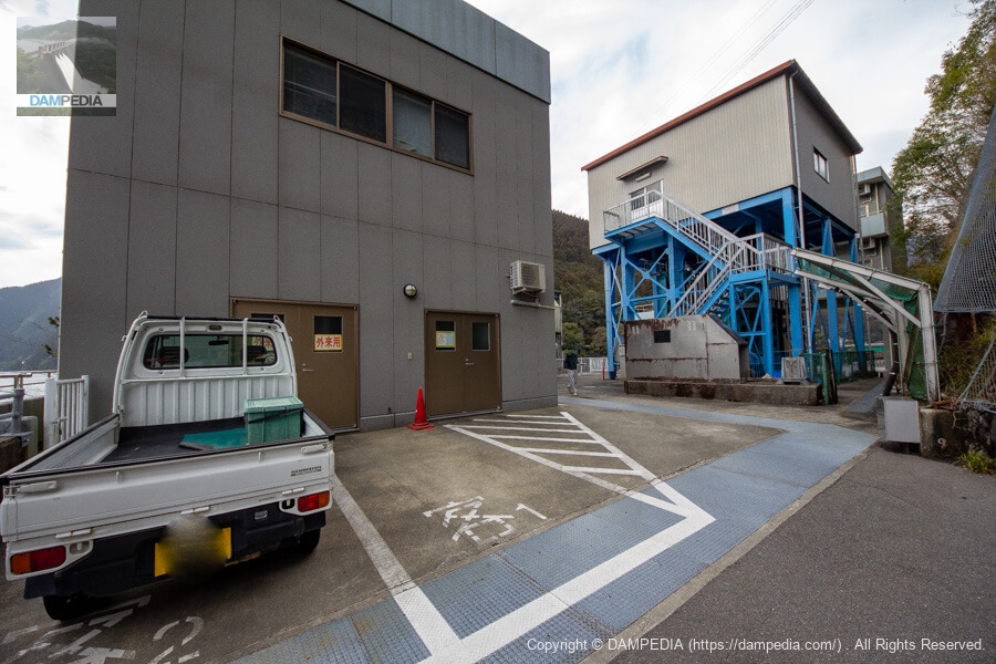
Control center and water intake
The management office and water intake are built in a narrow area on the left bank of the river, crowded together. The water taken in here is used to generate up to 62,000 kW of electricity at the Hinotani Power Station of the Tokushima Prefectural Bureau of Public Enterprises downstream. Incidentally, the Kagehira Power Station, which uses the reservoir of the Kominoso Dam upstream as its upper reservoir, also generates up to 46,500 kW of pumped-storage power.
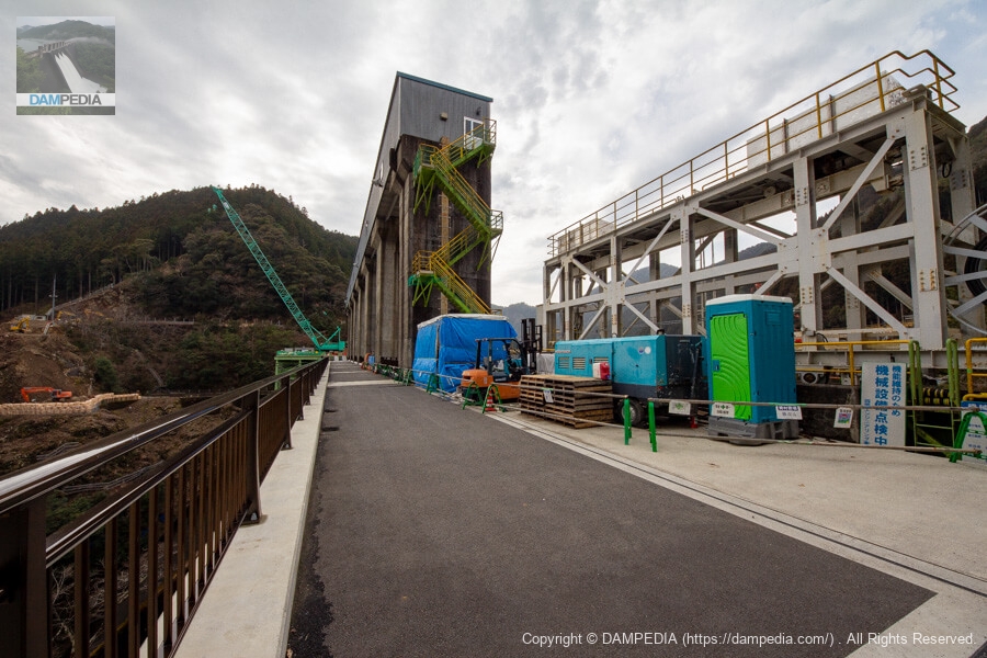
View of the top edge and gate pier from the left bank
It seems that the control bridge at the top end of the dam was replaced with a new one along with the remodeling work. The green and yellow color of the stairs and handrails to the gate hoist room is somewhat reminiscent of the Sugita Dam and Yoshino Dam of the Kochi Prefectural Enterprise Bureau in the neighboring prefecture.
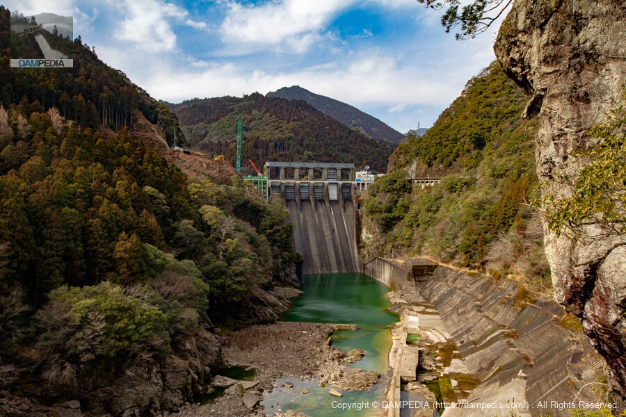
Looking downstream from the left bank
At the time of its construction, the Changankou Dam was planned to handle a flood volume of 9,000 m3/s caused by Typhoon Jane in 1950, but in August 2014 (Typhoon No. 11), it recorded a flood volume of 9,500 m3/s, the largest in the postwar period. Conversely, the area has been suffering from drought to the extent that water withdrawal has been restricted almost every year since 1995. In addition, sedimentation was progressing in the reservoir of the Changankou Dam, and there were concerns that the dam's functions would deteriorate as its effective water storage capacity decreased.
Therefore, we are embarking on a remodeling project, and the project has the following four main components.
Changes in reservoir capacity allocation [flood control functions, enhancement and conservation of unspecified capacity
Revaluation of the Choyangkou Dam Conversion Project Project, November 24, 2016, Ministry of Land, Infrastructure, Transport and Tourism, Shikoku Regional Development Bureau, from data provided by the Shikoku Regional Development Bureau, Ministry of Land, Infrastructure, Transport and Tourism
Flood discharge expansion, modification of force reduction works [enhancement of flood control functions].
Installation of selective water intake facilities [replenishment of unspecified water supply, improvement of muddy water discharge].
New construction of sediment removal facilities and use of the Otachi Dam [Introduction of strategic sediment management].
This was a major construction project that involved cutting two 10-meter-wide, 30-meter-high sections of the non-overflow portion of the right bank to the embankment and adding two crest gates. This was the first time in Japan that such work was done while operating a dam.
At this time, the existing gate was also being repaired. Repairing the existing gate is also a part of the remodeling project.
We called this remodeling project "magical remodeling," not in a derogatory or sarcastic way, but in a friendly or affectionate way. However, the local people were desperate because their lives and property were at stake.
View of the downstream face of the dike
Now that two new gates have been built on the right bank and the reduction works have been drastically changed from the photo below, the atmosphere of the dam has completely changed. I would definitely like to revisit the Choyamaguchi Dam even after the magical remodeling.
Chang'ankou Dam Specifications
note (supplementary information) symbol Bank lengthThe figures in parentheses for effective water storage capacity, dam operator, main body constructor, year of commencement, and year of completion are those after the modification project.
| Location | 22-1 Nagayasu, Naga-cho, Naga-gun, Tokushima |
| River Name | Nagawa River System Nagawa River |
| Objective | F (flood control, agricultural disaster prevention) N (unspecified water, water for river maintenance) P(Power generation) |
| Model | G(gravity-fed concrete dam) |
| Bank height | 85.5m |
| Bank length | 200m (200.7m) |
| Dam volume | 283,000 m3 |
| Watershed Area | 538.9 km2 (direct: 494.3 km2, indirect: 45 km2) |
| Reservoir area | 224ha |
| Total storage capacity | 54,278,000 m3 |
| Effective water storage capacity | 43,497,000 m3 (36,800,000 m3) |
| Dam operator | Tokushima Prefecture (Shikoku Regional Development Bureau) |
| Main body constructor | Kajima Corporation (Kajima Corporation, Hitachi Zosen Corporation, IHI Infrastructure Systems) |
| Year of launch | 1950 (1998) |
| Year Completed | 1955 (2028) |
| Name of Dam Lake | Nagayasuguchi Reservoir |
Other Equipment/Specifications
| Parking lot | ○ |
| Toilet | ○ |
| Park | × |
| PR Exhibition Hall | ○ |
| Fishing | ○○ (excluding no-take zones) |
Map around Changankou Dam
Weather around Changankou Dam
Accommodations that may be close to Changankou Dam


Comment