
Date of interview: Sunday, 3/2/2014
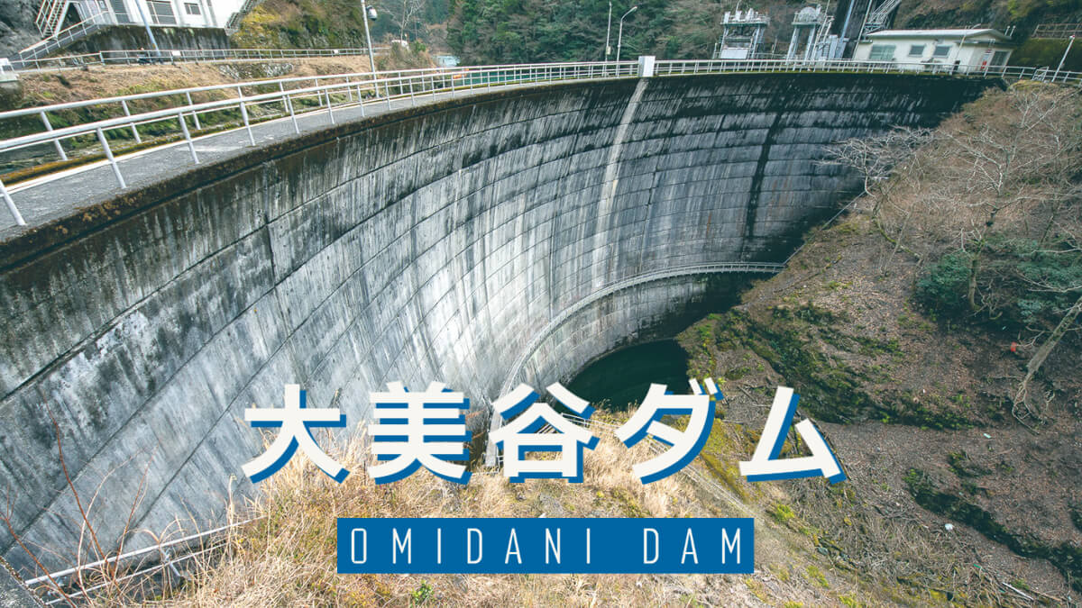
On the way from the Komino Dam to the Choanokuchi Dam, there is a dam that you should definitely stop by, although the direction is slightly different. That is the Omiya Dam. Like the Ominozawa Dam, the Omiya Dam is owned by Shikoku Electric Power Co.
Looking downstream from the right bank
And although the Ohmiya Dam is an arch dam of the same type as the Komino Dam, such a compact dome arch is hard to find elsewhere. The fact that the overflow portion is not visible makes it seem even more compact. However, the flood discharge is said to be hidden behind a landslide on the left bank, and it is a little regrettable that we cannot see it. The discharge from the flood discharge seems to be flowing on the right side of the photo. The highest structure on the left bank seems to be the location of the gate.
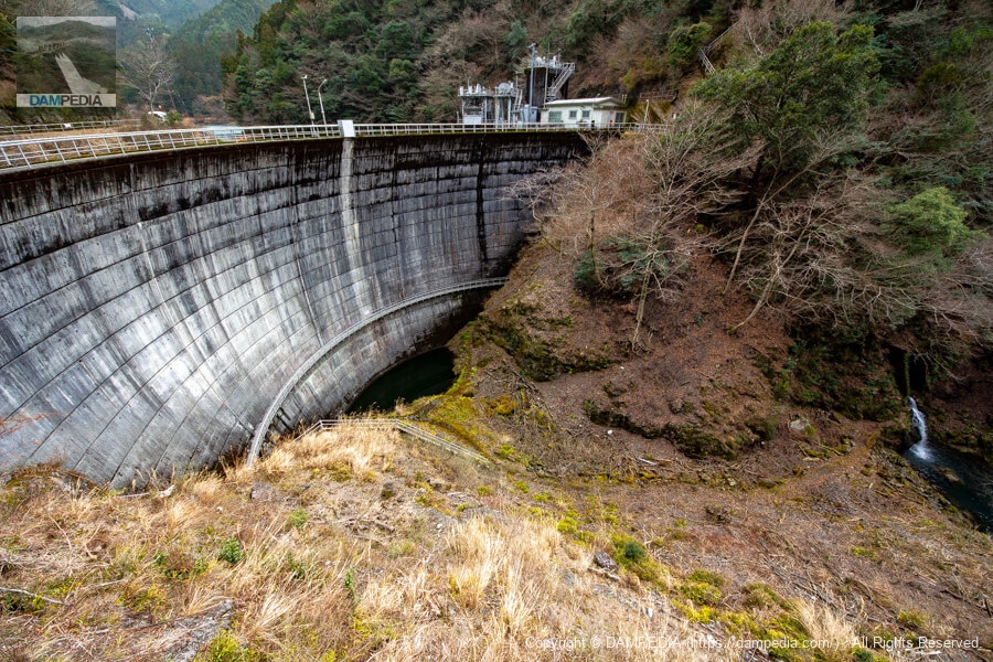
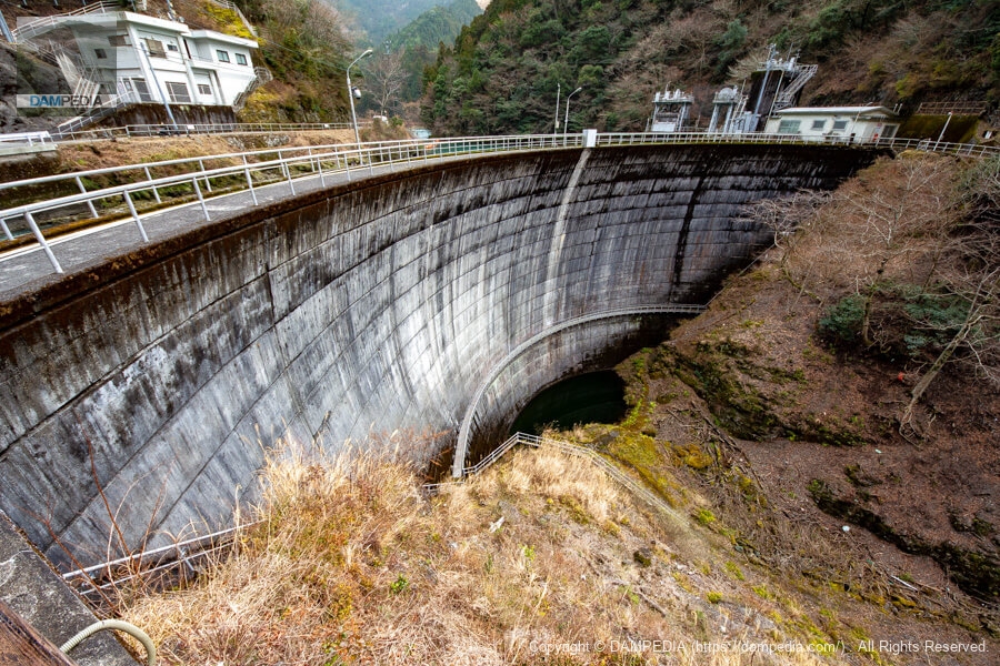
Shift your position a little and look at the downstream face of the dike
There were no photos of the control station, and the only photo I could find was the one below, so although it is similar in composition to the photo above, I am including it here on purpose. The control station (or more correctly, the dam guard station), which is now unmanned, stands on the upstream side overlooking the embankment.
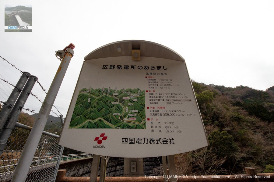
Hirono Power Plant Overview
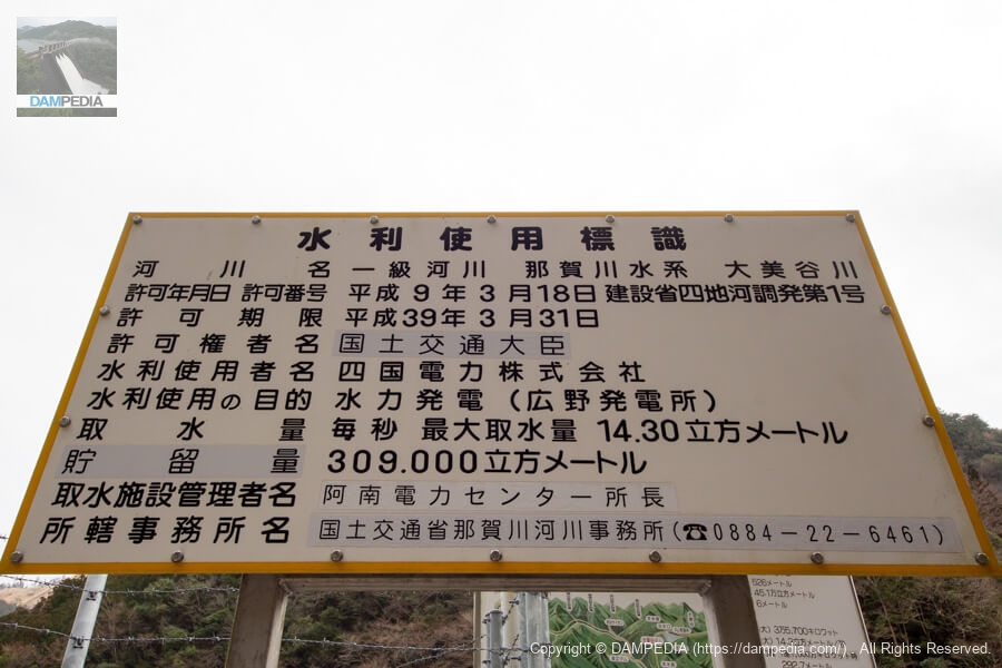
Water stored in the Omiya Dam is used to generate up to 35,700 kW of electricity at the Hirono Power Station, and a sign outlining this is posted on the right bank. Water is also taken from the surrounding valleys and rivers, and the sign indicates that there are six water intake facilities: the Sakashu-Kigashira River intake facility, the Fujigauchi Valley intake facility, the Anisetani intake facility, the Niiida intake facility, the Sawadani intake facility, and the Izumidani intake facility.
Water Use Signs
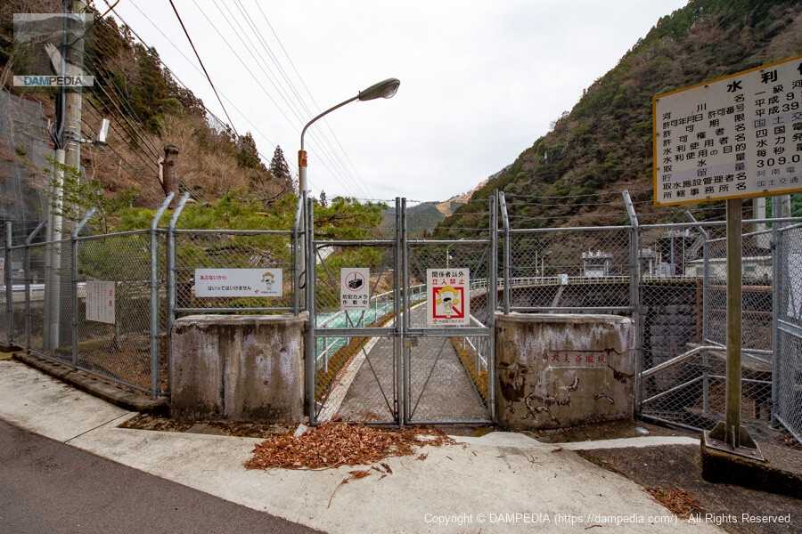
A water use sign has also been erected on the same right bank.
View of the top edge from the right bank
Unfortunately, the top edge is off-limits. Akari, the character of Shikoku Electric Power Company, seems to be admonishing people not to enter. Oubiya" is written on the main pillar.weirThe red color of the "" letters is similar to that of the Nagasawa Dam and Ohashi Dam of the same Shikoku Electric Power Company.
Space on the right bank
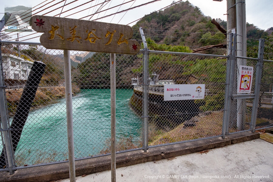
There is a small space on the right bank as well as a parking space, but a wooden sign saying "Omidani Dam" has been erected, depicting a maple tree, perhaps a spot for autumn foliage.
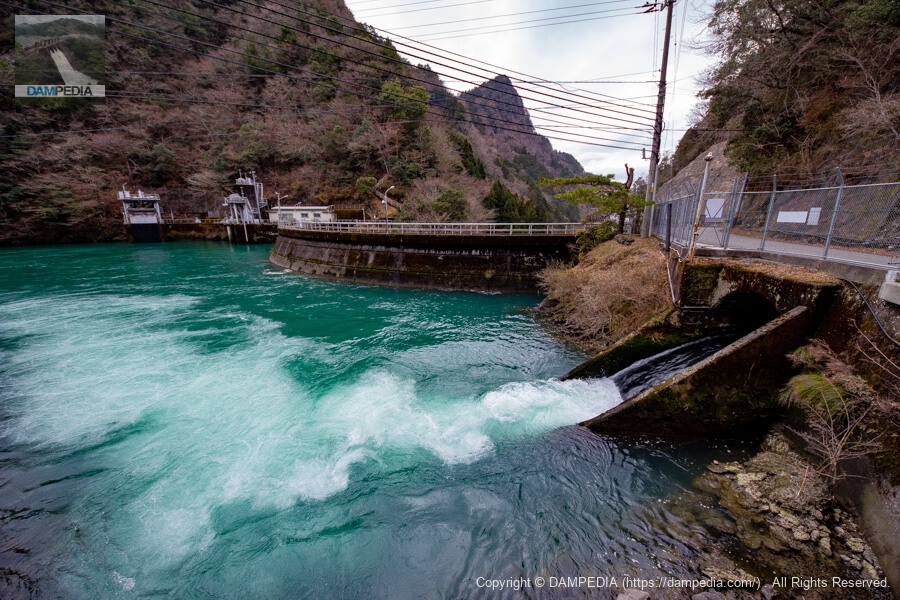
View of the upstream face of the embankment and the water inlet from the right bank
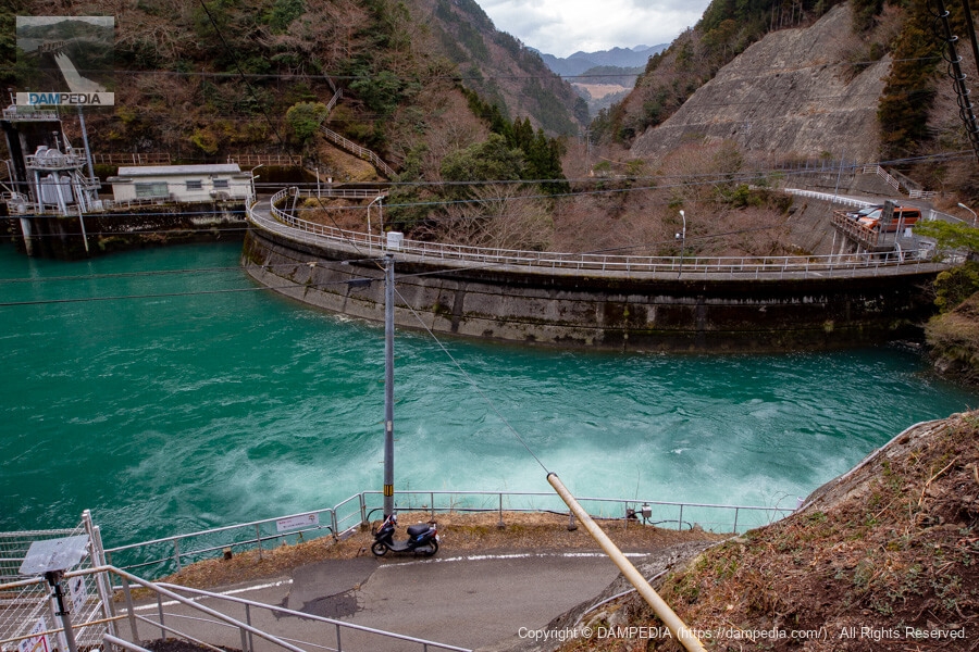
On the right bank, there is a structure with a large volume of water flowing into the reservoir at a high rate of flow. This is not water from a stream, but water that has been taken from each intake facility and poured into the reservoir through a branch canal. The reservoir has a beautiful color. It is an emerald blue reservoir that has been called "Ohbiya blue" for some time.
View of the upstream face of the levee from the hill beside the control center
Although there are some power lines in the way, we can see the upstream face of the embankment from a good position. You can clearly see that the water is dammed up by a good arch.
Although there were only a few points of interest to visit, the water was very clean and the Ohmiya Dam was a very compact arch dam.
Omiya Dam Specifications
| Location | Kigurina, Naga-cho, Naga-gun, Tokushima |
| River Name | Nagawa River system Omidani River |
| Objective | P(Power generation) |
| Model | A(arch dam) |
| Bank height | 31.5m |
| Bank length | 86m |
| Dam volume | 8,000 m3 |
| Watershed Area | 101.3 km2 (direct: 7.3 km2, indirect: 94 km2) |
| Reservoir area | 8ha |
| Total storage capacity | 451,000 m3 |
| Effective water storage capacity | 309,000 m3 |
| Dam operator | Shikoku Electric Power Co. |
| Main body constructor | Nishimatsu Construction |
| Year of launch | 1958 |
| Year Completed | 1960. |
| Name of Dam Lake | - |
Other Equipment/Specifications
| Parking lot | ○ |
| Toilet | × |
| Park | × |
| PR Exhibition Hall | × |
| Fishing | ○ |
Map of the area around the Omiya Dam
Weather around Ohmiya Dam
Accommodations that may be close to Ohmiya Dam

Comment