

Location: Aodo, Tsuchiyama-cho, Koka City, Shiga Prefecture
Date of interview: 06/17/2010 (Thursday)
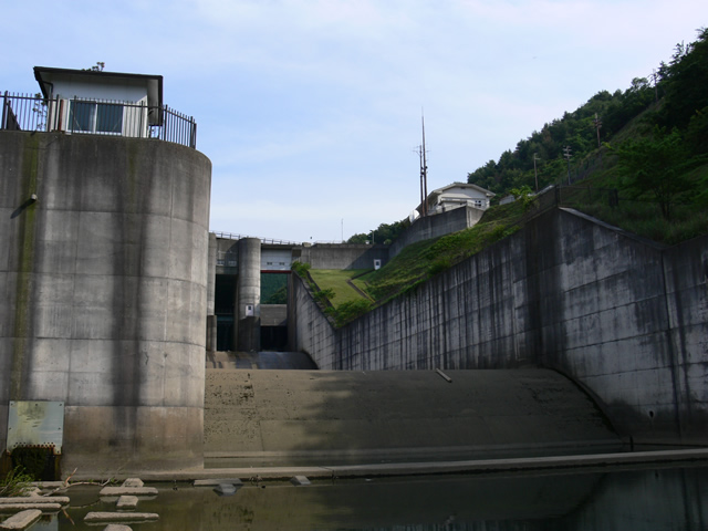
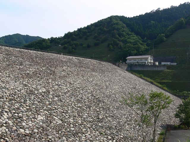
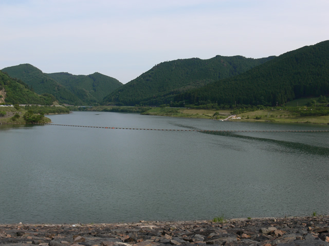
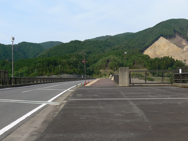
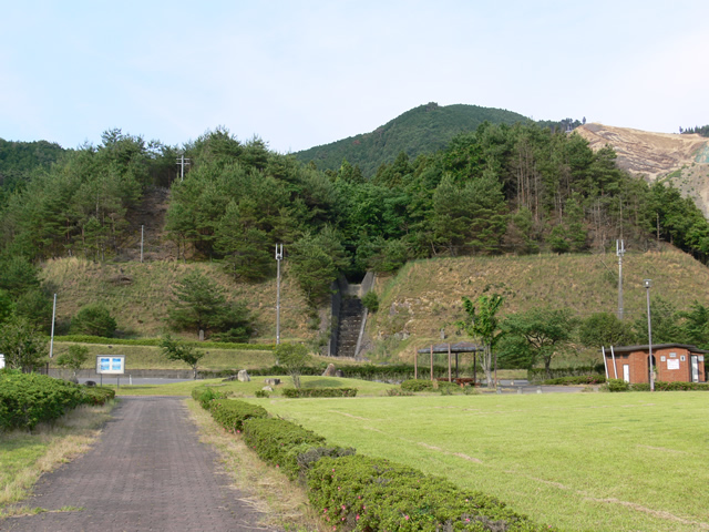
View of the levee from the parking lot downstream
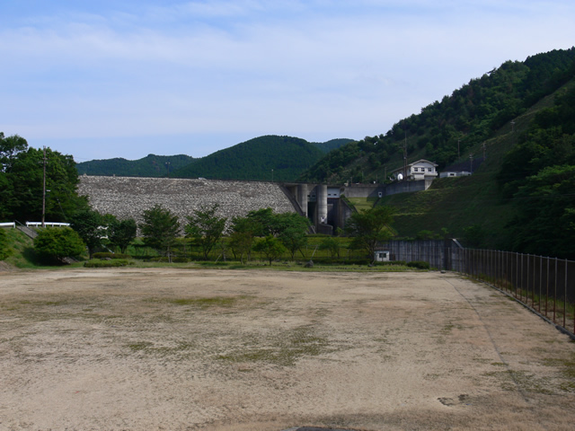
I came here to visit a dam in the Koka area. The name of the dam is not "Aotsuchi" but "Ootsuchi.
First, park your car in the parking lot in front of the plaza downstream and start exploring.
We came here as a family, so it's like a walk.
By the way, parking is also available at the dam site, so don't worry.
Spillway for river maintenance discharge

The Yasu River flows on the right as you look at the plaza.
You can see a tunnel there, which is a spillway for river maintenance discharge.
View of the levee from downstream
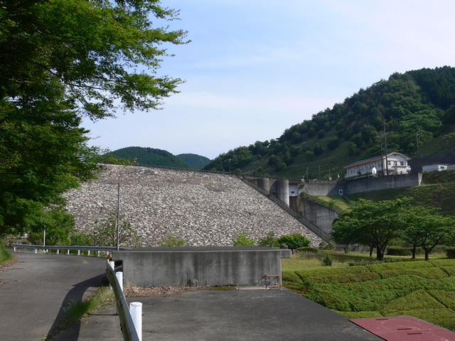
Now, the levee is getting a little closer. It was June, but it was not so hot and the weather was just right.
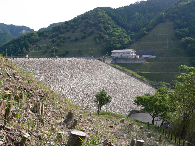
A closer view of the levee from downstream

I'm going to get even closer, but it's hard to find a good angle.
Hmm? Tunnel?
There is a passageway that goes right from this location. Perhaps you can go directly down!
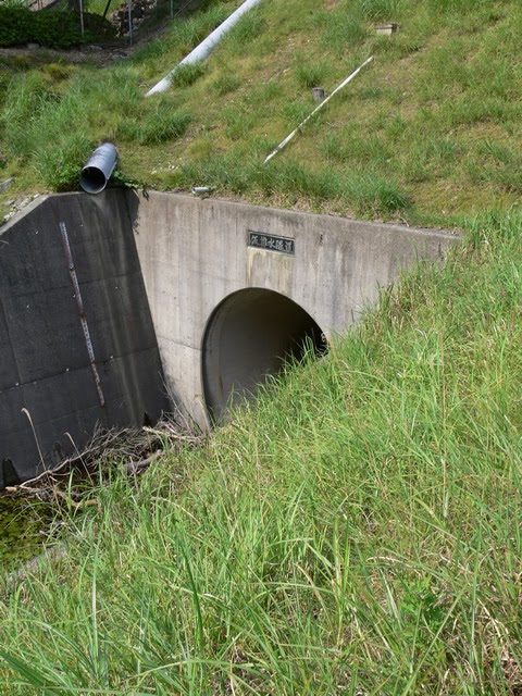
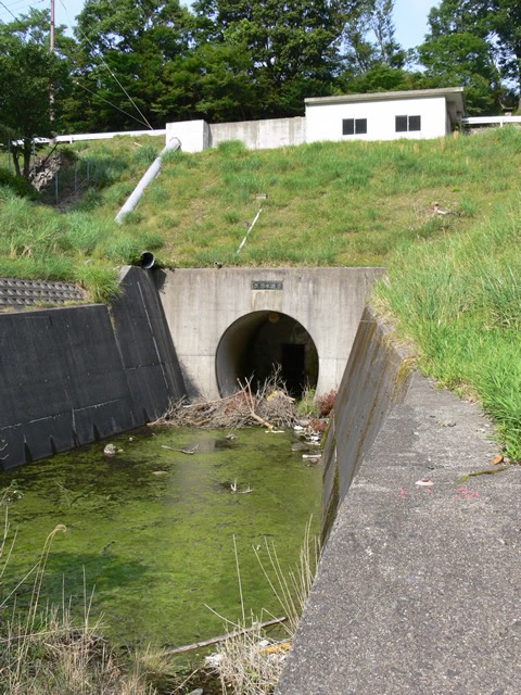
Before that, you will see another tunnel.
Temporary Drainage Tunnel (Tunnel)
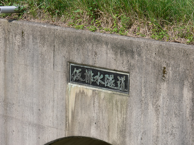
Temporary Drainage Tunnel (Temporary drainage tunnelIt is labeled as a "tunnel". This tunnel was used to temporarily divert the river flow during the construction of the main body of the dam. Temporary drainage tunnels are often seen passing under the dam site, but this tunnel seems to have been used as a route to go directly under the dam site and divert the river flow to the main river.
View of the conduit from downstream
Geez! This view!
Although the flow-conducting wall makes it difficult to see well, it is still very powerful.
I could have taken more interesting pictures if I went into the river, but that is indeed dangerous (laughs).
View of temporary drainage tunnel
Looking back, the temporary drainage tunnel is clearly visible. However, something round can be seen on the ceiling of the tunnel. It is too dark to tell in this photo...
Beehive!
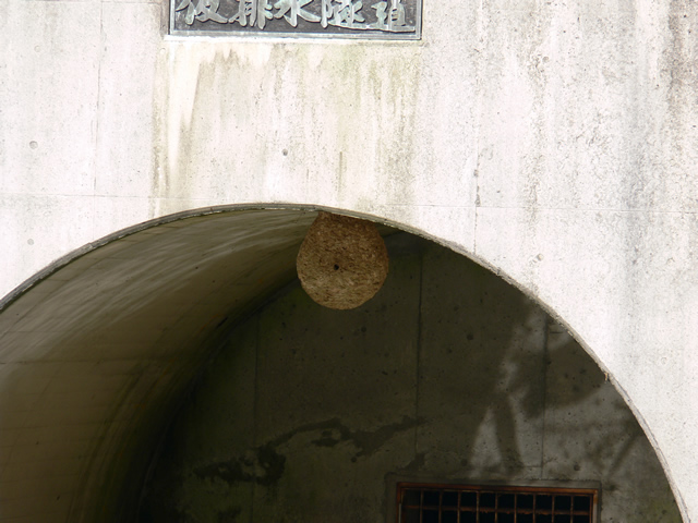
What a beehive! It looks like a hornet's nest!
I was very happy to see the bees, but I managed not to run into any bees.
View of the levee from the middle of the stairs from downstream to the top level

It is quite close to the levee.
The bissily laid riprap is impressive.
Then head to the top edge.
Tea plantation visible on the way up the stairs from downstream to the top level
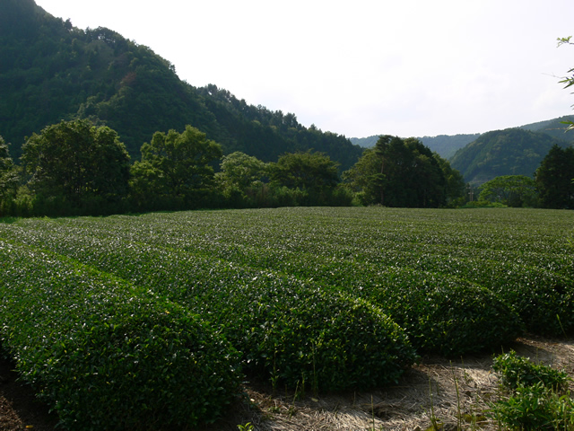
For some reason, there is a tea plantation on the stairs from downstream to the top level. Is this private property?
Climbing further stairs to view the embankment
Then I turned around and saw an orderly row of riprap. Still, it's a nice walk.
Finally reach the top level.
We finally reached the top level. The trees have since been trimmed, so one can imagine that the embankment was previously overgrown and could not be seen.
View of the top edge from the right bank

As you can see, the top end is open to automobile traffic. It is a wide prefectural road with one lane in each direction. The end of this road leads to the Yasu River Dam (3195-Yasu River Dam/Yasugawadamu) and further to the Suzuka Skyline.
From my house, it is closer via the Suzuka Skyline (Route 477), but the road has been closed since September 2008 when heavy rain caused a disaster (and another heavy rain in April 2010), and I have to come via the Tsuchiyama IC of Shinmeishin. (The Suzuka Skyline is scheduled to be restored in the spring of 2012, but there is a possibility of delay.)
View of the top edge from the right bank
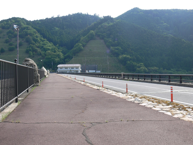
There are wide sidewalks and no shortage of places to stroll.
View of the quarry from the top
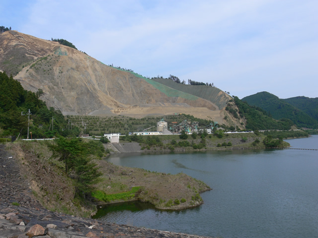
At the dam site on the right bank of the embankment is a quarry operated by a company called Koka Barrus Corporation, and several dump trucks were passing by that day.
View of the dam lake from the top
The surface of the lake is calm.
Bird painting
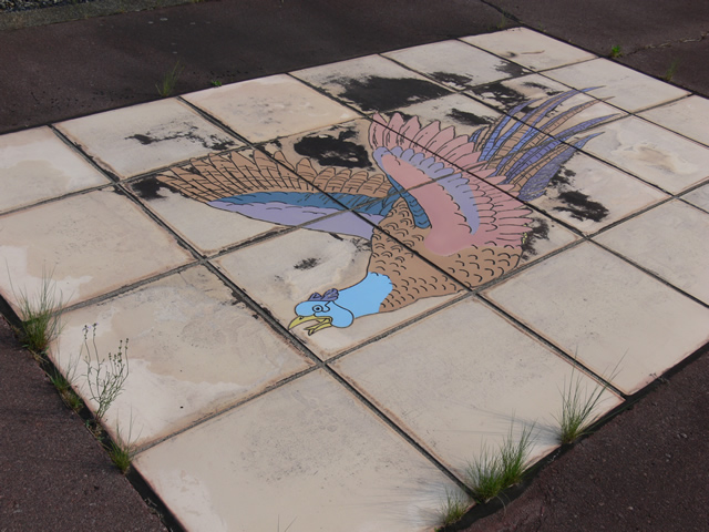
A bird is painted on the top edge. This bird is probably a pheasant.
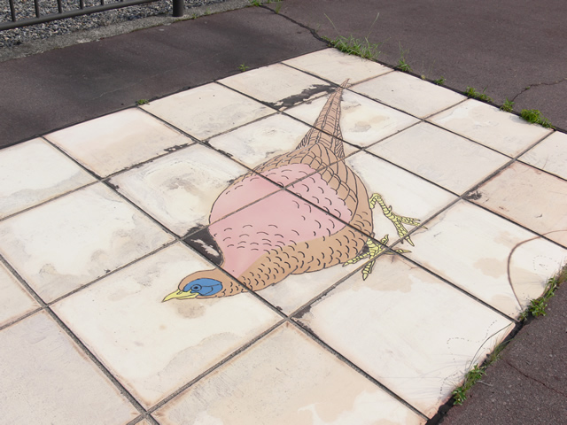
Bird painting #2
I looked up why it was a pheasant, and found that this place, which is now Koka City, was the town of Tsuchiyama, Koka County until September 2004, and that the town bird was the pheasant. (Aside: Koka City's bird is the kingfisher.)
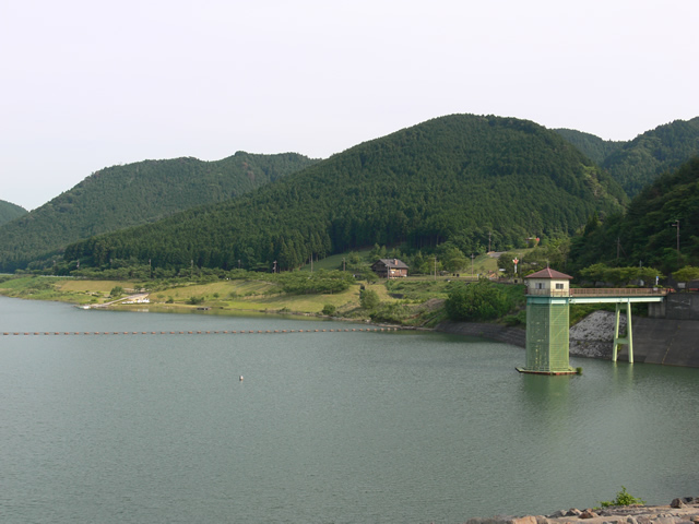
View of the water intake system from the top
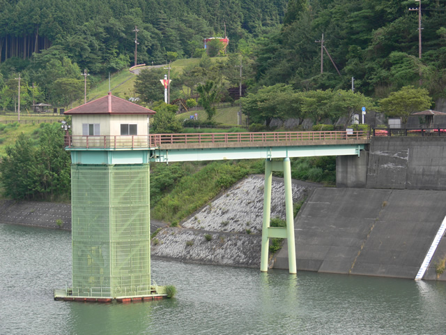
Water taken from this intake facility is discharged through the discharge channel shown in the second photo on page 1.
On the next page, we will introduce the flood discharge, the greatest feature of the Aodo Dam.
View of the reduction work from the top edge

First, from the downstream side.
The other side of the sub-dam is where we were at first. It is interesting that the end of the conduit is slit-shaped.
View of the emergency flood discharge from the top

continuedemergency flood discharge. So far, it is a free overflow flood discharge of the type often seen in rockfill dams.
View of the permanent flood discharge
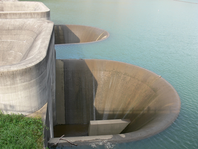
And this is the flood discharge, the most distinctive feature of the Aodo Dam. It is a flood discharge that has a reputation (?) for resembling a "dam hole" that was once popular on the Internet. It was just barely overflowing today. Today it was just barely overflowing, but personally I would have liked to see it overflow a little more (laugh).
View of the entire flood discharge
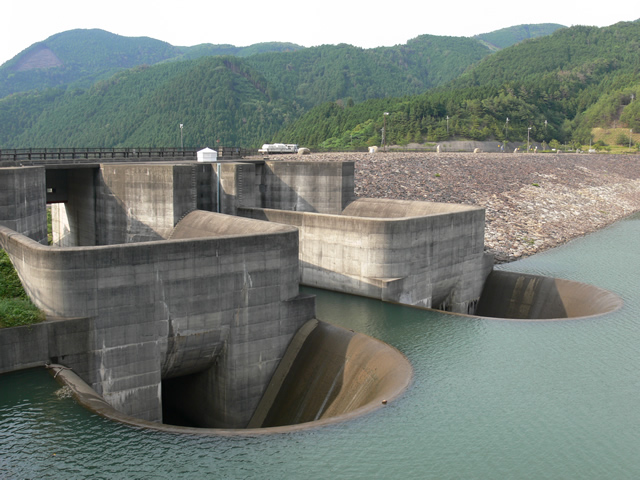
The entire structure can be clearly seen. The "hole" in the front is the normal flood discharge, which naturally flows when the water level is always full. However, if the inflow exceeds this level, the water will flow from a higher flood discharge. This is why it is called an emergency flood discharge. In other words, it is a multi-level structure.
This flood discharge is reputed to be "unique in the world". It is worth seeing.
cornerstone
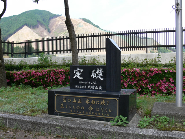
Next, we went to the management office to get a dam card. There is a cornerstone on the grounds of the administration office. The name of the governor of Shiga Prefecture at that time, Mr. Masayoshi Takemura, is on it. Mr. Takemura became a member of the Diet and served as a representative of the New Party Sakigake, Chief Cabinet Secretary, and Minister of Finance (he retired from politics in 2001).
Indigo mountain range reflected on the water
nurture the life of the living
It shows how important this dam is in protecting life and property.
View of the administration office
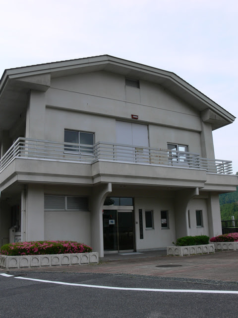
And the administration office.
Get the Blue Earth Dam card!
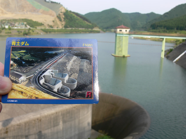
Got the Blue Earth Dam card! The picture on the card looks like the dam before waterlogging.
View of the top edge from the left bank
After getting the dam card, the coverage still continues.
The top end of the Aondo Dam seems very wide.
Swan Boat Ramp at Blue Earth Dam Echo Valley
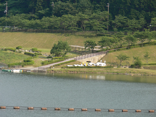
A park for camping and barbecues called "Blue Earth Dam Echo Valley" is maintained a short distance away. As expected on a weekday, there were no people there, but I guess it is crowded on weekends and holidays.
Echo Valley's website is also well designed.
Blue Earth Dam Echo Valley website
View from the top overlooking the selective intake system and the Echo Valley of the Blue Earth Dam
Sounds like a fun place to come with the family! I mean, I'm coming with my family. We didn't end up going to Echo Valley because the dam is the main attraction (laughs).
Then, we will continue to the right bank side.
Erosion control dam on the right bank
There is a large erosion control dam on the right bank.
View of the embankment on the lake side from the right bank
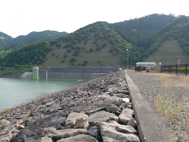
The riprap on the dam lake side is beautiful.
Stone monument on the right bank
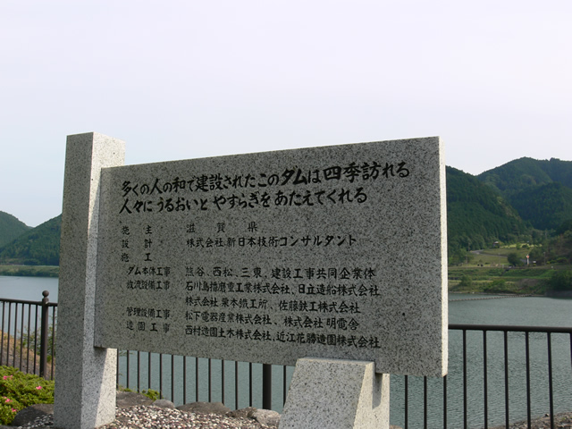
This dam, built with the harmony of many people, is visited in all seasons.
It provides people with moisture and comfort.
I felt that this dam was filled with the desire to Even if you are not a fanatic, you can enjoy the whole day.
View of the stone monument and embankment of the Blue Earth Dam

The grass is overgrown on the monument in a nice way (laughs).
View of the embankment from the right bank

We had actually planned to visit the dams in the area, but we ended up staying at only one, the Blue Earth Dam, for the day. It was such a fulfilling dam.
dam characteristics
| River Name | Yodo River System Yasu River |
|---|---|
| Objective | Flood control, agricultural disaster prevention, unspecified water, river maintenance water, water supply water, industrial water |
| Model | rockfill dam |
| Bank height | 43.5m |
| Bank length | 360m |
| Dam volume | 660,000m3 |
| Watershed Area | 54.3 km2 |
| Reservoir area | 62ha |
| Total storage capacity | 7,300,000m3 |
| Effective water storage capacity | 6,600,000m3 |
| Dam operator | Shiga prefecture (Kinki area) |
| Main body constructor | Kumagaya, Nishimatsu, Santo Kogyo |
| Year of launch | 1966 |
| Year Completed | 1987 |
Other facilities/observations
The parking lot is downstream andright bank (shore)It is located around the dam lake. There are many things to see and do at the Aodo Dam.
| Parking lot | ○ |
|---|---|
| Toilet | ○ |
| Park | ○ |
| PR Exhibition Hall | × |
| Fishing | ○ |

Comment